


January 4 Weather One More Cold Day Then January Thaw By Mid Week
Sunday, January 4, 2026 Overnight, there were some snow showers that crossed the region. I would not be surprised if there are reports of a fresh dusting of snow on…
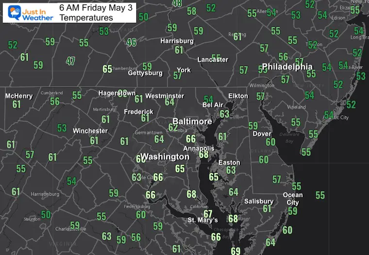
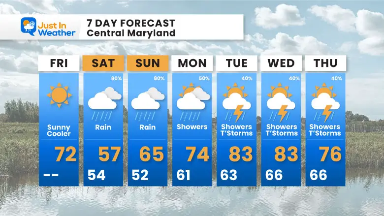
Friday May 3
Morning Report
Another record high of 90ºF was reached yesterday at BWI. This tied the mark set in 2018.
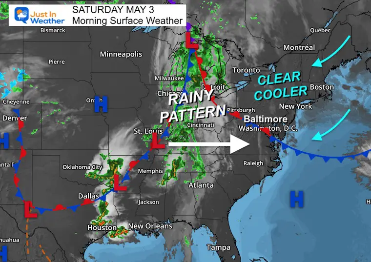
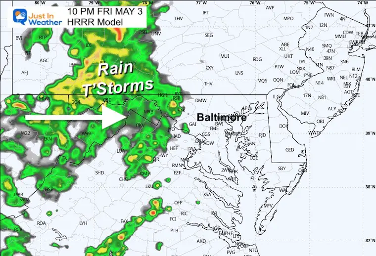
Today, a cooler wind will bring us closer to average/normal. The entire pattern is about to flip. Starting on Saturday, rain will settle in, and unfortunately, this does look worse than before. So, it could wash out your plans. The rain may also wash out Sunday plans.
Next week, the pattern remains nearly stalled. While temperatures warm up, we will shift from rain to showers and afternoon thunderstorms each day.
Still mild!
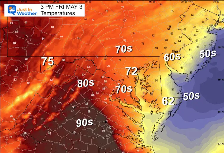
The cool front has moved through and we finally get back to that Canadian Air Mass. The wind shift from the East/Northeast will bring in much cooler weather by the water, along with some afternoon clouds.
Inland will be sunny and pleasant.
The next weather system will settle in this weekend and hold with the risk of rain each day into next week.
Closer to seasonal averages (normal).
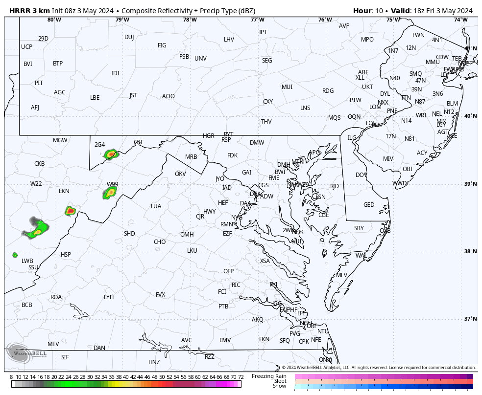
Rain and some thunderstorms in the mountains west of Frederick.
Sunrise at 6:05 AM
Sunset at 8:02 PM
Normal Low in Baltimore: 49ºF
Record 34ºF in 1986; 2005
Normal High in Baltimore: 72ºF
Record 92ºF 2018
Looking more wet. The adjustment to the forecast is the risk of rain throughout the day.
This is looking wetter!
Looking more like a soggy day/afternoon.
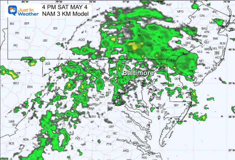
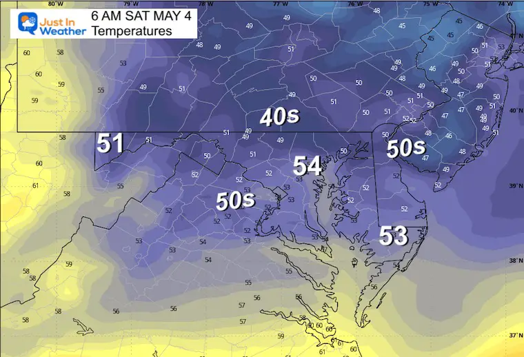
A chilly afternoon with more clouds and periods of rain.
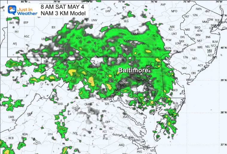
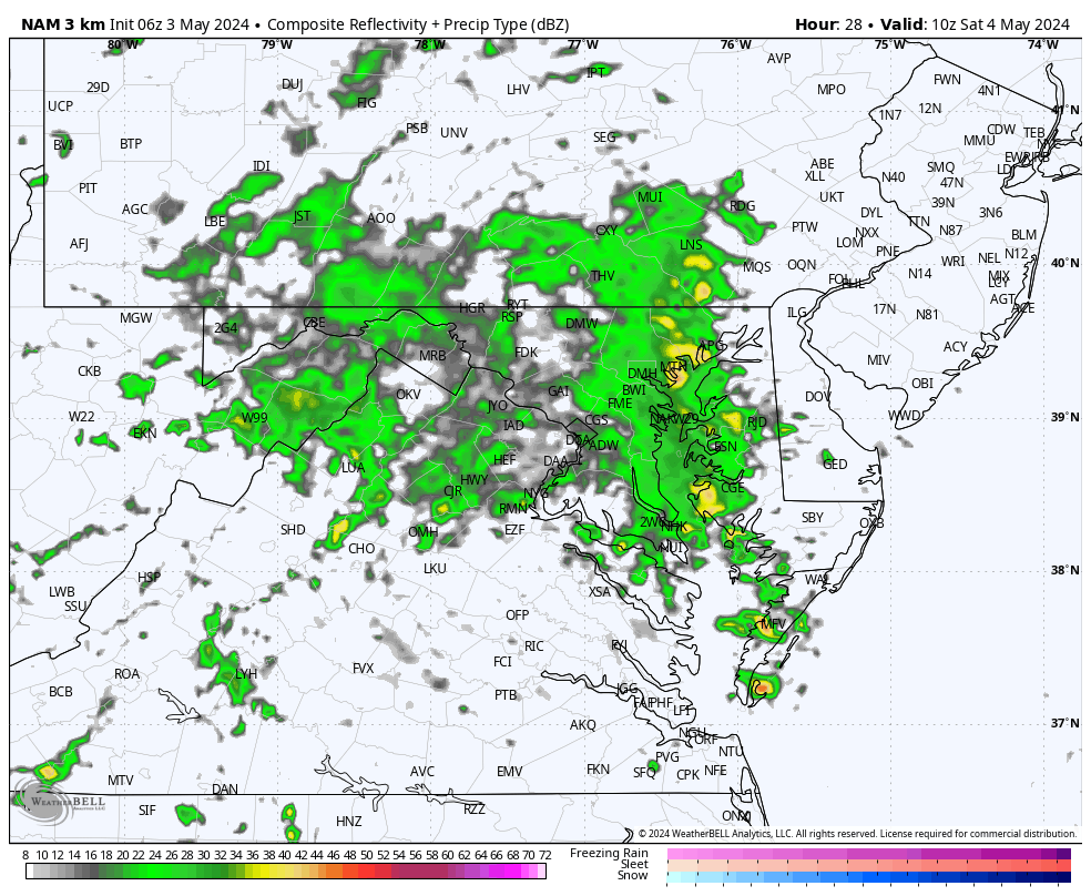
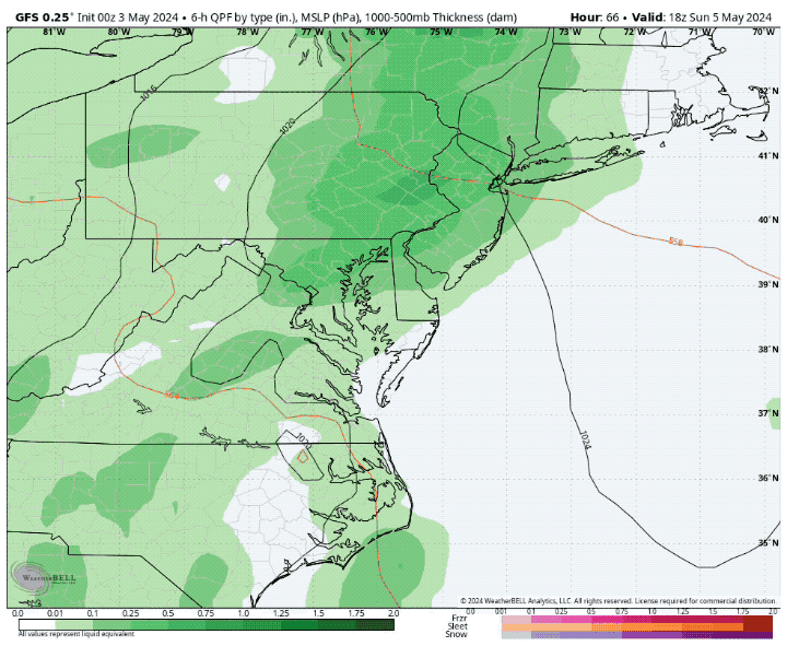
Another day with steady rain.
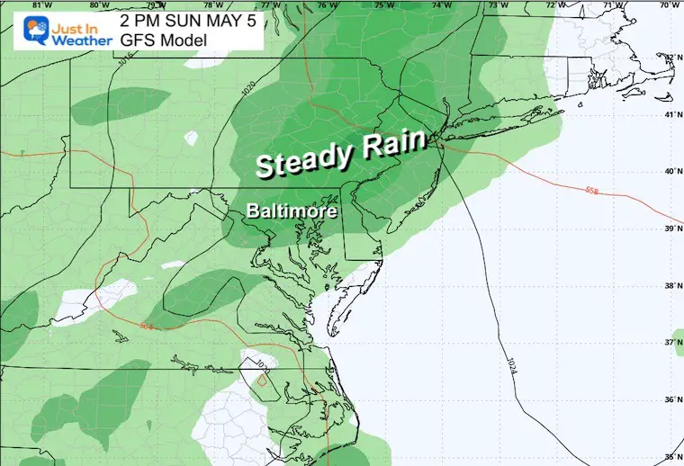
Steady rain again on Sunday, then a shift to more afternoon showers and thunderstorms during the work week.
This pattern is looking more wet!
The weekend sees more steady rain, and next week may have a risk of showers each day. As the weather warms up, this will shift to more afternoon thundershowers.
Click to see more and ‘Book’ a visit to your school

I am aware there are some spelling and grammar typos and occasional other glitches. I take responsibility for my mistakes and even the computer glitches I may miss. I have made a few public statements over the years, but if you are new here, you may have missed it: I have dyslexia and found out during my second year at Cornell University. It didn’t stop me from getting my meteorology degree and being the first to get the AMS CBM in the Baltimore/Washington region.
One of my professors told me that I had made it that far without knowing and to not let it be a crutch going forward. That was Mark Wysocki, and he was absolutely correct! I do miss my mistakes in my own proofreading. The autocorrect spell check on my computer sometimes does an injustice to make it worse. I also can make mistakes in forecasting. No one is perfect at predicting the future. All of the maps and information are accurate. The ‘wordy’ stuff can get sticky.
There has been no editor who can check my work while writing and to have it ready to send out in a newsworthy timeline. Barbara Werner is a member of the web team that helps me maintain this site. She has taken it upon herself to edit typos when she is available. That could be AFTER you read this. I accept this and perhaps proves what you read is really from me… It’s part of my charm. #FITF