Tuesday, April 16
Morning Report
Yesterday was sincerely a summer preview! Temperatures did soar as expected into the mid-80s with BWI hitting the mark of 85ºF. This fell short of the record 88ºF set in 1941. However, downtown Baltimore did experience the Urban Heat Island Effect by the Maryland Science Center with a high of 92ºF!
This heat helped fuel strong and severe thunderstorms. The most dynamic was across the Maryland and Pennsylvania line. This was actually on the northern fringe of the expected severe storm risk. The energy helped push cloud tops well over 40,000 Ft and allow for large hail to form. This was the most impressive image I got from Crystal Roman in Cecil County.
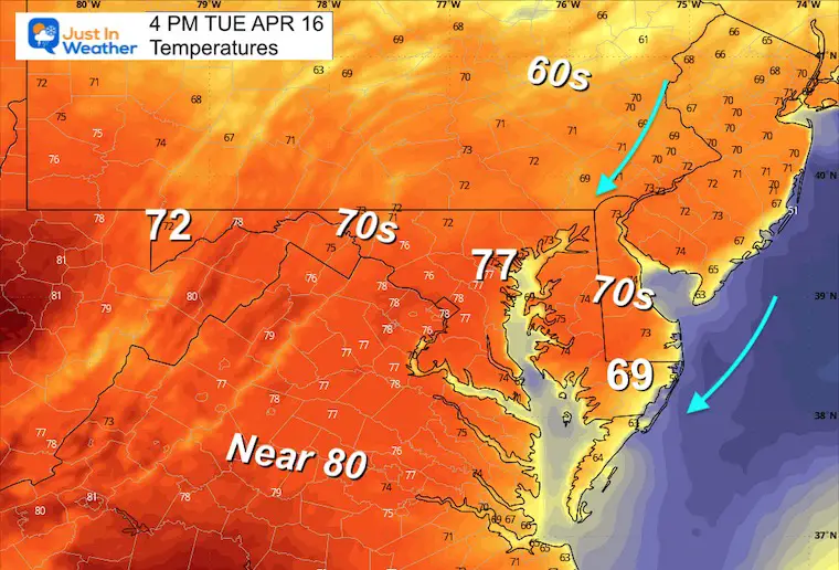
Today, a slightly cooler Northeast air flow will step temps back into the 70s, and that cooler trend will continue with rain added to the mix Wednesday through Friday.
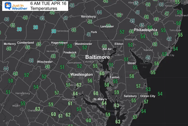
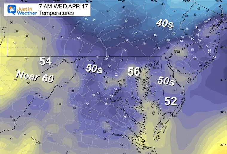
Morning Temperatures
Still very mild this morning!
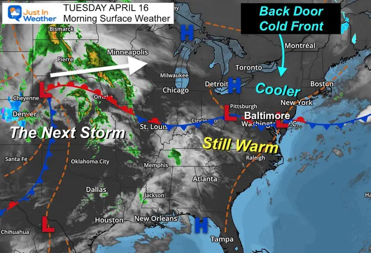
Morning Surface Weather
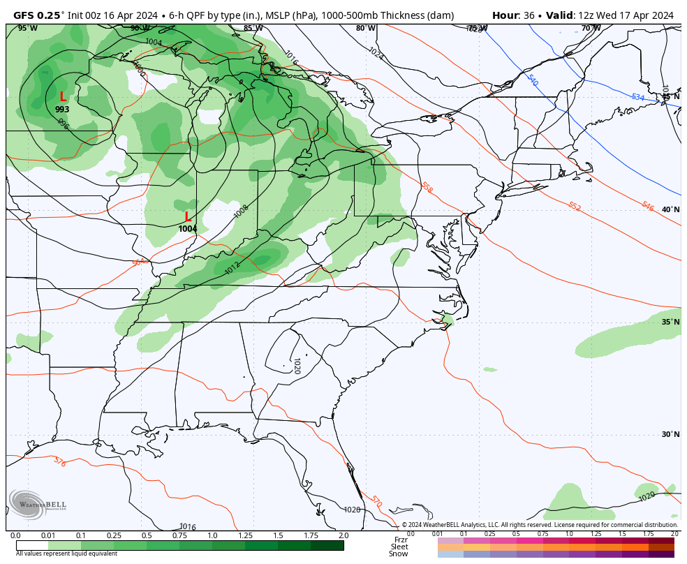
The stationary front is still nearby, but High Pressure across the Great Lakes is helping to push in dry and cooler air. As the next weather system approaches, this will be a more produced Backdoor Cold Front tomorrow. There will be more impulses sending waves of rain our way for the second half of the work week.
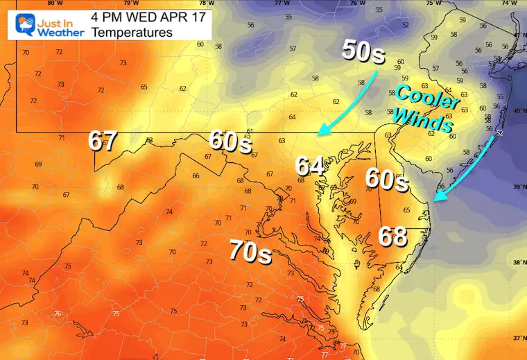
Afternoon Temperatures
CLIMATE DATA: Baltimore
TODAY April 16
Sunrise at 6:28 AM
Sunset at 7:46 PM
Normal Low in Baltimore: 44ºF
Record 30ºF in 1962
Normal High in Baltimore: 67ºF
Record 90ºF 2002; 2012
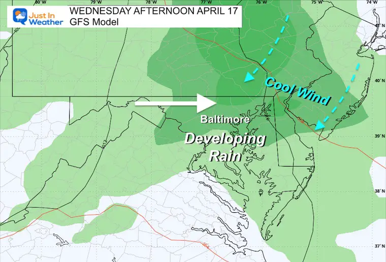
Wednesday Weather
A backdoor cold front will lock in lower temperatures with the Northeast wind. There will be steady rain in the afternoon and perhaps a rumble of thunder.
Morning Temperatures
Afternoon Temperatures
Weather Forecast Animation:
Wednesday to Friday
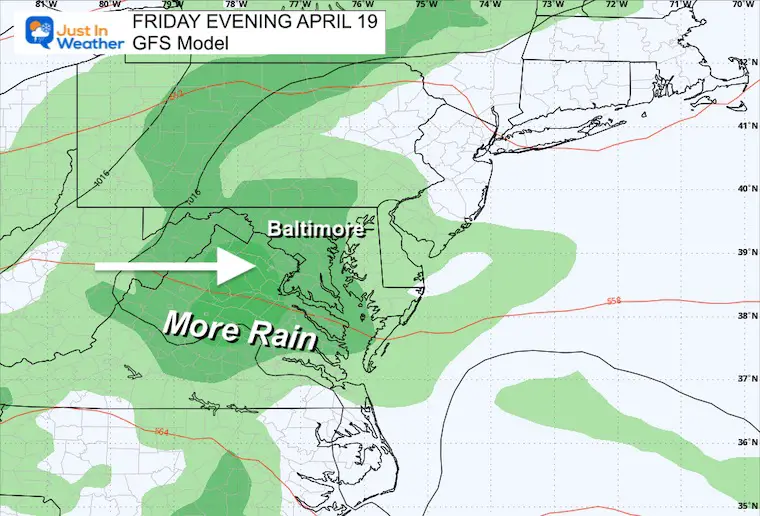
Rain moves in tomorrow, then breaks into showers on Thursday, with more rain later on Friday.
Snapshot Friday
The timing may change, but it looks like steady rain arrives later in the day.
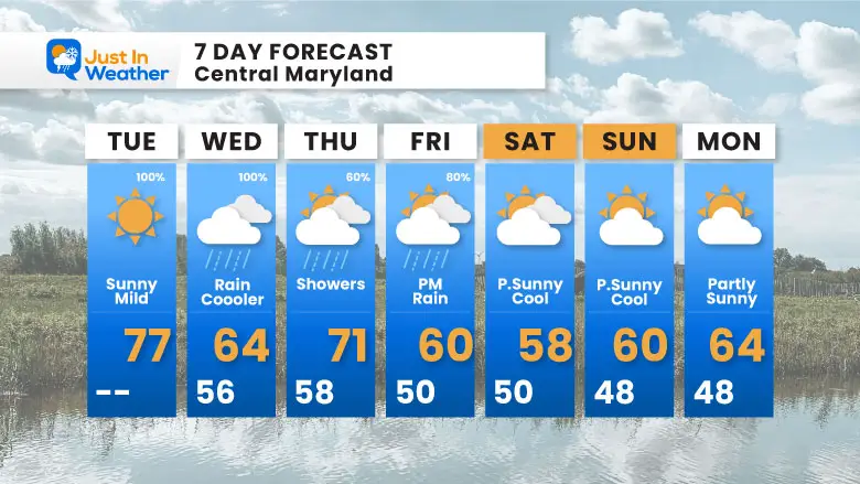
7 Day Forecast
The pattern will turn much cooler and wet for a few days. At this point the best chance for rain will be on Wednesday and Friday, then remaining cool but dry this weekend.
STEM Assemblies/In School Fields Trips Are Back
Click to see more and ‘Book’ a visit to your school

Please share your thoughts and best weather pics/videos, or just keep in touch via social media
RESTATING MY MESSAGE ABOUT DYSLEXIA
I am aware there are some spelling and grammar typos and occasional other glitches. I take responsibility for my mistakes and even the computer glitches I may miss. I have made a few public statements over the years, but if you are new here, you may have missed it: I have dyslexia and found out during my second year at Cornell University. It didn’t stop me from getting my meteorology degree and being the first to get the AMS CBM in the Baltimore/Washington region.
One of my professors told me that I had made it that far without knowing and to not let it be a crutch going forward. That was Mark Wysocki, and he was absolutely correct! I do miss my mistakes in my own proofreading. The autocorrect spell check on my computer sometimes does an injustice to make it worse. I also can make mistakes in forecasting. No one is perfect at predicting the future. All of the maps and information are accurate. The ‘wordy’ stuff can get sticky.
There has been no editor who can check my work while writing and to have it ready to send out in a newsworthy timeline. Barbara Werner is a member of the web team that helps me maintain this site. She has taken it upon herself to edit typos when she is available. That could be AFTER you read this. I accept this and perhaps proves what you read is really from me… It’s part of my charm. #FITF
Recent Snow Reports
Click each map for the maps and snow spotter lists.
February 17 Snow Report Maps
February 13 Snow Report Maps
January 19 Recap
Click here for the maps and full report
Jan 16 Snow Report
Click here or the map to see: The Snow Report Ending Jan 16
Subscribe for eMail Alerts
Explore More
Maryland Snow Climate History And Other Winter Pages


