Sunday, March 31
Morning Report
The burst of rain and thunder we had Saturday night did produce fog. Once that breaks up, most of us will see a dry day. More sun to the north, but clouds will redevelop today.
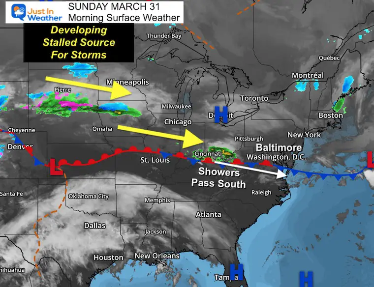
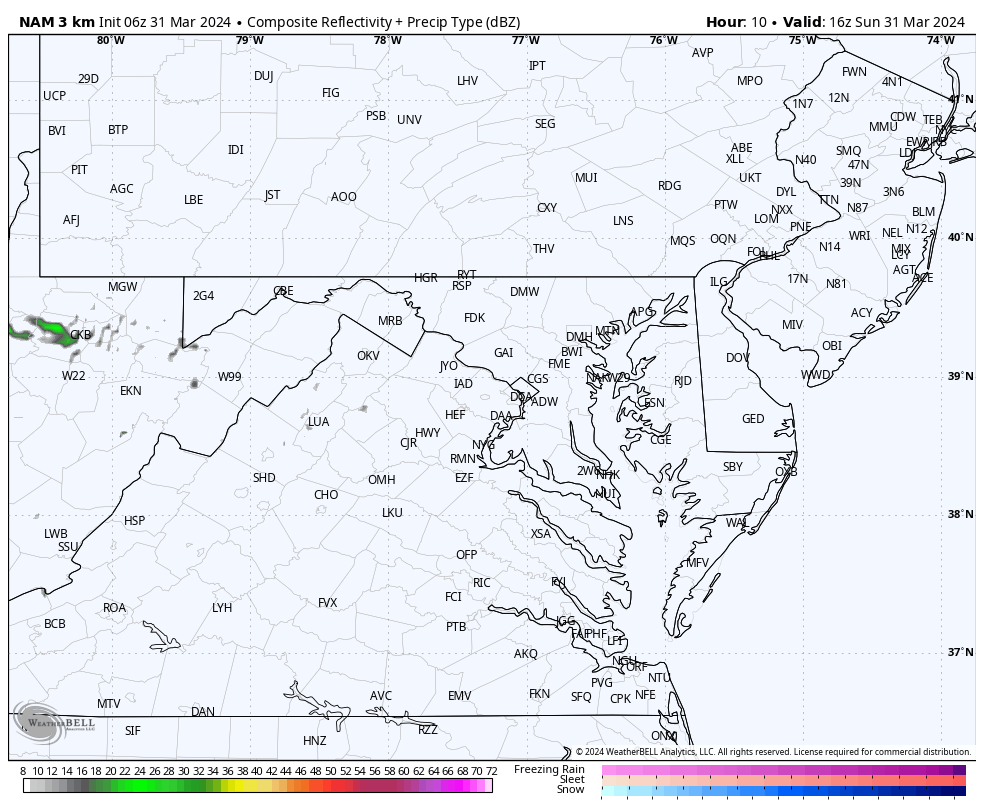
The weather pattern is very active, and the next impulse of rain showers will try to develop from the mountains to Southern Maryland this afternoon and evening.
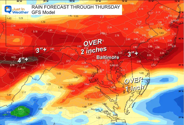
SOGGY WEEK AHEAD
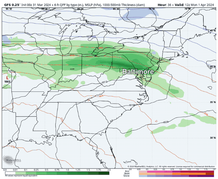
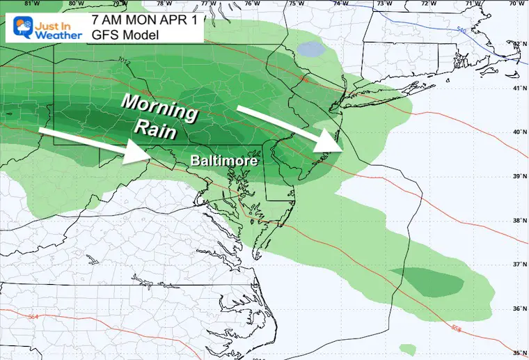
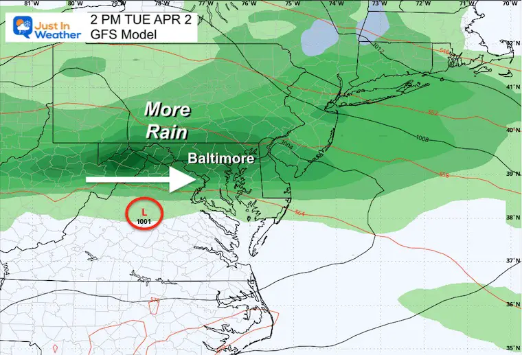
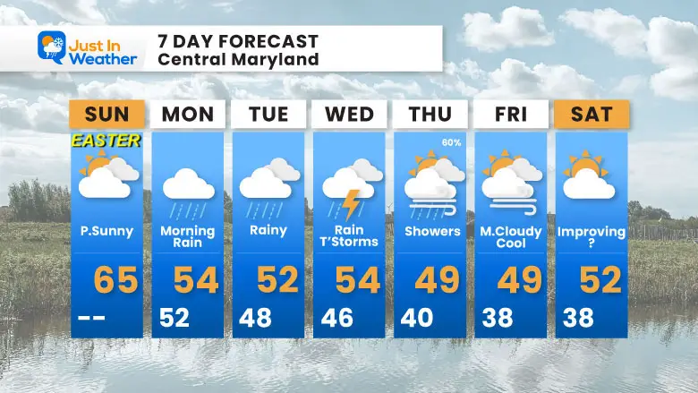
The work week ahead will be wet! Rain on Monday morning, may pause in the afternoon. Then more rain will fall through Thursday. We may see totals of 2 to 4 inches across the region.
Rain Forecast Through Thursday
Headlines
- Easter Sunday: One Day Break; Showers develop from mountains to Southern Maryland
- Next Week: Rainy Week
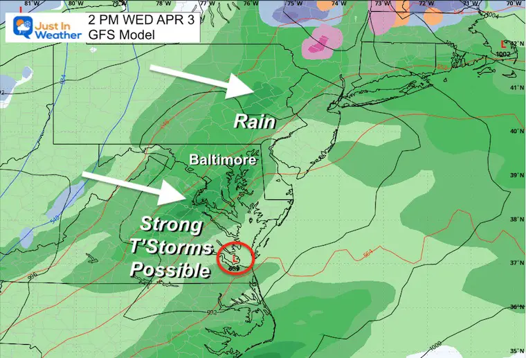
- Wednesday: Thunderstorms may be strong
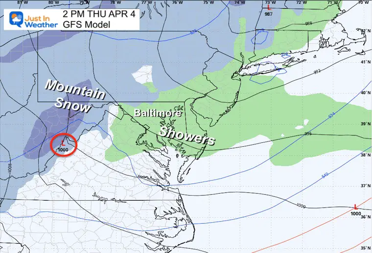
- Thursday: Chilly showers; Mountain Snow
Morning Surface Weather
After this sunny morning, the next weather system will be racing in with increasing clouds this afternoon.
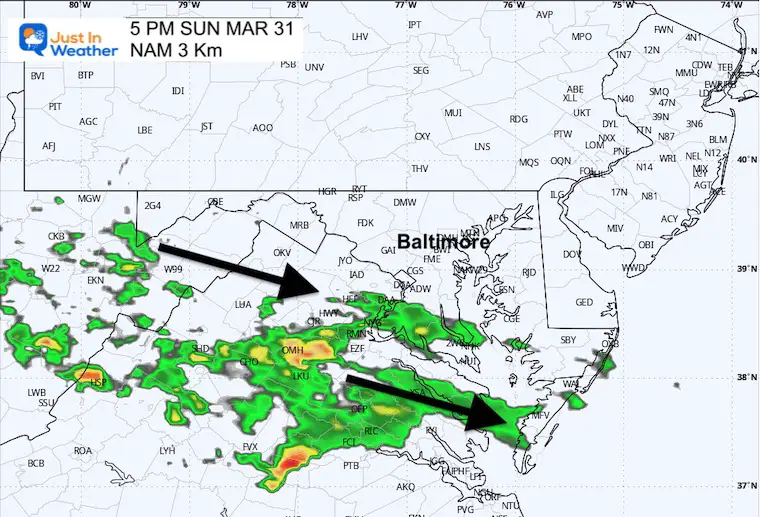
A cluster of rain will arrive late afternoon and evening.
Afternoon Temperatures
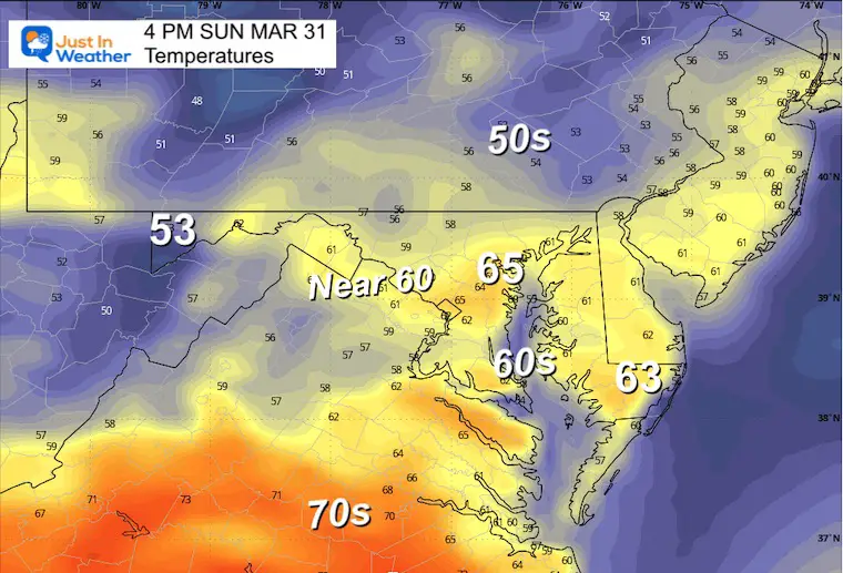
Late Afternoon
The track of rain showers will develop between the mountains to Southern Maryland. At this time, it looks like the best chance of getting wet will be AFTER 2 PM south of Annapolis.
Animation Noon to Midnight
IN CASE YOU MISSED THIS
CLIMATE DATA: Baltimore
TODAY March 31
Sunrise at 6:52 AM
Sunset at 7:30 PM
Normal Low in Baltimore: 38ºF
Record 20ºF in 1964
Normal High in Baltimore: 60ºF
Record 86ºF 1998
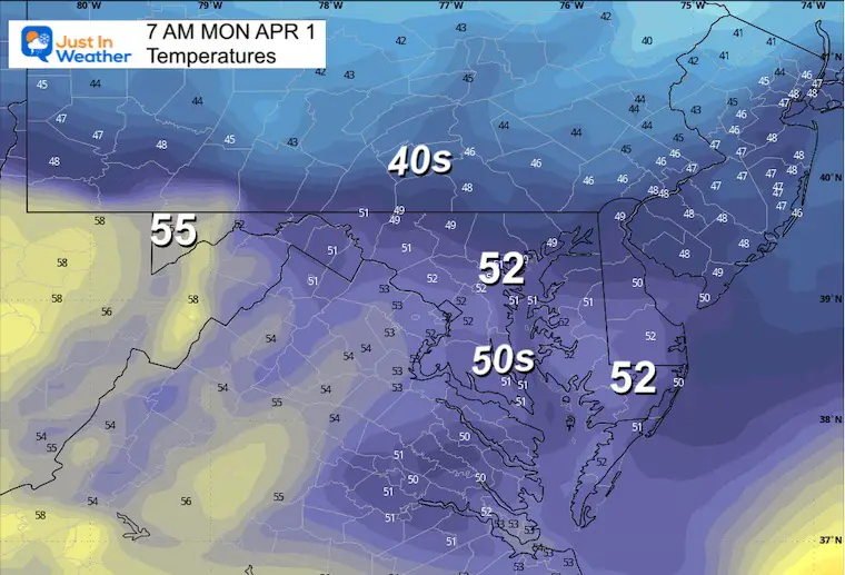
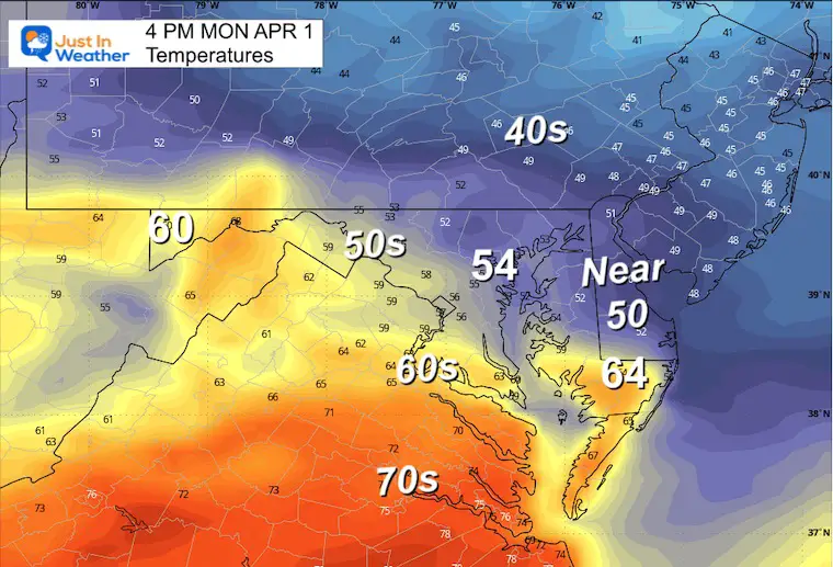
Monday Weather
Temperatures
Morning
Afternoon
Looking Ahead: Monday to Thursday
A sequence of impulses will bring us rain Monday morning, then again Tuesday. On Wednesday, a cold front may support heavier showers with strong thunderstorms.
Thursday brings in the cold upper level Low that keeps showers around with a burst of snow in the mountains.
Snapshots
Monday
Tuesday
Wednesday
Thursday
7 Day Forecast
STEM Assemblies/In School Fields Trips Are Back
Click to see more and ‘Book’ a visit to your school

Please share your thoughts and best weather pics/videos, or just keep in touch via social media
RESTATING MY MESSAGE ABOUT DYSLEXIA
I am aware there are some spelling and grammar typos and occasional other glitches. I take responsibility for my mistakes and even the computer glitches I may miss. I have made a few public statements over the years, but if you are new here, you may have missed it: I have dyslexia and found out during my second year at Cornell University. It didn’t stop me from getting my meteorology degree and being the first to get the AMS CBM in the Baltimore/Washington region.
One of my professors told me that I had made it that far without knowing and to not let it be a crutch going forward. That was Mark Wysocki, and he was absolutely correct! I do miss my mistakes in my own proofreading. The autocorrect spell check on my computer sometimes does an injustice to make it worse. I also can make mistakes in forecasting. No one is perfect at predicting the future. All of the maps and information are accurate. The ‘wordy’ stuff can get sticky.
There has been no editor who can check my work while writing and to have it ready to send out in a newsworthy timeline. Barbara Werner is a member of the web team that helps me maintain this site. She has taken it upon herself to edit typos when she is available. That could be AFTER you read this. I accept this and perhaps proves what you read is really from me… It’s part of my charm. #FITF
Recent Snow Reports
Click each map for the maps and snow spotter lists.
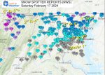
February 17 Snow Report Maps
February 13 Snow Report Maps
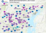
January 19 Recap
Click here for the maps and full report
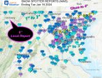
Jan 16 Snow Report
Click here or the map to see: The Snow Report Ending Jan 16
Subscribe for eMail Alerts
Explore More
Maryland Snow Climate History And Other Winter Pages


