


January 4 Weather One More Cold Day Then January Thaw By Mid Week
Sunday, January 4, 2026 Overnight, there were some snow showers that crossed the region. I would not be surprised if there are reports of a fresh dusting of snow on…
Wednesday Afternoon June 21, 2023
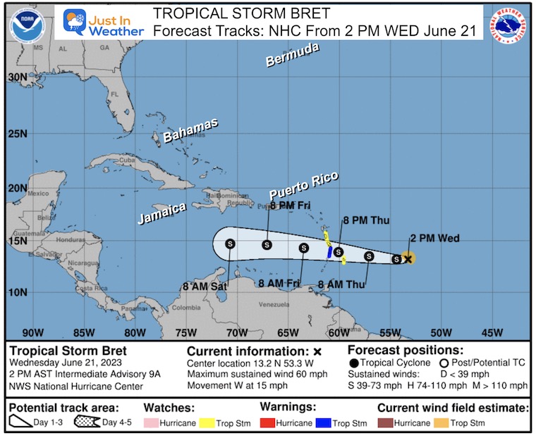
Now that we have a handle on Tropical Storm Bret, there appears to be a steady trend with the forecast track. The winds have reached 60 mph, and the track remains due west. While this is the general expectation, the overall track has been suppressed even farther south into the central Caribbean.
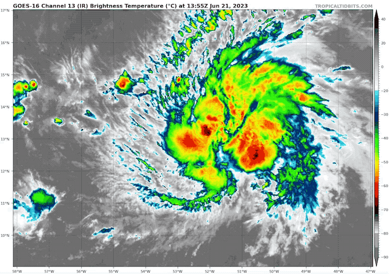
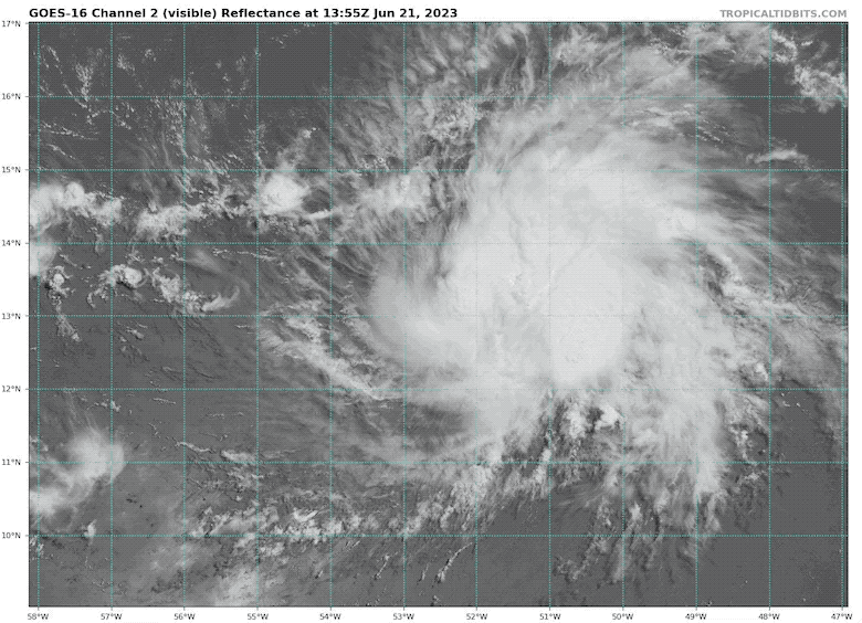
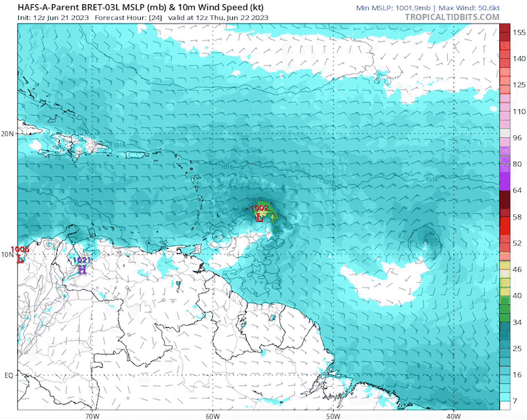
The circulation is wrapped, and cloud tops have been reported as warming, which is a signal of stagnant intensification or weakening. So, while it is larger, expanding to 80 miles from the center, it may have maxed out.
The colder colors are colored brighter and represent higher cloud cover. There are flare-ups and convection keeping this going, but the overall circulation is not well organized. So while the growth has stalled or even weakened, there may be some brief increases in intensity for the next day or two.
The tropical storm winds extend 80 miles from the center.
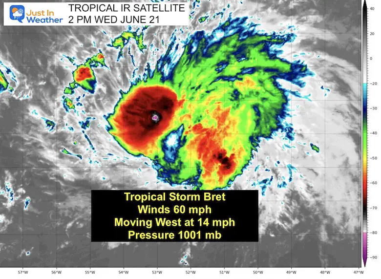
LOCATION…13.2N 53.3W
ABOUT 415 MI…670 KM E OF BARBADOS
MAXIMUM SUSTAINED WINDS…60 MPH…95 KM/H
PRESENT MOVEMENT…W OR 280 DEGREES AT 15 MPH…24 KM/H
MINIMUM CENTRAL PRESSURE…1001 MB…29.56 INCHES
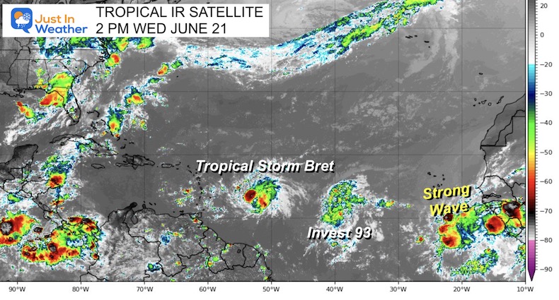
This may help show the ragged circulation. The higher, wispy, circus clouds are experiencing wind sheer and getting pushed more from the west. This is a common occurrence during an El Niño and one reason the season forecast is expected to be lower in storm numbers.
A Tropical Storm Warning is in effect for…
A Tropical Storm Warning means that tropical storm conditions are expected somewhere within the warning area within 36 hours.
A Tropical Storm Watch is in effect for…
A Tropical Storm Watch means that tropical storm conditions are possible within the watch area, in this case within the next 24 to 48 hours.
(Compare to model maps below)
Note that this track remains nearly due West AND still at Tropical Storm Intensity (S). The trend has continued to move further South. This may be noteworthy with future storms.
WIND: Tropical storm conditions are expected within the warning area and possible within the watch areas late Thursday and Thursday night.
RAINFALL: Through Saturday, storm total rainfall amounts of 3 to 6 inches with maximum amounts of 10 inches are possible across portions of the Lesser Antilles from Guadeloupe south to St. Vincent and the Grenadines, including Barbados. The heavy rainfall could lead to flash flooding, especially across areas of higher terrain.
Urban flooding is also possible.
SURF: Swells generated by Bret are expected to begin affecting portions of the Lesser Antilles on Thursday. These swells are likely to cause life-threatening surf and rip current conditions.
Please consult products from your local weather office.
This model has followed the overall trend passing farther south into the central Caribbean. That is farther away from Puerto Rico, but Jamaica may still be impacted at least by high waves.
The collection of model forecast plots all point almost due West. This is a further southward track.
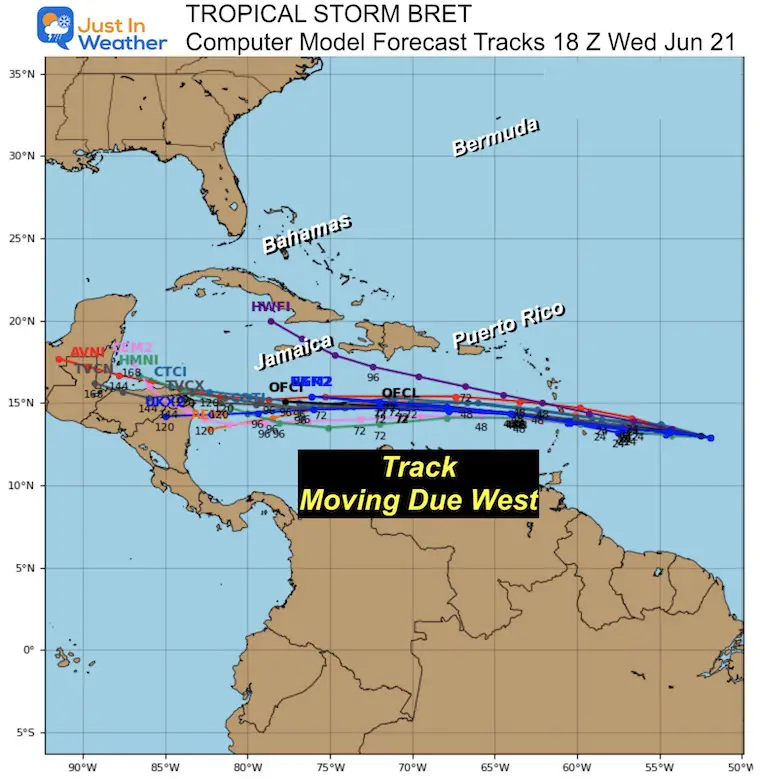
The ensemble members of the GEFS show agreement on this due West track. At this time, Nicaragua may get a landfall next Monday.

In addition to Tropical Storm Bret, to the east (behind it) is Invest 93 that has a 70% chance to develop on the next 48 hours. An even stronger tropical wave is now exiting Africa and worth watching for more development.
Note: On January 16, there was an unnamed Tropical Depression identified by The National Hurricane Center. It did not get a name but will be included in the overall tropical records. It was located about 300 miles from Bermuda.
I will have a more detailed article on the history of names soon.
Names are in alphabetical order.
Sign up and be the first to know!

I am aware there are some spelling and grammar typos, and occasional other glitches. I take responsibility for my mistakes, and even the computer glitches I may miss. I have made a few public statements over the years, but if you are new here you may have missed it: I have dyslexia, and found out during my second year at Cornell University. It didn’t stop me from getting my meteorology degree, and being first to get the AMS CBM in the Baltimore/Washington region. One of my professors told me that I had made it that far without knowing, and to not let it be a crutch going forward. That was Mark Wysocki and he was absolutely correct! I do miss my mistakes in my own proofreading. The autocorrect spell check on my computer sometimes does an injustice to make it worse. I also can make mistakes in forecasting. No one is perfect predicting the future. All of the maps and information are accurate. The ‘wordy’ stuff can get sticky. There has been no editor that can check my work when I needed it and have it ready to send out in a newsworthy timeline. Barbara Werner is a member of the web team that helps me maintain this site. She has taken it upon herself to edit typos, when she is able. That could be AFTER you read this. I accept this and perhaps proves what you read is really from me… It’s part of my charm.
#FITF