


January 13 Mild Ahead Of Arctic Front That Will Bring Rain To Snow Later Wednesday
Tuesday January 13 We are once again back to mild afternoons with sunshine, but that is about to change. The next cold front will usher in a series of arctic…
June 13, 2023
Tuesday Morning Update
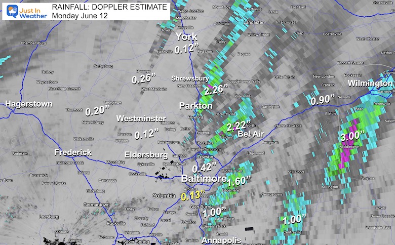
Remember that rain we expected yesterday? I hedged my call lower than the computer guidance and still supported a widespread 1/2 inch or more. Well, that didn’t exactly happen. Most of the areas that saw some rain, got under 1/4 inch. However, there were a few pockets of storms that dropped over 2 inches.
This Doppler Radar estimation shows the storm winners in Northern Baltimore to Southern York Counties. Another cell tracked into North Bel Air with 2.22”, while South Bel Air was closer to 0.25”.
Southeast Baltimore had over 1 inch of rain over Edgemere and Dundalk. The biggest winner was northern Delaware with 2 to 3 inches of rain.
Officially Baltimore’s BWI observed 0.13” at the airport, but more fell over the city.
Basically: If you missed out on the rain yesterday, you are not alone, but there were some lucky spots. While there is some more rain on the way, nothing will bust our growing drought in the near future.
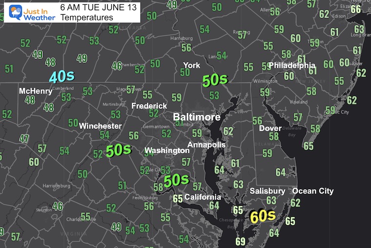
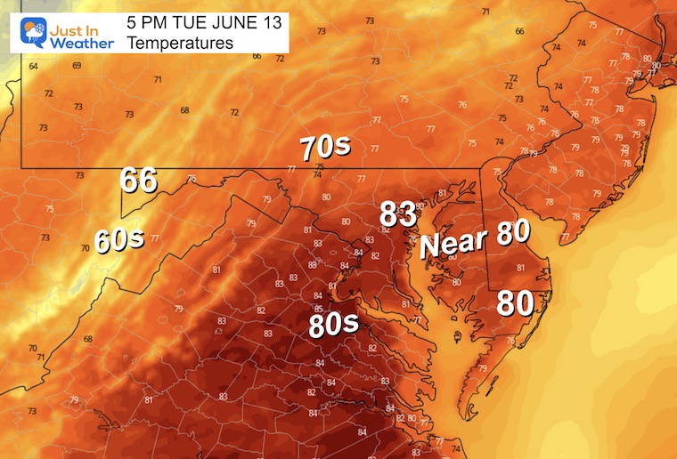
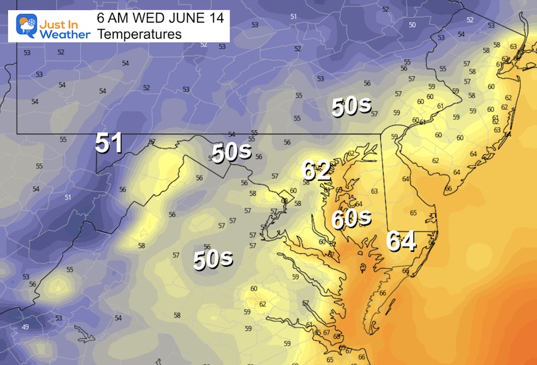
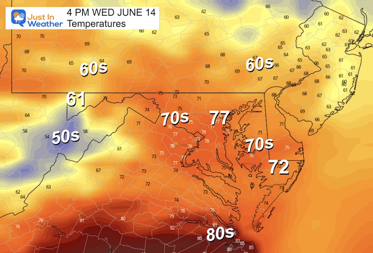
We are in mid-June and it still feels like early Spring. Temperatures have dropped into the 50s for most of our region with low humidity. This is a rarity and even includes some inland areas close to the 40s, which is the common theme in the mountains.
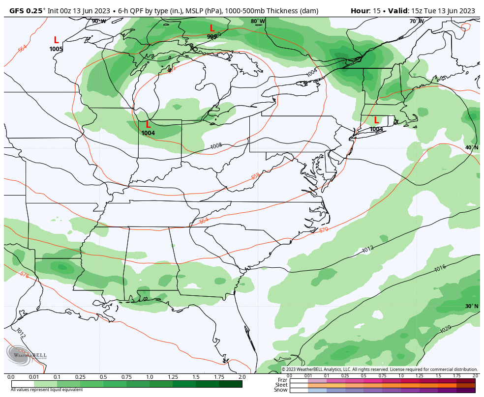
The large Upper Level circulation is easy to spot. We have a cool and dry patch in place this morning. We will watch the core Low shift east tomorrow.
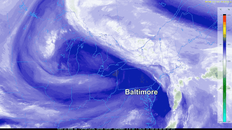
A pleasant air mass has built-in today, which is thanks to westerly winds around a larger upper level Low in the Great Lakes.
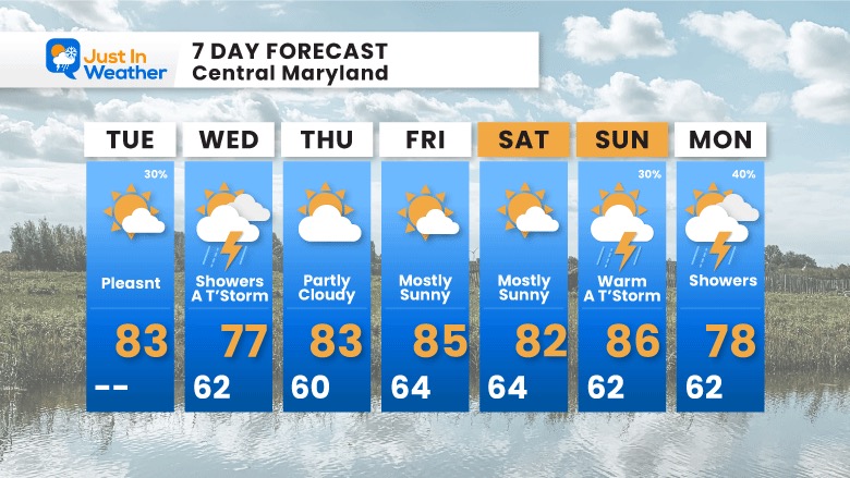
That system will pivot east and bring unsettled conditions again tomorrow. That will bring more clouds and a chance for showers.
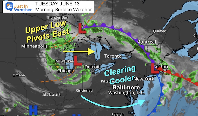
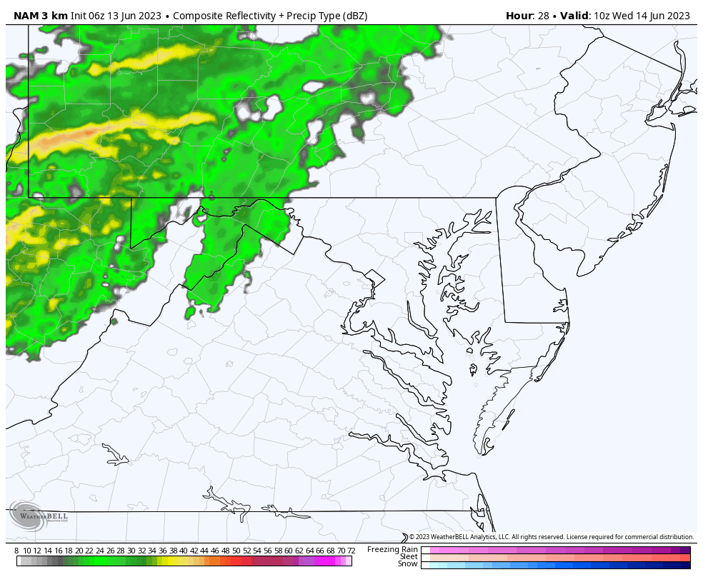
Watching that upper-level Low pivot east, it will bring some rain tomorrow, but more will be focused in the mountains to our north and west.
A closer look at the radar simulation is below.
Seasonal temps and comfortable humidity.
Sign up and be the first to know!
Normal Low in Baltimore: 62ºF
Record 51ºF in 1985
Normal High in Baltimore: 84ºF
Record 97ºF 2017
Not as chilly as tomorrow morning.
There will be steady rain in the mountains that will once again break up farther east. We will get showers in the morning, then pop-up thunderstorms in the afternoon.
I do not trust the model guidance to pin down specific times or locations. Just plan for showers and more rain likely farther west and north.
Temps are expected to be lower due to more clouds and showers.
For any other mid-June, this would be a very pleasant forecast. However, the pleasant and dry outlook is not good for our growing drought.
Showers tomorrow will be spotty, then the next ‘chance’ may be a thundershower on Father’s Day leading into showers on Monday.
Sign up and be the first to know!

I am aware there are some spelling and grammar typos, and occasional other glitches. I take responsibility for my mistakes, and even the computer glitches I may miss. I have made a few public statements over the years, but if you are new here you may have missed it: I have dyslexia, and found out during my second year at Cornell University. It didn’t stop me from getting my meteorology degree, and being first to get the AMS CBM in the Baltimore/Washington region. One of my professors told me that I had made it that far without knowing, and to not let it be a crutch going forward. That was Mark Wysocki and he was absolutely correct! I do miss my mistakes in my own proofreading. The autocorrect spell check on my computer sometimes does an injustice to make it worse. I also can make mistakes in forecasting. No one is perfect predicting the future. All of the maps and information are accurate. The ‘wordy’ stuff can get sticky. There has been no editor that can check my work when I needed it and have it ready to send out in a newsworthy timeline. Barbara Werner is a member of the web team that helps me maintain this site. She has taken it upon herself to edit typos, when she is able. That could be AFTER you read this. I accept this and perhaps proves what you read is really from me… It’s part of my charm.
#FITF