April 14, 2023
Friday Morning Update
We are chipping away at the record heat as slow moving weather systems will be riding over our region this weekend. The net result will bring in more clouds today, perhaps with some late showers that will increase overnight and Saturday.
The timing may not be optimal over the weekend, and the rain totals will be scattered, but this will be beneficial to the moderate drought conditions.
I want to repeat some information I showed last night, in case you missed it. Today’s weather report will follow below.
Record Heat Thursday
Baltimore tied the record high for the date of 89ºF, which was set on April 13 in 1977.
In Washington DC, Dulles tied their record set in that same year at 87ºF.
Dozens Of Records Tied or Broken Thursday
Moderate Drought
The latest drought monitor shows most of central Maryland and The Lower Eastern Shore at level D1 = Moderate Drought. Combine a nearly snowless winter plus total precipitation nearly 1/2 of normal for the year, and the problems become more obvious.
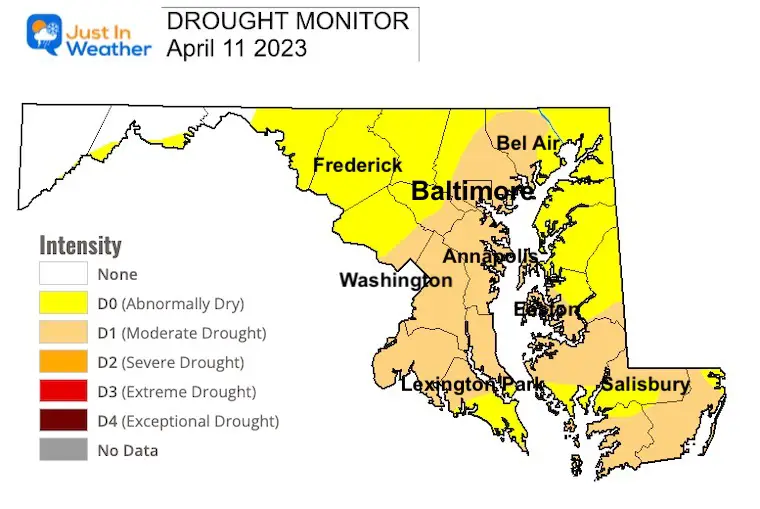
Local Conditions For Baltimore at BWI
- Rainfall to date = 5.94”
- Normal = 11.45”
- Deficit = 5.51
- LAST YEAR TO DATE = 12.30”
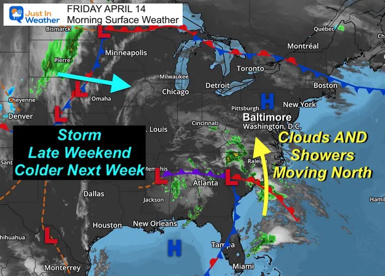
Friday Morning Surface Weather
The same weather system that helped produce historic flooding around Fort Lauderdale, FL is creeping north. We will not get the same intense activity, but it will be increasing the moisture we desperately need. Clouds will be increasing today and perhaps we will get late day or overnight showers. More rain on Saturday will show up as scattered showers and storms.
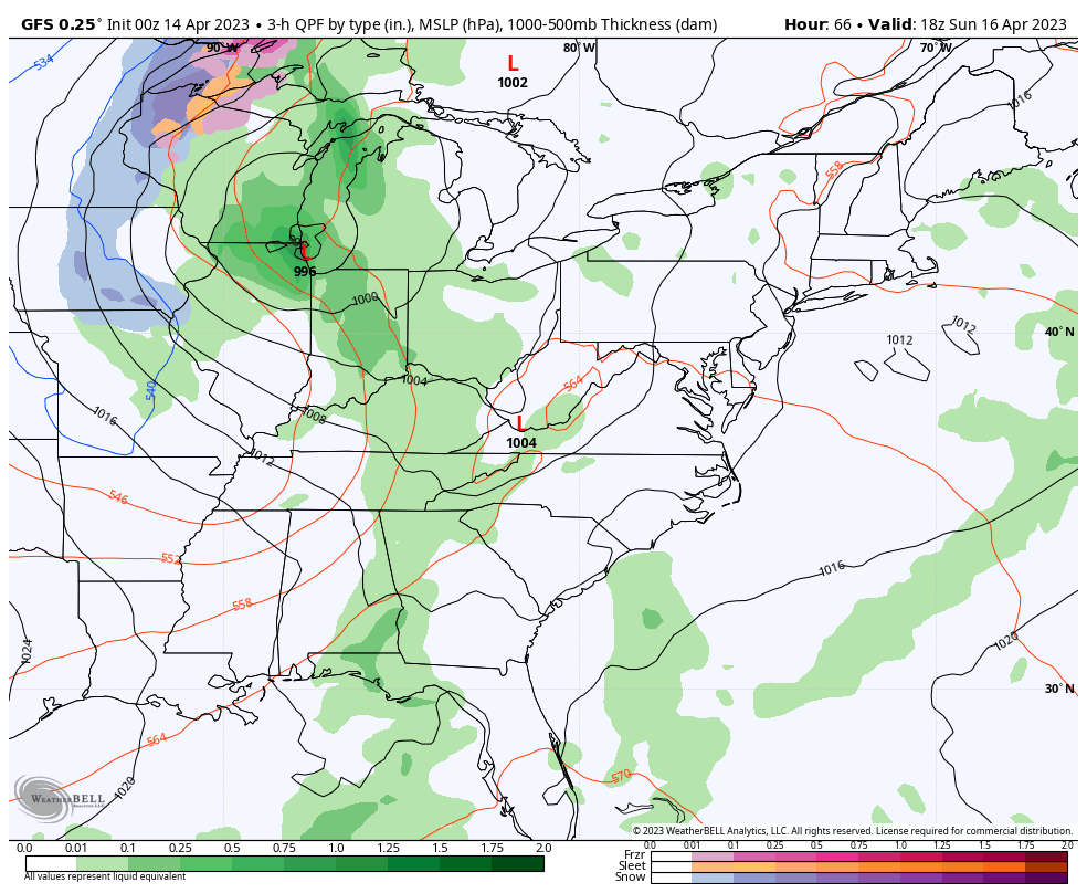
The next main event will be a storm in the central US that will arrive Sunday night.
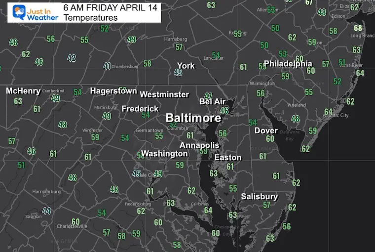
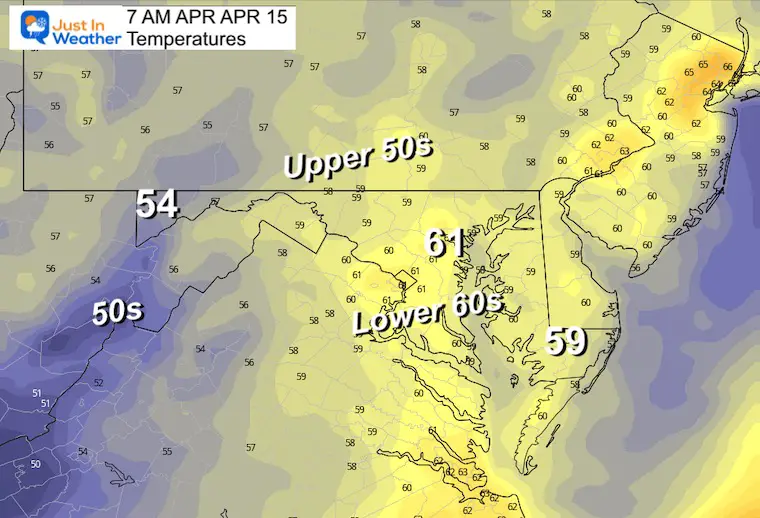
Morning Temperatures
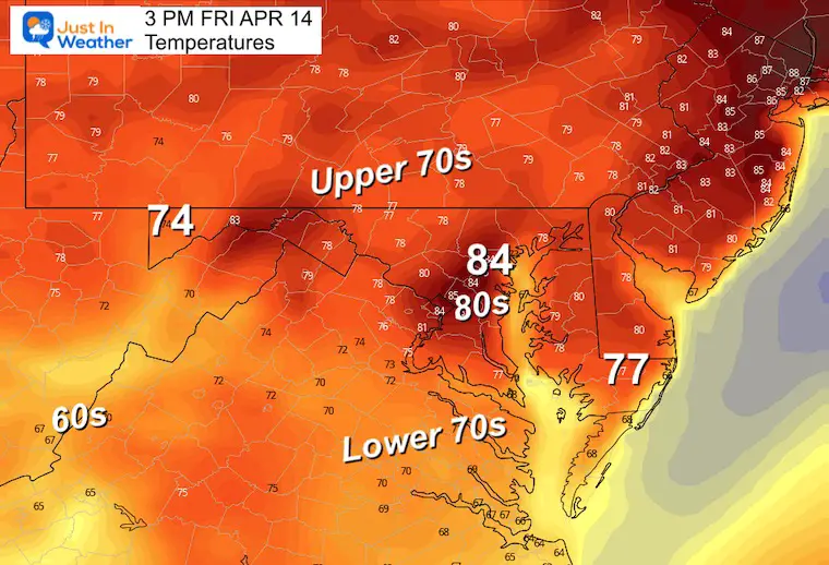
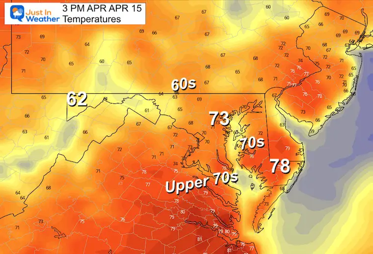
Afternoon Temperatures
Not nearly as warm as yesterday.
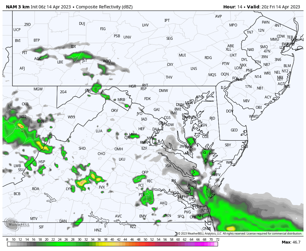
Radar Simulation
4 PM Friday to Saturday Morning
This NAM 3 KM Model is the most aggressive, but I wanted to show the worst case scenario… It looks like we will have increasing clouds. As for rain showers??? There is a slight chance later this afternoon and evening.
Overnight we may see more showers or thunderstorms.
Subscribe for eMail Alerts
CLIMATE DATA
TODAY April 14
Normal Low in Baltimore: 43ºF
Record 24ºF in 1950
SNOW: 0.3” in 1940
Normal High in Baltimore: 66ºF
Record 89ºF in 1977
REPORTS:
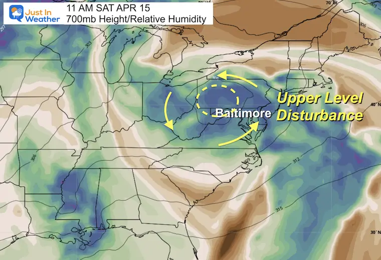
Weekend Weather
A disturbance will bring scattered showers on Saturday. This will NOT be a washout. It will be tough to pin down specific locations and timing of showers until we get closer. So for now, just keep it as part of your planning.
Sunday will be warm and the storms are more likely to hold off until evening and overnight.
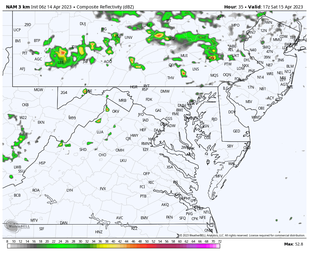
Radar Simulation
1 PM Saturday to Midnight
This will NOT be a washout, but there will be scattered showers popping anywhere at any time. The model shown here is NOT precise and may miss some cells.
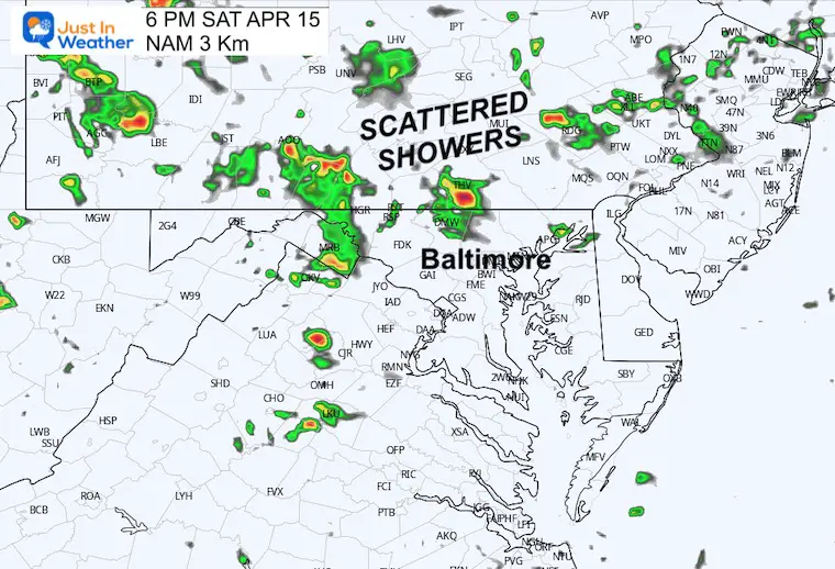
Evening Snapshot
At this time it is best to just expect a shower or maybe a thunderstorm at any time.
I had to include the risk for some sparks of lightning, so please pay attention if you have outdoor plans.
Temperatures
Morning
Afternoon
Cooler temps with more clouds and showers.
Model Animation
Saturday Afternoon to Tuesday Morning
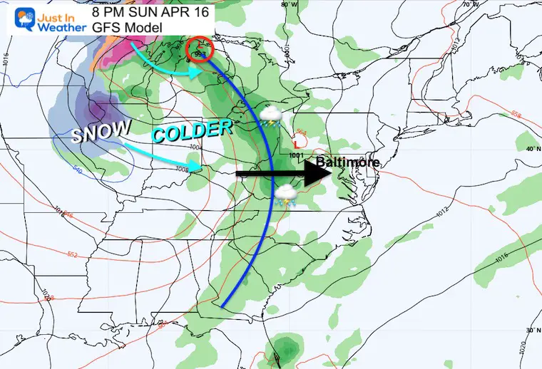
The core storm will pass through the Great Lakes. This will swing a cold front our way Sunday night into Monday morning. It may maintain the line of thunderstorms then usher in the colder winds.
Sunday Night Snapshot
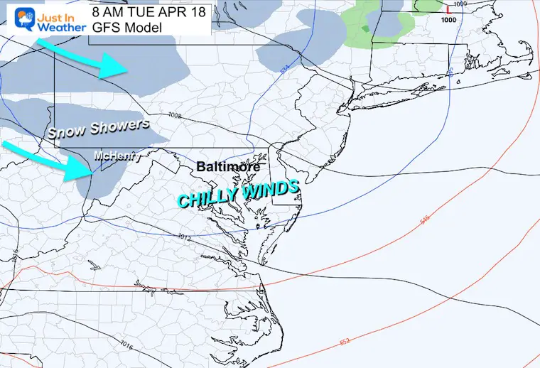
Tuesday Morning Snapshot
As the cold winds reach us, snow showers will fall over the mountains of western Maryland.
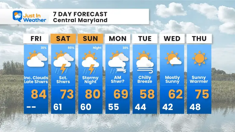
7 Day Forecast
This weekend will be cooler with more clouds, increased humidity, and some showers. The real drop will be noticed by Tuesday.
STEM Assemblies/In School Fields Trips Are Back
Click to see more and ‘Book’ a visit to your school

Please share your thoughts, best weather pics/videos, or just keep in touch via social media
RESTATING MY MESSAGE ABOUT DYSLEXIA
I am aware there are some spelling and grammar typos, and occasional other glitches. I take responsibility for my mistakes, and even the computer glitches I may miss.
I have made a few public statements over the years, but if you are new here you may have missed it:
I have dyslexia, and found out during my second year at Cornell University. It didn’t stop me from getting my meteorology degree, and being first to get the AMS CBM in the Baltimore/Washington region. One of my professors told me that I had made it that far without knowing, and to not let it be a crutch going forward. That was Mark Wysocki and he was absolutely correct!
I do miss my mistakes in my own proofreading. The autocorrect spell check on my computer sometimes does an injustice to make it worse. I also can make mistakes in forecasting. No one is perfect predicting the future.
All of the maps and information are accurate. The ‘wordy’ stuff can get sticky.
There has been no editor that can check my work when I needed it and have it ready to send out in a newsworthy timeline. Barbara Werner is a member of the web team that helps me maintain this site. She has taken it upon herself to edit typos, when she is able. That could be AFTER you read this.
I accept this and perhaps proves what you read is really from me…
It’s part of my charm.
#FITF


