January 30 Mild Today Then Arctic Air On The Way And Some Snow
January 30, 2023
Monday Morning Report
Today starts off and will remain mild. There are areas of patchy fog around Baltimore, and rain in southern Maryland. This afternoon will be the most comfortable of the week.
Arctic air is showing up on the weather map just to our west, and it will begin to arrive tomorrow. As a result, it now appears a band of showers will develop that will mix snow and sleet in with rain.
Wednesday morning remains a little contentious with the modeling, so I ask again to keep an open mind. After that, the core of the arctic blast will reach us this weekend, just in time for the Maryland Polar Bear Plunge.
Headlines
- Today: Very Mild
- Tuesday: Colder with Snow and Rain Showers
- Wednesday: Still watching possible light snow
- Weekend: Arctic Blast
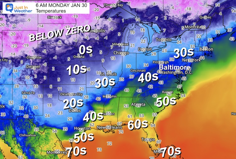
Morning Temperatures
I am showing the wide view today to showcase the arctic blast. This air mass is undeniable and will be slowly moving in our direction. The 20s have reached Dallas with temperatures in the -teens and -20s across the Northern Plains and Rockies.
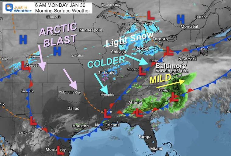
Morning Surface Weather
The arctic front remains just to our west. We remain on the mild side with rain showers in southern Maryland.
Tracking this front is the challenge of the week as the speed and progress will determine both how cold we get AND if light snow may break out over the next few days.
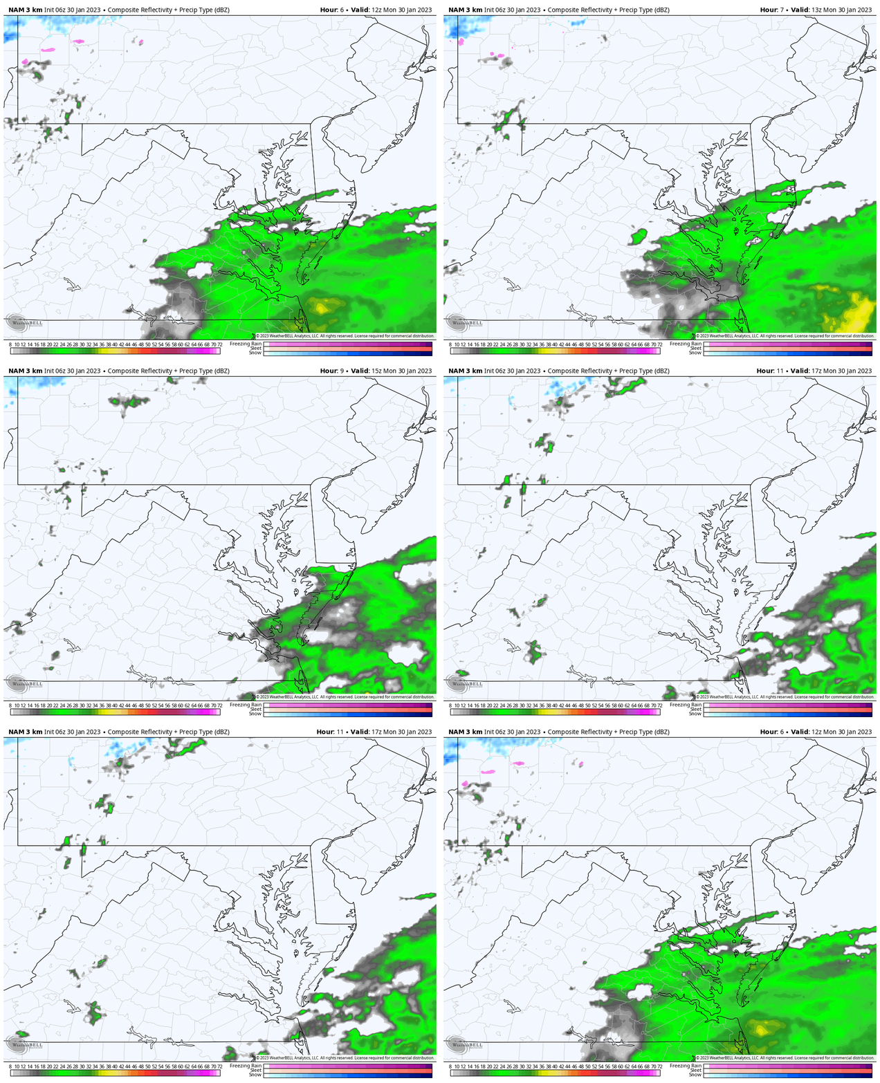
Radar Simulation
7 AM to Noon
Light rain across southern Maryland…
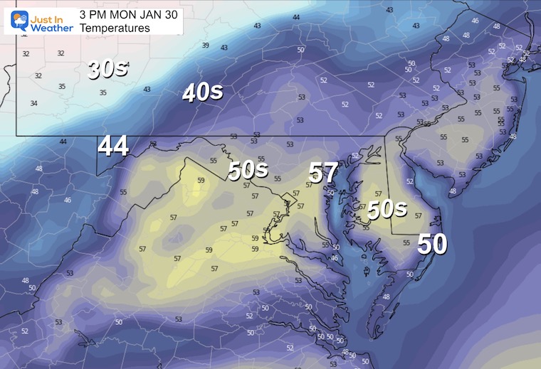
Afternoon Temperatures
Today will be the warmest day of the week! I hope you get out to enjoy it.
Subscribe for eMail Alerts
Weather posts straight to your inbox
Sign up and be the first to know!
CLIMATE DATA
TODAY January 30
Normal Low in Baltimore: 25ºF
Record -4ºF in 1873
SNOW: 9.1” 1930
Normal High in Baltimore: 44ºF
Record 72ºF 1914
Climate Trivia
Latest Measurable Snow In Baltimore
Today Is Still 3rd Latest
- Feb 21 in 1973 (50 years ago)
- Feb 6 in 1914 (109 years ago)
- Jan 29 in 2023 (So Far Confirmed)
- Jan 25 in 1992 ( 31 years ago)
- Jan 25 in 1901 ( 122 years ago)
- Jan 23 in 1966 (57 years ago)
Tuesday Weather
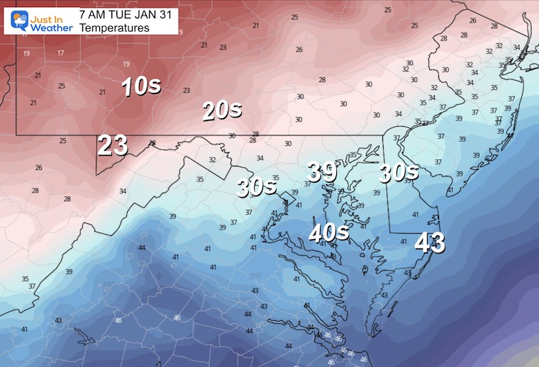
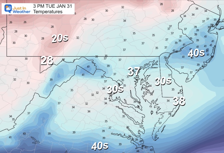
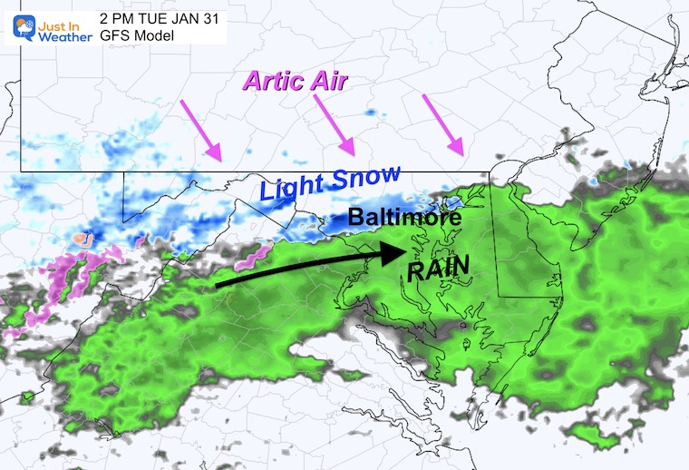
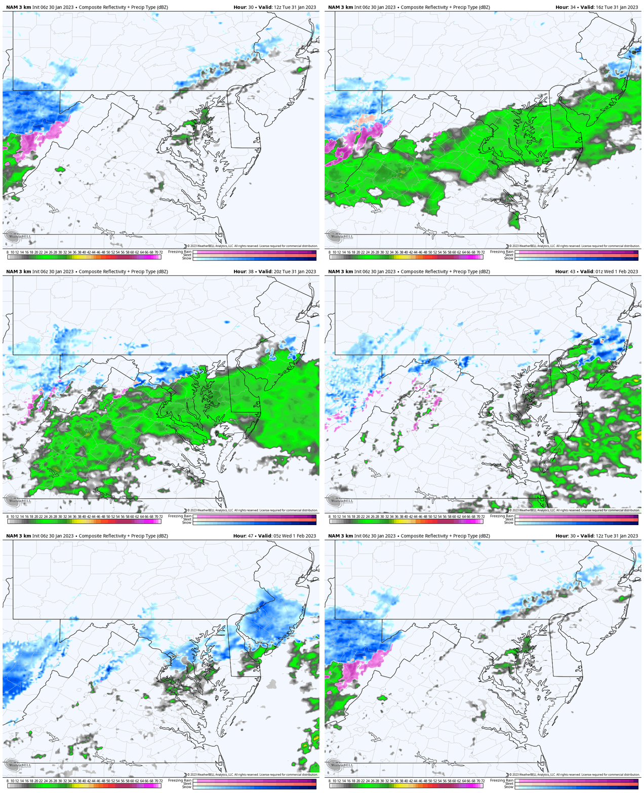
The arctic front will develop some showers with rain south and snow on the north side. This will slowly pass southward through central Maryland during the afternoon.
Temperatures Morning
Temperatures Afternoon Highs
Snapshot: Mid Afternoon
If there are light snow or sleet showers in central Maryland, temps should be just above freezing on the surface.
Radar Simulation
7 AM to Midnight
Wednesday Outlook:
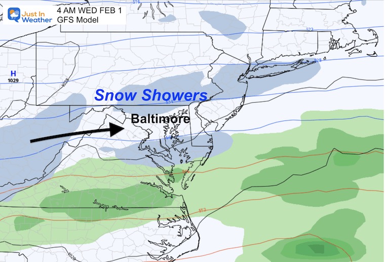
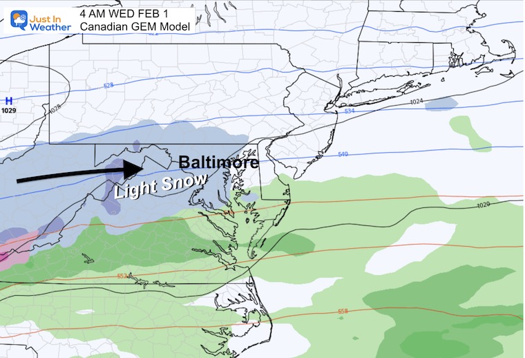
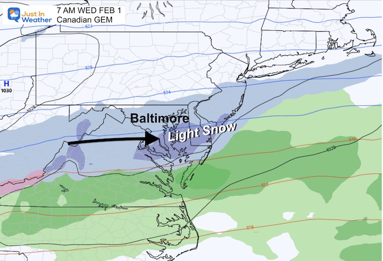
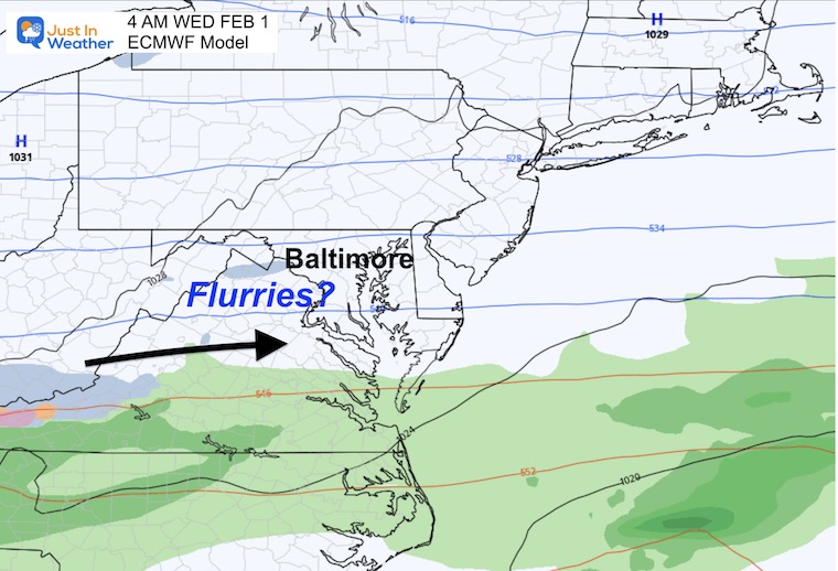
This is still up for debate as the models remain widely spread for snow or no! This is all based on where that arctic front settles. If it remains across Maryland, we get light snow. If it moves farther south, we miss that disturbance.
Early Morning
GFS Model
This has trended back north with the front and showing snow showers.
Canadian GEM Model
This has been the most persistent keeping the front across Maryland and letting that impulse impact fully, albeit with light snow before and through sunrise.
4 AM
7 AM
European ECMWF
This model remains farthest south with the front, keeping us dry.
My Thoughts
We will definitely experience a colder winter week. The uncertainty for snow remains and it appears whatever we may see will be small.
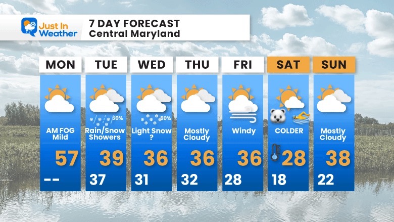
7 Day Forecast
The arctic air will be arriving this week. The progress of that air mass and the cold front is the make or break for the mid week snow. We do expect the core of the coldest air to reach us Saturday…. Unfortunately appropriate for the Maryland Polar Bear Plunge.
Also See:
Winter History: Low Snow And Late Starts
See my research based on Baltimore data since 1883.
Subscribe for eMail Alerts
Weather posts straight to your inbox
Sign up and be the first to know!

STEM Assemblies/In School Fields Trips Are Back
Click to see more and ‘Book’ a visit to your school
My Winter Outlook: Not A Typical La Niña!
I see many factors to support colder influence with multiple systems. Early and later in winter. Check it out.
October 27 Nor’easter Recap Still Breezy Then Next Storm Friday
Also See The Winter Outlook Series:
October 27 Nor’easter Recap Still Breezy Then Next Storm Friday
Farmer’s Almanac Comparison
September Starts Meteorological Autumn: Weather Climate Stats For Maryland at Baltimore
Triple Dip La Niña Winter
https://justinweather.com/2022/09/09/winter-outlook-2023-la-nina-triple-dip-expectations/
CONNECTION TO WINTER?
If you want a snowy winter, this is what you might want to look for in the rest of the tropical season.
Rainbow Ice Cave In Mt. Rainier A Very Rare Find: Photos And Video
Wooly Bear Caterpillars
https://justinweather.com/2022/10/25/winter-weather-outlook-from-the-wooly-bear-caterpillar/
Persimmon Seeds
Click to see Top 20 and MORE
Winter Weather Folklore Top 20 And More Outlook Signals From Nature For Cold And Snow
Normals And Records: Maryland and Baltimore Climate History
Please share your thoughts, best weather pics/videos, or just keep in touch via social media
-
-
Facebook: Justin Berk, Meteorologist
-
Twitter: @JustinWeather
-
Instagram: justinweather
-


