January 29 Rain Showers Brief Warming And Then Much Colder
January 29 2023
Sunday Morning Report
A frontal boundary bringing in rain today will be crossing the mountains today, then central areas mid day. Some afternoon showers, but this system may fall apart east of the mountains.
A brief boost in temps on Monday will be followed by a dramatic cool down. The question about snow remains uncertain as computer model guidance is still split.
I remain confident with the cold air mass, but I ask you keep an open mind about the rest given the low confidence in guidance.
Headlines
- Today: Rain Showers
- Monday: Very Mild
- Colder Air On The Way
Morning Temperatures
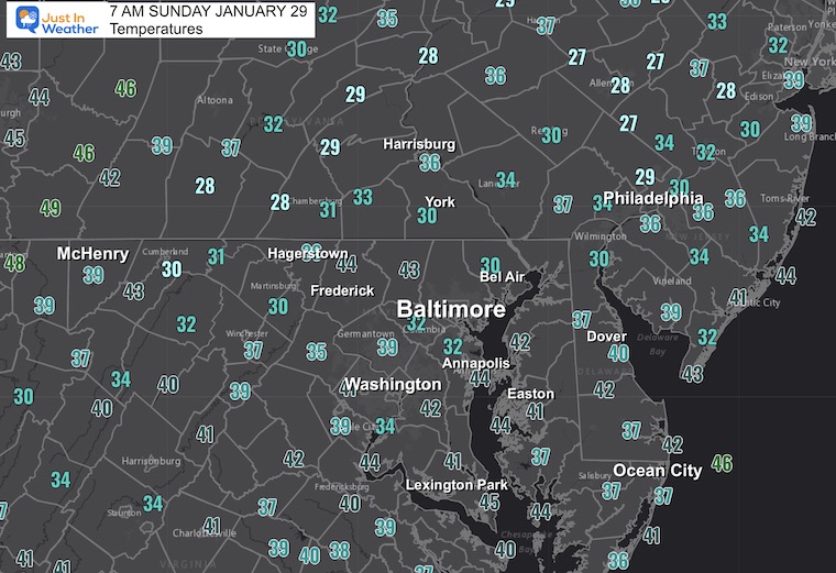
Morning Surface Weather
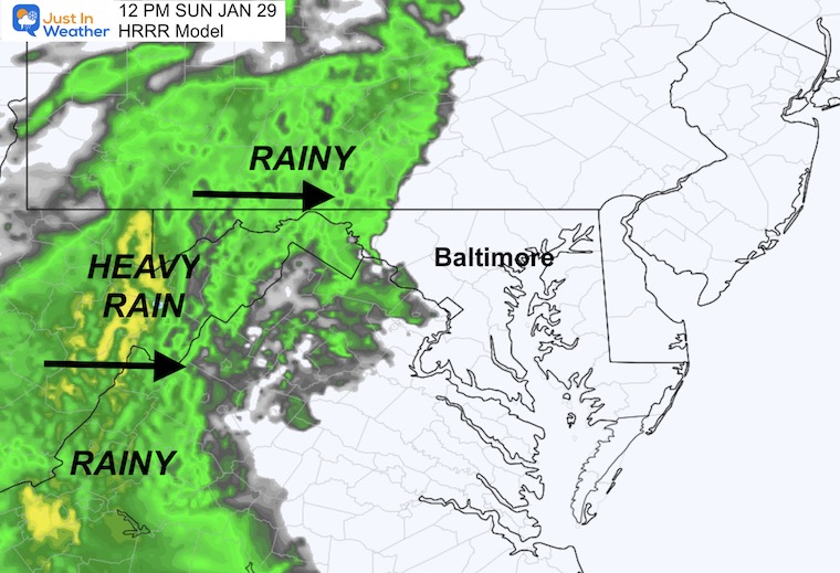
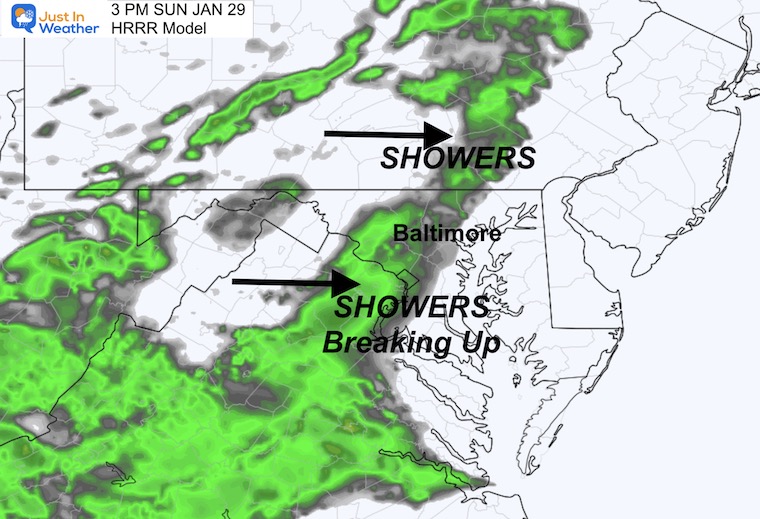
A steady field of rain is streaming across the Appalachian Mountains. This is our weather system, but it is likely to fall apart east of the mountains (see below).
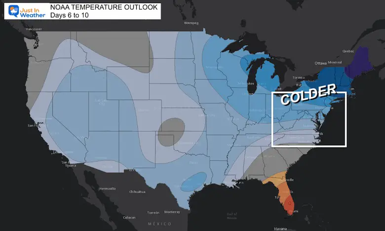
Behind this cold front, much colder air will spread south and east. This will reach the Mid Atlantic coast for the second half of the work week.

LIVE RADAR WIDGET
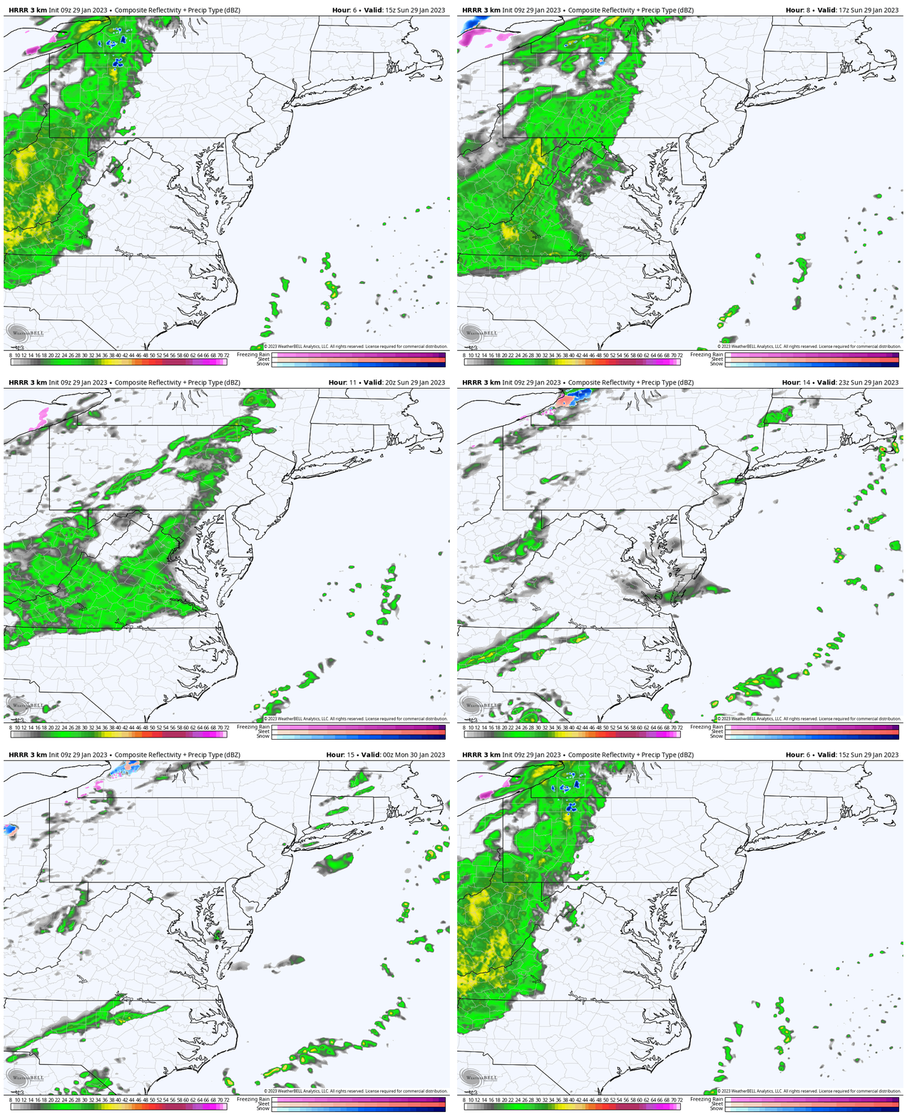
We will be tracking rain entering the mountains this morning, then falling apart as it heads east.
Radar Simulation
10 AM to 7 PM
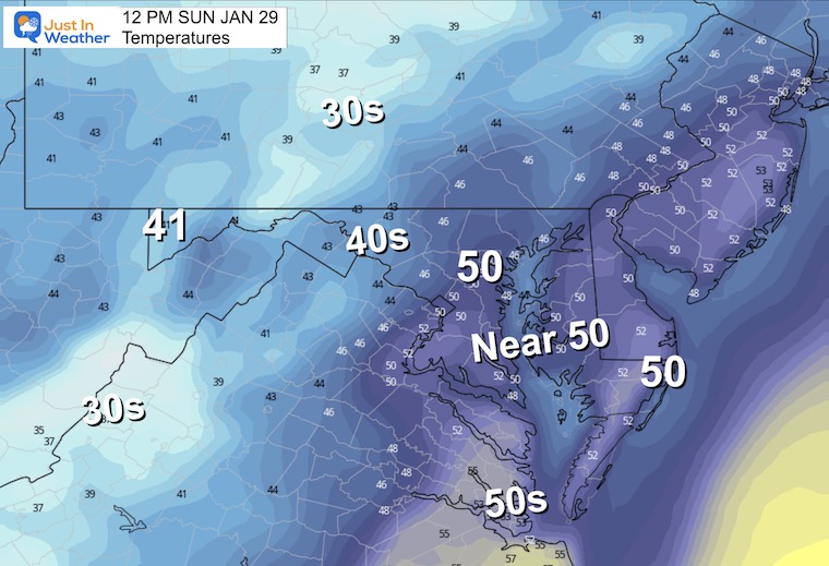
Noon Weather
Radar Snapshot
Temperatures
This may be the warmest time of day, before the rain showers arrive.
3 PM Weather
Radar Snapshot
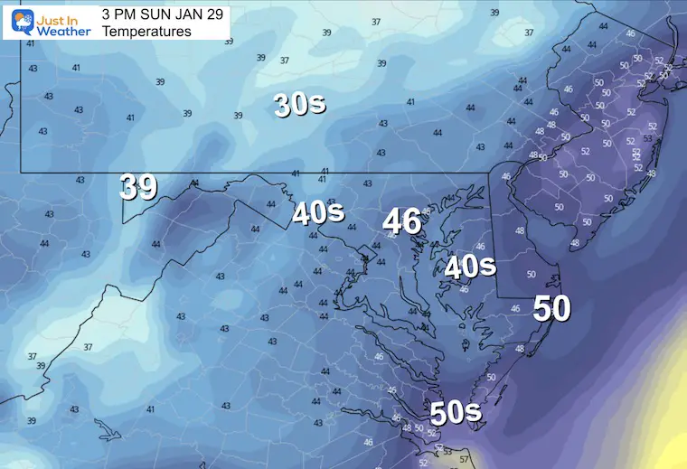
Temperatures
Notice the central areas drop from near 50ºF to the mid 40s.
Climate Trivia
Latest Measurable Snow In Baltimore
Today Is Still 3rd Latest
- Feb 21 in 1973 (50 years ago)
- Feb 6 in 1914 (109 years ago)
- Jan 28 in 2023 (So Far Confirmed)
- Jan 25 in 1992 ( 31 years ago)
- Jan 25 in 1901 ( 122 years ago)
- Jan 23 in 1966 (57 years ago)
Subscribe for eMail Alerts
Weather posts straight to your inbox
Sign up and be the first to know!
CLIMATE DATA
TODAY January 29
Normal Low in Baltimore: 25ºF
Record -7ºF in 1963
SNOW: 9.1” 1966
Normal High in Baltimore: 43ºF
Record 75ºF 1975
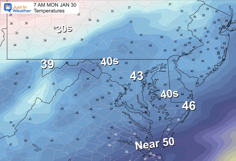
Monday Weather
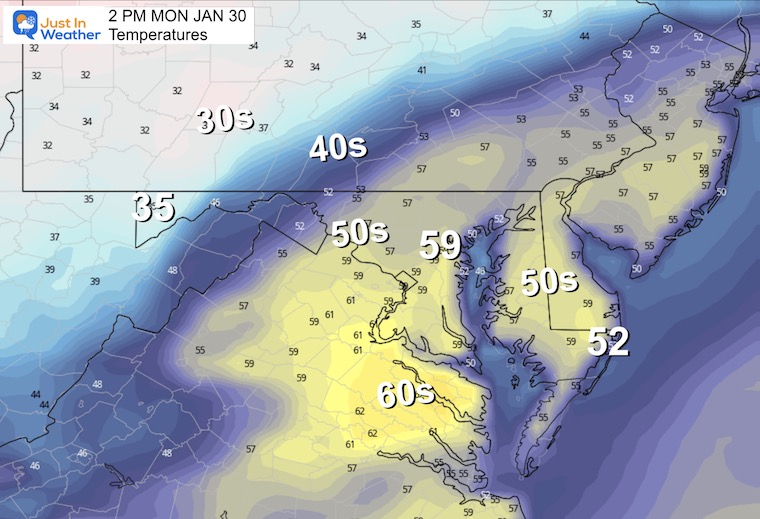
We may begin with fog, then the sun will break out to boost temps in a hurry.
Temperatures Morning
Temperatures Afternoon Highs
We will see colder air reach the mountains through central Pennsylvania. However, a surge of warm air for metro areas will jump into the upper 50s and perhaps a few spots hitting 60ºF.
Storm Outlook:
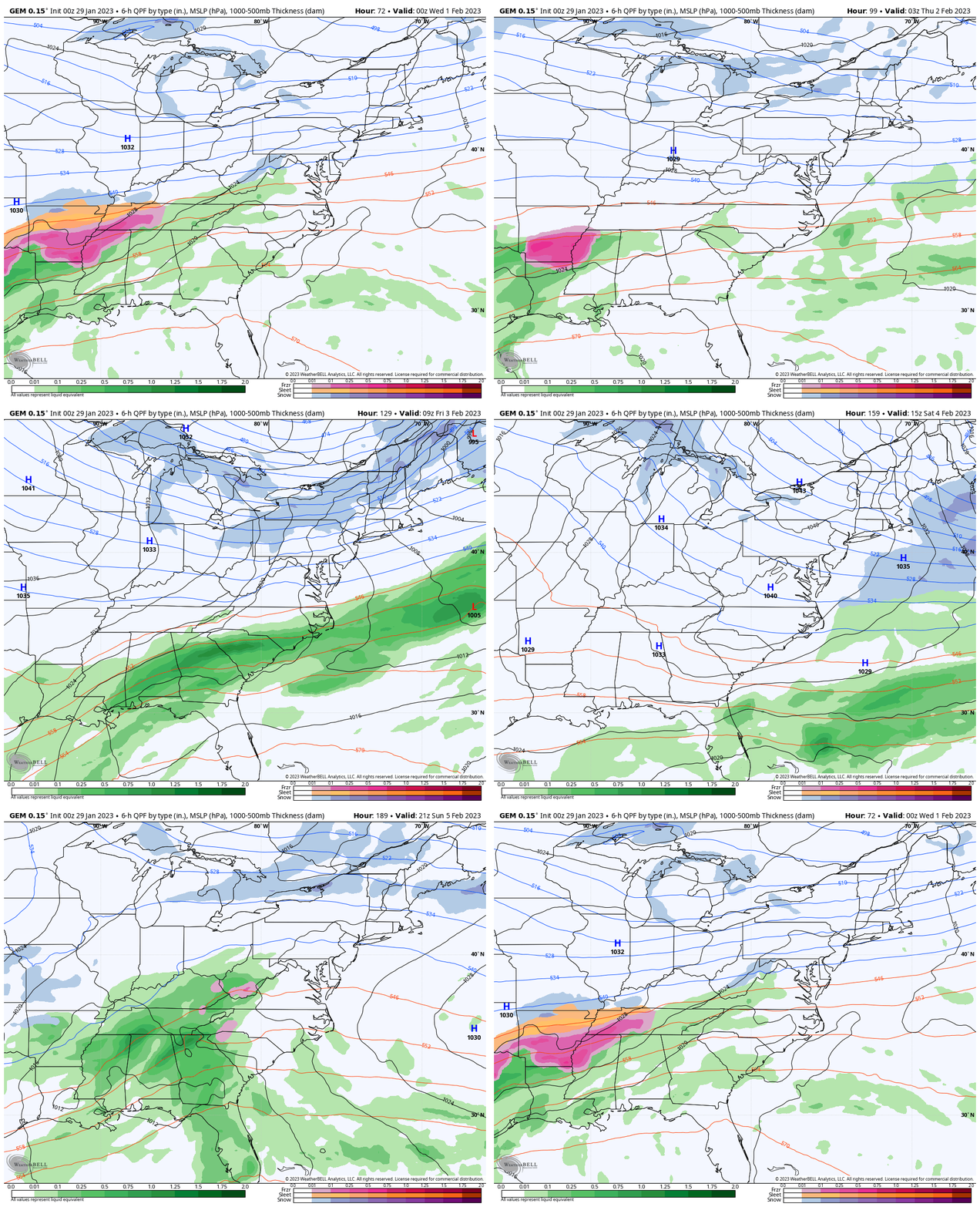
I am going to show the comparison of The Canadian GEM to the The European ECMWF Model. The GEM tends to perform at its best when there is arctic air in place. We will have that in the week ahead. However, there is a very big difference!
Canadian GEM
Tuesday Afternoon to NEXT Monday
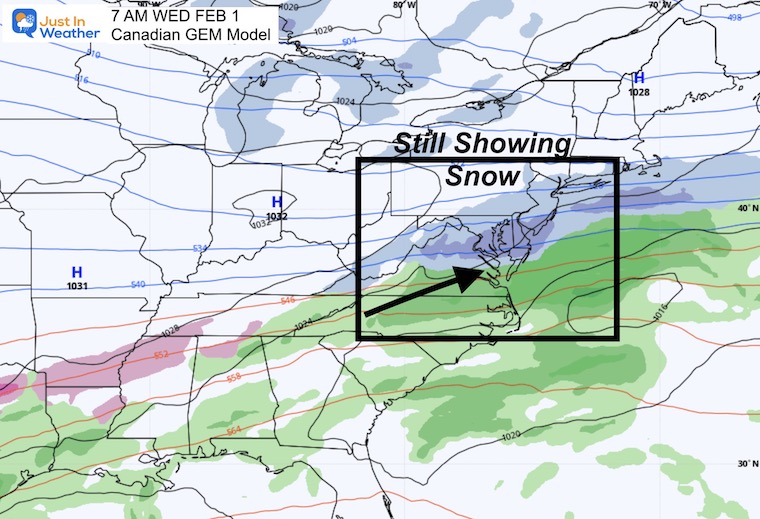
This keeps the front closer mid week, and keeps the light snow in our region on Wednesday. It also is still developing a coastal storm next Monday.
Snapshot:
Wednesday still showing light snow.
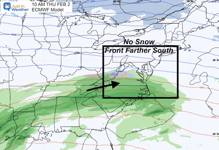
European ECMWF
This has held on to suppressing the cold front farther south. As a result, the next round of precipitation would be on Thursday and missing our region. Instead of what it had shown earlier as a light snow event, it is now mostly dry.
It brings in the arctic air over the weekend. This is a case where it may be too cold to snow. In actuality it brings High Pressure to the Mid Atlantic, inhibiting that previously touted storm.
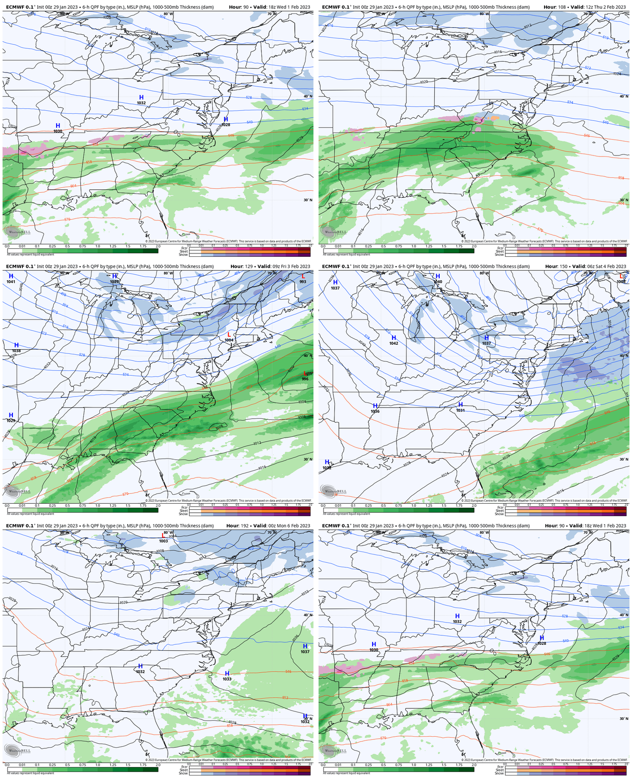
Snapshot:
Thursday now keeping us dry.
My Thoughts
I am still not trusting this cold air will reach that far south. There has been a history of models going too far south, then trending back north. So I am keeping an open mind and I hope you can as well.
Also See:
NOAA Outlook: Cold Start To February AND La Niña Ending Soon
Click for the full report
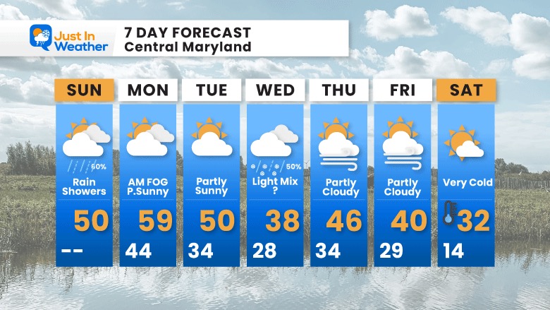
7 Day Forecast
Very Cold Air is expected next Saturday. I have modified the temperatures to not be as cold as some products have suggested. We often tend to see computer guidance push too far to an extreme, then pull back.
Also See:
Winter History: Low Snow And Late Starts
See my research based on Baltimore data since 1883.
Subscribe for eMail Alerts
Weather posts straight to your inbox
Sign up and be the first to know!

STEM Assemblies/In School Fields Trips Are Back
Click to see more and ‘Book’ a visit to your school
My Winter Outlook: Not A Typical La Niña!
I see many factors to support colder influence with multiple systems. Early and later in winter. Check it out.
October 27 Nor’easter Recap Still Breezy Then Next Storm Friday
Also See The Winter Outlook Series:
October 27 Nor’easter Recap Still Breezy Then Next Storm Friday
Farmer’s Almanac Comparison
September Starts Meteorological Autumn: Weather Climate Stats For Maryland at Baltimore
Triple Dip La Niña Winter
https://justinweather.com/2022/09/09/winter-outlook-2023-la-nina-triple-dip-expectations/
CONNECTION TO WINTER?
If you want a snowy winter, this is what you might want to look for in the rest of the tropical season.
Rainbow Ice Cave In Mt. Rainier A Very Rare Find: Photos And Video
Wooly Bear Caterpillars
https://justinweather.com/2022/10/25/winter-weather-outlook-from-the-wooly-bear-caterpillar/
Persimmon Seeds
Click to see Top 20 and MORE
Winter Weather Folklore Top 20 And More Outlook Signals From Nature For Cold And Snow
Normals And Records: Maryland and Baltimore Climate History
Please share your thoughts, best weather pics/videos, or just keep in touch via social media
-
-
Facebook: Justin Berk, Meteorologist
-
Twitter: @JustinWeather
-
Instagram: justinweather
-


