Friday Night Quick Look At Snow For Sunday And Beyond
January 6 2023
This will be a quick look at the small event on the way, just to keep up to date with what we have been following all week. Before I get into the model view, I want to do a little review:
Baltimore just had a record warm start to a new year. The first FIVE Days of 2023 reached the 60s, and Day Six reached the 50s!
- The ground is still retaining that warmth!
Thunder was heard across much of central Maryland Thursday evening and night. I have mentioned this a lot this past week and for years in my Winter Weather Folklore: “If in winter there is thunder, snow may fall in one week or under”.
- This has happened countless times, and we do see support for snow on Sunday and again next week. It is very important to note that falling snow does NOT promise stickage. This go around, I must lean towards more melting, but inland and higher elevations could get some slush.
I was at Homestead Wakefield Elementary School in Bel Air early today doing my winter STEM Program. In one of my assemblies, a girl asked me, “Is snow real”? I paused and had to say it broke my heart that she even had to think to ask that. But I was confident she would see the real thing soon. At least seeing it ‘falling’ could be really soon! This Sunday event is NOT our pattern change, but it is a break from the extreme warmth and a trend back into a winter direction.
Model Comparison
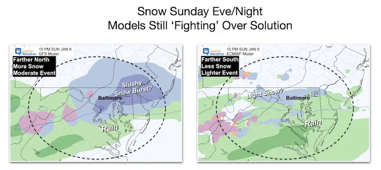
Both the GFS (American) and ECMWF (European) Models are still showing snow. The GFS is farther north and persistent with a heavier snow burst for a few hours. The ECWMF is farther south and weaker. The main story here is there the signal for some snowflakes falling, the theme and just the little change many are looking for.
There are other models also showing snow, but these are the major players I have been showing you. Let’s take a little closer look.
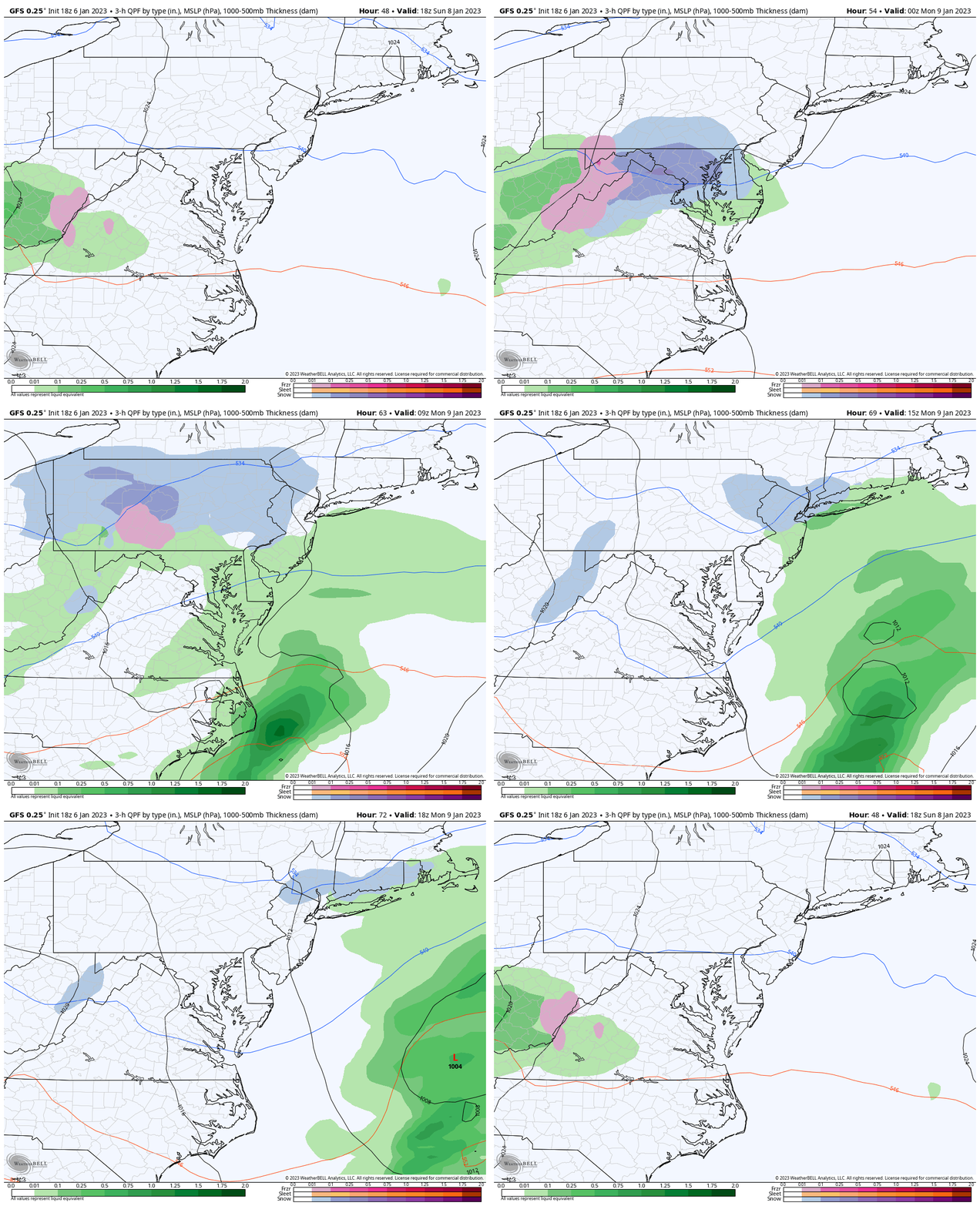
GFS Model Animation:
1 PM SUN to 1 PM MON
This is mostly an evening and night event. Using this timing and model bias, I can suggest this model supports snow between 6 PM and midnight.
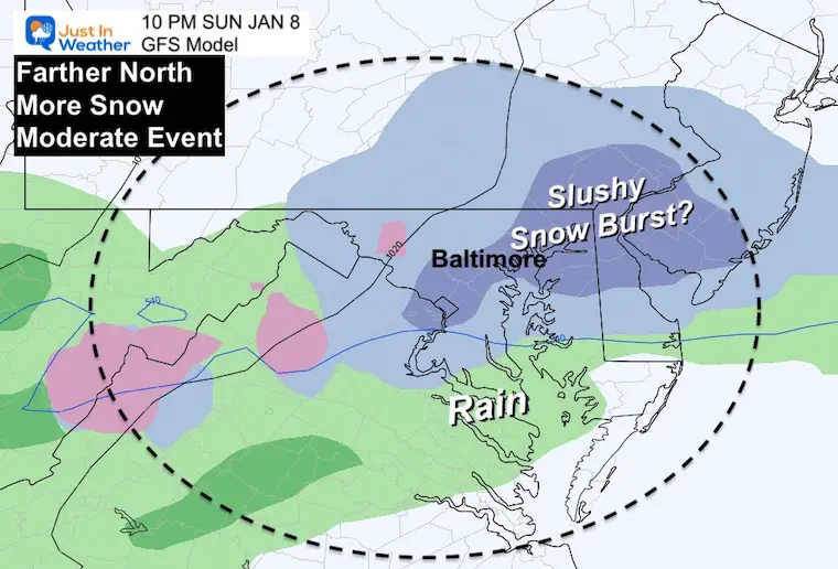
Snapshot at 10 PM
We see a burst of snow in the evening through midnight, then ending as rain in the morning. This suggests warming with the event and NOT a travel issue to start the work week.
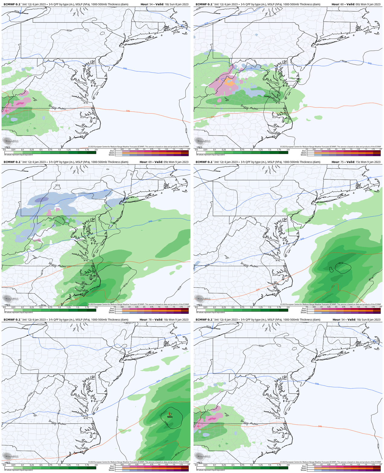
ECMWF Model Animation:
1 PM SUN to 1 PM MON
This weaker event begins in metro areas by 7 PM Sunday and ends close to sunrise on Monday.
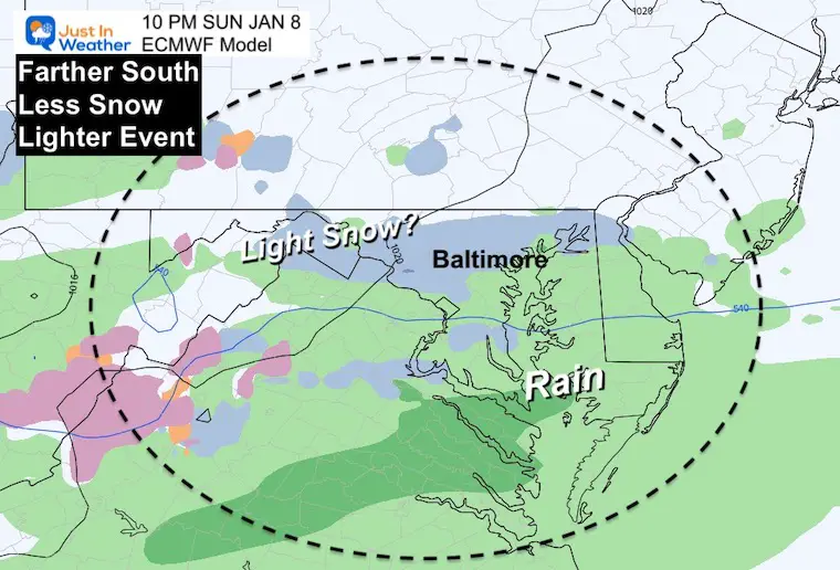
Snapshot at 10 PM
If there is snow, it will likely be more inland and away from the water.
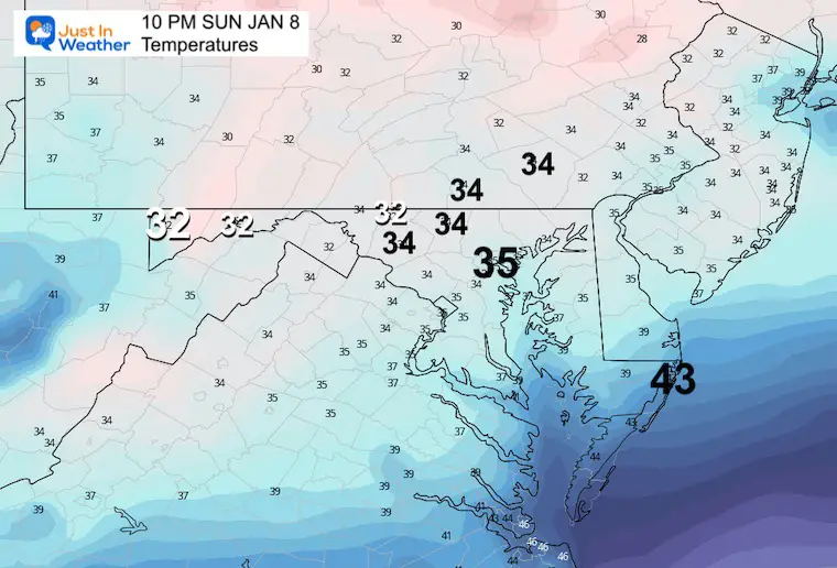
Temperatures at 10 PM
This is KEY! In addition to the ground retaining warmth from this week, there is not much cooling prior to, or with this event. If there are temps near freezing (32ºF), it will be marginal at best in higher elevations around 1000 Ft or higher.
If we get the snow burst, it may lay on the grass and car tops, but hard to get it to stick on the roads.
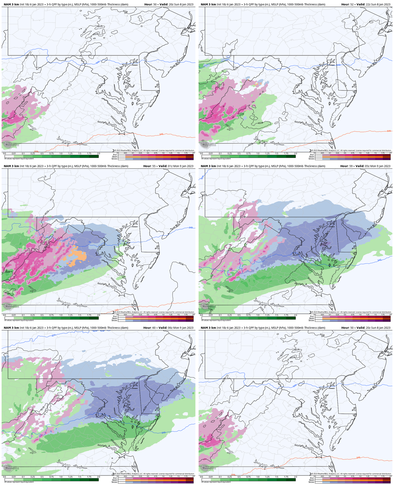
Another Model: The NAM 3 Km Animation
This latest run was out through 1 AM Monday as of my post time. This was more in line with the stronger GFS. It looks like a moderate to heavy burst, but wait for it…
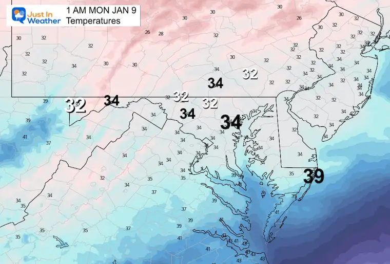
Temperatures at 10 PM
The NAM ALSO shows marginal temps near but mostly above freezing. That is a slushy wet snow for the grass at best, but hard to lay and stay on the roads. Again, elevation is key!
My Thoughts:
With this knowledge, I have a hard time considering the snow forecast from these models, so I am not showing them.
Also note: The GFS was the model pushing more snow with the flash freeze before Christmas. If you don’t remember what happened, there is a reason… It was not much more than a brief burst of thunder sleet on I-95. We had some ‘stuff’ but the GFS was overdone. I am using this Sunday’s event to point out whether it continues to overplay its hand, or can finally be taken more seriously.
I do think we may see snow ‘falling’ for many areas, but I doubt any stickage. In fact it may even have trouble with slushy snow even on the grassy areas in much of the main urban areas. But the ambiance could be the reminder the kids need to remember that it is still winter.
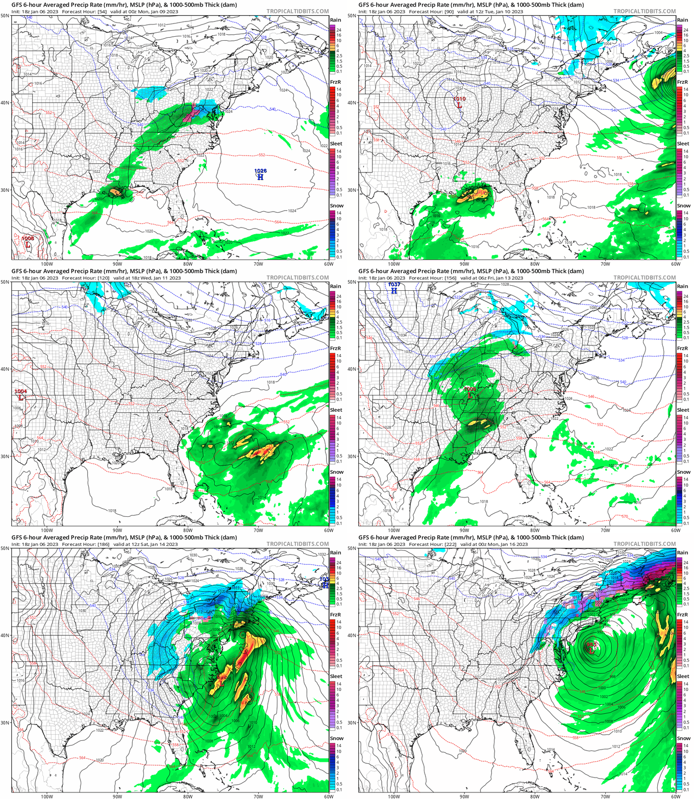
Just For Fun: Week Ahead On The GFS
SUN JAN 6 to SUN JAN 15
I am showing the wider view because there is less close detail AND I am confident next weekend will be the change.
However, it is showing a storm trying to form. That is worth recognition for the atmosphere trying to do ‘something’, I just think it is worth watching, but will evolve to something different than this solution. Could that be snow, or just another cold rain?….. Keep watching with me. I do believe the pattern will turn colder and more favorable for snow to end the month and take us to February. FITF
Faith in the Flakes Gear
What is Faith in the Flakes?
It began with my son in 2009
October 27 Nor’easter Recap Still Breezy Then Next Storm Friday
SNOWSTIX – Available Now
STEM Assemblies/In School Fields Trips Are Back
Click to see more and ‘Book’ a visit to your school
My Winter Outlook: Not A Typical La Niña!
I see many factors to support colder influence with multiple systems. Early and later in winter. Check it out.
October 27 Nor’easter Recap Still Breezy Then Next Storm Friday
Also See The Winter Outlook Series:
October 27 Nor’easter Recap Still Breezy Then Next Storm Friday
Farmer’s Almanac Comparison
September Starts Meteorological Autumn: Weather Climate Stats For Maryland at Baltimore
Triple Dip La Niña Winter
CONNECTION TO WINTER?
If you want a snowy winter, this is what you might want to look for in the rest of the tropical season. (You might be seeing a lot of commercial snow removal people out this Winter).
Rainbow Ice Cave In Mt. Rainier A Very Rare Find: Photos And Video
Wooly Bear Caterpillars
https://justinweather.com/2022/10/25/winter-weather-outlook-from-the-wooly-bear-caterpillar/
Persimmon Seeds
Click to see Top 20 and MORE
Winter Weather Folklore Top 20 And More Outlook Signals From Nature For Cold And Snow
Normals And Records: Maryland and Baltimore Climate History
Please share your thoughts, best weather pics/videos, or just keep in touch via social media
-
Facebook: Justin Berk, Meteorologist
-
Twitter: @JustinWeather
-
Instagram: justinweather


