Thursday Mid Morning Ice Storm Update And Temperature Roundup
December 15 2022
Thursday Morning at 8 AM
Today’s weather is a classic example of how we can predict what will fall from the sky and generally the temperatures on the ground, but the net result of the ground is still challenging. As I forecast and nowcast like this morning, I look back at my own notes. It appears the First Call Map I posted 3 days ago has held up best. So I wanted to start with that and see how it matches with the current conditions and what you are seeing.
My First Call Map From Monday
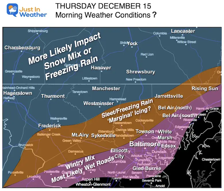
8 AM Roundup – Central Maryland
I have more local maps and a quick forecast below.
Note:
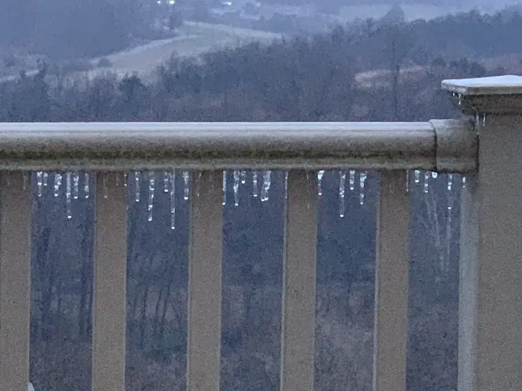
Some of us have icicles continuing to grow longer. That, in addition to ice on cars, trees, and steps. Meanwhile the bulk of the roads are wet. That is the challenge of being within a degree or two of freezing.
Please remain cautious and alert as you travel. There may be some icy spots that look wet.
Schools:
I think the cautious call for a delay and now most in central Maryland are going in on time was the best call to make this morning.
There are some closings or ‘virtual’ days implemented in the mountains and southern PA.
Weather posts straight to your inbox
Sign up and be the first to know!
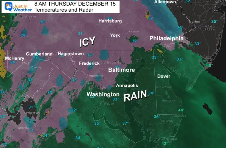
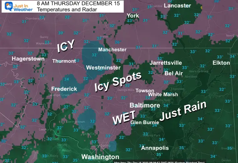
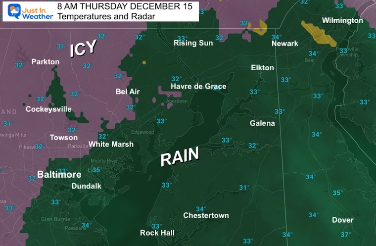
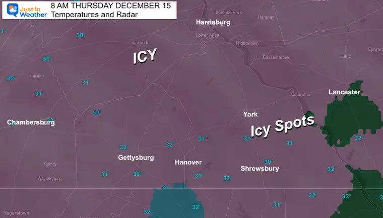
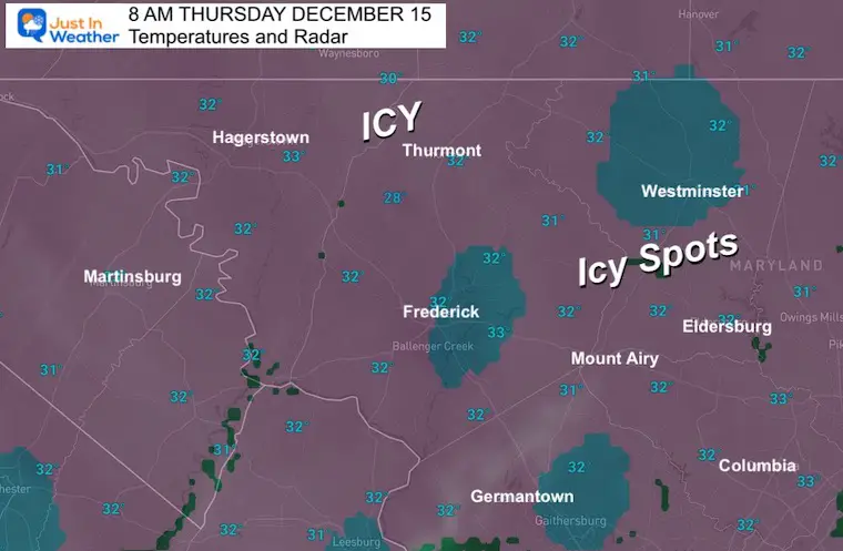
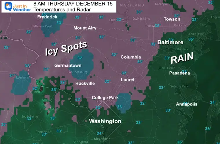
Temperatures And Radar (Estimate) At 8 AM
Regional View – This shows a classic set up with rain along I-95, the cities, and surrounding the Bay. Inland where it is just cold enough, there is an icy mix.
Northeastern Maryland
Baltimore, Harford, and Cecil Counties.
Temps are warming just a little. Most roads are wet, but there are some icy spots in the pink shading.
Southern Pennsylvania
Just on the edge of freezing, most roads are wet. But there are more icy spots and ice accumulating. Many schools here did call the day ‘virtual/distance’ learning to play it safe.
West Central Maryland
Carroll County is on the edge of that ice accumulation along with wet roads.
The Ice Storm Warning was expanded to include Hagerstown in Washington County and Frederick in Frederick County. City areas may be wet, but the surrounding region does have ice accumulation.
Washington DC Area
The city is wet, but parts of Montgomery and Howard Counties may have ice accumulation and some spotty ice on mostly wet roads.
As expected, just rain near I-95 through Baltimore City and Anne Arundel County.
New Weather Display
I have been working with my friend and graphic artist Casey Berry on new ways to help show snow forecasts for travelers. They are not all ready yet, however I felt I needed to grab the first two and apply them to this event for people who travel these routes. I’d love to know if you find them helpful and I will have more during the winter ahead.
This applies to general conditions in those areas that are not treated or less traveled side roads/side walks. Interstates will be heavily worked with chemicals but still could get icy.
Traveling WEST on I-70 and or I-68 between Baltimore and Western Maryland.
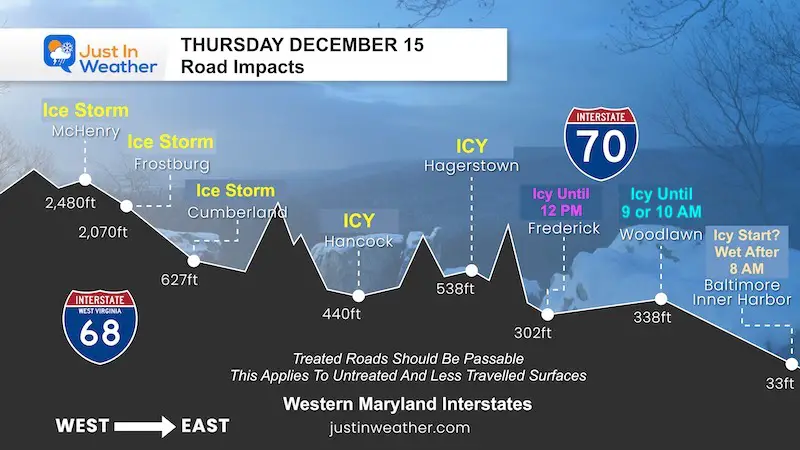
Morning Conditions
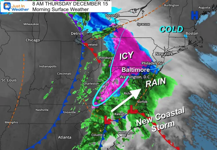
Surface Weather Map
The new coastal Low is taking form and will pass through later today. Then it will be New England’s problem for more snow and ice.
As far as our day is concerned, most of us will thaw by noon, with some lingering ice inland in the mountains and central PA.
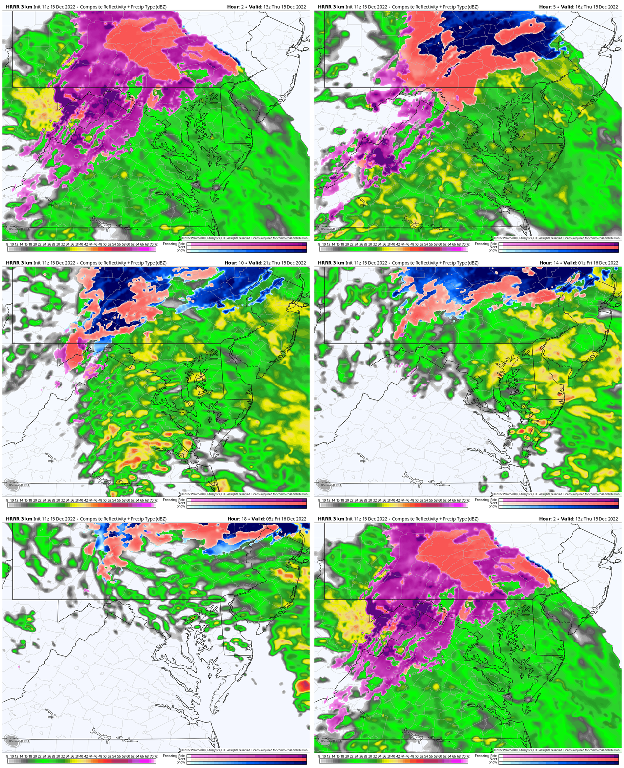
Radar Simulation
HRRR Model 8 AM to Midnight
The warming will gradually win for most of us. Here we see some pockets of icing in the mountains of Washington and Frederick Counties and Southern PA along I-81 and Rt 15.
Moderate to heavy rain in central Maryland will come to an end by 10 PM.
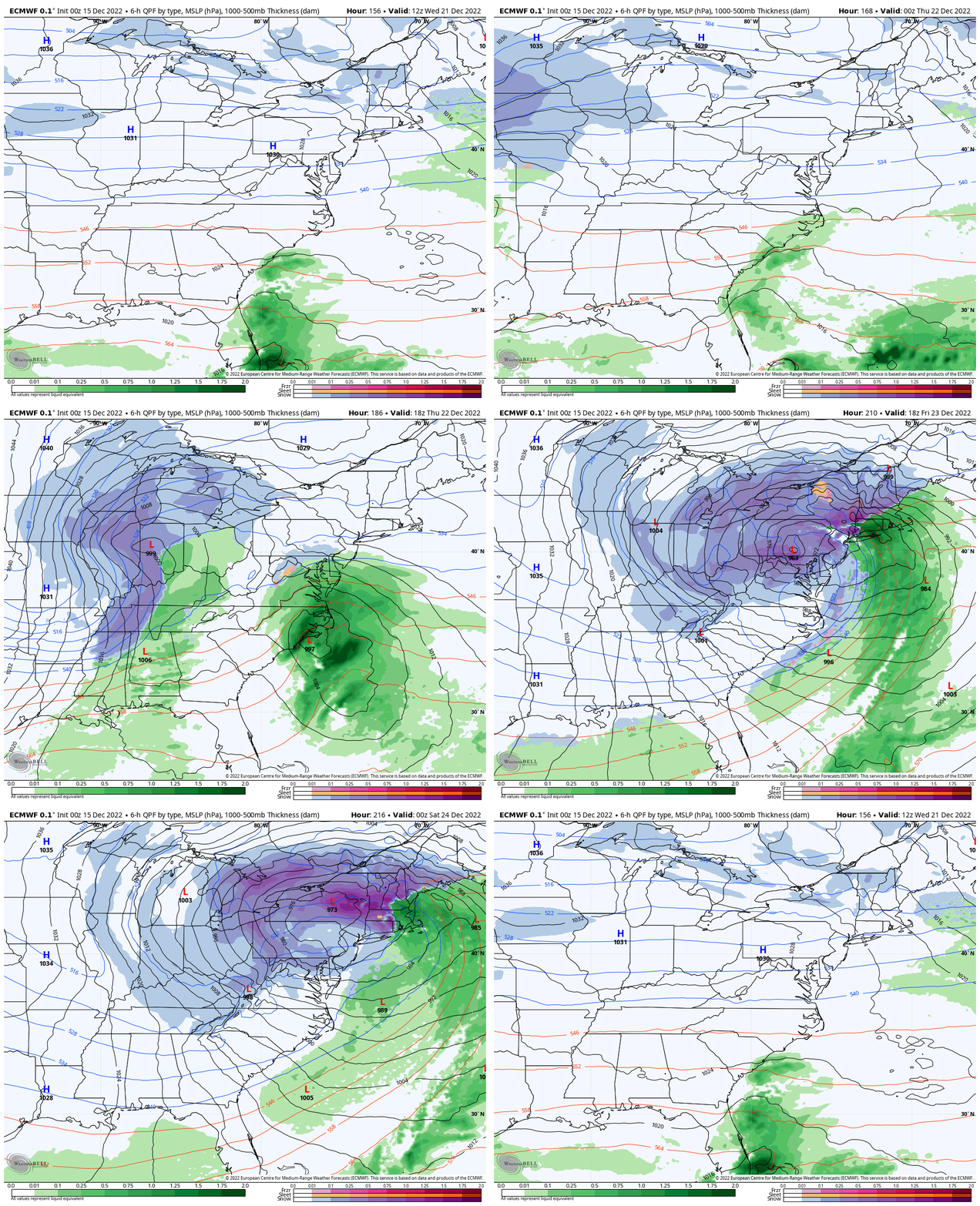
Looking Ahead:
I DO NOT want to make a formal storm forecast for 8 DAYS AWAY! However, next week is when I, and others have mentioned a full display of the pattern change. Here is a nugget from the European Model.
ECMWF MODEL Simulation: 7 AM Wed Dec 21 to 7 PM Fri Dec 23
Here we see that potential winter storm before Christmas. For now I will pay attention to Thursday and Friday of next week. I will have my regular daily forecast posted close to noon. #FITF
Faith in the Flakes Gear
What is Faith in the Flakes?
It began with my son in 2009
October 27 Nor’easter Recap Still Breezy Then Next Storm Friday
SNOWSTIX – Available Now
STEM Assemblies/In School Fields Trips Are Back
Click to see more and ‘Book’ a visit to your school
My Winter Outlook: Not A Typical La Niña!
I see many factors to support colder influence with multiple systems. Early and later in winter. Check it out.
October 27 Nor’easter Recap Still Breezy Then Next Storm Friday
Also See The Winter Outlook Series:
October 27 Nor’easter Recap Still Breezy Then Next Storm Friday
Farmer’s Almanac Comparison
September Starts Meteorological Autumn: Weather Climate Stats For Maryland at Baltimore
Triple Dip La Niña Winter
CONNECTION TO WINTER?
If you want a snowy winter, this is what you might want to look for in the rest of the tropical season. (You might be seeing a lot of commercial snow removal people out this Winter).
Rainbow Ice Cave In Mt. Rainier A Very Rare Find: Photos And Video
Wooly Bear Caterpillars
https://justinweather.com/2022/10/25/winter-weather-outlook-from-the-wooly-bear-caterpillar/
Persimmon Seeds
Click to see Top 20 and MORE
Winter Weather Folklore Top 20 And More Outlook Signals From Nature For Cold And Snow
Normals And Records: Maryland and Baltimore Climate History
Please share your thoughts, best weather pics/videos, or just keep in touch via social media
-
Facebook: Justin Berk, Meteorologist
-
Twitter: @JustinWeather
-
Instagram: justinweather


