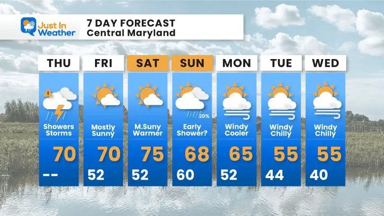
There are actually two cold fronts moving through today.The weather system has already brought a steady rain this morning. More rain and some strong thunderstorms are expected as we move through the afternoon. This includes new showers developing and the front that will start with a crawl, which may keep some areas with repeated cells, then it moves through tonight.
There is a low risk for storms to turn severe. If so, high wind gusts would be the culprit. Small hail, dangerous lightning, and/or heavy downpours are possible. If there are cells with severe limits reached: A Watch may be issued for POTENTIAL, and a WARNING will be issued when it is PROMISED and being tracked through towns and counties.
This post is designed to simply show you the radar expectations and live view, so you can check on the progress and return to see if it is on time or faster as in recent events.
Morning Surface Weather
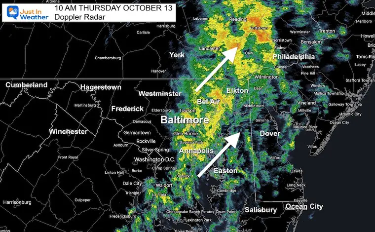
Two cold fronts: The first one helped initiate the rain this morning. There is a second line of rain in the mountains disconnected from the second front.It will take until tonight for the entire complex to move through and reach the coast.
Radar Snapshot at 10 AM Thursday
Compare this to the first image in the slider below.
Note: The crawl or slow movement is actually a line of rain waiting for the second front to catch up and push it through.
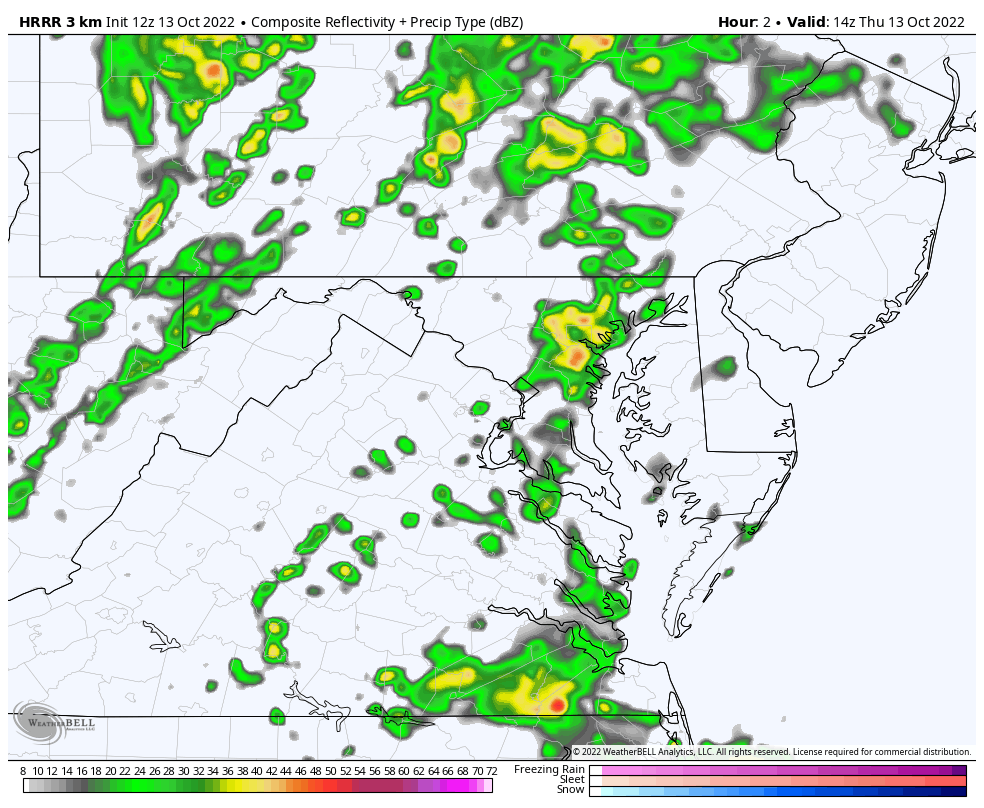
Highlight Timeline Slider —-> 2 PM to 11 PM
Below this is the Live Radar to compare AND further below the simulation in motion through midnight.
october-13-weather-radar-hrrr-storm-thurday-pm-2
october-13-weather-radar-hrrr-storm-thurday-pm-3
october-13-weather-radar-hrrr-storm-thurday-pm-4
october-13-weather-radar-hrrr-storm-thurday-pm-5
october-13-weather-radar-hrrr-storm-thurday-pm-6
october-13-weather-radar-hrrr-storm-thurday-pm-7
october-13-weather-radar-hrrr-storm-thurday-pm-8
october-13-weather-radar-hrrr-storm-thurday-pm-9
october-13-weather-radar-hrrr-storm-thurday-pm-10
october-13-weather-radar-hrrr-storm-thurday-pm-11
Live Radar Widget
This will update all day. Use the controls to pan and zoom.