July 23 2022
Saturday Morning Update
The heat is on… I may be dating myself, but do you remember that song from Beverly Hills Cop? I always wondered if the singer Glenn ‘Frey’ was just significance or coincidence?
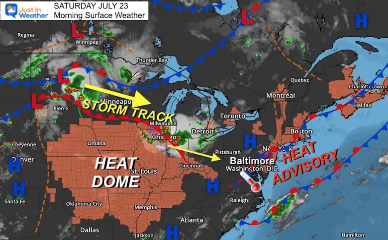
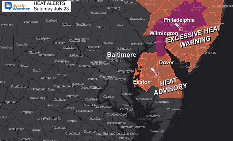
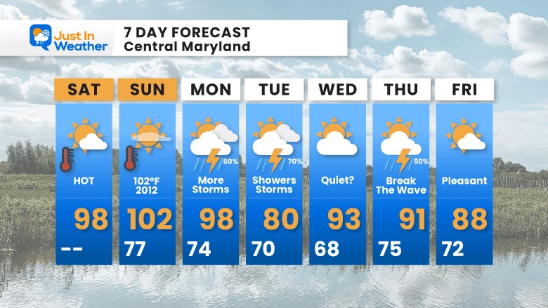
We may feel like we are frying this weekend as the temperatures and humidity crank up. Today will be just enough to prompt the Heat Alerts on Delmarva up to Philadelphia and metro New York. But tomorrow the surge may push triple digits and the record in Baltimore.
The storm track is in the Great Lakes and should reach the mountains later today. That complex may end up coding up our sky later and tonight. It will be the next impulse that we watch for the first break with more local storms Monday and Tuesday… Later in the week may be the end of the heat wave for the region.
This Morning
Heat Alerts
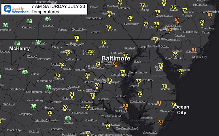
Morning Temperatures
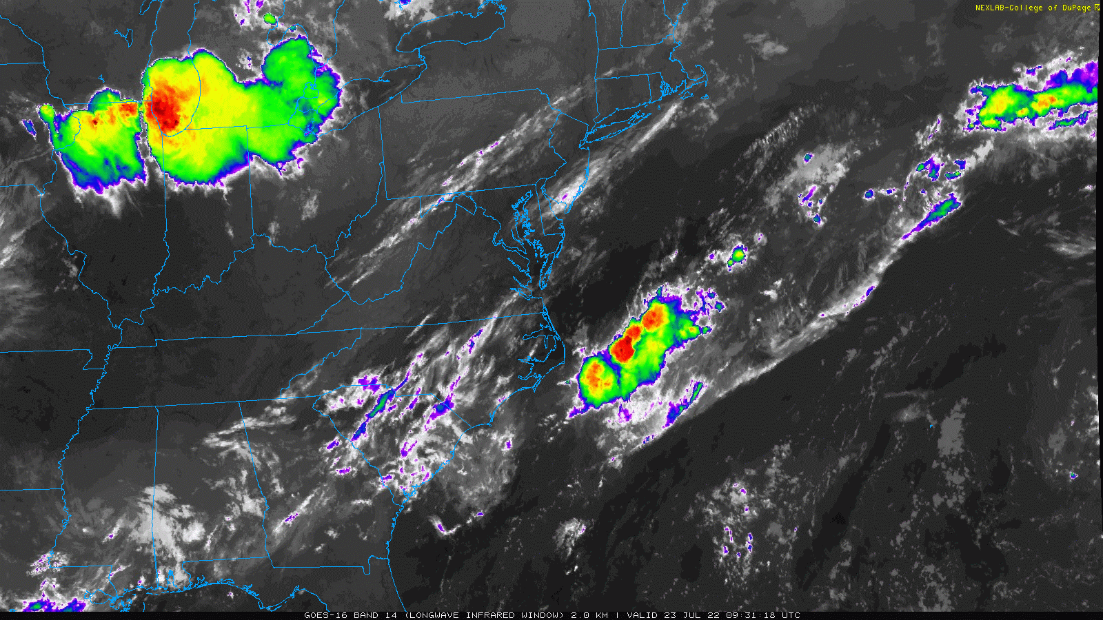
Satellite Loop 5:30 AM to 7:30 AM
There are thin band of clouds this morning that could provide early breaks in the sun and slow the local heating at times.
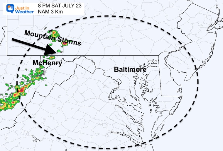
The storm complex highlighted in red around Chicago is spreading to the east and southeast towards Cleveland this morning. This is what should spawn storms in the mountains of western Maryland late afternoon and evening.
We should see the extension of high thin cirrus clouds this afternoon and maybe a veil of milky white in the sky to dim the late day and evening sun in metro areas from this.
Afternoon Temperatures
Radar Simulation
That storm line may reach Deep Creek Lake sooner than suggested below. The main story is that the mountains will get the storms and heat relief.
CLIMATE DATA
TODAY July 23rd
Normal Low in Baltimore: 67ºF
Record 57ºF in 1977
Normal High in Baltimore: 88ºF
Record 102ºF 2011
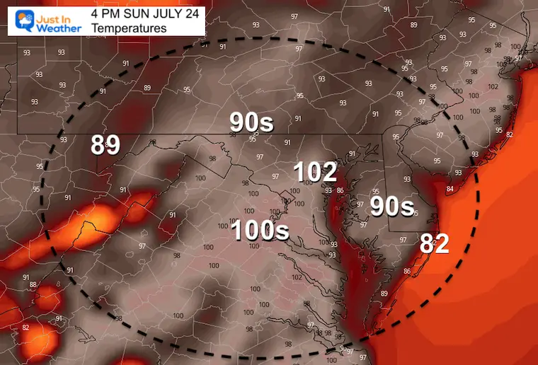
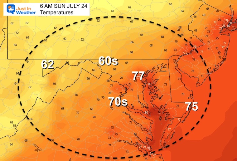
Sunday Temperatures
Morning
Afternoon
Record High 101ºF set in 2010

Looking Ahead
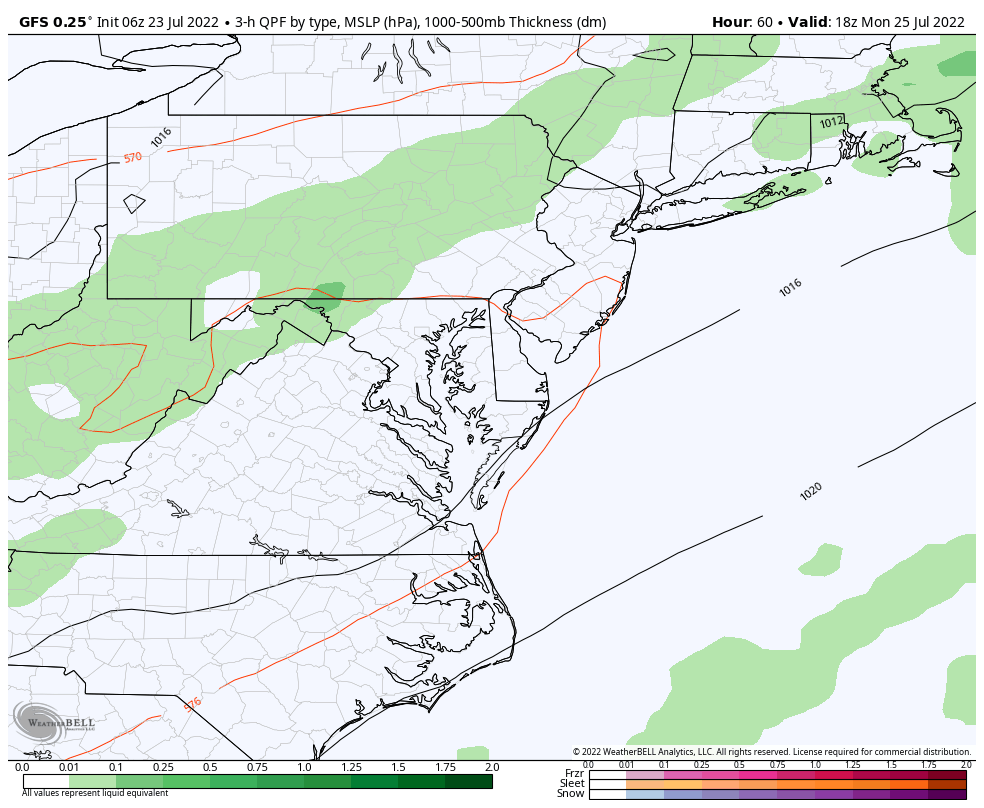
GFS Model 2 PM Monday to 2 PM Friday
More storms are expected on Monday and lasting into Tuesday. This may start with a severe outburst, then one cooler day.
Then next push will be at the end of the week, which may end our heat wave by Friday.
7 Day Forecast
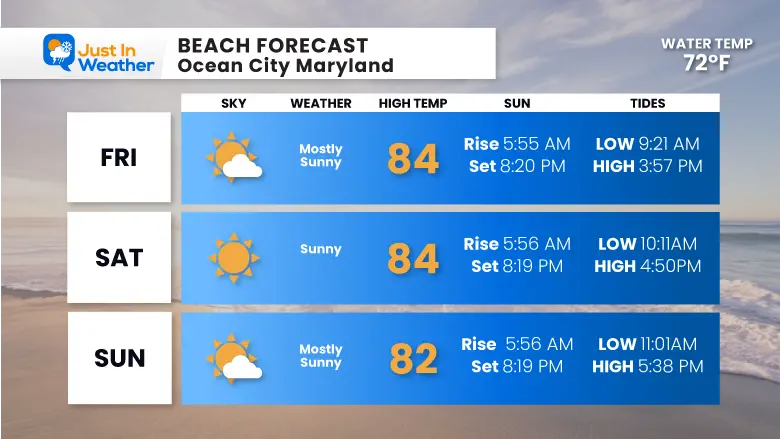
Beach Conditions This Weekend
Storm Reports
Reviewing Monday
Storm Reports And Videos From July 18 Across Maryland
July 12
Was there a tornado? Here are my reports.
Still no formal statement from The National Weather Service
July 12 Severe Storm Radar Scans: Was There A Tornado Or Not?
July 12 Storm Reports Pics And Videos


