May 8 Mothers Day Weather Still Chilly Winds With Some Improvement
May 8 2022
Sunday Morning Report
Happy Mother’s Day! It will be a little better weather for some.
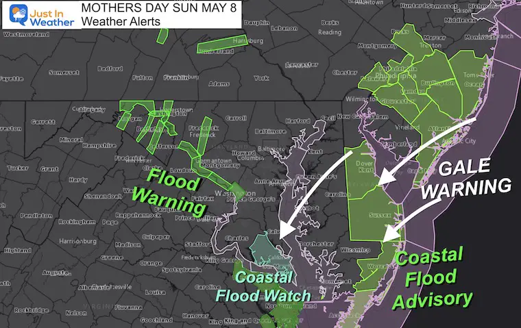
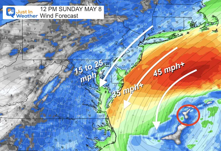
We are still under the influence of this coastal storm that seems out of place. Winds have been gusting over 50 mph in parts of Maryland, which I can confirm during our bike ride in Cambridge yesterday! Today will feature high winds and more rain showers across Delmarva. A Gale Warning along the coast, with flood warnings for high water being pushed onshore.
Meanwhile, the sky will be brightening west and north, but some leftover high water still have Flood Warnings in place along rivers.
Warnings
Video: Not Optimal Cycling Weather
Here is my recap documenting my experience with the Six Pillars event around Cambridge Maryland.
Temps ranged from 48ªF to 53F.
We confirmed winds gusted to 50 mph on three local weather stations. If you get to see my full post, we actually LOVED IT and I am grateful I have recovered to be able to do this.
This Morning…
Morning Conditions
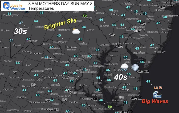
Temperatures/Observations
Most areas are in the 40s, with 30s in Western Maryland.
Waves top 15 FT offshore from Ocean City… Winds will be Gale Force over 40 mph there today!
Father inland there have been some breaks in the clouds brightening the sky.
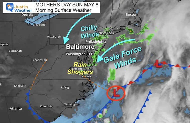
Surface Weather
Low Pressure is slowly drifting farther Southeast, but still dominating our weather.
The sky is brightening to the north and west, but winds will remain a factor to keeping temps chilly.
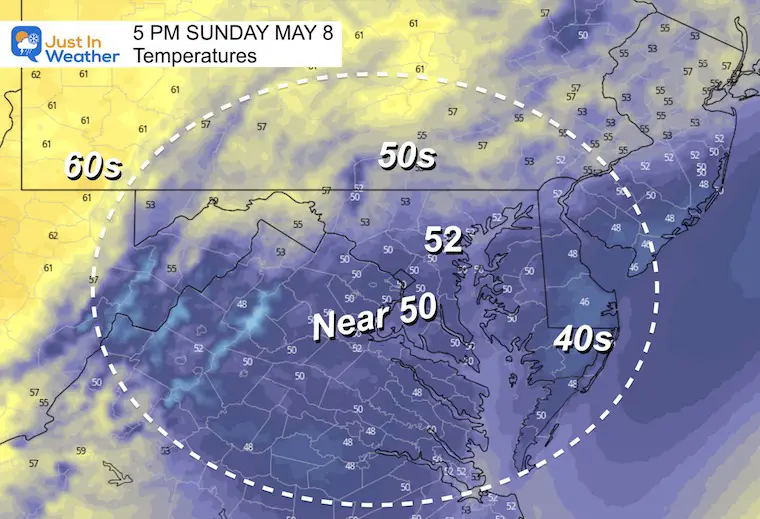
Closer to the storm, southern Maryland and Delmarva will remain with showers AND stronger winds. The result will be cooler temps closer to the coast.
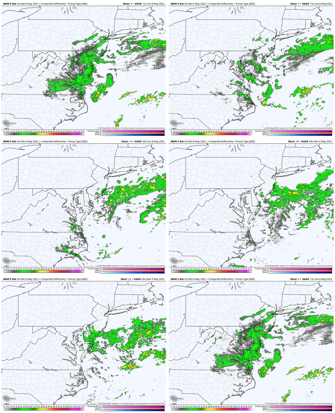
Radar Simulation 8 AM to Midnight
Showers this morning will regenerate near the Bay and Delmarva this afternoon and tonight.
Wind Forecast
Similar conditions remain all day.
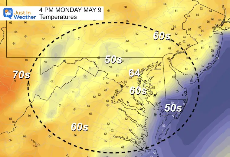
Afternoon Temperatures
Weather posts straight to your inbox
Sign up and be the first to know!
CLIMATE DATA
TODAY May 8th
Normal Low in Baltimore: 49ºF
Record 33ºF in 1997
Normal High in Baltimore: 72ºF
Record 93ºF 1930
Monday Weather
Morning
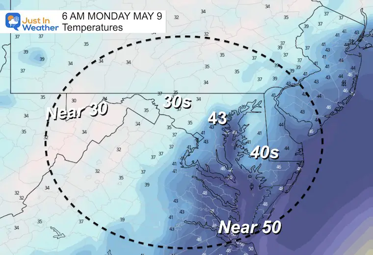
Afternoon
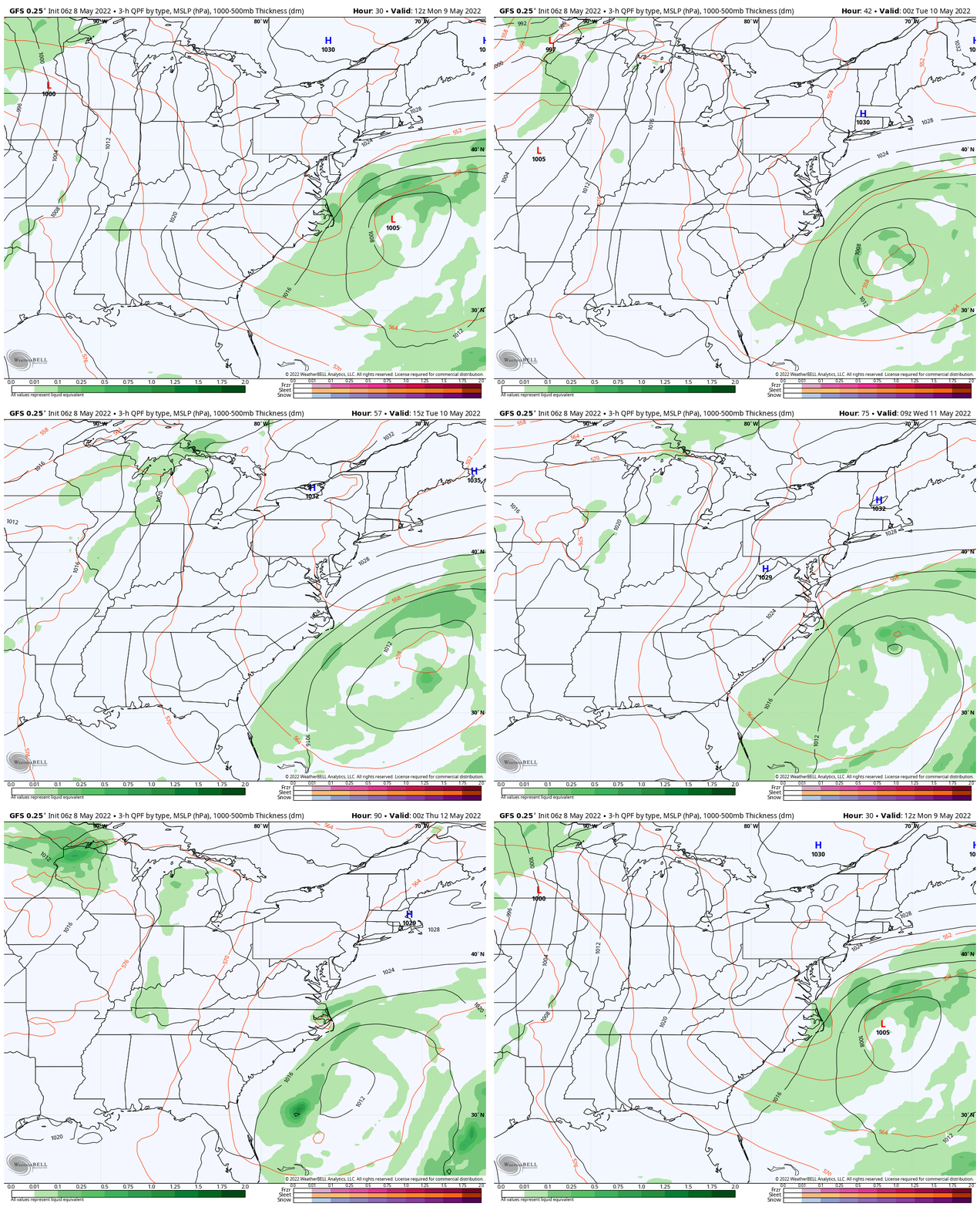
Weather Pattern Through Wednesday
Watch that storm continue to churn and slip to our south…
High Pressure will take hold and eventually ease on the cold
Looking Ahead: NOAA Outlook For Summer Heat By Mid Month
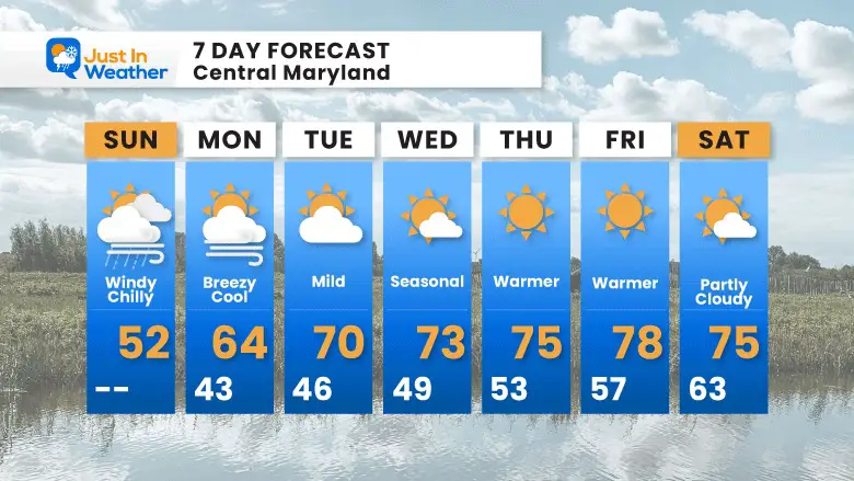
7 Day Forecast
That storm will continue to control the wind flow, but ease over the next few days to allow for sunshine and warming back to near ‘normal’
Tropical Season Begins June 1
Related Posts
Atlantic Tropical History: Maps of Origin Regions Every 10 Days
Please share your thoughts, best weather pics/video, or just keep in touch via social media
Facebook: Justin Berk, Meteorologist
Twitter: @JustinWeather
Instagram: justinweather
*Disclaimer due to frequent questions:
I am aware there are some spelling and grammar typos. I have made a few public statements over the years, but if you are new here you may have missed it:
I have dyslexia, and found out at my second year at Cornell. I didn’t stop me from getting my meteorology degree, and being first to get the AMS CBM in the Baltimore/Washington region.
I do miss my mistakes in my own proofreading. The autocorrect spell check on my computer sometimes does an injustice to make it worse.
All of the maps and information are accurate. The ‘wordy’ stuff can get sticky.
There is no editor that can check my work when I need it and have it ready to send out in a newsworthy timeline.
I accept this and perhaps proves what you read is really from me…
It’s part of my charm.


