April 28 Chilly Winds Then Another Frost Or Freeze Followed By A Warm Up
April 28 2022
Thursday Morning Report
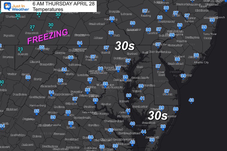
It is chilly this morning, but I do have some good news. Thanks to the brisk winds AND cloud cover, we avoided the hard freeze. It sounds counter intuitive, but it did help keep temps from dropping lower and prevent frost from forming where most of our region has dropped into the 30s.
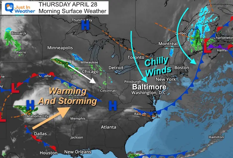
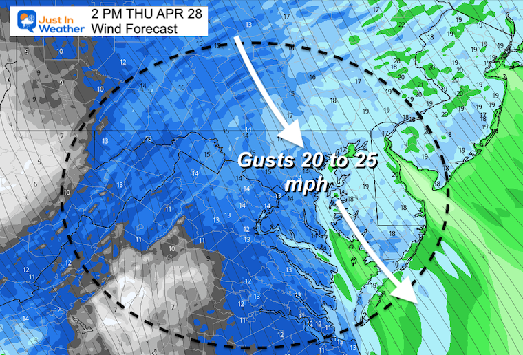
Those winds will remain with us today, and I will be among many parents shivering on the baseball field (or other sport) later today with our kids.
Tonight the clouds should depart and winds settled allowing for a freeze and widespread frost. Then a slow moderation this weekend and BIG WARM UP early next week. Here’s a look
Morning Set Up
Satellite Loop
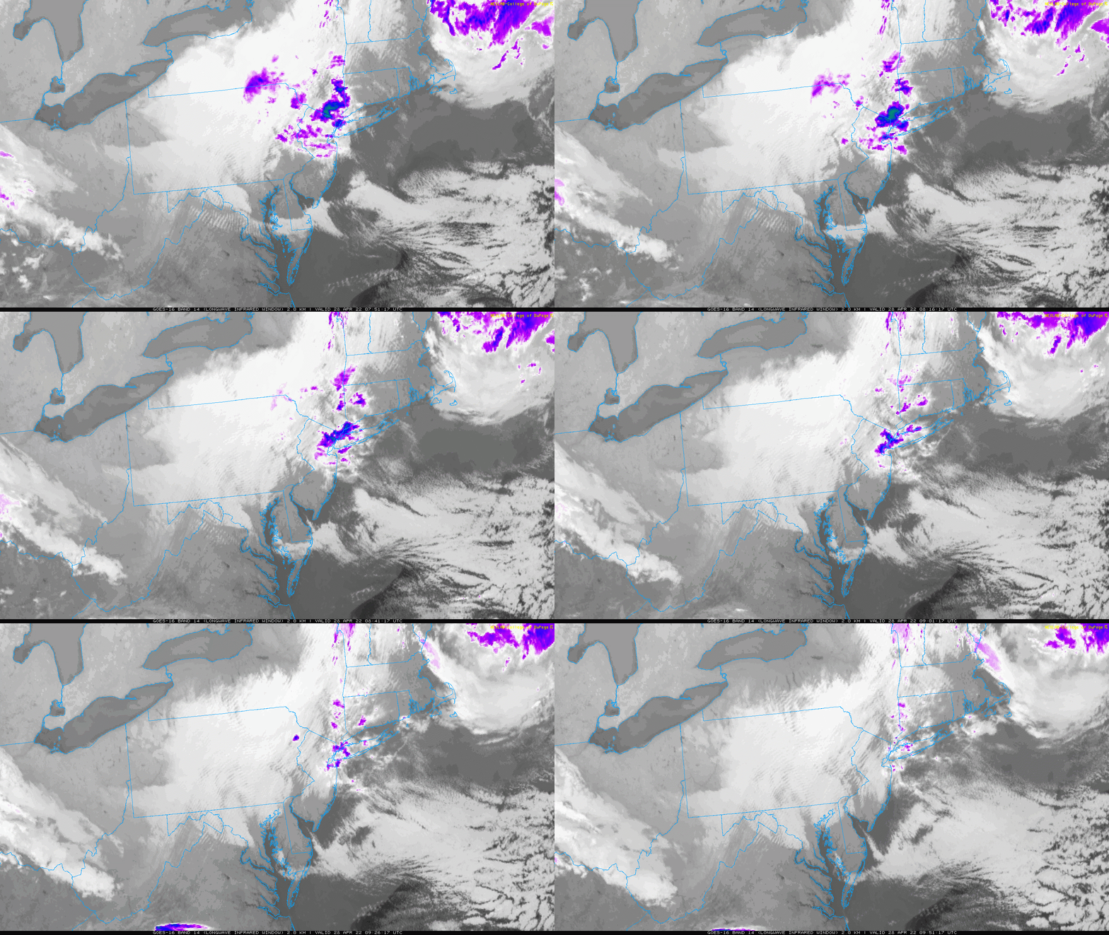
Here we can see the band of clouds early this morning… This is what limited how cold temps could drop.
Morning Temperatures
Many mid 30s, but not below freezing locally.
Morning Surface Weather
Wind Forecast
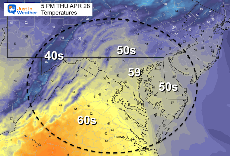
Afternoon Temperatures
CLIMATE DATA
TODAY April 28th
Normal Low in Baltimore: 46ºF
Record 33ºF in 1998
Normal High in Baltimore: 69ºF
Record 90ºF 1957
Temperatures
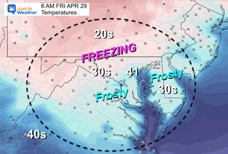
Friday Morning
There should be another Freeze Warning issued inland, and possible Frost Advisory extended farther south.
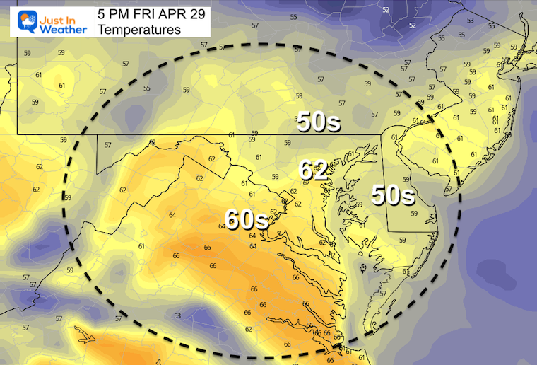
Friday Afternoon
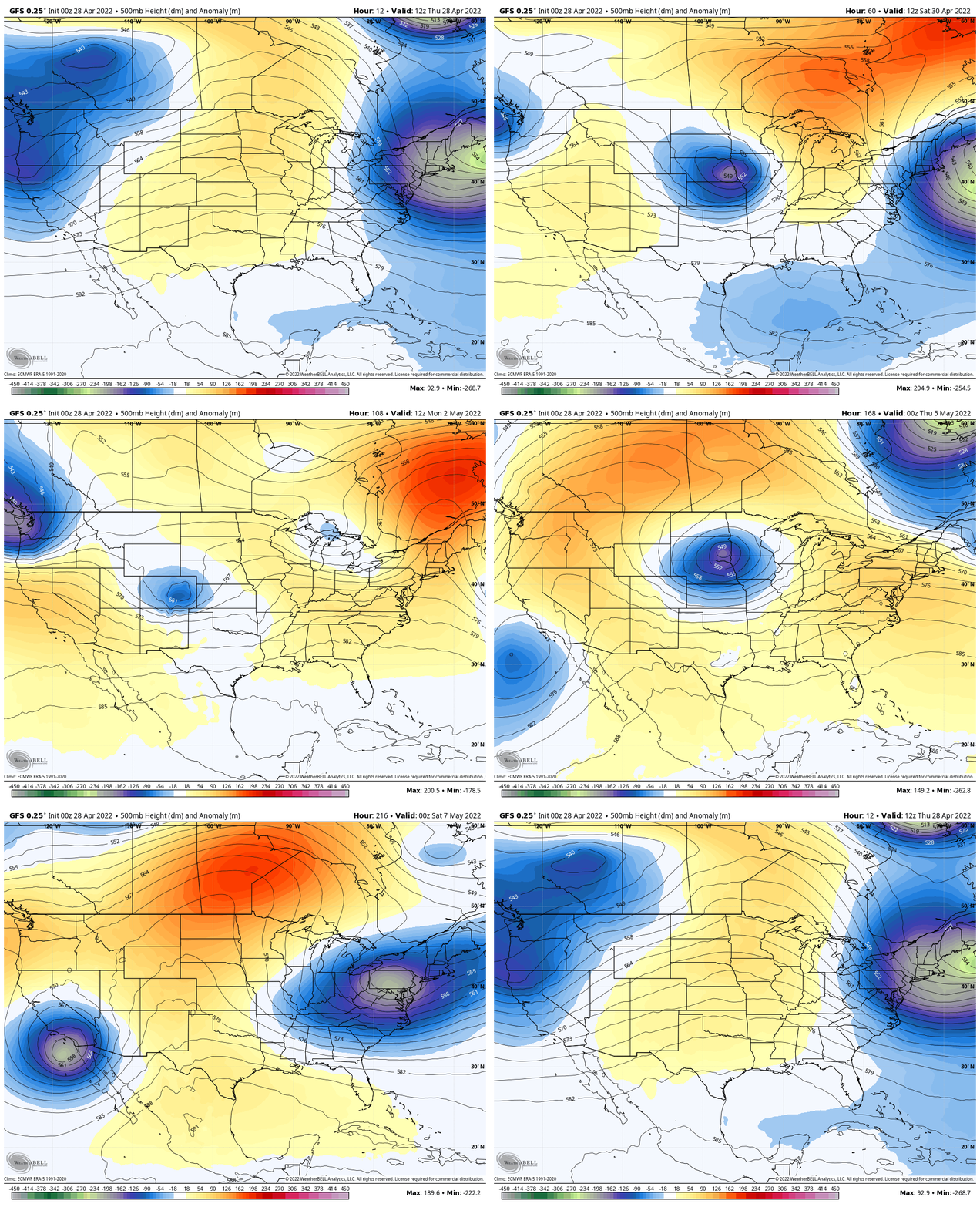
Looking Ahead: Jet Stream Through Next Friday
While we lift the jet and warm up early next week, anther storm with chilly air may reach us at the next of next week.
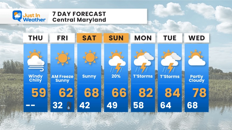
7 Day Forecast
Widespread Spread frost tomorrow morning. It is possible some local areas drop to freezing. That’s a plant killer for sure.
The slow warming trend this weekend back closer to ‘normal’ will peak in the 80s early next week. That comes with Thunderstorms, then another cool down later next week.
Weather posts straight to your inbox
Sign up and be the first to know!
Tropical Season Begins June 1
Related Posts
Atlantic Tropical History: Maps of Origin Regions Every 10 Days
Please share your thoughts, best weather pics/video, or just keep in touch via social media
Facebook: Justin Berk, Meteorologist
Twitter: @JustinWeather
Instagram: justinweather
*Disclaimer due to frequent questions:
I am aware there are some spelling and grammar typos. I have made a few public statements over the years, but if you are new here you may have missed it:
I have dyslexia, and found out at my second year at Cornell. I didn’t stop me from getting my meteorology degree, and being first to get the AMS CBM in the Baltimore/Washington region.
I do miss my mistakes in my own proofreading. The autocorrect spell check on my computer sometimes does an injustice to make it worse.
All of the maps and information are accurate. The ‘wordy’ stuff can get sticky.
There is no editor that can check my work when I need it and have it ready to send out in a newsworthy timeline.
I accept this and perhaps proves what you read is really from me…
It’s part of my charm.


