


Winter Weather Advisory Sunday As Snowfall In Two Parts Affecting Two Different Areas
Saturday Evening Update January 17 2026 One thing I carry after all of my years of forecasting: If one model does a really good job in an active pattern, then…
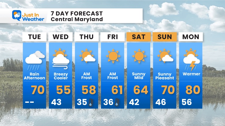
Tuesday April 26 2022 at 10 AM
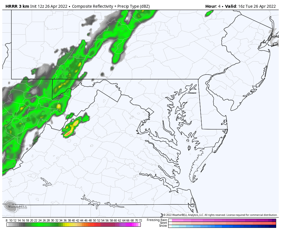
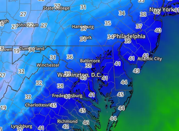
The rain on the way today may turn heavy at times. The latest update from the HRRR Model simulation shows that heavier banding reaching metro areas in central Maryland this evening.
What we have is called an Anafront. It is a cold front with the bulk of the rain behind the boundary in the colder air, as apposed to ahead of the boundary. This is in part thanks to a Low Pressure wave developing along that front and will be riding along it while passing through our region.
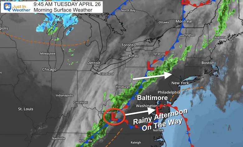
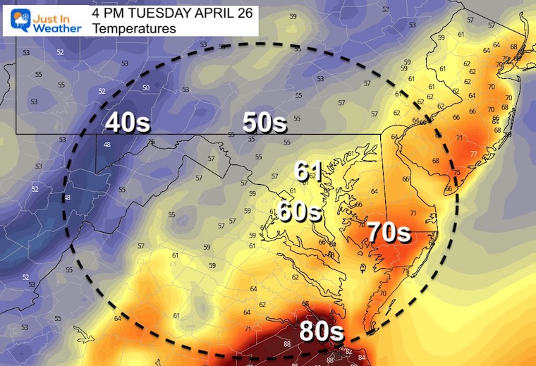
With a situation like this, temperatures will peak mid day, then fall into ‘chilly mode’ during the afternoon and evening. Something to consider for your outdoor plans and after school sports. Some with play their events and you may want to dress accordingly. Others like baseball and softball will likely be cancelled.
This should update on its own…


Compare two model solutions for rain today. Totals likely to be around 0.25″ over a span of 4 to 6 hours. But some locally heavier returns possible with embedded bands.
12 PM to 10 PM
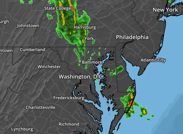
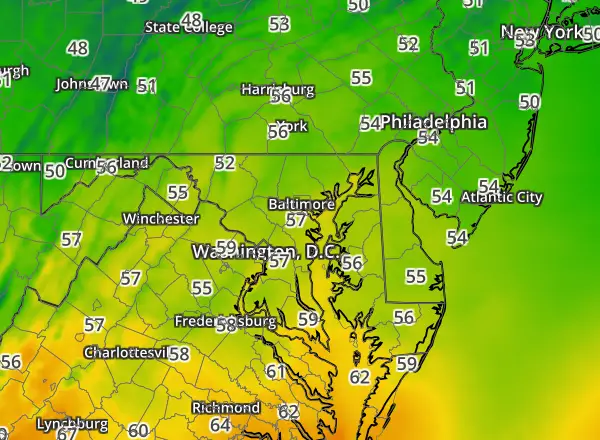
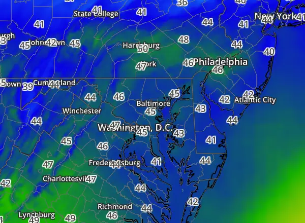
This shows rain reaching metro Baltimore between 2 PM and 4 PM.
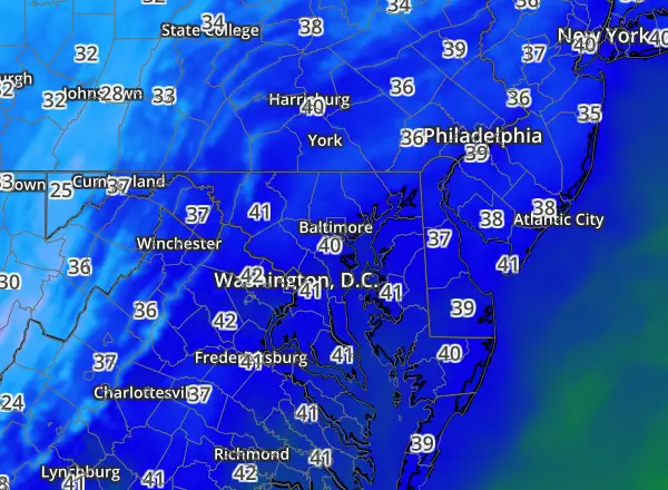
The heaviest rain bands in central Maryland will be between 6 PM and 8 PM.
12 PM to 10 PM


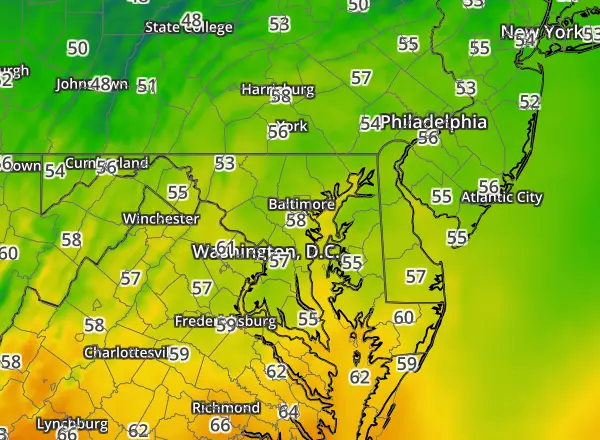
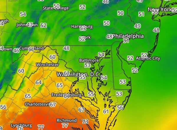
Near 70ºF around Baltimore and The Bay…
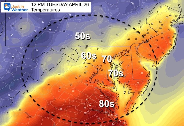
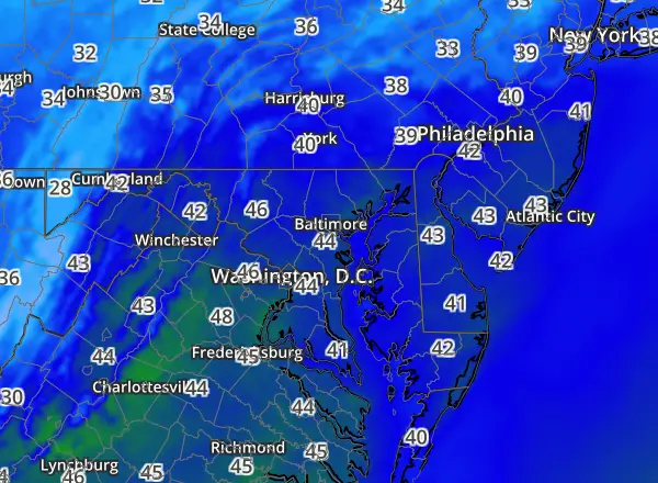
After the rain begins, temps will drop into the lower 60s and 50s.

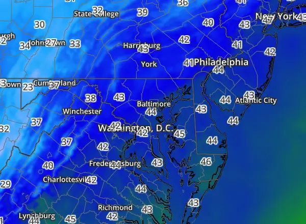


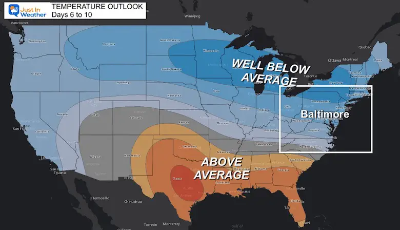
Repeating pattern will keep temps cooler into the first week or two of May
Widespread Spread will be Thursday and Friday mornings. It is possible some local areas drop to freezing. That’s a plant killer for sure.
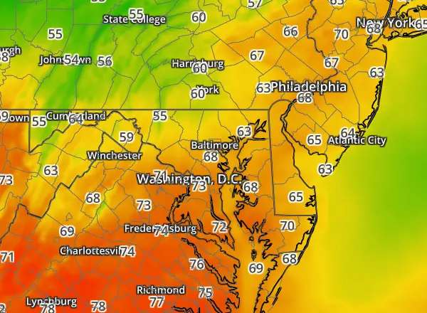
This weekend we been a warm up, with top temps before thunderstorms on Monday afternoon.
Sign up and be the first to know!

Atlantic Tropical History: Maps of Origin Regions Every 10 Days


*Disclaimer due to frequent questions:
I am aware there are some spelling and grammar typos. I have made a few public statements over the years, but if you are new here you may have missed it:
I have dyslexia, and found out at my second year at Cornell. I didn’t stop me from getting my meteorology degree, and being first to get the AMS CBM in the Baltimore/Washington region.
I do miss my mistakes in my own proofreading. The autocorrect spell check on my computer sometimes does an injustice to make it worse.
All of the maps and information are accurate. The ‘wordy’ stuff can get sticky.
There is no editor that can check my work when I need it and have it ready to send out in a newsworthy timeline.
I accept this and perhaps proves what you read is really from me…
It’s part of my charm.