April 19 2022
Tuesday Morning Report
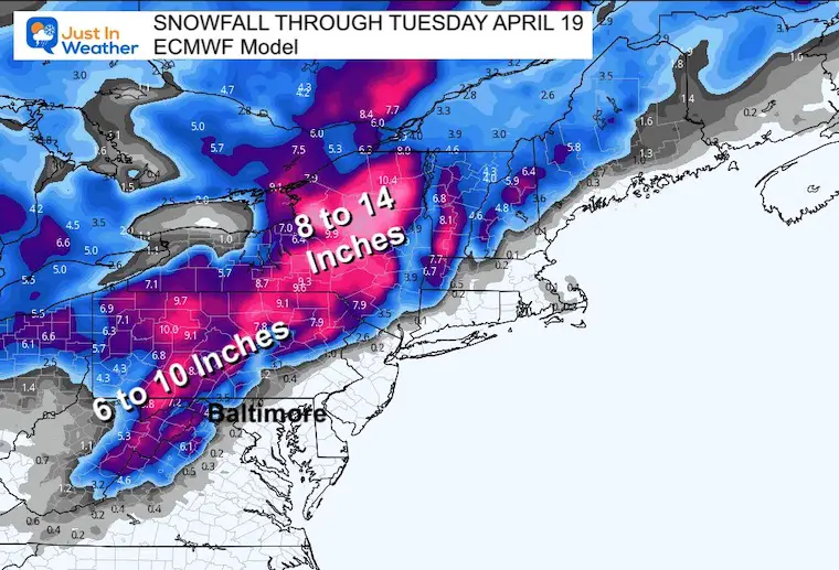
This weather map looks more like a Nor’easter this morning. Low Pressure near Atlantic City NJ is moving away, but the large footprint will continue to affect us today. What will be impressive are the snow totals, which are already over 10” as nearby as Montrose, PA.
A few inches has fallen even closer by Hagerstown MD and on Ski Whitetail in PA.
Snow showers will remain in western Maryland, and rain showers through the day could mix with snow or sleet at time, which gusty winds will bring us a measurable wind chill.
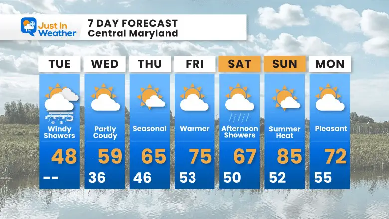
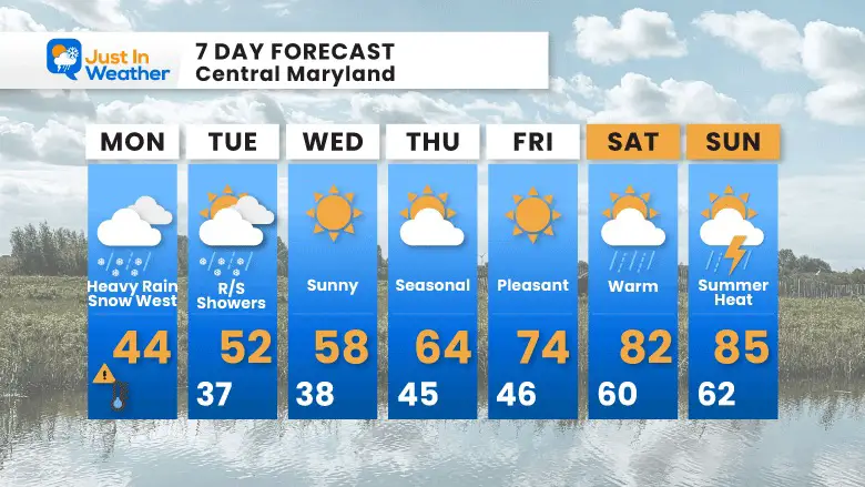
Hang in there, a warm up is on the way and summer heat will return this weekend.
Monday Morning
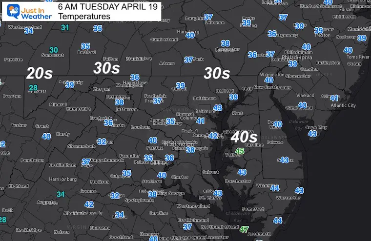
Temperatures
It is chilly…
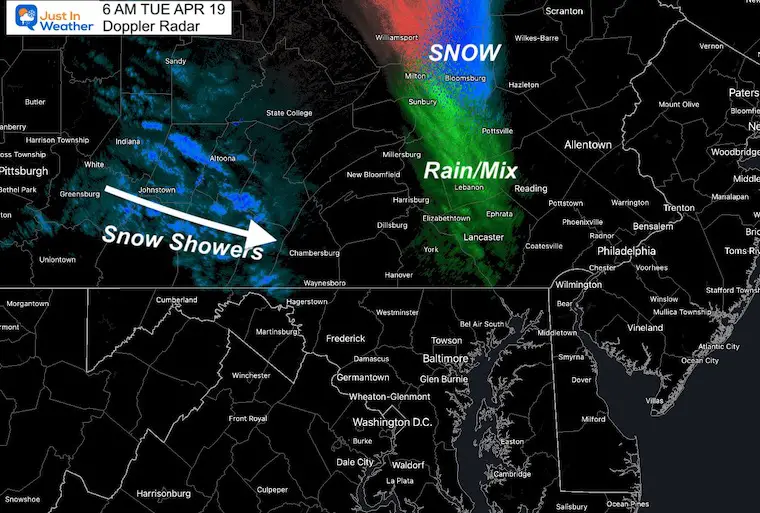
Doppler Radar
Snow showers in the mountains near Hagerstown may bring flurries to the northern suburbs this morning… Heavier snow is found North of Harrisburg on I-81 to the Poconos.
Surface Weather
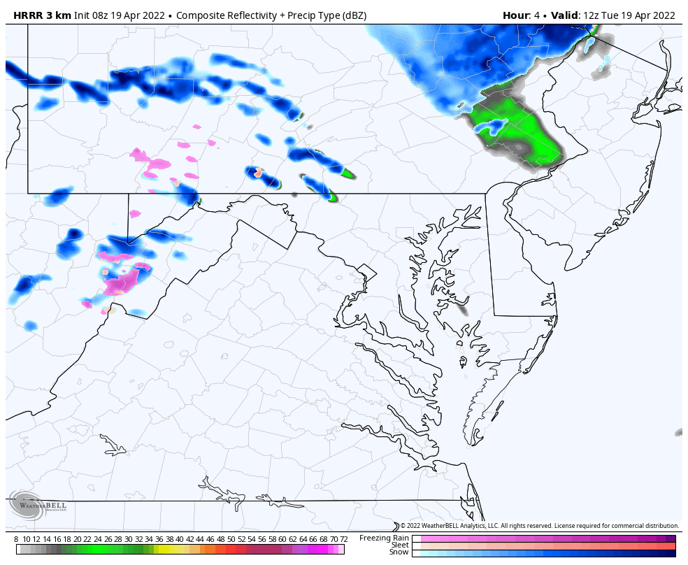
Nor’easter moving to the NorthEast US has a large pool of cold air. Heavy snow is falling over northern PA to central NY. Snow showers have developed off of the Great Lakes into the mountains… and we will track more today.
Winds will increase this afternoon reinforcing the cold air and showers.

In Case You Missed It
Click to see the report on Monday’s Snow In Maryland…

Unstable Air Mass…
Radar Simulation 8 AM to 8 PM
There will be more showers through the day. Snow in the mountains may bring a few inches on Garrett County. Rain showers farther east could still mix with sleet or snow a times.
Afternoon Highs
This will be well below average and deceiving because it will FEEL colder!

Wind Forecast
Average wind 15 to 20 mph, with gusts up to 35 mph.

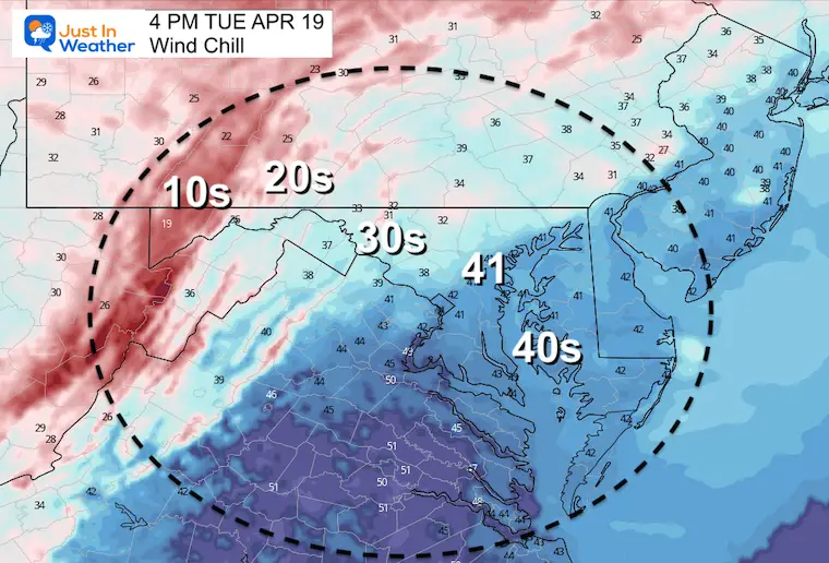
Wind Chill
Metro and Bay areas will feel like the lower 40s. Inland will feel like the 30s… With winter cold (10s and 20s) in the mountains.
CLIMATE DATA
TODAY April 19th
Seasonal Snow: 14.4”
Normal Low in Baltimore: 44ºF
Record 24º F in 1875
Normal High in Baltimore: 66ºF
Record 93ºF 1896
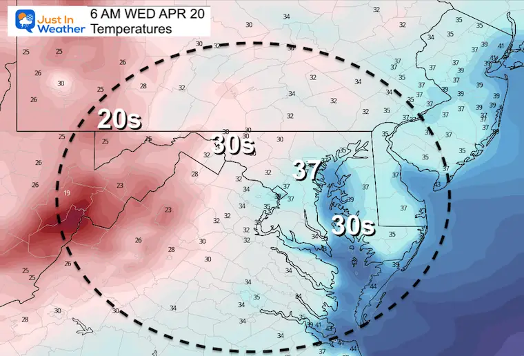
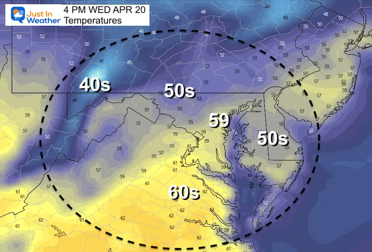
Wednesday
Morning Temperatures
Wednesday Afternoon
7 Day Forecast
Total Snow Potential!!!
7 Day Forecast
Rain may mix with snow for nearby suburbs later today.
Rain and snow showers possible Tuesday afternoon.
Two more mornings with possible FROST, then Summer Heat builds in next weekend.
Tropical Season Begins June 1
Atlantic Hurricane Forecast

Related Posts
Atlantic Tropical History: Maps of Origin Regions Every 10 Days


Please share your thoughts, best weather pics/video, or just keep in touch via social media
*Disclaimer due to frequent questions:
I am aware there are some spelling and grammar typos. I have made a few public statements over the years, but if you are new here you may have missed it:
I have dyslexia, and found out at my second year at Cornell. I didn’t stop me from getting my meteorology degree, and being first to get the AMS CBM in the Baltimore/Washington region.
I do miss my mistakes in my own proofreading. The autocorrect spell check on my computer sometimes does an injustice to make it worse.
All of the maps and information are accurate. The ‘wordy’ stuff can get sticky.
There is no editor that can check my work when I need it and have it ready to send out in a newsworthy timeline.
I accept this and perhaps proves what you read is really from me…
It’s part of my charm.


