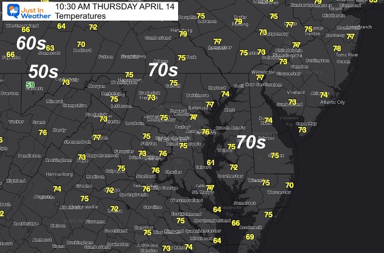
It still feels like summer outside. Many areas began the day in the 60s and 70s, aiming for another push into the 80s. This is well above ‘normal’ but not a record. Also, considering the snow/sleet mix last weekend and Frost Advisory on Monday morning, this big swing is actually pretty common. It does however come with a price. That is a return back to reality with likely storms.
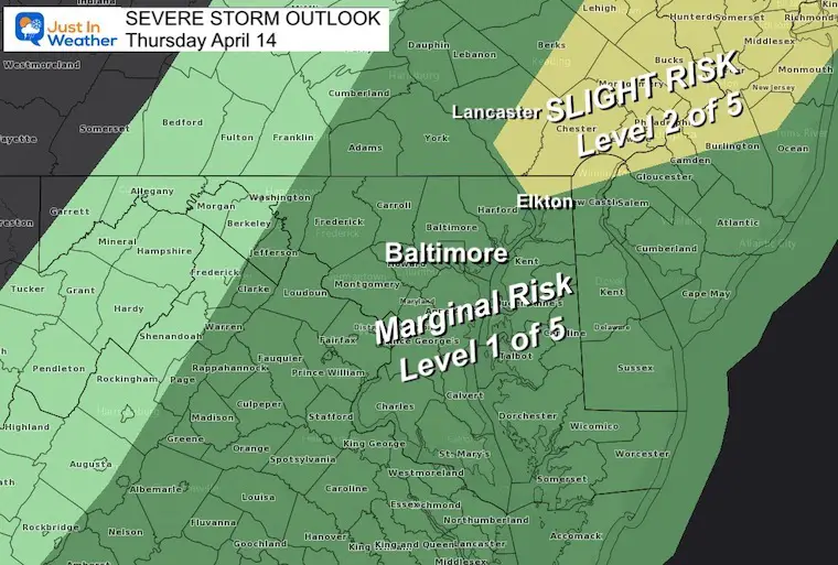
Most of our region is in target for a quick line of thunderstorms this afternoon. There is a small chance that can turn severe, which NOAA has identified with the Severe Storm Outlook. While the higher level is painted over Northeastern Maryland and Eastern PA, there is still a marginal chance for central Maryland to get a storm to turn severe.
A severe storm by definition has one or more of the following:
Winds over 58 mph
Hail over 1 inch diameter (size of a quarter)
Flash Flooding
Isolated Tornados
Should the threat increase, one of two advisories will be issued:
Watch (Severe T’Storm or Tornado): This means it ‘MIGHT’ happen, but not promised. It’s a better chance and we are paying attention
Warning (Severe T’storm or Tornado): This means it IS HAPPENING NOW and BEING TRACKED. In this case specific counties and towns in the path will be listed.
Any thunderstorm can have:
Dangerous lightning
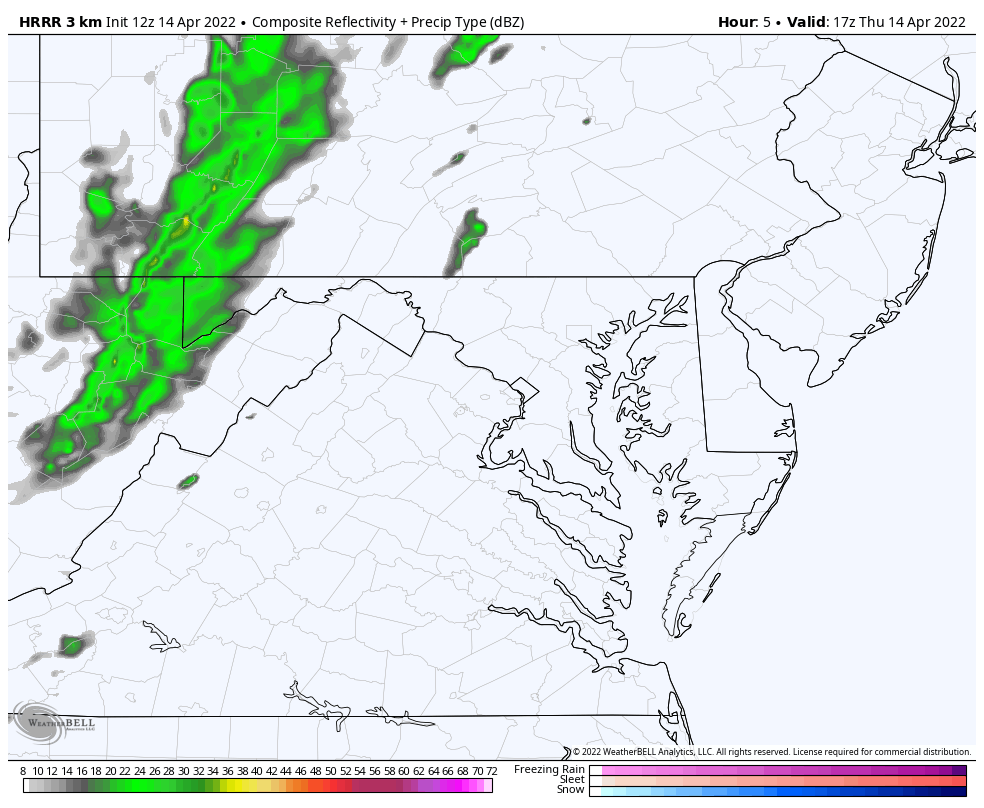
Timeline slider—> NAM 3 Km
This is guide not a promise.
I would allow a 1 hour buffer, so for example: 4 PM shows storm near Baltimore… Plan for that region any time between 3 PM and 5 PM.
april-14-weather-radar-storm-thursday-pm-2
april-14-weather-radar-storm-thursday-pm-3
april-14-weather-radar-storm-thursday-pm-4
april-14-weather-radar-storm-thursday-pm-5
april-14-weather-radar-storm-thursday-pm-6
april-14-weather-radar-storm-thursday-pm-7
april-14-weather-radar-storm-thursday-pm-8
april-14-weather-radar-storm-thursday-pm-9
COMPARE TO
Updated HRRR Model
Animation 1 PM to 12 AM (Midnight) Friday
This shows the line breaking up around Baltimore, but lingering showers in the metro area for a few hours between 3 PM and 8 PM.
This will be later on Delmarva, but clear out sooner farther west. By 4 PM this should be over from Frederick to the mountains.
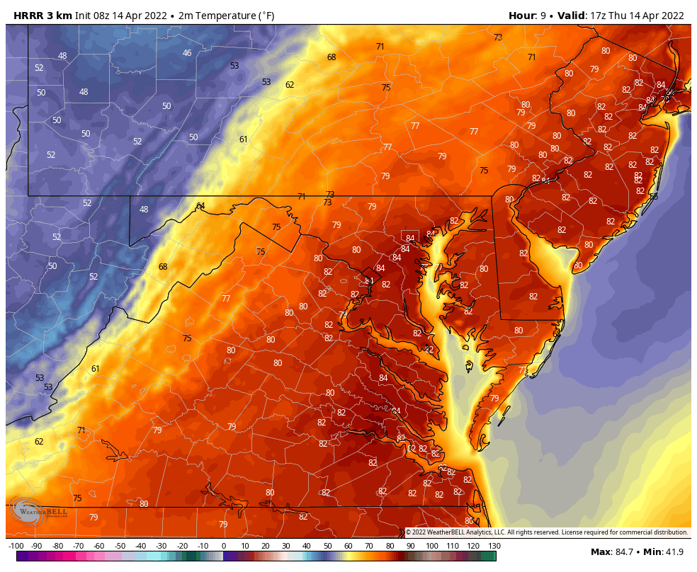
Temperatures:
10:30 AM
We already have fuel in place, and it might feel a little humid along with the stronger breezes.
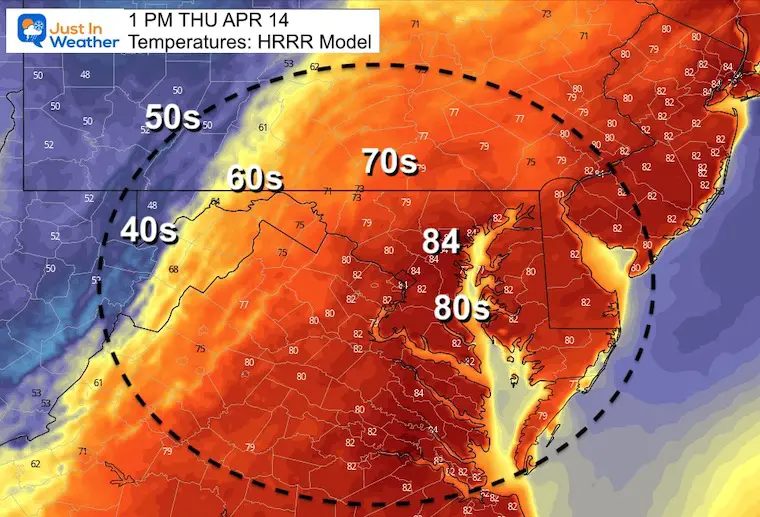
Afternoon Highs: Full For Storms
(This HRRR Model performed best with yesterday’s temps)
Temperature Animation
Early afternoon high, then cooling quickly through evening.
I am aware there are some spelling and grammar typos. I have made a few public statements over the years, but if you are new here you may have missed it:
I have dyslexia, and found out at my second year at Cornell. I didn’t stop me from getting my meteorology degree, and being first to get the AMS CBM in the Baltimore/Washington region.
I do miss my mistakes in my own proofreading. The autocorrect spell check on my computer sometimes does an injustice to make it worse.
All of the maps and information are accurate. The ‘wordy’ stuff can get sticky.
There is no editor that can check my work when I need it and have it ready to send out in a newsworthy timeline.
I accept this and perhaps proves what you read is really from me…