Wednesday Morning Report
Today is the day we get temps to spike. There will be clouds and a breeze, but we should jump well above 80ºF. This will be the first time for BWI at that mark since October 25, 2021, or 170 days ago!
How warm we may get is still up for grabs. Check out the wide range of forecast highs among models. We tend to verify warmer than forecast, so get ready for summer numbers!
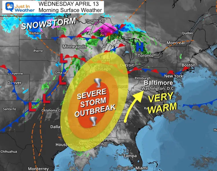
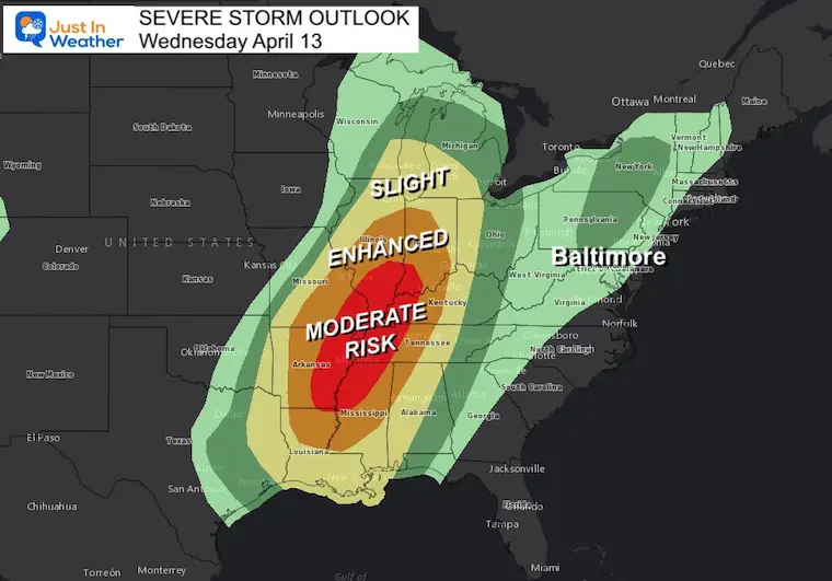
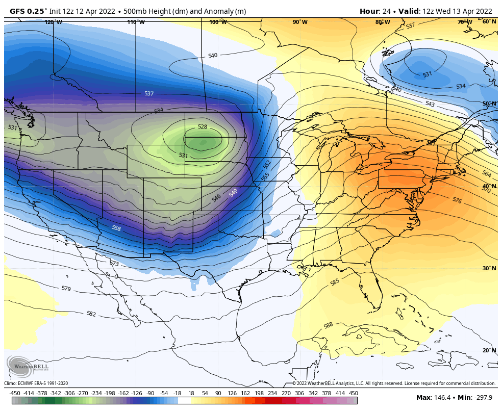
A large storm complex has spread a legitimate blizzard across the Northern Plains, while a few clusters of severe storms have spread from the Upper Midwest To the Gulf Coast. Today’s Moderate Risk means there is likely to be an outbreak of tornados that could include St. Louis, Memphis, and even Nashville.
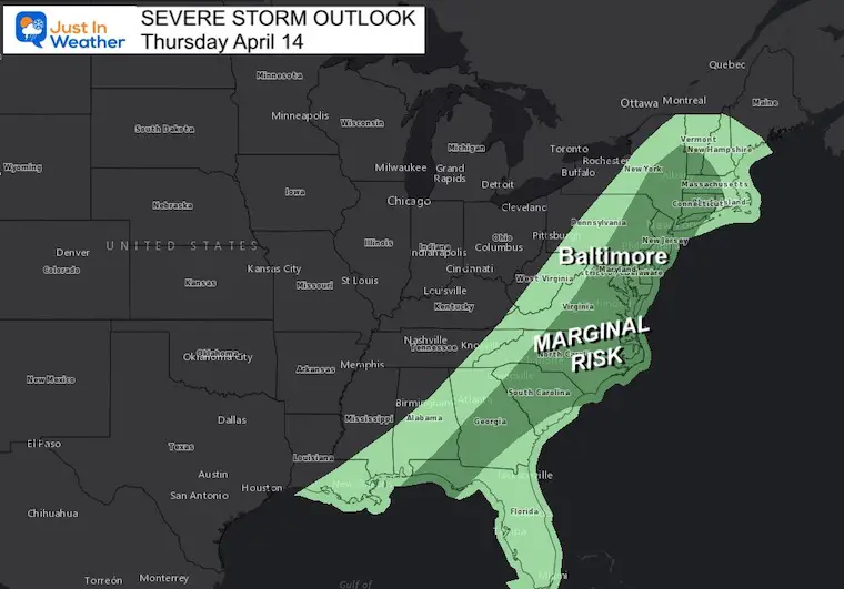
We will get that line of storm, but it will arrive in a diminished form tomorrow afternoon.
Wednesday Set Up
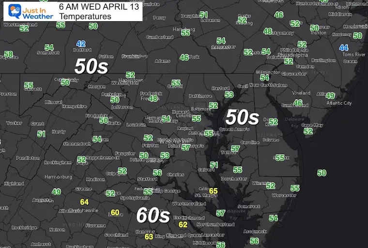
Morning Temperatures
Surface Weather
Feet of snow in North Dakota!
Sever Storm risk from Chicago – southward to New Orleans.
We get in on summer heat, and debris clouds. So the sky will range from dim sunshine and milky white to cloudy at times.
Severe Storm Outlooks
Today
The concern is that a lot of the moderate risk area will get their storms overnight.
Tomorrow
The threat diminishes for us on Thursday, but there will be some storms with a small chance they turn severe.
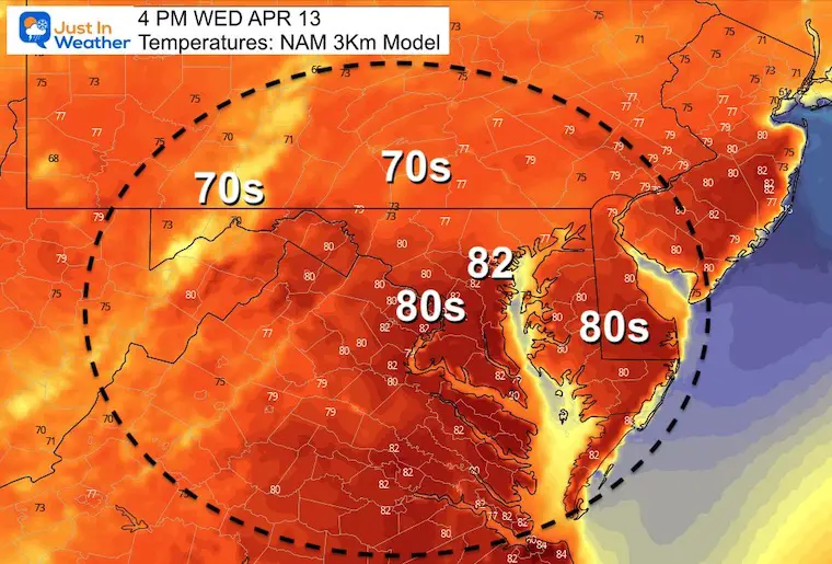
Afternoon Highs:
Compare the model forecasts…
HRRR

NAM 3 Km
GFS

CLIMATE DATA
TODAY April 13
Seasonal Snow: 14.4”
Normal Low in Baltimore: 42ºF
Record 26º F in 1973
Normal High in Baltimore: 64ºF
Record 89ºF 1977
*We have a small chance to challenge this today.
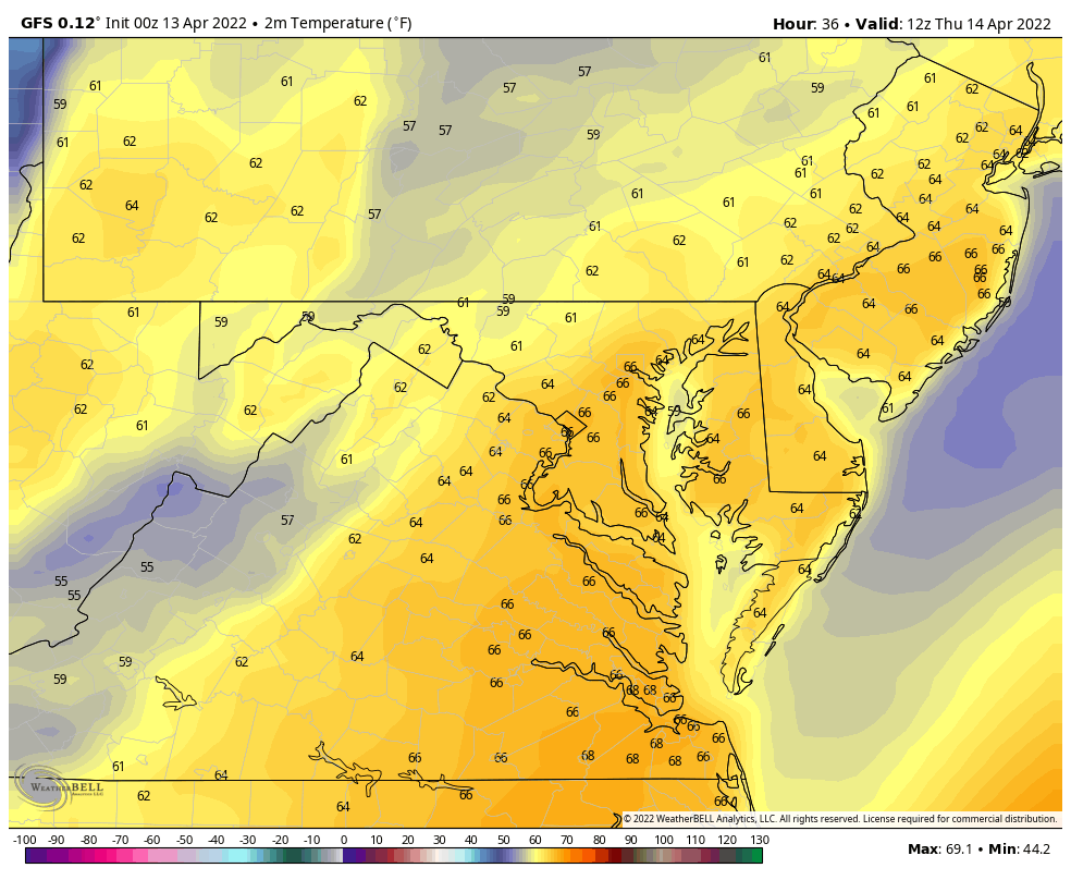
Thursday Temperatures
Morning

Forecast Animation Through 4 PM
We should reach our high early afternoon, then drop with the cold front.
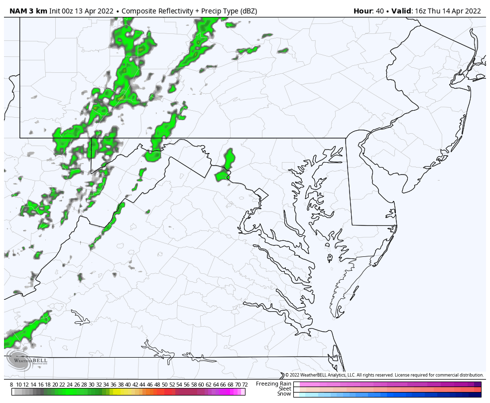
Rain Animation: NAM 3 KM
12 PM to 8 PM
The potential for a strong or severe storm will be with us, but the timing will be a quick hit. Likely early to mid afternoon and lasting less than 1/2 hour.
Looking FAR Ahead
Jet Stream Animation: 2 Weeks!
Wednesday April 13 to Wednesday April 27
There will be a few ups, and downs. The main premise here is that the second half of April is not clear cut. We will have some more warm days, but a few more deep troughs will continue to bring cool downs and maybe some more frosty mornings.
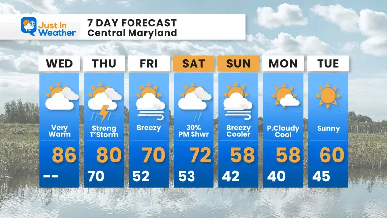
7 Day Forecast
Passover Begins Friday at Sundown
Easter is Sunday
Tropical Season Begins June 1
Atlantic Hurricane Forecast

Related Posts
Atlantic Tropical History: Maps of Origin Regions Every 10 Days


Please share your thoughts, best weather pics/video, or just keep in touch via social media
*Disclaimer due to frequent questions:
I am aware there are some spelling and grammar typos. I have made a few public statements over the years, but if you are new here you may have missed it:
I have dyslexia, and found out at my second year at Cornell. I didn’t stop me from getting my meteorology degree, and being first to get the AMS CBM in the Baltimore/Washington region.
I do miss my mistakes in my own proofreading. The autocorrect spell check on my computer sometimes does an injustice to make it worse.
All of the maps and information are accurate. The ‘wordy’ stuff can get sticky.
There is no editor that can check my work when I need it and have it ready to send out in a newsworthy timeline.
I accept this and perhaps proves what you read is really from me…
It’s part of my charm.


