


July 18 Flood Watch In The Mountains Then Storms Expand Back This Weekend
Friday, July 18 2025 Morning Report There is some relief in sight, but I remain cautious. For the short term, today remains muggy, while the focus of strong storms and…
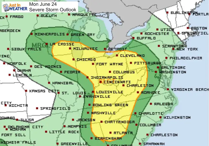
Monday June 24 2019
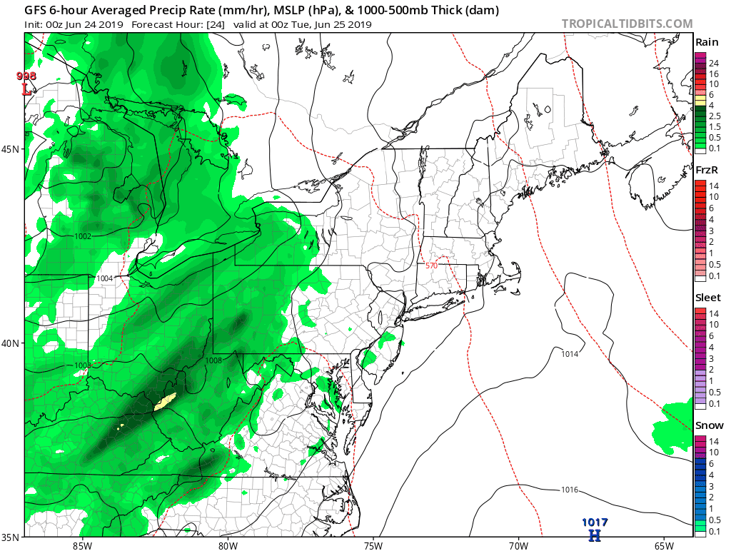
We are now officially in summer so it was inevitable that heat returns. We get in on some of that today and for the rest of this week. As it arrives, a band of severe storms is likely to our west. The latest indication is that this cluster will fade east of the mountains, but we could still get in on some remaining downpours into the evening. Then, just hot this week.
In Maryland, there is a chance for severe storms between 2 PM and 4 PM from McHenry to Hagerstown. But as the cluster moves east after 5PM it should loose energy.
Please note that as we get closer, these are potential alerts to be issued.
Severe Thunderstorm Watch: A broad area and window with a 4 to 6 hour time frame. This means it MIGHT happen.
Severe Thunderstorm Warning: A focused area like a county usually with a 30 to 60 minute time frame. This means it IS HAPPENING NOW.
Tornado Warning: A focused area and time frame. This would list towns in a likely path within a 15 to 45 minute window.
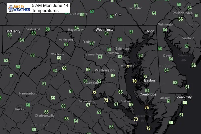
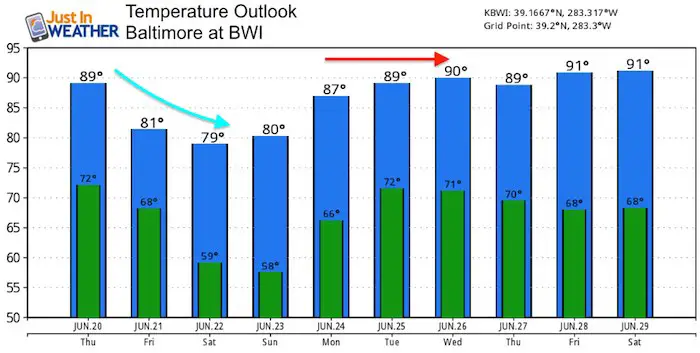
Morning Temperatures
Kids Trek Too!
Bring Your Kids To Join My Team This Summer
Click the logo for more information
![]()
Average High: 86ºF
Record High: 100ºF in 2010
Average Low: 64ºF
Record Low: 50ºF in 1972
Sunrise: 5:40 AM
Sunset 8:36 PM
*Daylight = 0:09 shorter than yesterday
*Bay Water Temperature = 74ºF at Thomas Pt. Light House
Just in case you don’t get all posts on your social media feed, stay up to date with the latest info…
Click here to sign up for email alerts…. Be the first to hear any new weather.
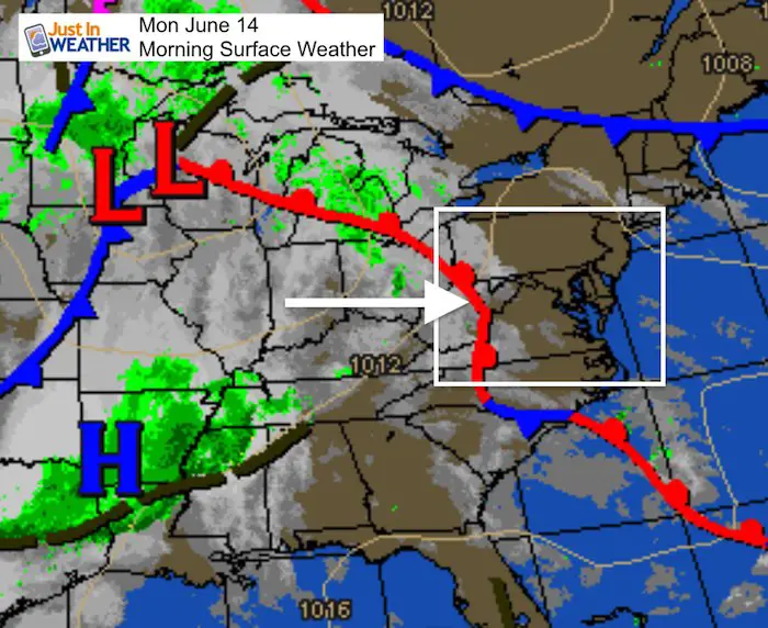
Morning Set Up
The warm front to our west will be responsible for the storms and our boost in temperatures this week.
Rain Timeline —> slider
The support shows storms in the mountains fading as they move east. There still could be downpours and lighting as this first cluster arrives between 5 PM and 7 PM

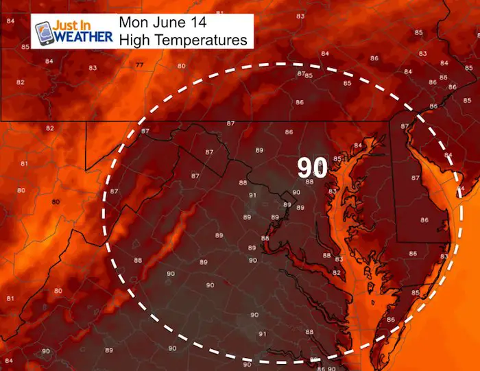
High Temperatures
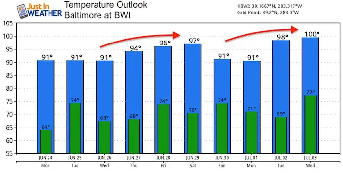
Looking Ahead
After today, the rest of the week will just be hot! The chance of afternoon storms will be isolated
Temperature Outlook
Join My Team: Maryland Trek 6
Our look got an upgrade, but we have the same purpose. Please click the logo take a look at our new page.

Temperature Outlook
Support Our Nonprofit:
Proceeds go to our programs Providing FREE holistic care for kids in cancer treatment and up to 5 years post treatment and caregivers.
![]()
Shine On
Proceeds from all sales go to Just In Power Kids. Click the image to shop and show your support.

Love Maryland Shirts and Hoodies
This shirt was designed by my ‘bonus’ daughter Jaiden. The hoodie has been the biggest hit, so our promotion has been extended until the end of this week.
|
||
|
Show your love for Maryland and make this 14 year old artist and her mom extra proud
|
Please share your thoughts, best weather pics/video, or just keep in touch via social media
Related Links:
Was Your County Not Included?
Click this map for more on the regional forecast zones
