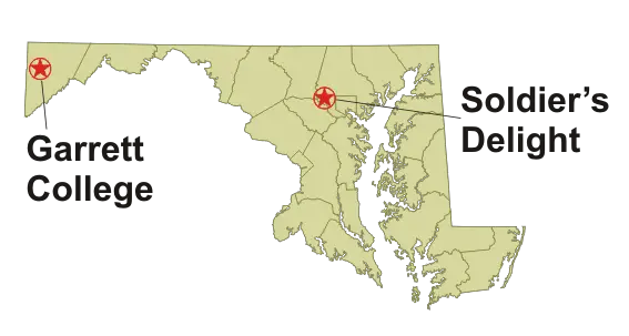
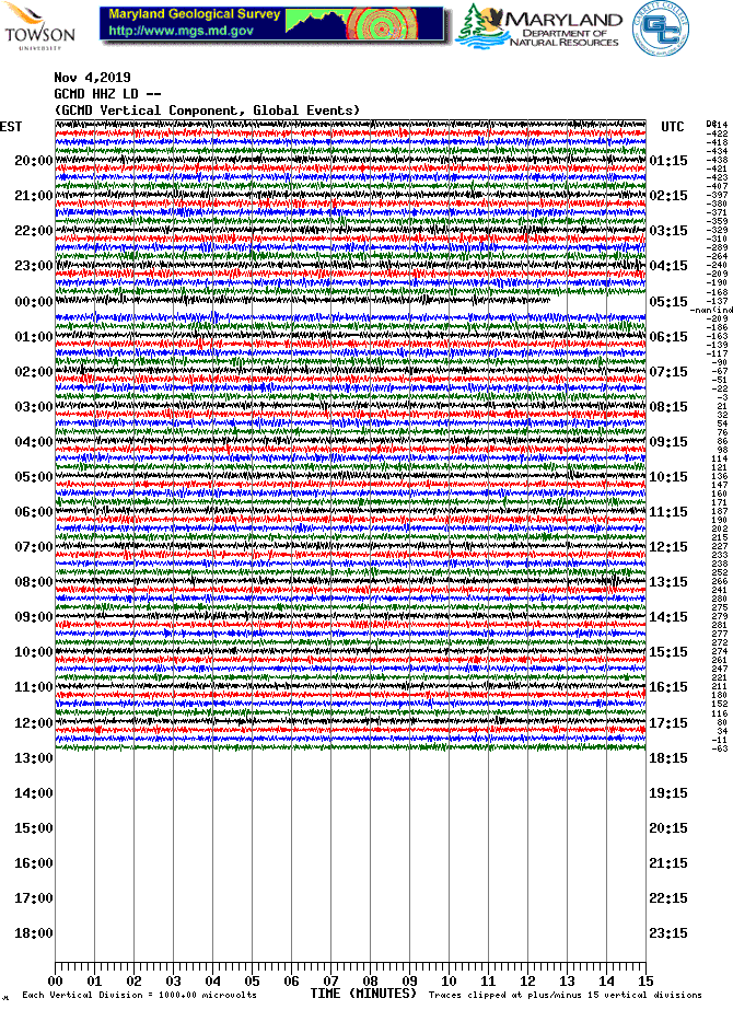
Seismic Network
DYFI: Did You Feel It Mapping from USGS
The United States Geologic Survey (USGS) collects information from people who felt an earthquake and creates maps that show what people experienced and the extent of damage. The lowest level M 2.5 is the base point for what is likely to be noticed by humans.The archive maps here date back to 1999 for the nation and show a wide spread of active spots.
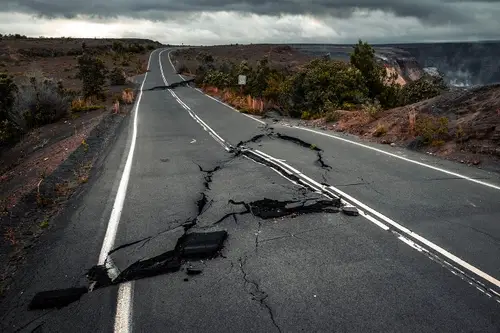
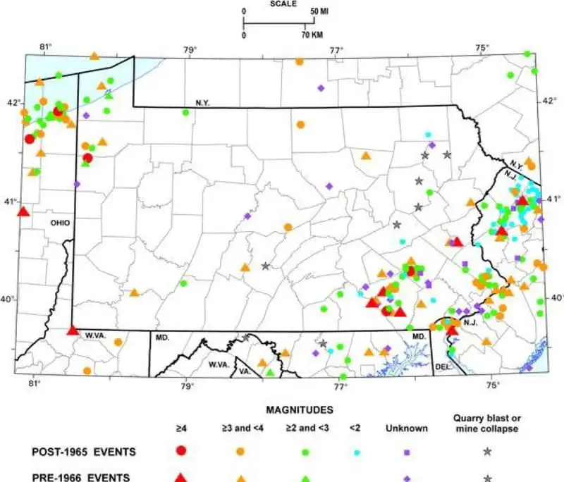
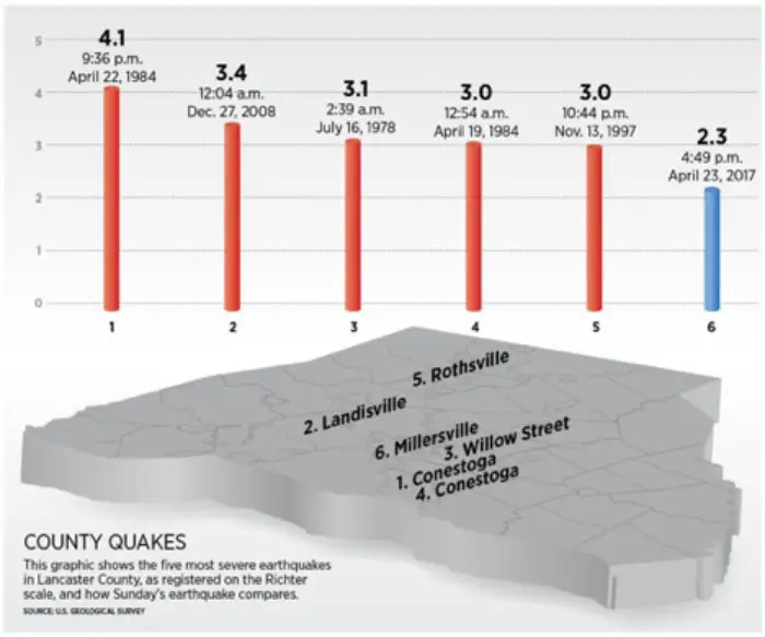
Locally we have had more quakes than you might have expected. Our region along and east of the Appalachian mountains contains a lot of old fault lines. The mountain range is the oldest in the world and thanks to the forces that created them at one time was higher than the Himalayas.
Two active locations have been in central VA and Lancaster County, PA. In fact, Lancaster County gets more quakes than the rest of Pennsylvania and is responsible for many tremors reaching into central Maryland.
DYFI: Did You Feel It Mapping from USGS
(DYFI) collects information from people who felt an earthquake and creates maps that show what people experienced and the extent of damage.
-
Search DYFI ArchivesThey configure this search to return only events with DYFI products. You may enter additional search parameters for magnitude threshold, time window, and geographic area.
-
Summary MapsCumulative and yearly response maps for earthquakes in the U.S. and around the world.

Latest Earthquakes
Latest earthquakes map and list. Tap/click on "gear icon" for options and settings powered by USGS.
for Google Maps) https://earthquake.usgs.gov/fdsnws/event/1/
While strong earthquakes are unusual in Maryland, the state occasionally experiences perceptible earthquakes. I consider portions of Maryland to be at moderate risk for earthquake damage. In order to evaluate and monitor this risk, Maryland Geological Survey has developed the Maryland Seismic Network. The Seismic Network provides high quality, real-time data on local earth movements and earthquakes in Maryland and other more distant earthquakes around the globe.
Lorem ipsum dolor sit amet, consectetur adipiscing elit. Suspendisse varius enim in eros elementum tristique. Duis cursus, mi quis viverra ornare, eros dolor interdum nulla, ut commodo diam libero vitae erat. Aenean faucibus nibh et justo cursus id rutrum lorem imperdiet. Nunc ut sem vitae risus tristique posuere.