November 6 Record Warmth Surges In Plus Hurricane Rafael Update And Rain This Weekend
November 6, 2024
Wednesday Morning Report
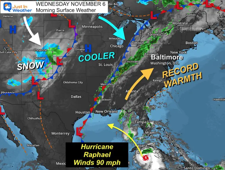
There is a lot going on the weather map this morning and so much to explore in this report. The highlights include record heat today and tomorrow morning, a strong cold front fading before reaching us, but there is rain possible to end our weekend.
Farther west, there is moderate snowfall over Colorado, including Denver.
Meanwhile, Hurricane Rafael now has 100 mph winds. It will cross Western Cuba today and head into the Gulf of Mexico. The track is trending south, but some influence may help feed us that rain by Sunday night—not a lot, but something.
Morning Surface Weather
A surge of warm air will sweep across the Eastern US this afternoon, likely breaking multiple temperature records.
The cold front to our west looks impressive but will run into dry air and fade overnight before reaching us.
Farther west, we see early winter with snow around Denver, where they also have drought issues.
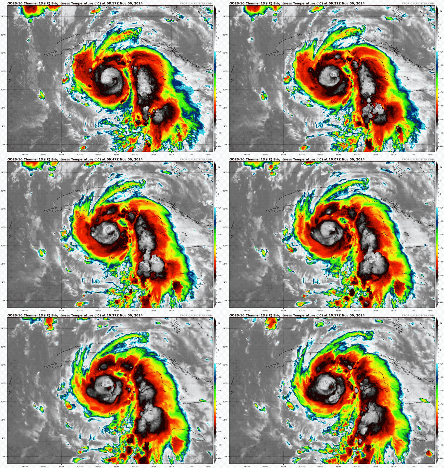
Hurricane Rafael is approaching Cuba and may gain some more strength, then move into the Gulf of Mexico.
I want to focus on the Hurricane first, then the local weather and extended forecast below.
Hurricane Rafael Satellite
Hurricane-force winds reach only 15 miles from the center.
Tropical Storm force winds reach 105 miles from the center.
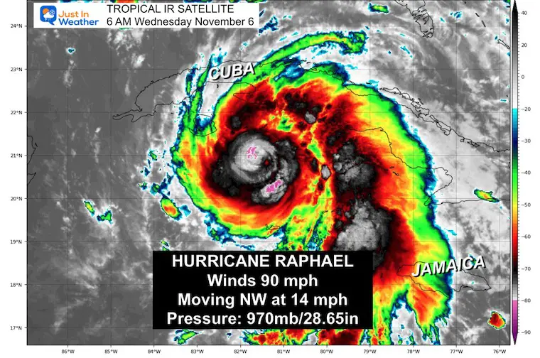
National Hurricane Center Update at 4 AM EST
- LOCATION…20.6N 81.3W
- ABOUT 120 MI…190 KM SE OF THE ISLE OF YOUTH
- ABOUT 195 MI…310 KM SSE OF HAVANA CUBA
- MAXIMUM SUSTAINED WINDS…90 MPH…150 KM/H
- PRESENT MOVEMENT…NW OR 315 DEGREES AT 14 MPH…22 KM/H
- MINIMUM CENTRAL PRESSURE…970 MB…28.65 INCHES
Hurricane Rafael Satellite
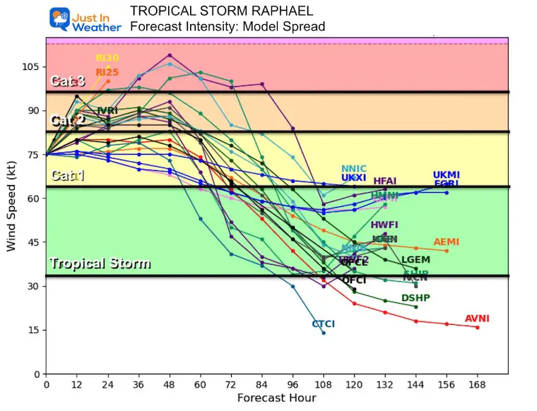
Forecast Intensity
It is likely to reach Category 3 today, then hold steady or slowly weaken.
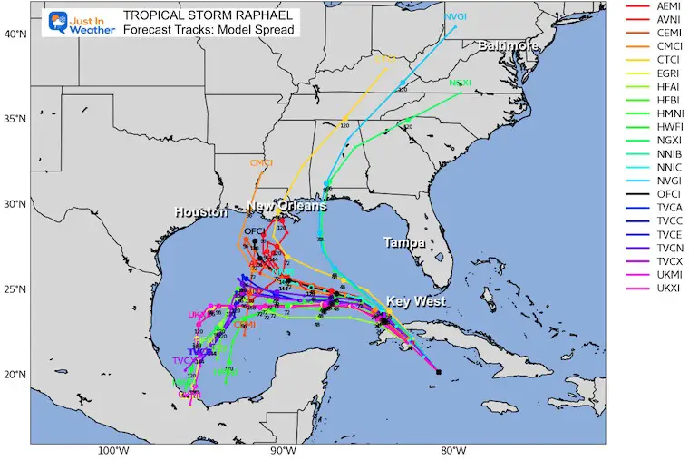
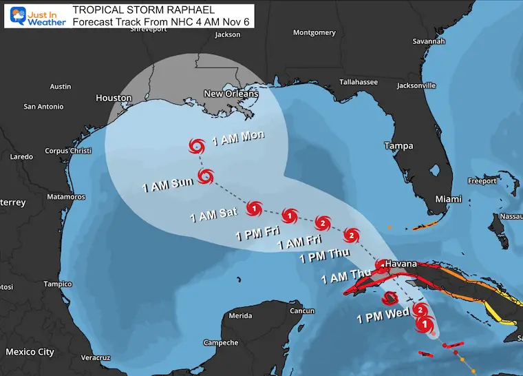
Forecast Tracks
Computer Model Spread
There is a lot of uncertainty with this storm, so the true timing and location of landfall have low confidence.
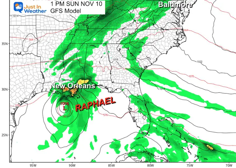
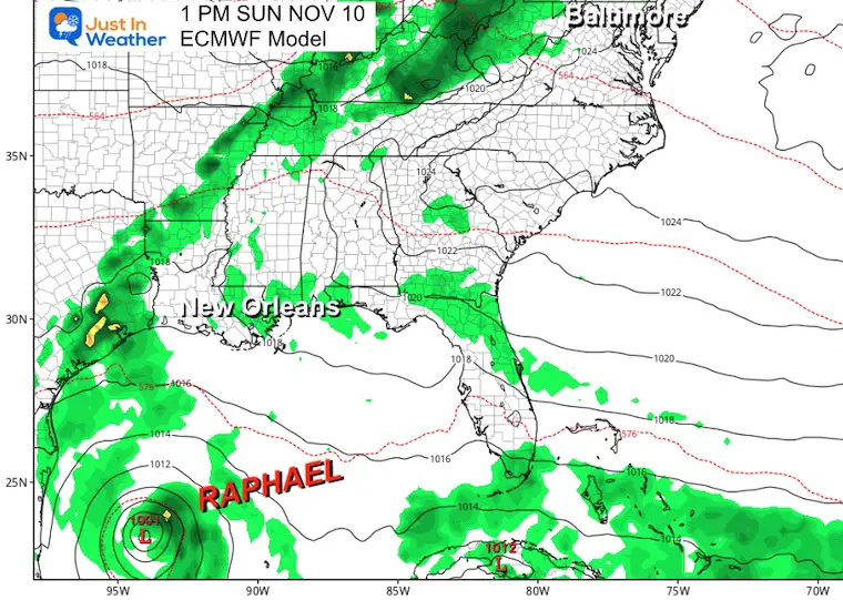
Comparing Main Models This Weekend
GFS Model
ECMWF Model
National Hurricane Center
NHC keeps the storm center farther south of New Orleans.
SUMMARY OF WATCHES AND WARNINGS IN EFFECT:
A Hurricane Warning is in effect for…
- Cayman Islands
- Cuban provinces of Pinar del Rio, Artemisa, La Habana, Mayabeque, Matanzas, and the Isle of Youth
A Tropical Storm Warning is in effect for…
- Jamaica
- Cuban provinces of Villa Clara, Cienfuegos, Sancti Spiritus, and Ciego de Avila
A Tropical Storm Watch is in effect for…
- Cuban provinces of Camaguey and Las Tunas
- Lower and Middle Florida Keys from Key West to west of the Channel 5 Bridge
- Dry Tortugas
LOCAL WEATHER
Baltimore Drought Update
- No Measurable Rain Since October 2nd = 35 Days!
- There was a ‘trace’ on October 4th and November 1st.
- Rainfall DOWN -6.55” since Sep 1
Morning Temperatures at 6 AM
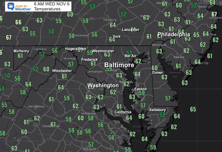
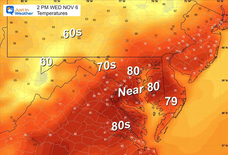
Afternoon Forecast Temperatures
Record High was 80° set in 2015. This looks like it will be broken!
CLIMATE DATA: Baltimore
TODAY November 6
Sunrise at 6:40 AM
Sunset at 4:59 PM
Normal Low in Baltimore: 39ºF
Record 22ºF in 1991
Normal High in Baltimore: 61ºF
Record 80ºF 2015
THURSDAY NOVEMBER 7
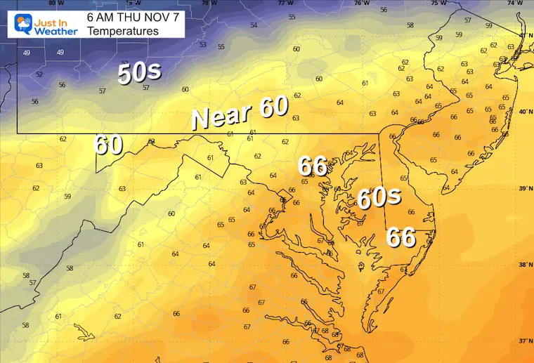
Still very warm and may start with a morning record, then a slightly cooler afternoon.
Morning Lows
Record WARM MINIMUM in Baltimore – 62ºF in 1938
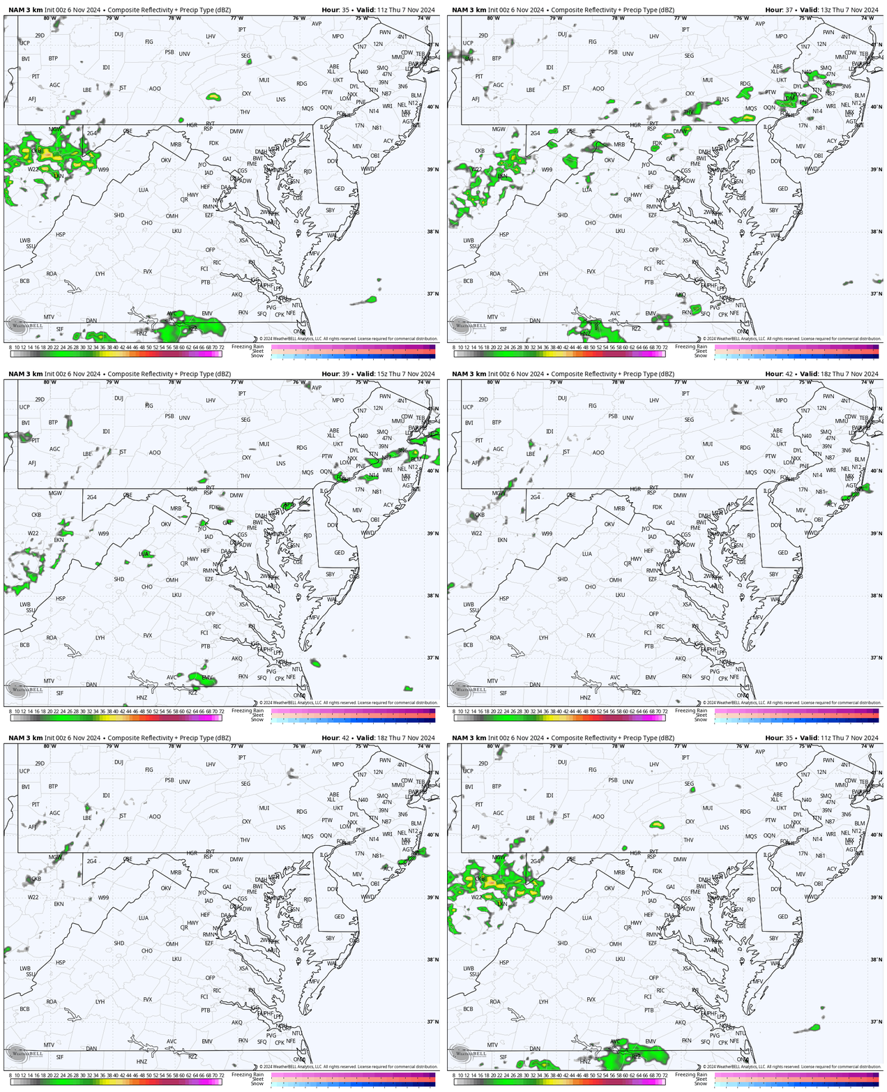
Radar Simulation: 6 AM to 1 PM
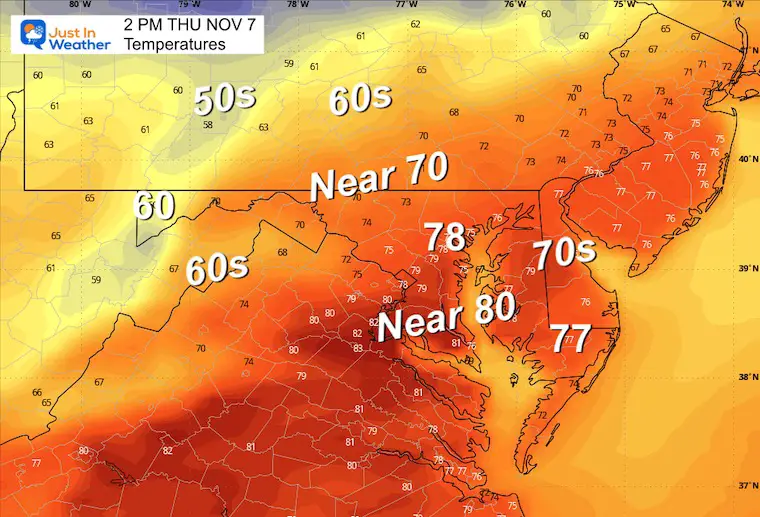
Afternoon Highs
Record High in Baltimore = 81ºF in 2022
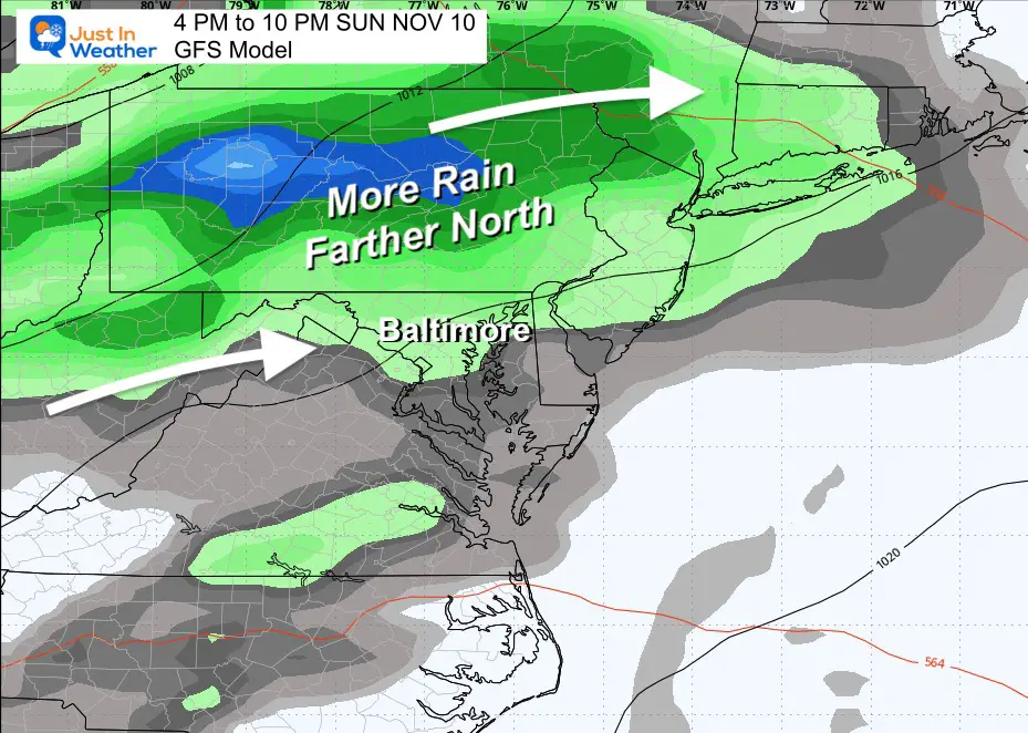
GFS Model Forecast: Saturday to Monday
It looks like Rafael might help send some moisture up the cold front… but not a direct impact.
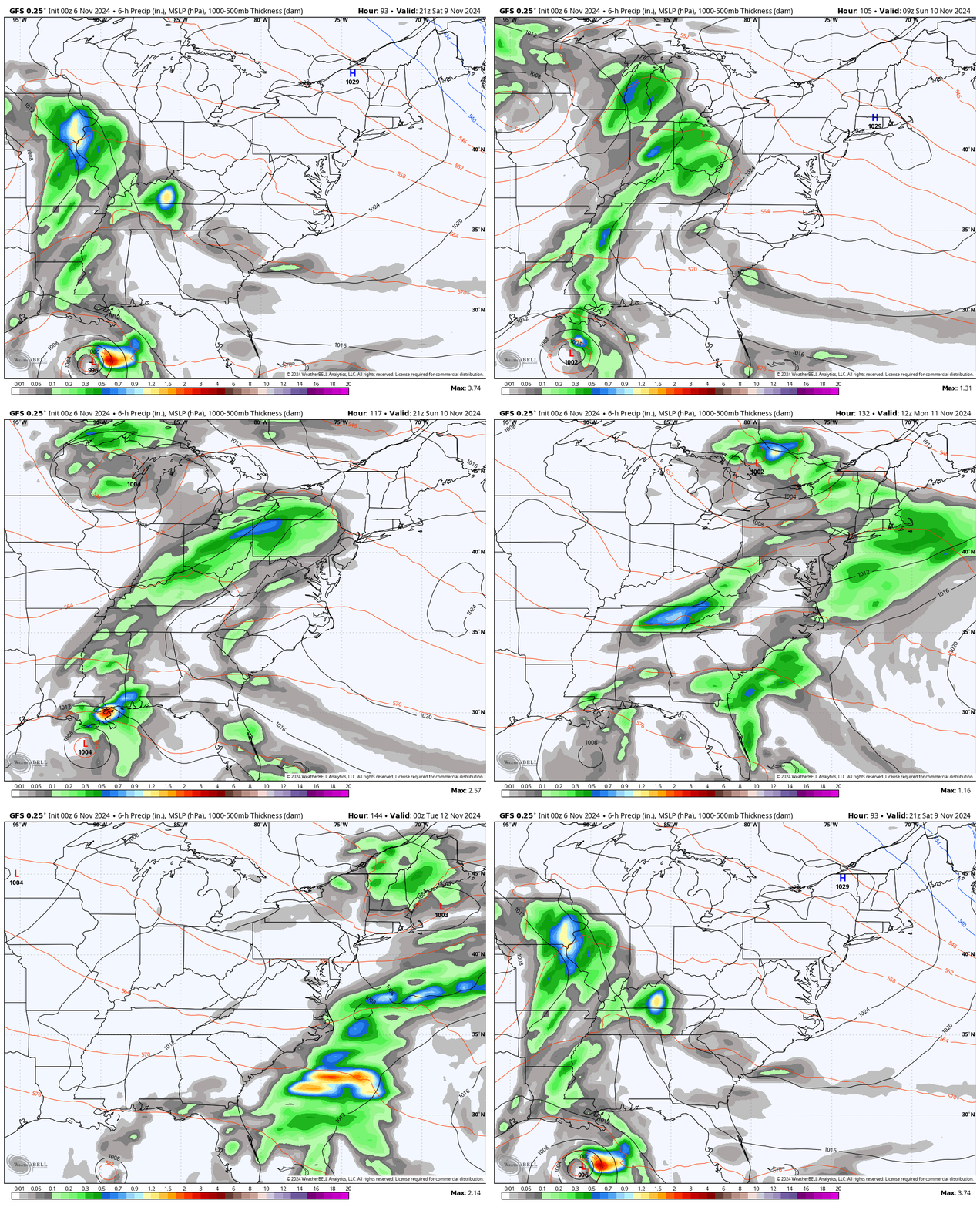
Sunday Night
The best chance of rain is at the end of the weekend. Perhaps after a dry start to Sunday, it will end wet.
This is NOT enough rain to dent the drought, but it is something.
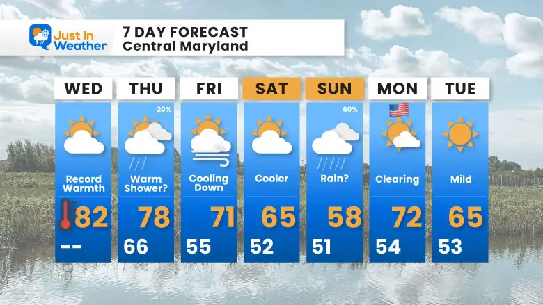
7 Day Forecast
The cooldown will truly start to be felt on Friday. The trend back to near-normal temps will come with that chance of rain on Sunday…. another mild push next week, but not as warm.
Subscribe for eMail Alerts
Weather posts straight to your inbox
Sign up and be the first to know!
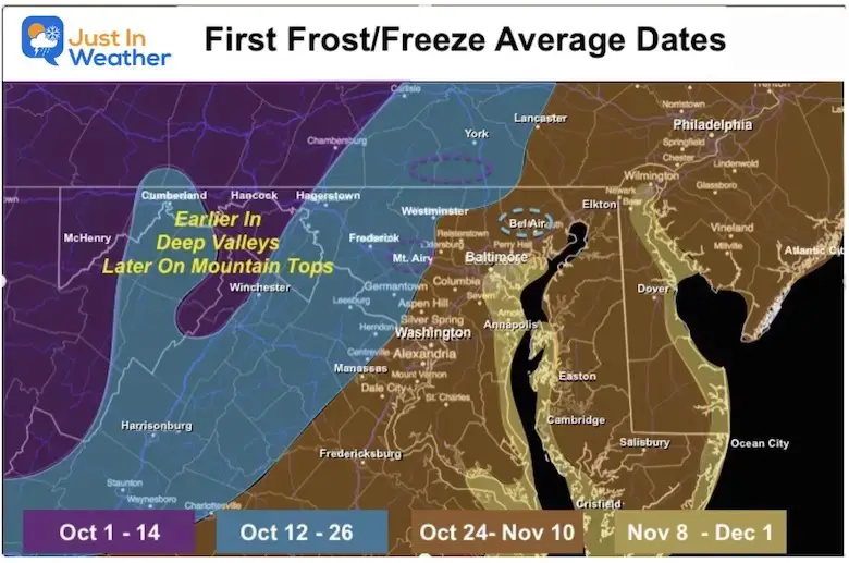
FIRST FROST DATES
Here are the average dates across Maryland, and they match the advisories we saw last week.
Click this image to see more details across Maryland and Pennsylvania.
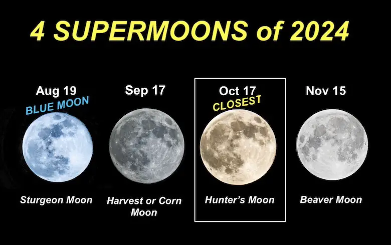
FOUR SUPERMOONS OF 2024
Please share your thoughts and best weather pics/videos, or just keep in touch via social media.
-
Facebook: Justin Berk, Meteorologist
-
Twitter
-
Instagram
SCHEDULE A WEATHER BASED STEM ASSEMBLY
Severe Weather: Storm Smart October and next spring
Winter Weather FITF (Faith in the Flakes): November To March
Click to see more and send a request for your school.
THANK YOU:
Baltimore Magazine Readers Choice Best Of Baltimore
Maryland Trek 11 Day 7 Completed Sat August 10
We raised OVER $104,000 for Just In Power Kids – AND Still Collecting More
The annual event: Hiking and biking 329 miles in 7 days between The Summit of Wisp to Ocean City.
Each day, we honor a kid and their family’s cancer journey.
Fundraising is for Just In Power Kids: Funding Free Holistic Programs. I never have and never will take a penny. It is all for our nonprofit to operate.
Click here or the image to donate:
RESTATING MY MESSAGE ABOUT DYSLEXIA
I am aware there are some spelling and grammar typos and occasional other glitches. I take responsibility for my mistakes and even the computer glitches I may miss. I have made a few public statements over the years, but if you are new here, you may have missed it: I have dyslexia and found out during my second year at Cornell University. It didn’t stop me from getting my meteorology degree and being the first to get the AMS CBM in the Baltimore/Washington region.
One of my professors told me that I had made it that far without knowing and to not let it be a crutch going forward. That was Mark Wysocki, and he was absolutely correct! I do miss my mistakes in my own proofreading. The autocorrect spell check on my computer sometimes does an injustice to make it worse. I also can make mistakes in forecasting. No one is perfect at predicting the future. All of the maps and information are accurate. The ‘wordy’ stuff can get sticky.
There has been no editor who can check my work while writing and to have it ready to send out in a newsworthy timeline. Barbara Werner is a member of the web team that helps me maintain this site. She has taken it upon herself to edit typos when she is available. That could be AFTER you read this. I accept this and perhaps proves what you read is really from me… It’s part of my charm. #FITF


