July 6 Excessive Heat Warning And Beryl Weakened But Expected To Hit Texas As A Hurricane
Saturday, July 6 2024
Morning Report
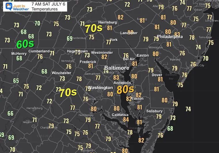
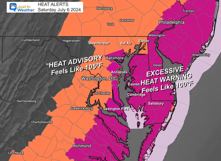
The heat reaches its peak today! We know we have a problem when places like Baltimore’s BWI reported 83ºF at 7 AM, after a low of only 81ºF. This launchpad and high humidity have promoted an Excessive Heat Warning for metro areas, around the Chesapeake Bay, and most of Delmarva inland from the beaches. It may feel like 110ºF this afternoon.
Morning Temperatures
Excessive Heat Warning
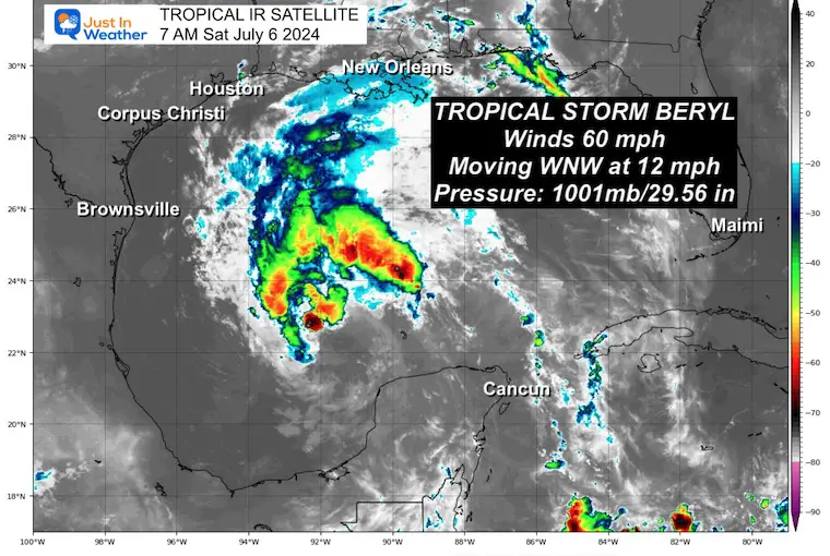
Tropical Storm Beryl
More on this storm with the full forecast below… showing how it may influence our weather next week.
Today’s Weather
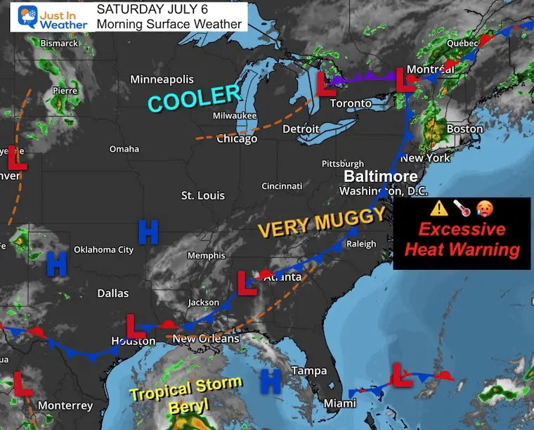
Hot, humid, and very uncomfortable! In fact it will be dangerous for many to be outside for an extended period of time. Relief will be slow, and the trade-off will be more storms during the week. As Beryl makes landfall on the Texas coast Monday, some of that moisture may influence our weather in the week ahead.
Morning Surface Weather
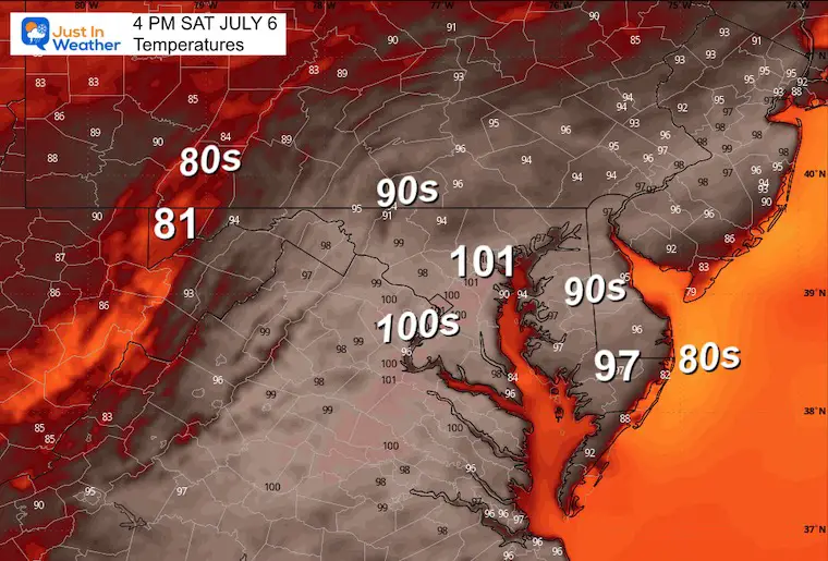
Afternoon Temperatures
It may feel up to 10 degrees warmer than what is shown here.
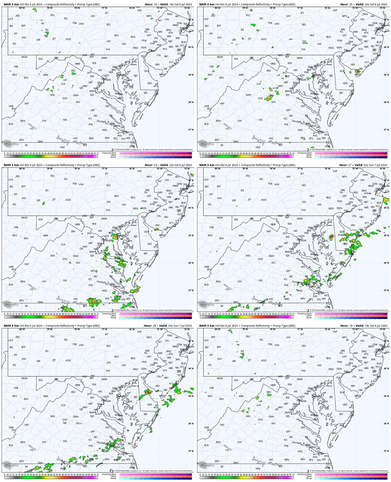
Radar Simulation
Not much activity today.. But there is a 20% chance of isolated thundershowers developing between 4 PM and 8 PM.
CLIMATE DATA: Baltimore
TODAY July 6
Sunrise at 5:47 AM
Sunset at 8:36 PM
Normal Low in Baltimore: 67ºF
Record 51ºF in 1979
Normal High in Baltimore: 89ºF
Record 105ºF 2010
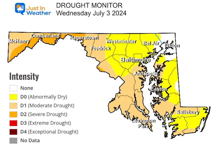
Drought Monitor
SUNDAY JULY 7
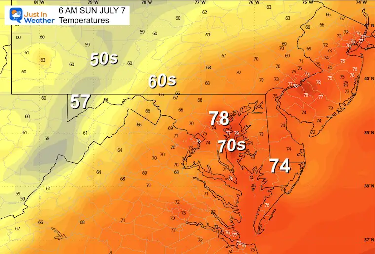
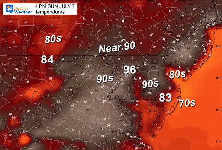
Hot and Humid AGAIN
Morning Temperatures
Afternoon Temperatures
Tropical Storm Beryl
The downgrade to a tropical storm was expected after crossing Mexico’s Yucatan and getting disrupted. Now back over water, it will reorganize to a Category 1 hurricane before making landfall in Texas. This hurricane has made a turn north, which puts Corpus Christi to Houston in sight.
When it moves inland, it will inject tropical moisture across the Southeast US during the week ahead.. which may affect the Mid-Atlantic as well.
Morning Satellite Loop
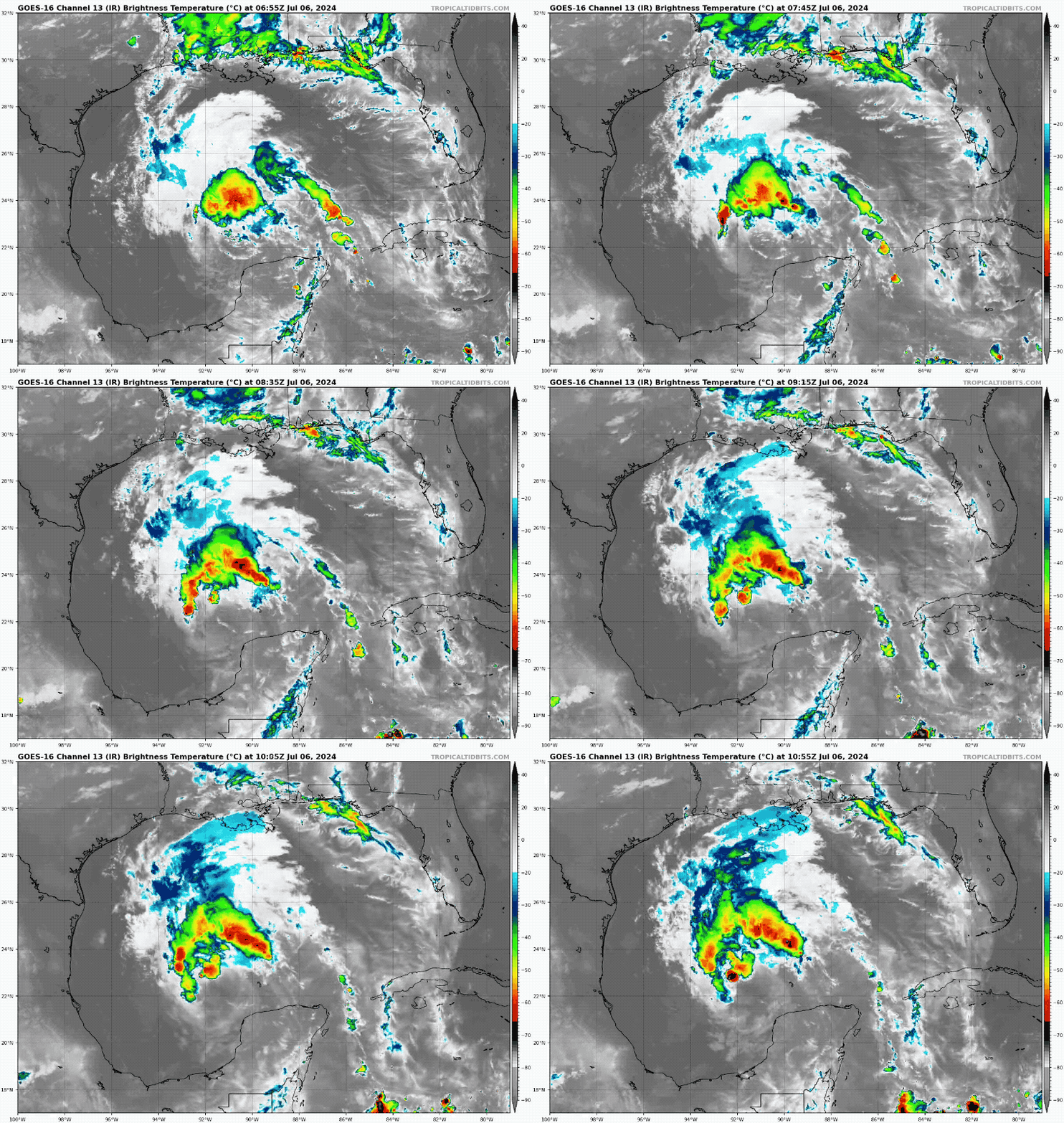
SUMMARY OF 400 AM CDT…0900 UTC…INFORMATION
———————————————-
LOCATION…22.2N 91.3W
ABOUT 545 MI…875 KM SE OF CORPUS CHRISTI TEXAS
MAXIMUM SUSTAINED WINDS...60 MPH…95 KM/H
PRESENT MOVEMENT...WNW OR 300 DEGREES AT 12 MPH…19 KM/H
MINIMUM CENTRAL PRESSURE…1001 MB…29.56 INCHES
LIVE WIND WIDGET
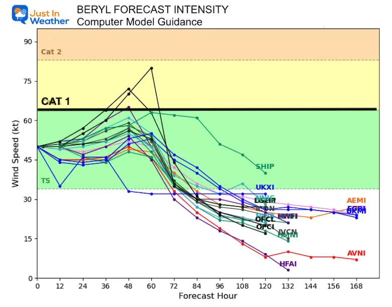
Computer Model Forecast Intensity
Not all members show it, but it is expected to become a Category 1 Hurricane again this weekend.
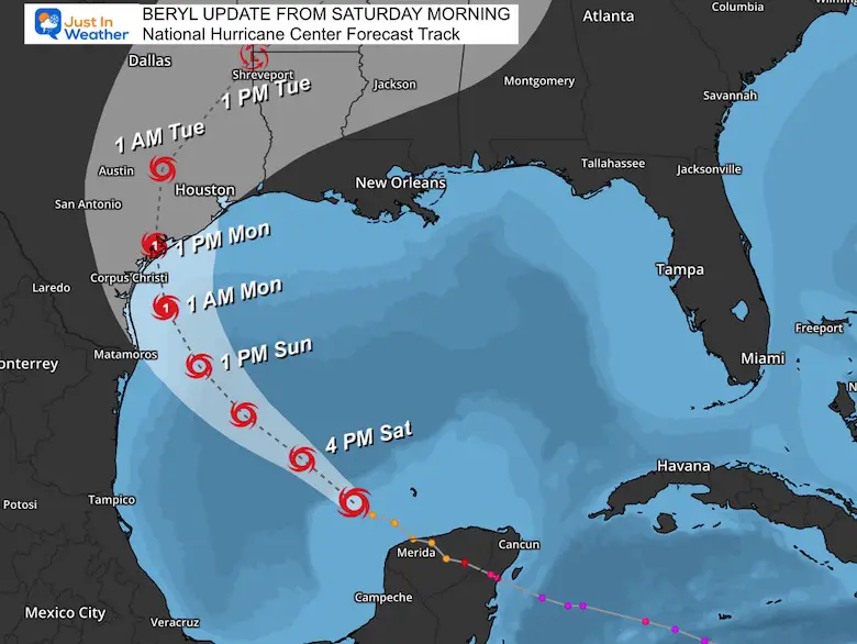
National Hurricane Center Forecast Track
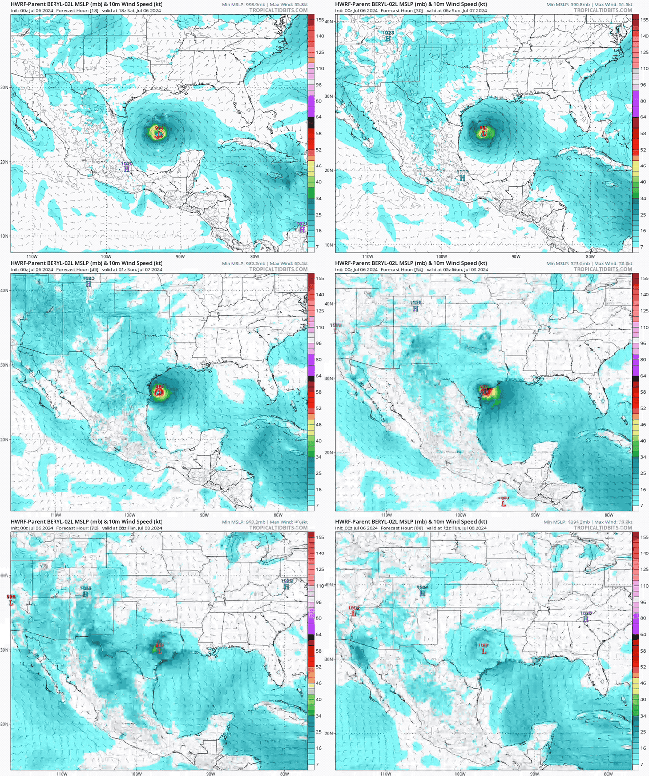
With the turn north, a delayed landfall now puts it around Monday afternoon to hit between Corpus Christi and Houston.
HWRF Model Forecast Track
SUMMARY OF WATCHES AND WARNINGS IN EFFECT:
A Hurricane Watch is in effect for…
* The Texas coast from the mouth of the Rio Grande northward to San Luis Pass
* The northeastern coast of mainland Mexico from Barra el Mezquital to the mouth of the Rio Grande
A Storm Surge Watch is in effect for…
* The Texas coast from the mouth of the Rio Grande northward to High Island
Looking Ahead: Tuesday to Friday
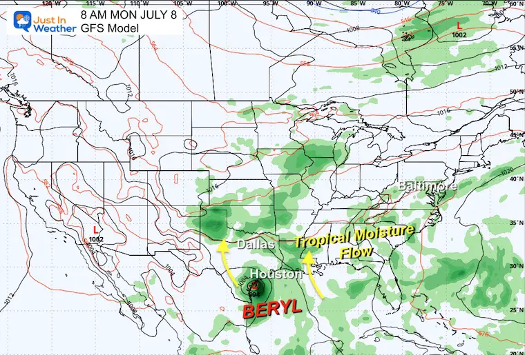
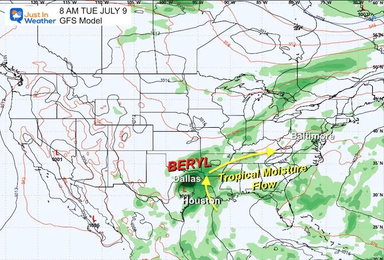
We can see some influence from Beryl adding tropical moisture along the frontal boundary… expanding to the east. We will NOT get the storm in an organized form, but we will see more thunderstorms each day.
Snapshots
Monday
Tuesday
Animation Through Friday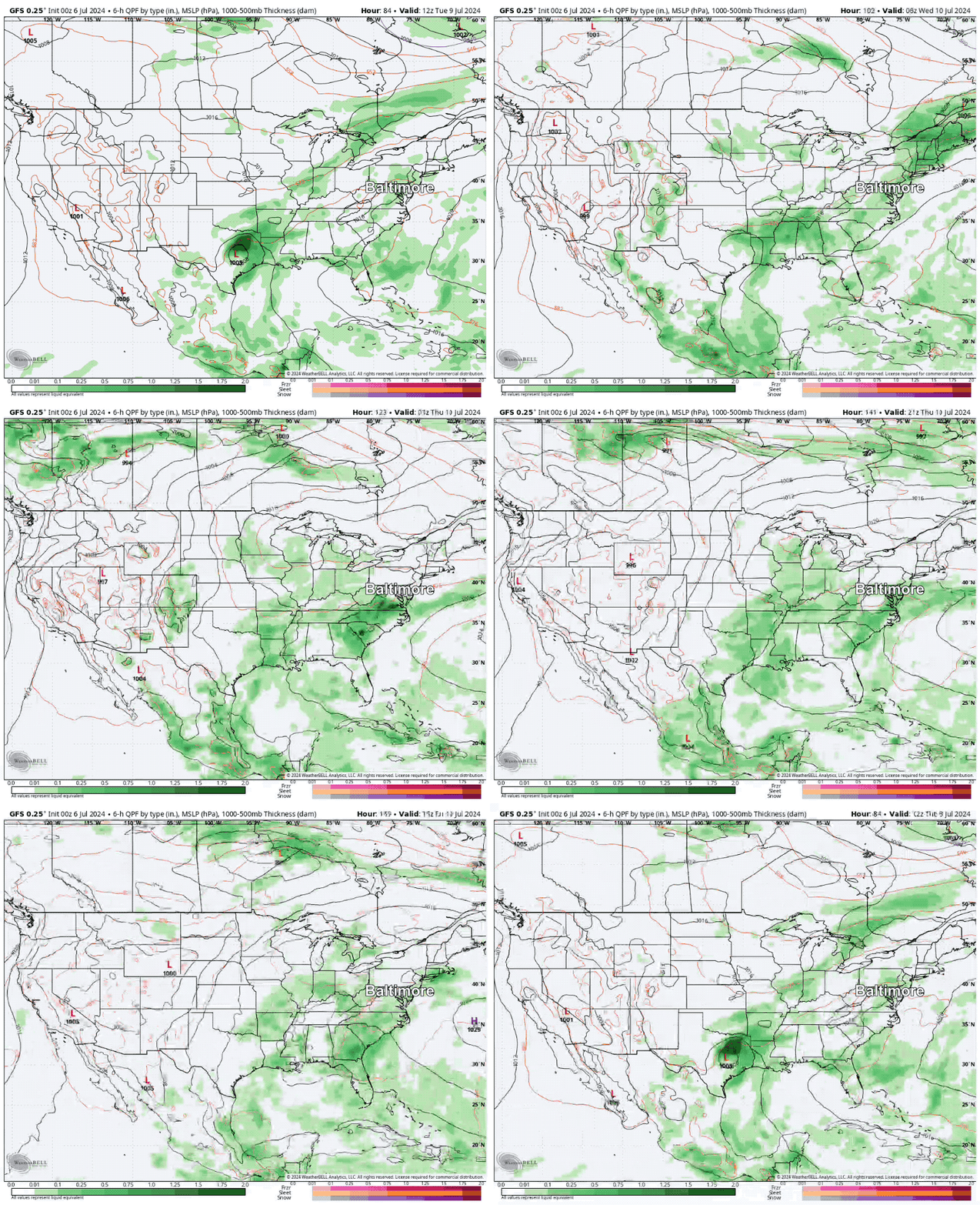
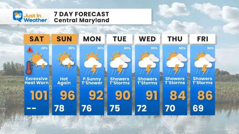
7 Day Forecast
The peak heat this weekend will gradually lower, but the trade-off will be increased daily thunderstorms next week.
Please share your thoughts and best weather pics/videos, or just keep in touch via social media
-
Facebook: Justin Berk, Meteorologist
-
Twitter
-
Instagram
RESTATING MY MESSAGE ABOUT DYSLEXIA
I am aware there are some spelling and grammar typos and occasional other glitches. I take responsibility for my mistakes and even the computer glitches I may miss. I have made a few public statements over the years, but if you are new here, you may have missed it: I have dyslexia and found out during my second year at Cornell University. It didn’t stop me from getting my meteorology degree and being the first to get the AMS CBM in the Baltimore/Washington region.
One of my professors told me that I had made it that far without knowing and to not let it be a crutch going forward. That was Mark Wysocki, and he was absolutely correct! I do miss my mistakes in my own proofreading. The autocorrect spell check on my computer sometimes does an injustice to make it worse. I also can make mistakes in forecasting. No one is perfect at predicting the future. All of the maps and information are accurate. The ‘wordy’ stuff can get sticky.
There has been no editor who can check my work while writing and to have it ready to send out in a newsworthy timeline. Barbara Werner is a member of the web team that helps me maintain this site. She has taken it upon herself to edit typos when she is available. That could be AFTER you read this. I accept this and perhaps proves what you read is really from me… It’s part of my charm. #FITF


