July 1 Weather Post Storm Cool Breeze Major Hurricane Beryl And Independence Day Storms
Monday, July 1 2024
Morning Report
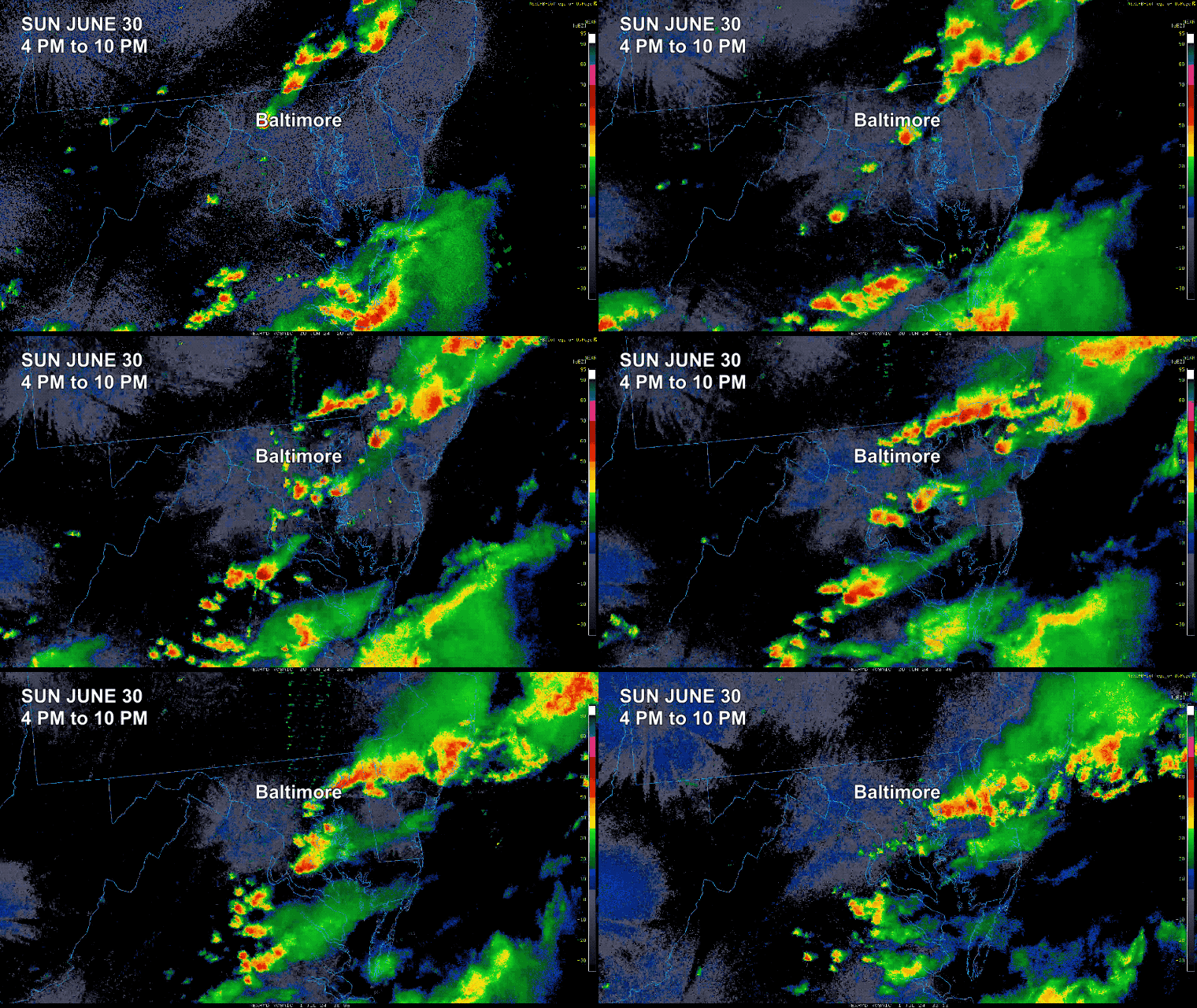
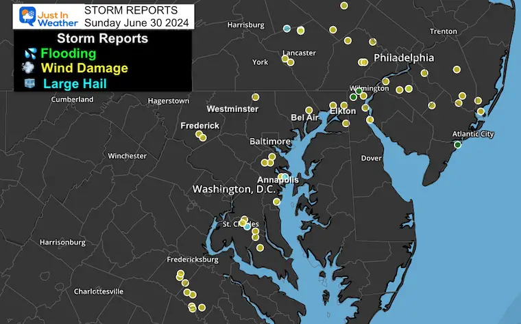
The weekend of storms came to a peak Sunday evening with locally heavy (needed) rain and some pockets of wind damage. Today we get the benefits of the new air mass that has already brought in cooler winds and lower humidity.
We will warm back up with high heat and strong storms from Thursday, July 4, into the Independence Day Weekend Holiday. Explore all the details below.
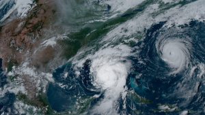
HURRICANE BERYL
This is historic! In addition to the quick ramp-up from a named Tropical Storm to a hurricane, this was THE FIRST CATEGORY 4 Storm In The Atlantic in June… Now, in July, as we track it through the Caribbean, it is down to Category 3.
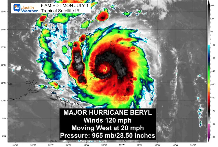
Morning IR Satellite
Hurricane Force Winds reach 35 miles from the center.
Tropical Storm Force Winds reach 125 miles from the center.
Risks On Islands Across Path:
- Rainfall spread of 3 to 10 inches
- Storm Surge 6 to 9 Feet.
SUMMARY OF 500 AM AST
———————————————-
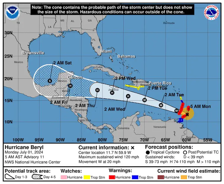
- LOCATION…11.7N 59.9W
- ABOUT 125 MI…200 KM ESE OF GRENADA
- ABOUT 140 MI…225 KM SE OF ST. VINCENT
- MAXIMUM SUSTAINED WINDS…120 MPH…195 KM/H
- PRESENT MOVEMENT…W OR 280 DEGREES AT 20 MPH…31 KM/H
- MINIMUM CENTRAL PRESSURE…965 MB…28.50 INCHES
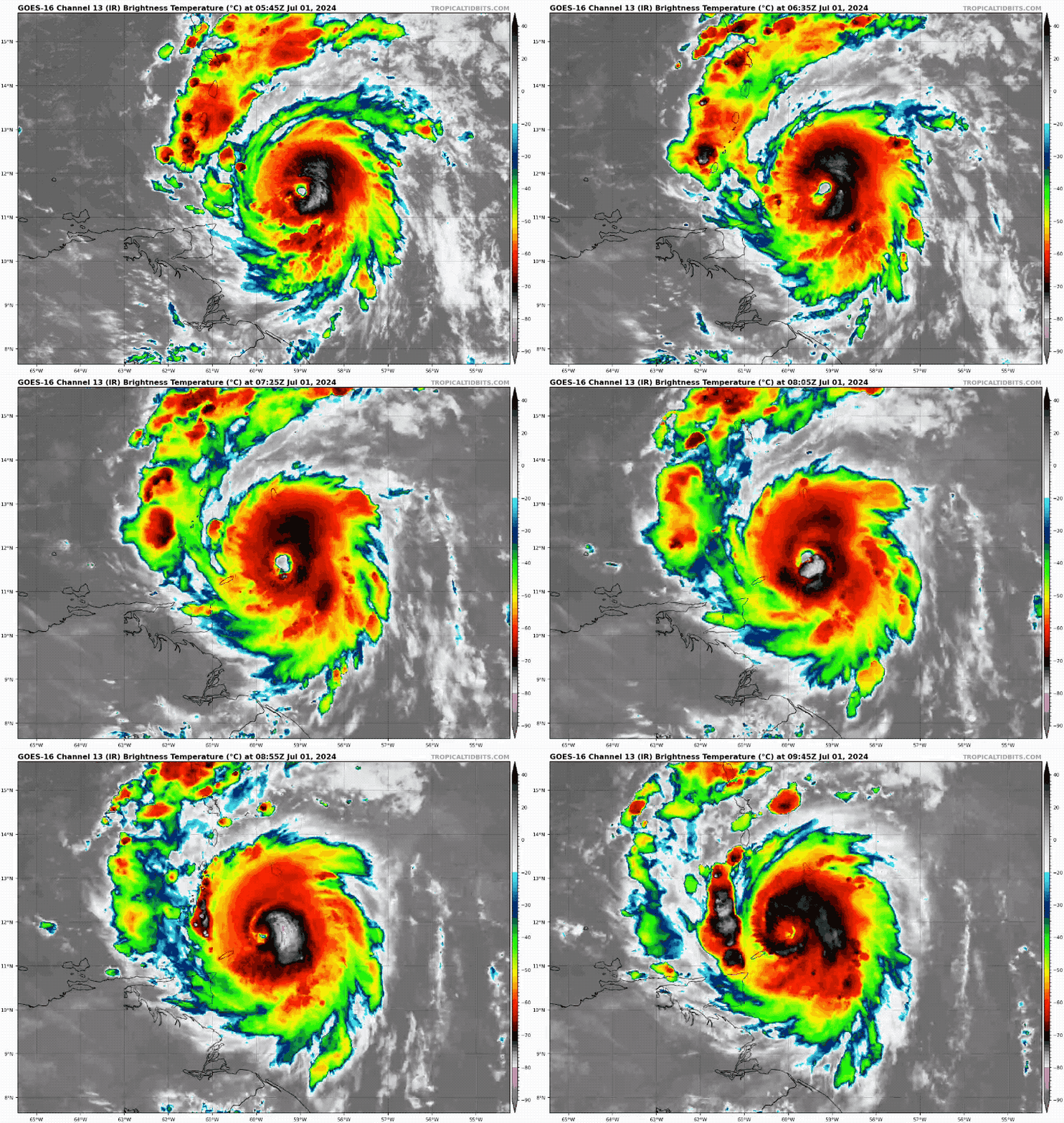
Morning Satellite Loop
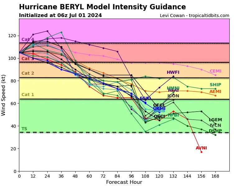
Model Forecast Intensity
This is expected to begin to weaken after crossing the Islands of Barbados, St. Lucia, St. Vincent, Grenadine Islands, Grenada, and Tobago.
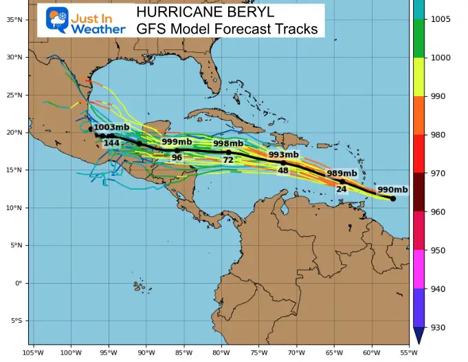
Model Forecast Track
National Hurricane Center Forecast Track And Alerts
SUMMARY OF WATCHES AND WARNINGS IN EFFECT:
A Hurricane Warning is in effect for…
* Barbados
* St. Lucia
* St. Vincent and the Grenadine Islands
* Grenada
* Tobago
A Tropical Storm Warning is in effect for…
* Martinique
* Trinidad
A Tropical Storm Watch is in effect for…
* Dominica
* South coast of Dominican Republic from Punta Palenque westward to the border with Haiti
* South coast of Haiti from the border with the Dominican Republic to Anse d’Hainault
Sunday Local Storm Recap:
Radar Loop
Storm Reports
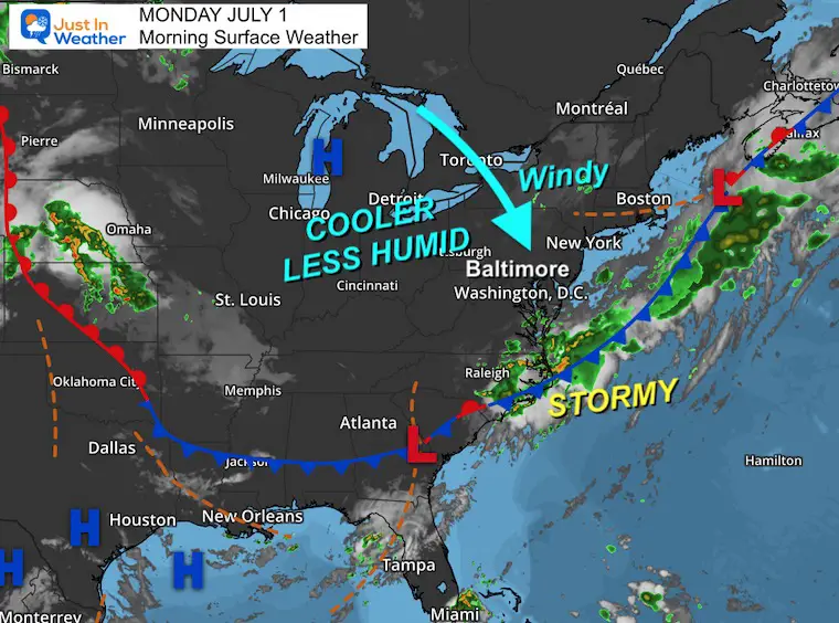
Morning Surface Weather
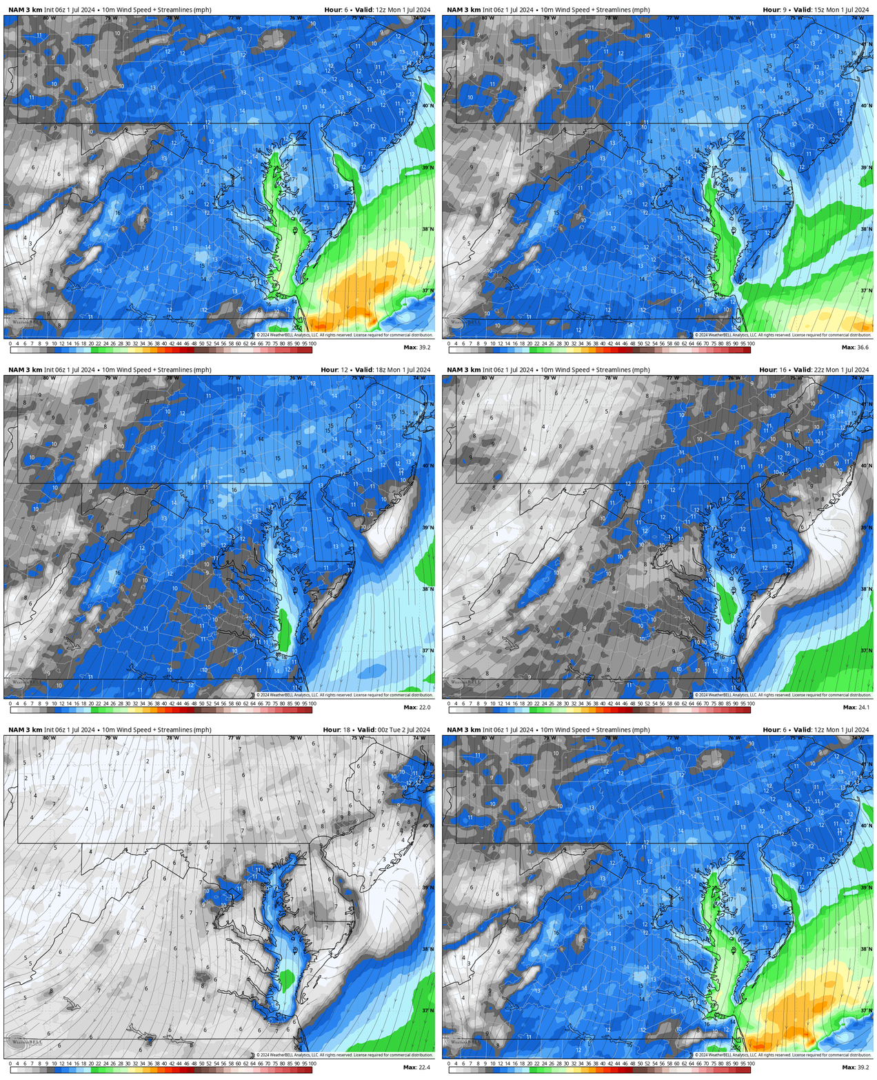
High Pressure is building in a new air mass from Canada. The cold front is still producing storms across the North Carolina coast this morning, while a large area of clear and cool weather dominates the Great Lakes to the Northeast.
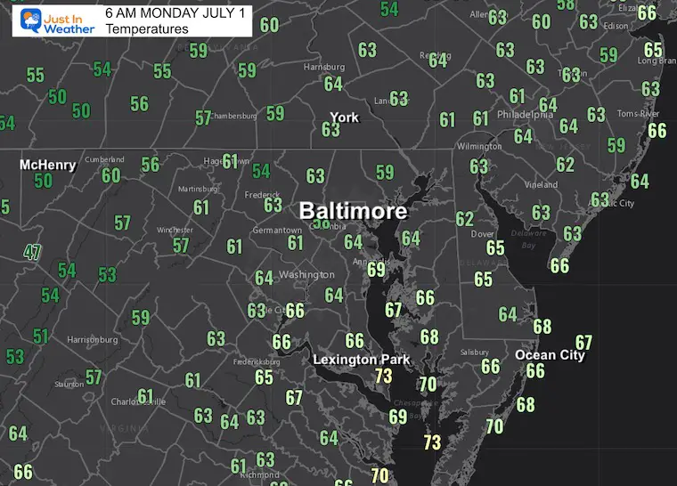
Morning Temperatures
Wind Forecast: 8 AM to 8 PM
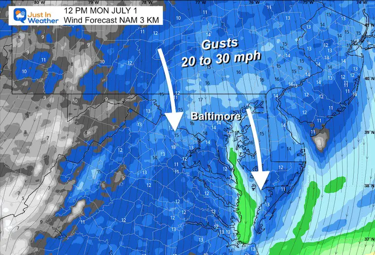
Snapshot at Noon
Winds will gust up to 30 mph FROM THE NORTH!
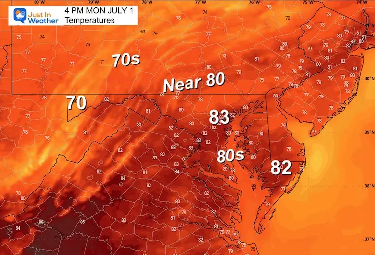
Afternoon Temperatures
CLIMATE DATA: Baltimore
TODAY July 1
Sunrise at 5:44 AM
Sunset at 8:37 PM
Normal Low in Baltimore: 67ºF
Record 50ºF in 1988
Normal High in Baltimore: 88ºF
Record 103ºF 1901
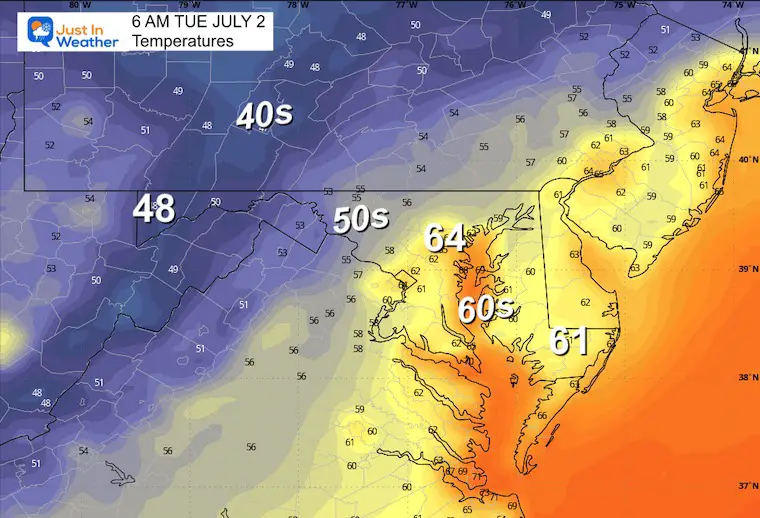
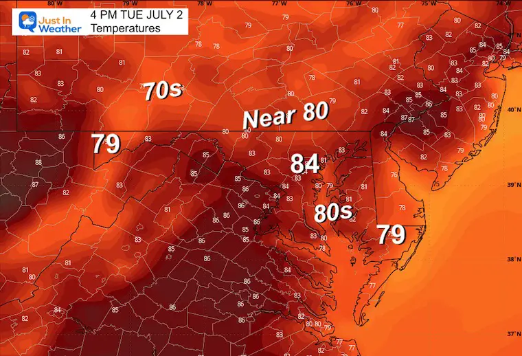
Tuesday
Still pleasantly cool with low humidity. Winds will be lighter.
Morning Temperatures
Afternoon Temperatures
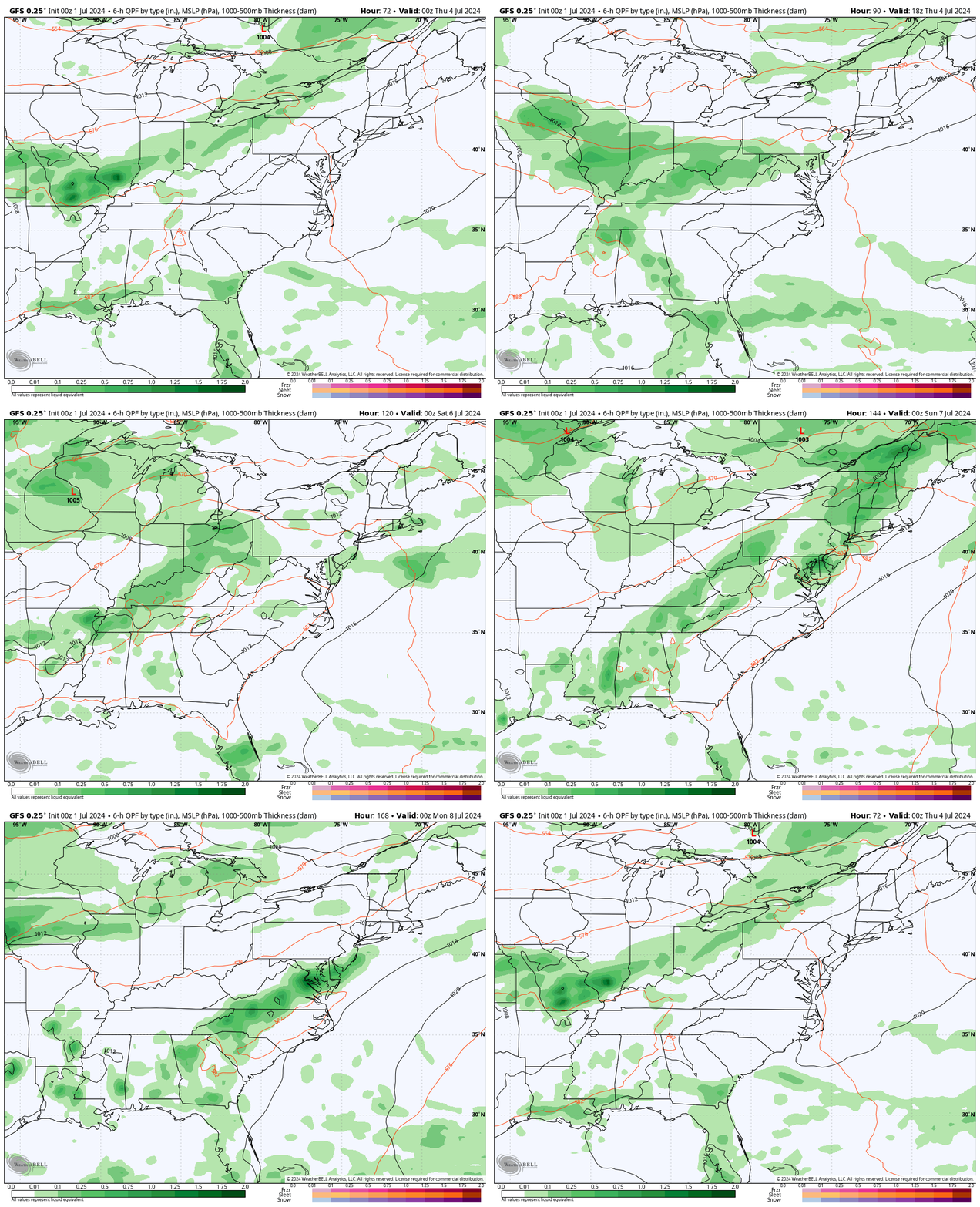
Looking Ahead: Wednesday Evening to Sunday Evening
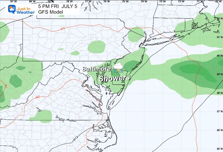
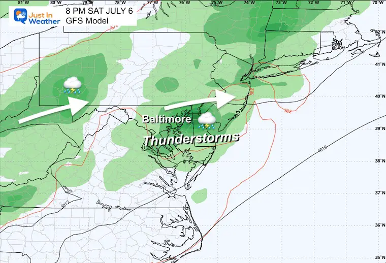
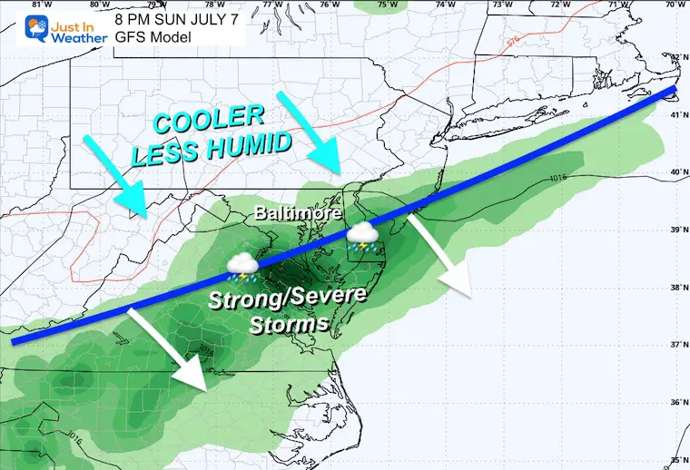
The next surge of heat, humidity, and storms will occur on Independence Day and into the weekend, with higher heat!
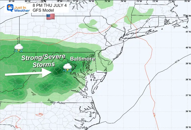
July 4th Evening
There is a chance for strong to severe evening storms. This is five days away, so it’s worth keeping in mind with a buffer. It could change, but you might want to allow for a change of plans.
Friday Evening
Saturday Evening
Sunday Evening
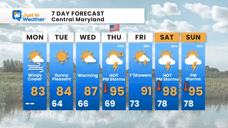
7 Day Forecast
A pleasant start to the week. The heat, humidity, and storms will return for Independence Day!
If You Missed It: Click To See
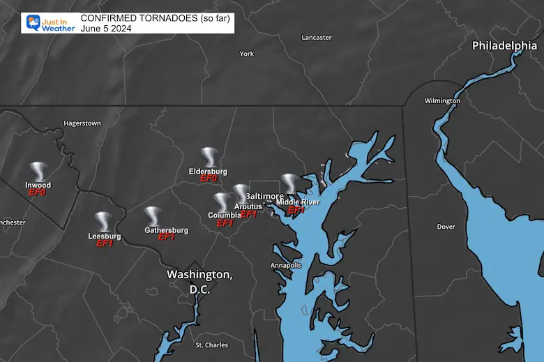
5 Tornadoes Confirmed In Maryland (so far) on June 5
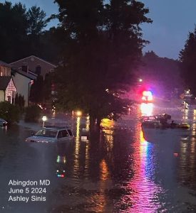
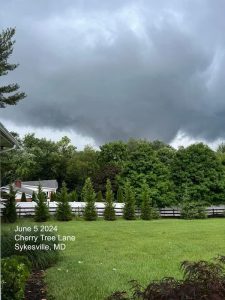
June 5 Storm Report (Preliminary) With Videos And Photos
Hurricane Season Outlook
Click to read: NOAA Releases Most Aggressive Outlook
Please share your thoughts and best weather pics/videos, or just keep in touch via social media
-
Facebook: Justin Berk, Meteorologist
-
Twitter
-
Instagram
RESTATING MY MESSAGE ABOUT DYSLEXIA
I am aware there are some spelling and grammar typos and occasional other glitches. I take responsibility for my mistakes and even the computer glitches I may miss. I have made a few public statements over the years, but if you are new here, you may have missed it: I have dyslexia and found out during my second year at Cornell University. It didn’t stop me from getting my meteorology degree and being the first to get the AMS CBM in the Baltimore/Washington region.
One of my professors told me that I had made it that far without knowing and to not let it be a crutch going forward. That was Mark Wysocki, and he was absolutely correct! I do miss my mistakes in my own proofreading. The autocorrect spell check on my computer sometimes does an injustice to make it worse. I also can make mistakes in forecasting. No one is perfect at predicting the future. All of the maps and information are accurate. The ‘wordy’ stuff can get sticky.
There has been no editor who can check my work while writing and to have it ready to send out in a newsworthy timeline. Barbara Werner is a member of the web team that helps me maintain this site. She has taken it upon herself to edit typos when she is available. That could be AFTER you read this. I accept this and perhaps proves what you read is really from me… It’s part of my charm. #FITF


