Wednesday June 19 2024
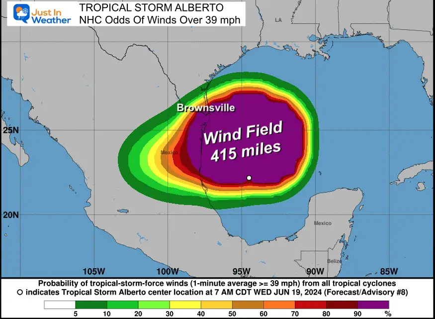
The first storm of the 2024 Atlantic Tropical Season has formed today. It will be a quick event as it is poised to make landfall overnight across the Mexican Gulf Coast. This is a large storm with winds extending over 400 miles from the center, which includes South Texas.
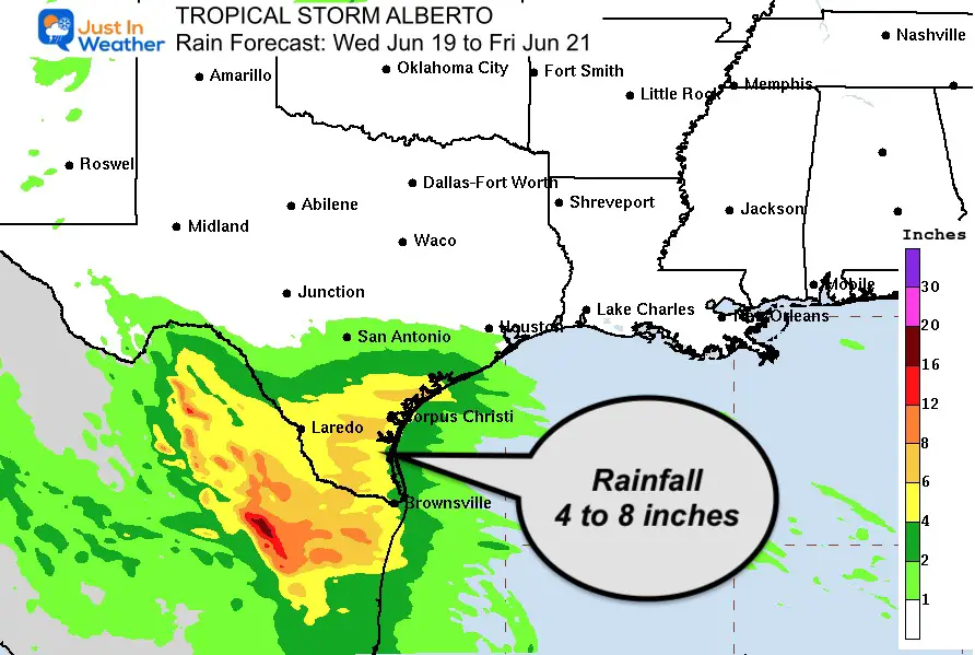
The rainfall with the onshore flow may produce up to 8 inches as this pushes inland.
This heightens the awareness of the expected busy hurricane season, but this is currently on pace with a normal expectation and a very localized event. This will be more of a flooding issue than anything else. Here is a look at the set up, stats, and forecast maps.
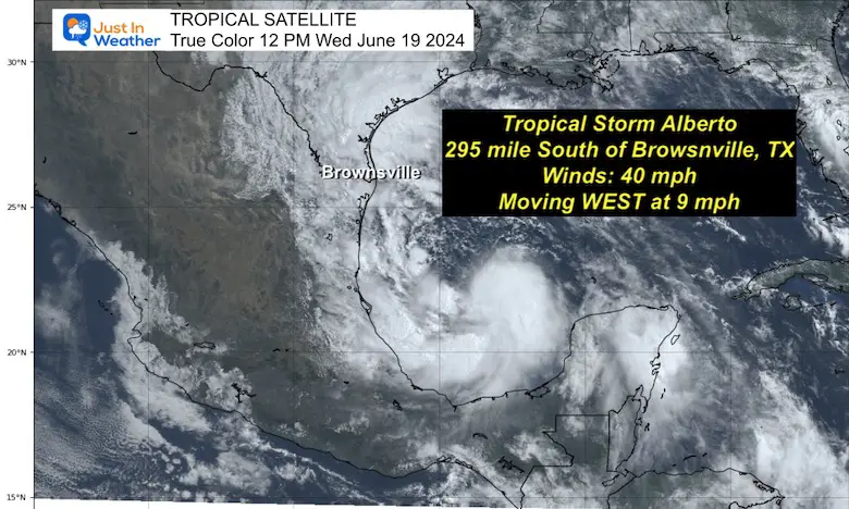
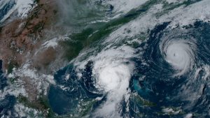
Satellite Snapshot
Tropical Storm Warnings
A Tropical Storm Warning is in effect for…
* the Texas coast from San Luis Pass southward to the mouth of the Rio Grande
* the northeastern coast of Mexico south of the mouth of the Rio Grande to Tecolutla.
A Tropical Storm Warning means that tropical storm conditions are expected somewhere within the warning area.
Live Radar Widget
National Hurricane Center Update
10 AM CDT/11 AM EDT
———————————————–
LOCATION…22.2N 95.0W
ABOUT 185 MI…300 KM E OF TAMPICO MEXICO
ABOUT 295 MI…480 KM SSE OF BROWNSVILLE TEXAS
MAXIMUM SUSTAINED WINDS…40 MPH…65 KM/H
PRESENT MOVEMENT…W OR 270 DEGREES AT 9 MPH…15 KM/H
MINIMUM CENTRAL PRESSURE…995 MB…29.39 INCHES
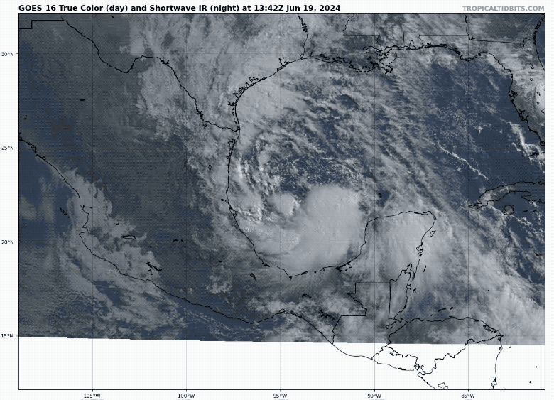
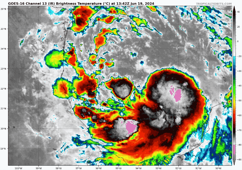
Satellite Loops
True Color Satellite
Infrared Satellite
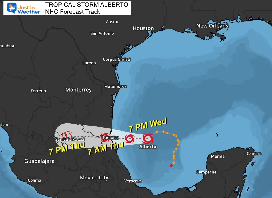
Forecast Track and Time
This will make landfall overnight and fade as it moves west across the mountains of central Mexico.
Wind Forecast
Tropical Storm Force Winds OVER 39 mph extend 415 miles to the north of the center.
Wind Widget
Rainfall Forecast
Tropical Storm Alberto is expected to produce rainfall totals of 5 to 10 inches across northeast Mexico into South Texas.
Maximum totals of around 20 inches are possible across the higher terrain of the Mexican states of Coahuila, Nuevo Leon, and Tamaulipas. This rainfall will likely produce considerable flash and urban flooding along with new and renewed river flooding. Mudslides are also possible in areas of higher terrain across northeast Mexico.
Hurricane Season Outlook
Click to read: NOAA Releases Most Aggressive Outlook
Please share your thoughts and best weather pics/videos, or just keep in touch via social media
If You Missed It: Click To See
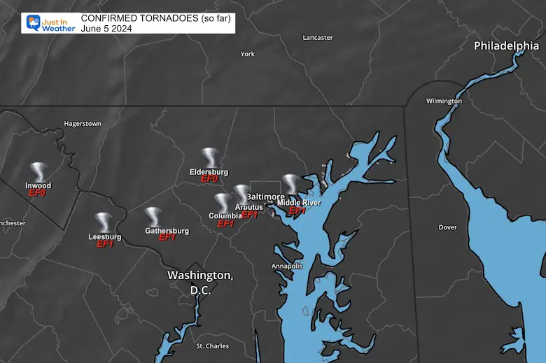
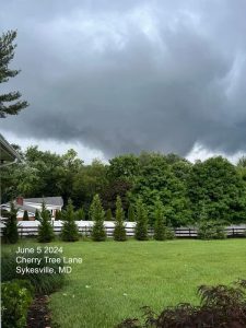
June 5 Storm Report (Preliminary) With Videos And Photos

RESTATING MY MESSAGE ABOUT DYSLEXIA
I am aware there are some spelling and grammar typos and occasional other glitches. I take responsibility for my mistakes and even the computer glitches I may miss. I have made a few public statements over the years, but if you are new here, you may have missed it: I have dyslexia and found out during my second year at Cornell University. It didn’t stop me from getting my meteorology degree and being the first to get the AMS CBM in the Baltimore/Washington region.
One of my professors told me that I had made it that far without knowing and to not let it be a crutch going forward. That was Mark Wysocki, and he was absolutely correct! I do miss my mistakes in my own proofreading. The autocorrect spell check on my computer sometimes does an injustice to make it worse. I also can make mistakes in forecasting. No one is perfect at predicting the future. All of the maps and information are accurate. The ‘wordy’ stuff can get sticky.
There has been no editor who can check my work while writing and to have it ready to send out in a newsworthy timeline. Barbara Werner is a member of the web team that helps me maintain this site. She has taken it upon herself to edit typos when she is available. That could be AFTER you read this. I accept this and perhaps proves what you read is really from me… It’s part of my charm. #FITF


