


January 13 Mild Ahead Of Arctic Front That Will Bring Rain To Snow Later Wednesday
Tuesday January 13 We are once again back to mild afternoons with sunshine, but that is about to change. The next cold front will usher in a series of arctic…
June 14, 2023
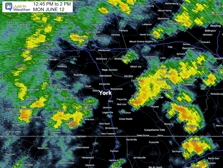
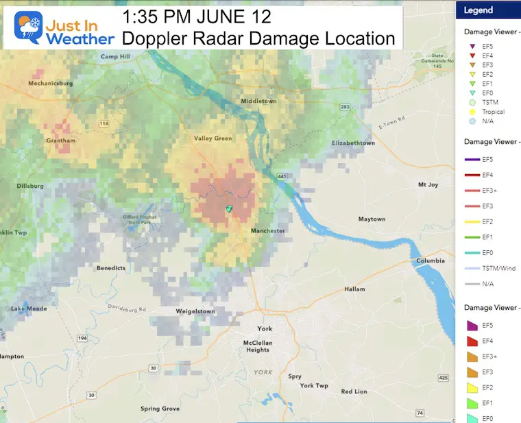
In the storms that moved through the Mid-Atlantic region on Monday, June 12, there was one cell in particular that turned severe. At 1:27 PM, The National Weather Service posted a Tornado Warning for northern York County. This cell was indicated by Doppler Radar.
This stirred added excitement as Pennsylvania just had the first May on record with no severe weather.
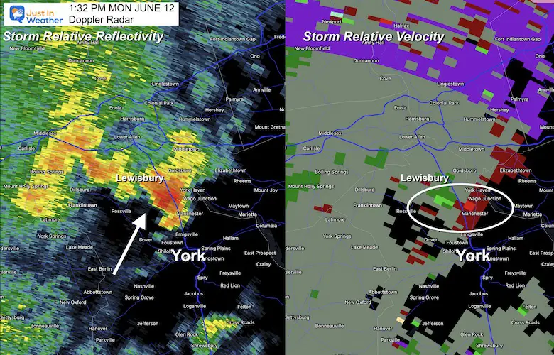
This is a comparison of the Doppler Radar Reflectivity on the Left and Velocity on the Right. This shows the brief hook echo that passed north of York over the Conowingo Township.
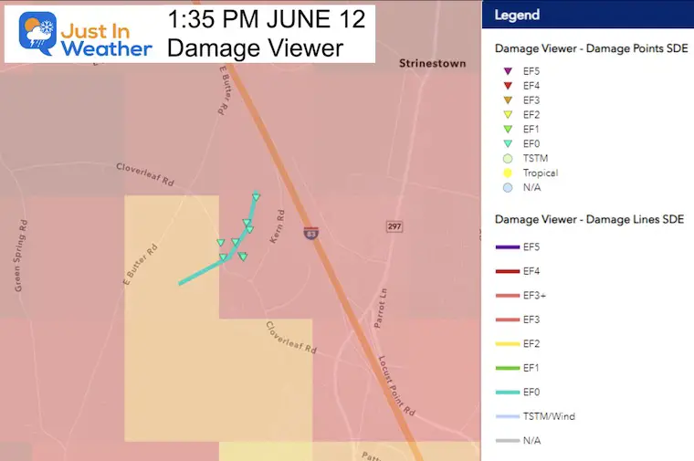
The tornado was identified with winds of 75 mph, on the ground for 0.37 miles, and a maximum width of 130 yards.
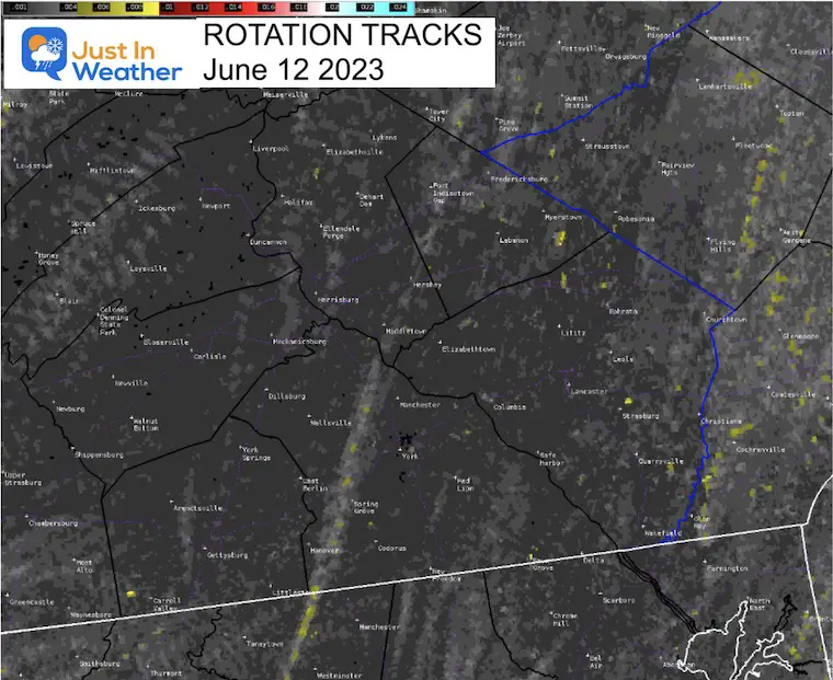
Here we can see the track of the storm cell moving almost due north around 30 mph.
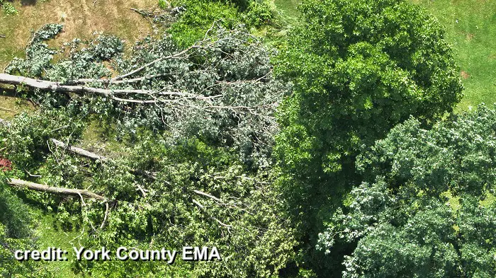
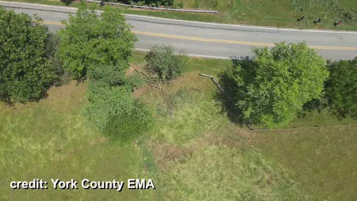
AT 1:30 PM LOCAL TIME A TORNADO TOUCHED DOWN IN CONEWAGO TOWNSHIP.
THE TORNADO CROSSED CLOVERLEAF RD AND TRACKED 1/3 OF A MILE
CAUSING MINOR DAMAGE TO TREES IN THE AREA BEFORE LIFTING AT 1:32
PM LOCAL TIME. A FEW TREES WERE UPROOTED BETWEEN CLOVERLEAF RD AND
KERN RD. THE NWS STATE COLLEGE OFFICE CONDUCTED THIS SURVEY IN
CONJUNCTION WITH YORK COUNTY EMERGENCY MANAGEMENT, CUMBERLAND
COUNTY EMERGENCY MANAGEMENT, AND SEARCH & RESCUE 93.
At approximately 1:30 PM yesterday (Monday), a brief EF-0 tornado touched down in Conewago Twp, York County with max winds near 75 mph. The tornado knocked down a few trees along its 1/3 mile track, on the ground for less than 2 minutes. #PAwx pic.twitter.com/CIkSqr1oMa
— NWS State College (@NWSStateCollege) June 13, 2023
Sign up and be the first to know!

I am aware there are some spelling and grammar typos, and occasional other glitches. I take responsibility for my mistakes, and even the computer glitches I may miss. I have made a few public statements over the years, but if you are new here you may have missed it: I have dyslexia, and found out during my second year at Cornell University. It didn’t stop me from getting my meteorology degree, and being first to get the AMS CBM in the Baltimore/Washington region. One of my professors told me that I had made it that far without knowing, and to not let it be a crutch going forward. That was Mark Wysocki and he was absolutely correct! I do miss my mistakes in my own proofreading. The autocorrect spell check on my computer sometimes does an injustice to make it worse. I also can make mistakes in forecasting. No one is perfect predicting the future. All of the maps and information are accurate. The ‘wordy’ stuff can get sticky. There has been no editor that can check my work when I needed it and have it ready to send out in a newsworthy timeline. Barbara Werner is a member of the web team that helps me maintain this site. She has taken it upon herself to edit typos, when she is able. That could be AFTER you read this. I accept this and perhaps proves what you read is really from me… It’s part of my charm.
#FITF