April 17, 2023
Monday Morning Update
The past 6 days reached the 70s and 80s in our region. That included tying the record high 89ºF last Thursday. While we did have some severe storms over the weekend and a few showers overnight, we all get in on a new cooler air mass.
We will notice the strong breeze and lower temperatures today. What might be a shock will be snow showers in far western Maryland, and perhaps some local frost alerts by Wednesday morning. Then we get back to more summer heat later this week AND yet another weekend with rain.
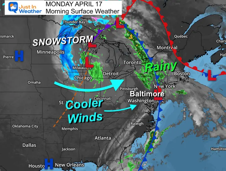
Morning Surface Weather
A strong storm is rolling through the Great Lakes and producing significant snow across Wisconsin. Many areas are expecting to get into the 1 Foot+ range.
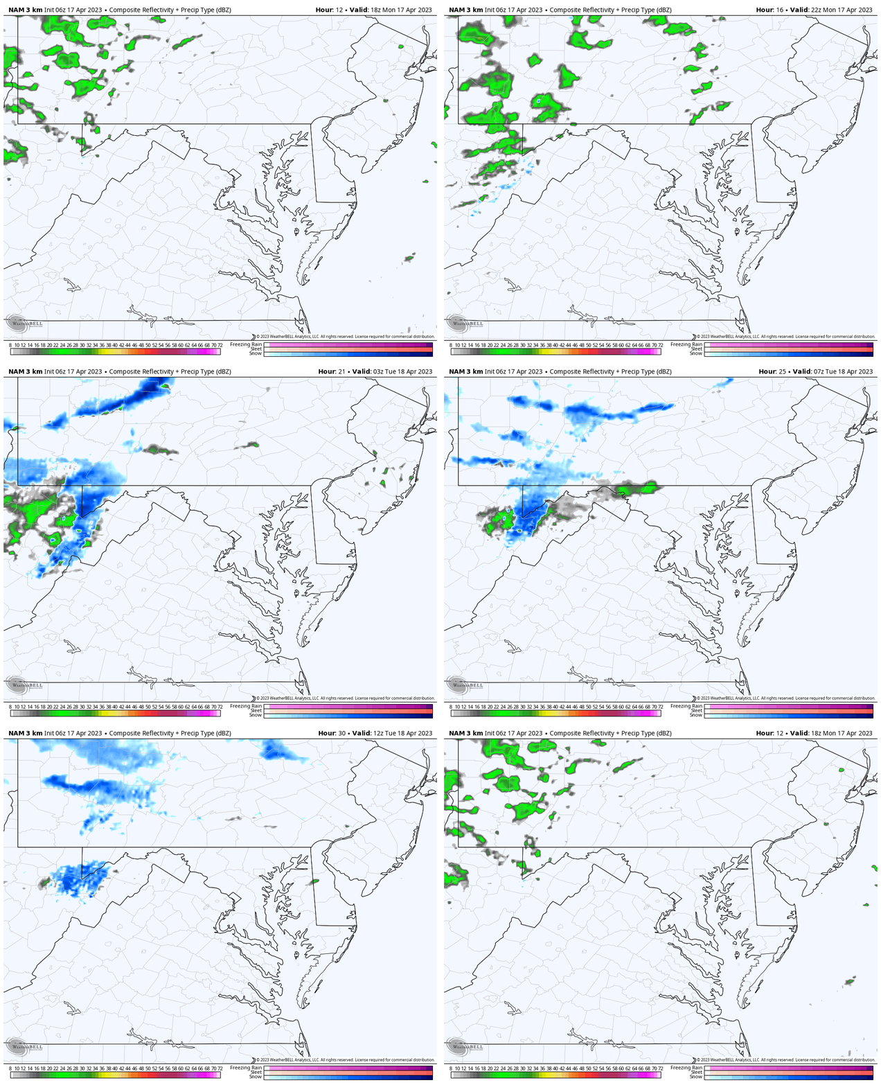
This same storm will be cranking the cooler winds our way. The only other mention of snow will be the potential for up to 1 inch across the mountains of far western Maryland overnight.
Morning Temperatures
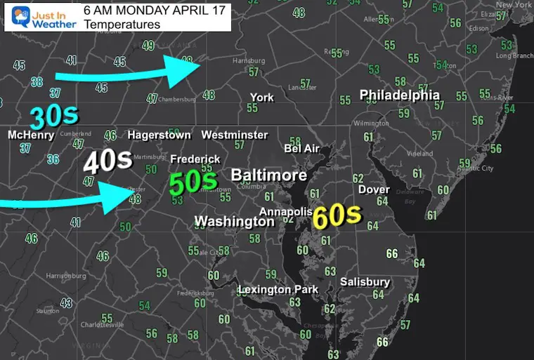
Hint of the cooler air on the way.
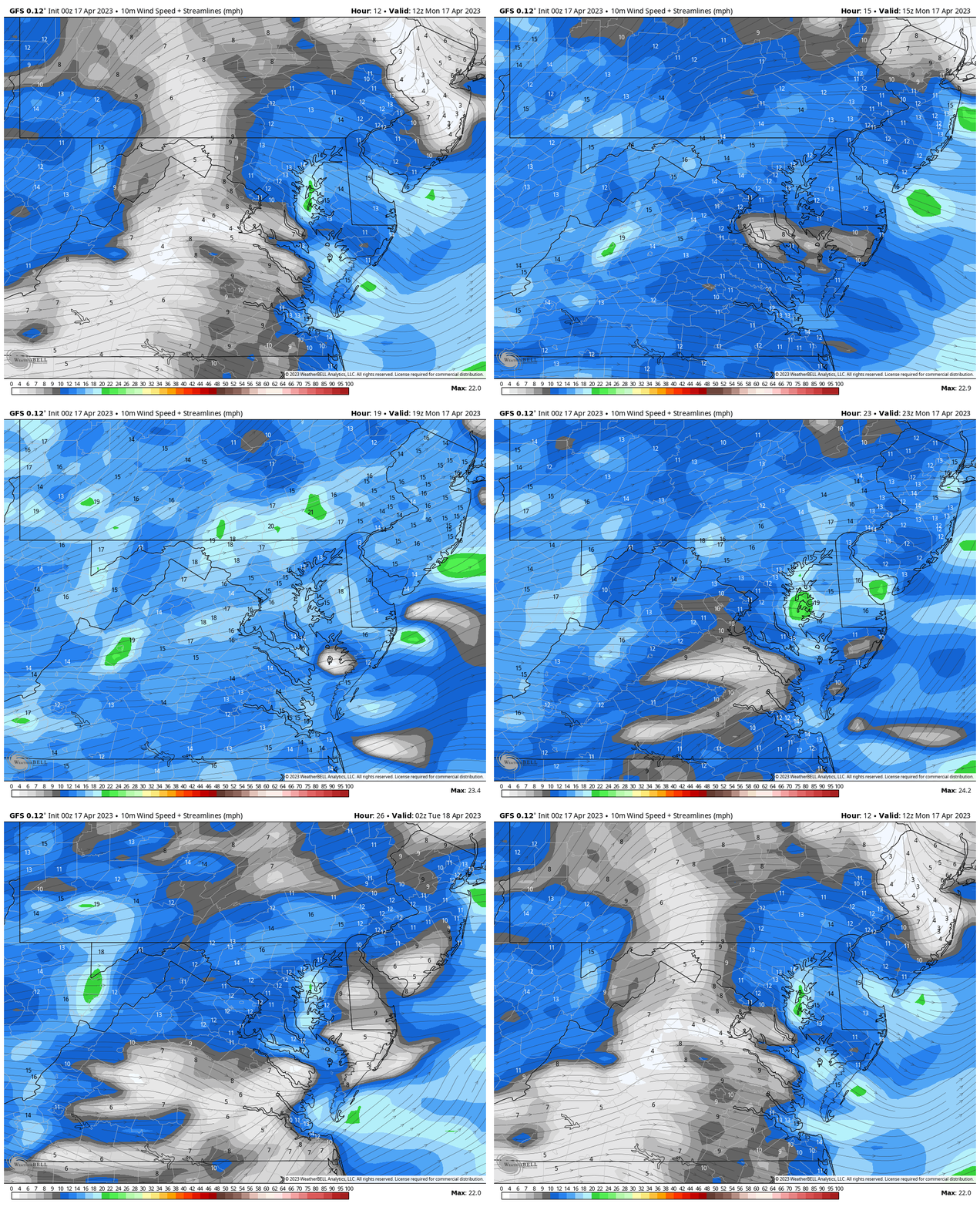
Wind Forecast: 8 AM to 10 PM
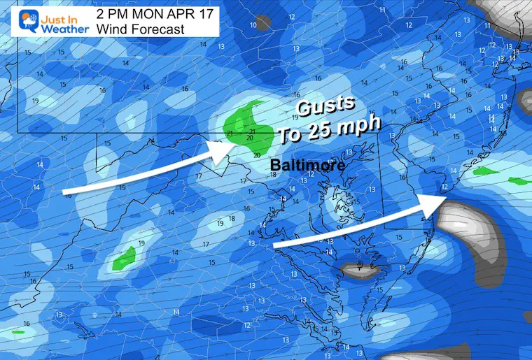
Wind Snapshot
Peak winds will gust to 25 mph from the west to southwest.
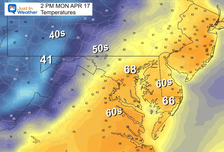
Afternoon Temperatures
Most areas will be in the 60s, with the cooler 50s farther west and north.
Radar Simulation:
2 PM MON to 8 AM TUE
Subscribe for eMail Alerts
Weather posts straight to your inbox
Sign up and be the first to know!
CLIMATE DATA
TODAY April 17
Normal Low in Baltimore: 44ºF
Record 39ºF in 1875
SNOW: Trace in 2001
Normal High in Baltimore: 67ºF
Record 93ºF in 2002
REPORTS:
Winter 2023 Recap: My BUSTED Snow Outlook
La Niña Has Ended. El Niño May Return By Fall
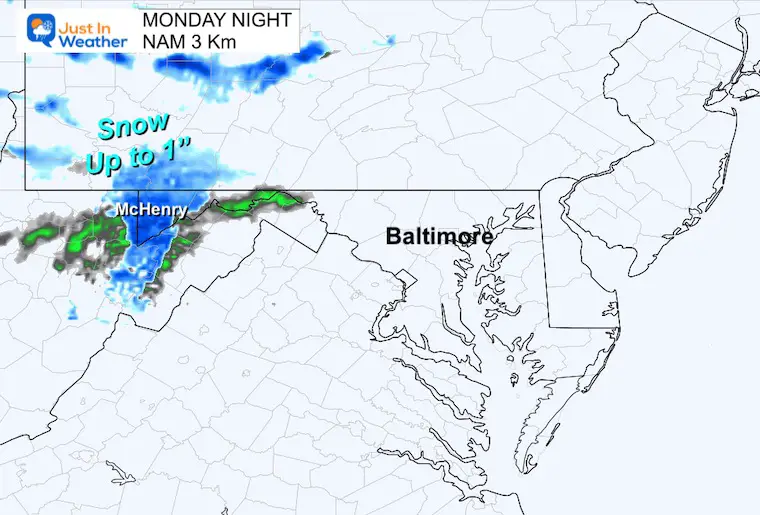
Monday Night/Tuesday Morning Weather
There may be a slushy coating to 1 inch of snow in the high mountains. As part of that chilly air, we will have more clouds and a cooler breeze, but should remain dry.
Morning Temperatures

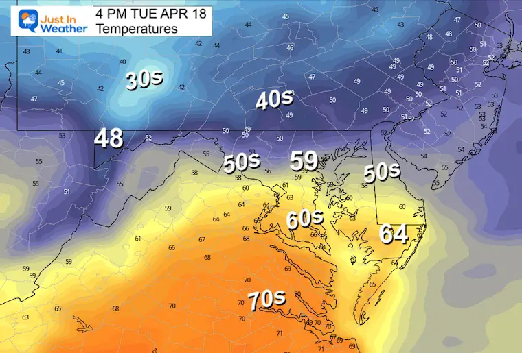
Afternoon Temperatures
In Case You Missed It:
Video: Full Bloom Tulips At Hershey Gardens In PA
Looking Ahead:
Friday Afternoon to Monday Morning
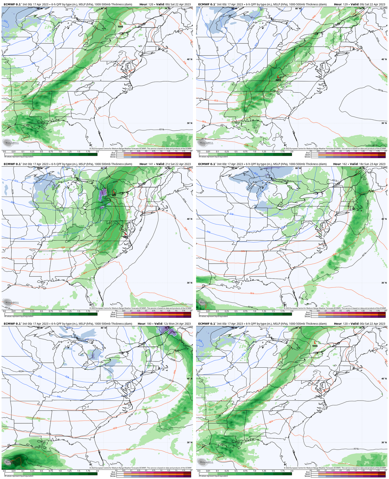
The next weather system looks like another strong cold front with a line of rain and thunderstorms later Saturday. If this plays out, we will get into a cooler pattern for Sunday with a few scatted showers but less rain.
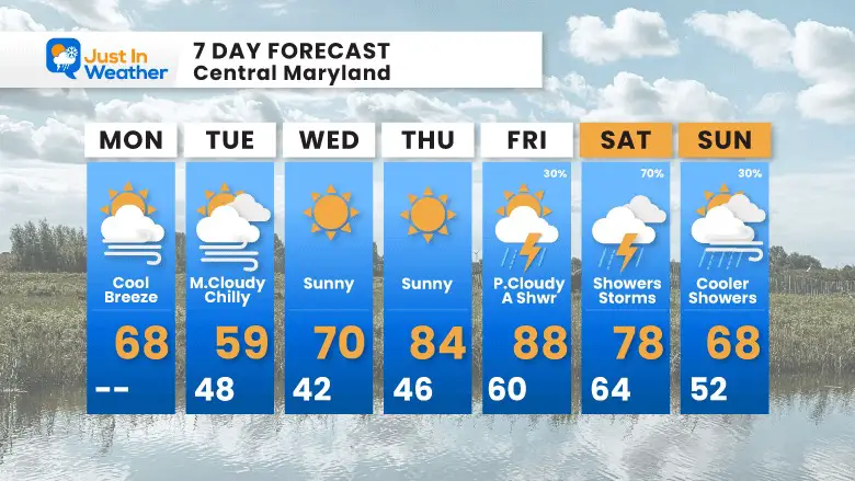
7 Day Forecast
After a chilly start, and perhaps some inland frost Wednesday morning, we will see a quick bounce back to summer heat later this week.
The best chance for more rain and storms appears to be on Saturday.
STEM Assemblies/In School Fields Trips Are Back
Click to see more and ‘Book’ a visit to your school
Please share your thoughts, best weather pics/videos, or just keep in touch via social media
-
Facebook: Justin Berk, Meteorologist
-
Twitter
-
Instagram
RESTATING MY MESSAGE ABOUT DYSLEXIA
I am aware there are some spelling and grammar typos, and occasional other glitches. I take responsibility for my mistakes, and even the computer glitches I may miss.
I have made a few public statements over the years, but if you are new here you may have missed it:
I have dyslexia, and found out during my second year at Cornell University. It didn’t stop me from getting my meteorology degree, and being first to get the AMS CBM in the Baltimore/Washington region. One of my professors told me that I had made it that far without knowing, and to not let it be a crutch going forward. That was Mark Wysocki and he was absolutely correct!
I do miss my mistakes in my own proofreading. The autocorrect spell check on my computer sometimes does an injustice to make it worse. I also can make mistakes in forecasting. No one is perfect predicting the future.
All of the maps and information are accurate. The ‘wordy’ stuff can get sticky.
There has been no editor that can check my work when I needed it and have it ready to send out in a newsworthy timeline. Barbara Werner is a member of the web team that helps me maintain this site. She has taken it upon herself to edit typos, when she is able. That could be AFTER you read this.
I accept this and perhaps proves what you read is really from me…
It’s part of my charm.
#FITF


