April 15, 2023
Saturday Morning Update
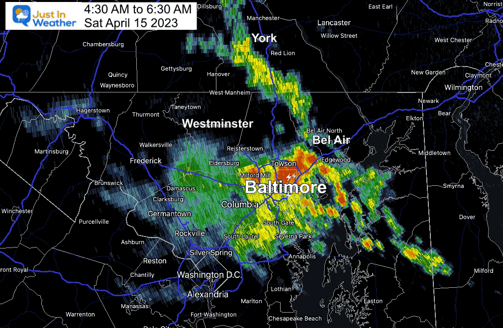
Did you wake up to the sound of heavy rain or even thunder early this morning? There was cluster of heavy rain that moved north through central Maryland into Southern Pennsylvania before sunrise which dropped some locally heavy rain. The recorded loop below shows the movement around the upper level circulation that will continue to affect us all day.
Got Outdoor Plans?
We will look at two computer model simulations showing the development of showers and storms, but they will be scattered. My best suggestion is to keep the likelihood of showers in mind, but they may pass through in a matter of minutes to less than one hour. During the afternoon and evening, some may include lightning. That can be a danger even if these storms are not considered severe.
On Sunday, we will warm up again and have a mostly dry day. The next push of rain will be overnight into Monday morning. Then briefly cooler winds will also include a return of snow showers to Garrett County in western Maryland.
Early Morning Radar Recap
4:30 AM to 6:30 AM
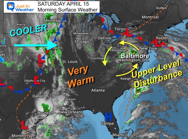
Morning Surface Weather
The Upper Level Disturbance is the reason we have showers and storms in the Mid Atlantic. The circulation can be seen on the satellite loop below and the radar simulations.
After this moves out tonight, we will get a warm day tomorrow, followed by the cold front with a brief cooling early next week.
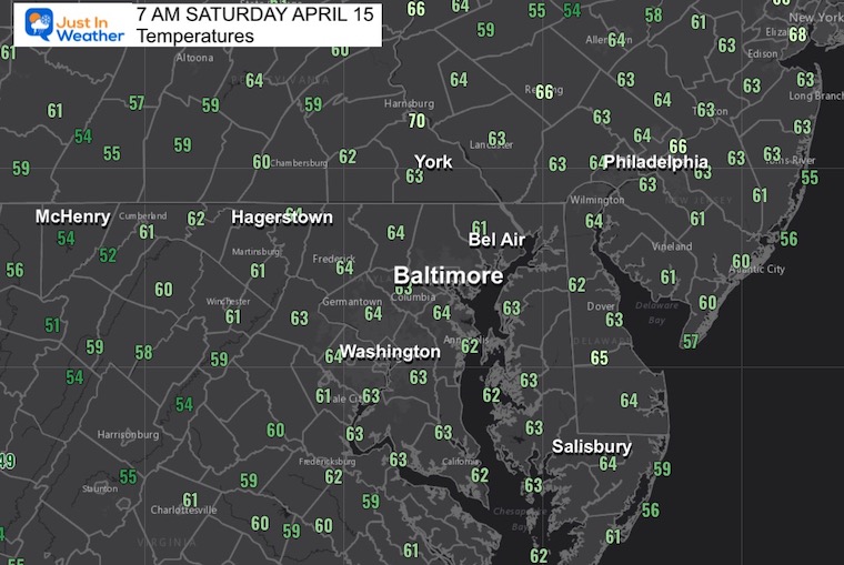
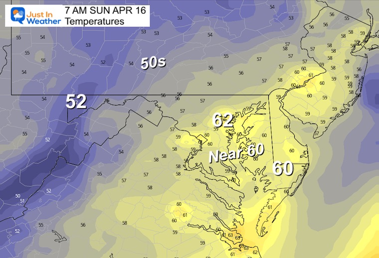
Morning Temperatures
A warm and dare I say ‘muggy’ start to the day.
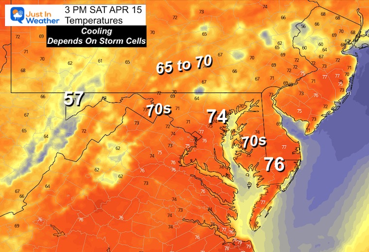
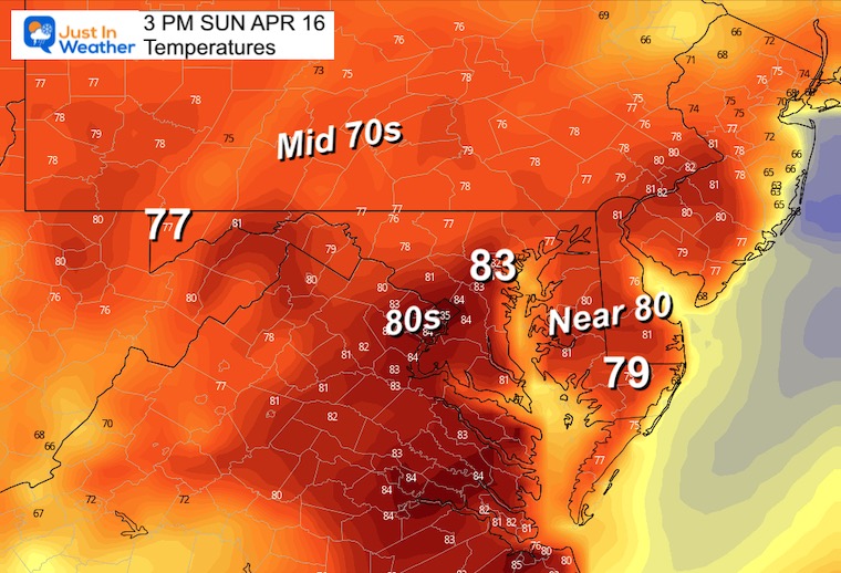
Afternoon Temperatures
Not nearly as warm as yesterday. Places that end up on the 60s will depend on where the showers set up!
Radar Simulations
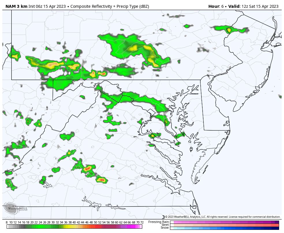
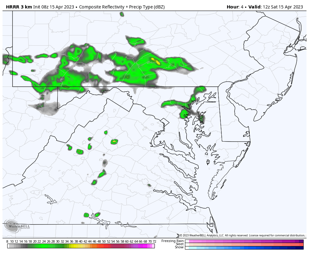
These are guides/NOT PERFECT! However, I am showing the NAM 3Km and HRRR Models to show how similar they are.
NAM 3 Km 8 AM to 10 PM
Notice the movement of the showers/cells around the upper level spin.
The showers will ignite and become more numerous in the afternoon and evening.
HRRR 8 AM to 10 PM
This is very similar to the model above. See key-time snapshots below.
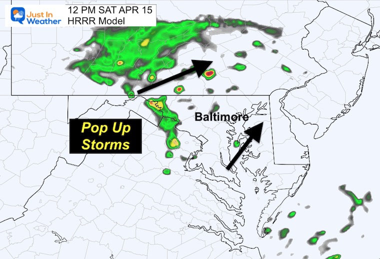
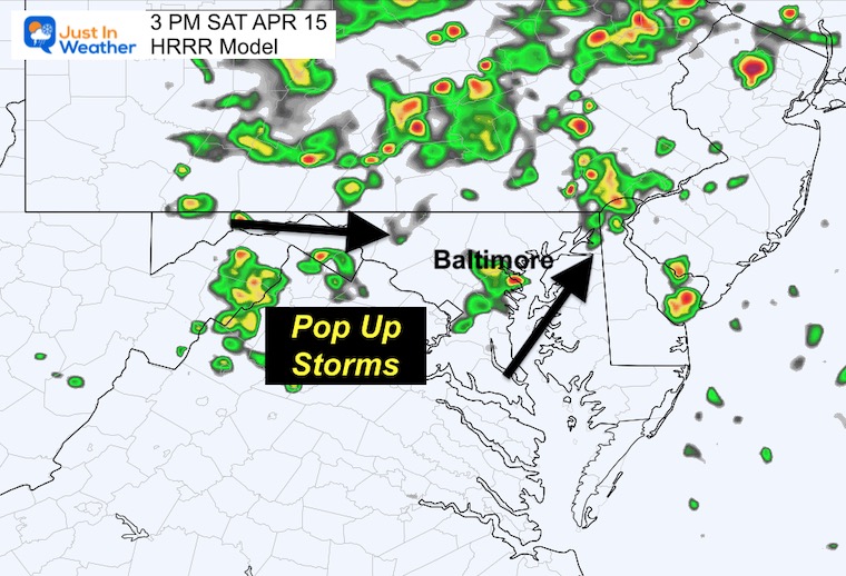
Snapshots
Please note: These are suggestions, and are NOT PERFECT. I will add the live radar widget below for you to come back and compare later.
12 PM – Noon
The daily heating will help ignite more pop-up showers and a few thunderstorms. Lightning is a definite possibility to be concerned with.
3 PM – Mid Afternoon
The bulk of energy may be in PA, but north central Maryland will have scattered showers popping up randomly.
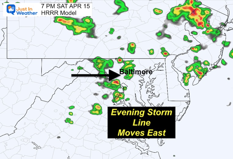
7 PM – Evening
More widespread showers and perhaps a line of storms could move from the mountains to metro areas.
LIVE RADAR/LIGHTNING WIDGET
Subscribe for eMail Alerts
CLIMATE DATA
TODAY April 15
Normal Low in Baltimore: 43ºF
Record 31ºF in 1973
SNOW: 0.3” in 1923
Normal High in Baltimore: 67ºF
Record 88ºF in 1941
REPORTS:
Temperatures Sunday
Morning
Still very warm for this time of year.
Afternoon
Warmer with a breeze and partly cloudy. The risk of rain will be low until overnight.
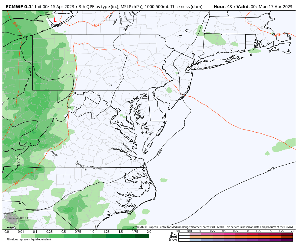
ECMWF Model Animation
Sunday Night to Tuesday Morning
A line of heavier rain and thunderstorms will move out of Ohio and cross the mountains at night. We will get the push of rain and some boomers overnight, ending Monday morning. This will be followed by cooler air… and snow showers in Western Maryland.
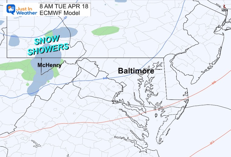
Tuesday Morning Snapshot
As the cold winds reach us, snow showers will fall over the mountains of western Maryland.
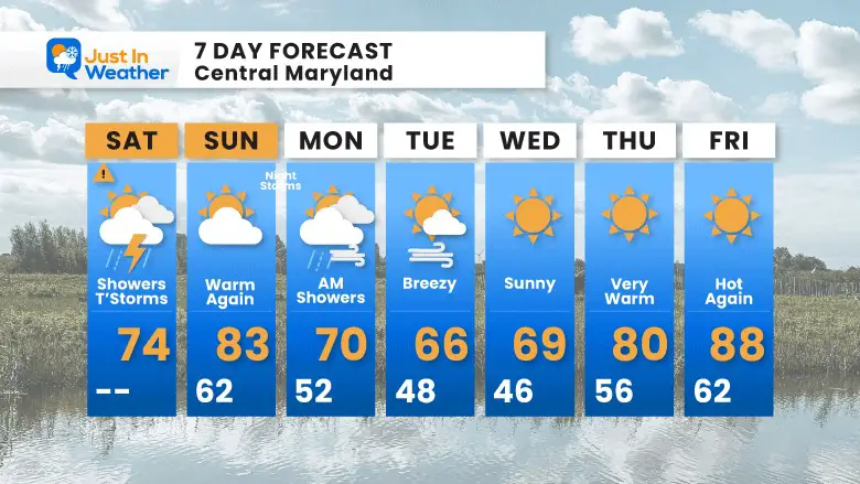
7 Day Forecast
The cooler start next week will be near normal temps. Then we will get back to the pre-summer heat again later in the week.
STEM Assemblies/In School Fields Trips Are Back
Click to see more and ‘Book’ a visit to your school

Please share your thoughts, best weather pics/videos, or just keep in touch via social media
RESTATING MY MESSAGE ABOUT DYSLEXIA
I am aware there are some spelling and grammar typos, and occasional other glitches. I take responsibility for my mistakes, and even the computer glitches I may miss.
I have made a few public statements over the years, but if you are new here you may have missed it:
I have dyslexia, and found out during my second year at Cornell University. It didn’t stop me from getting my meteorology degree, and being first to get the AMS CBM in the Baltimore/Washington region. One of my professors told me that I had made it that far without knowing, and to not let it be a crutch going forward. That was Mark Wysocki and he was absolutely correct!
I do miss my mistakes in my own proofreading. The autocorrect spell check on my computer sometimes does an injustice to make it worse. I also can make mistakes in forecasting. No one is perfect predicting the future.
All of the maps and information are accurate. The ‘wordy’ stuff can get sticky.
There has been no editor that can check my work when I needed it and have it ready to send out in a newsworthy timeline. Barbara Werner is a member of the web team that helps me maintain this site. She has taken it upon herself to edit typos, when she is able. That could be AFTER you read this.
I accept this and perhaps proves what you read is really from me…
It’s part of my charm.
#FITF


