May 1 Comparing Different Storm And Temperature Timelines This Afternoon
May 1 2022
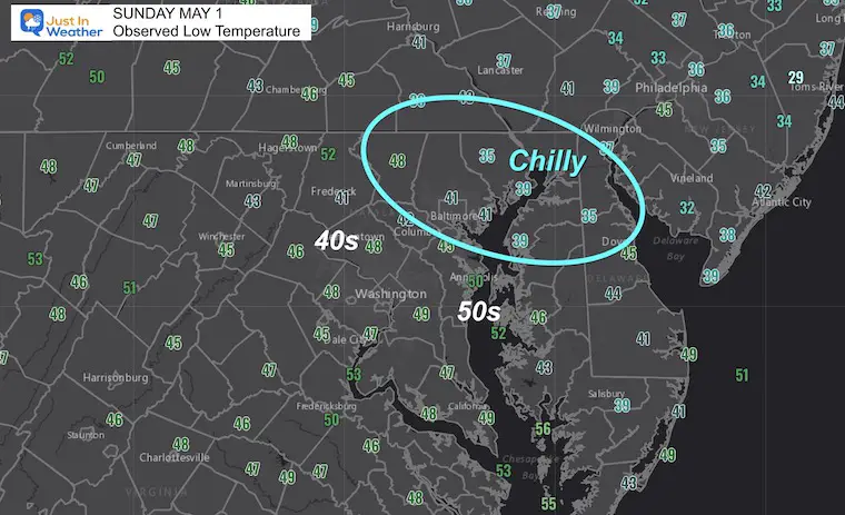
Sunday Morning Report
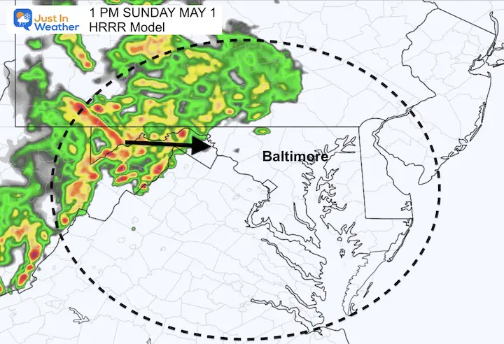
We had a chilly, but quiet start to this morning and brand new month. However, the next weather system will be arriving mid day into the afternoon. What I find intriguing is that the two short range models have two different solutions for how the day will play out. One brings rain in sooner with a chilly afternoon, the other is warmer with more thunderstorms. I will compare them below.
Either way, we expect to have rain move in today, so your plans may be affected.
Later in the work week, we get into a pattern repeating Low Pressure systems that will bring a few days with chilly rain our way. This is likely to extend into next weekend.
Morning Set Up
Morning Low Temperatures
Morning Surface Weather
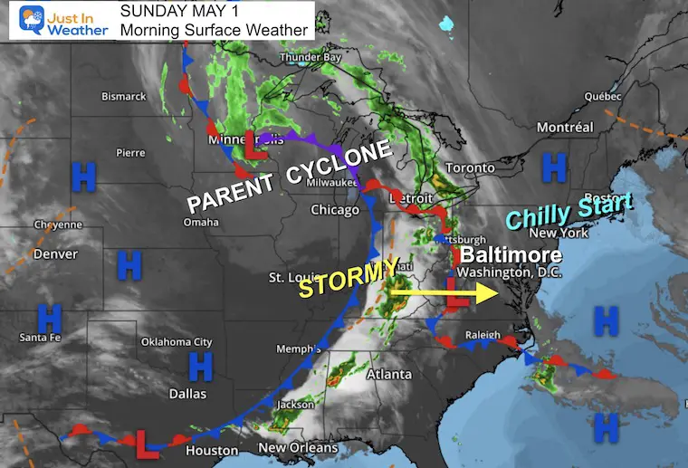
This large storm is what has been responsible for extensive tornado outbreaks over the past two days.
As is often the case, the system weakens as it reaches us.
The debate now is the impact on our afternoon. I will compare two very different simulations with my suggestion below.
NOAA Severe Storm Risk
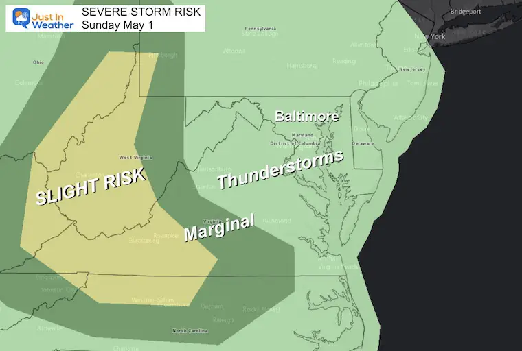
Model Simulation Comparison
The two ideas here are from the high resolution short range models:
The NAM 3Km brings rain in by noon, then resulting in an afternoon with temps cooler in the 50s.
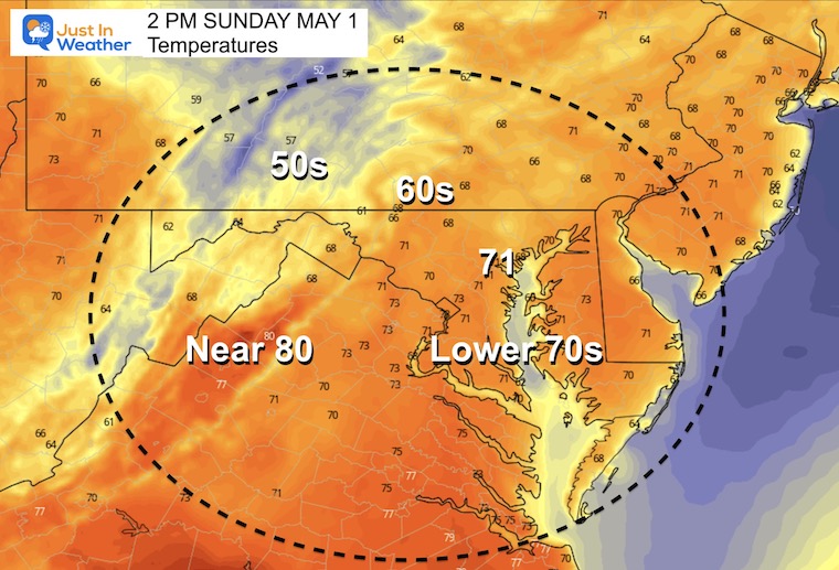
The HRRR Model brings the rain in later. This allows temps to reach the 70s, which fuels a line of strong storms, which look like a chance to embed severe cells farther east than the NOAA outlook shown above.
Check this out:
NAM 3 Km Solution
Radar Simulation: 12 PM to Midnight
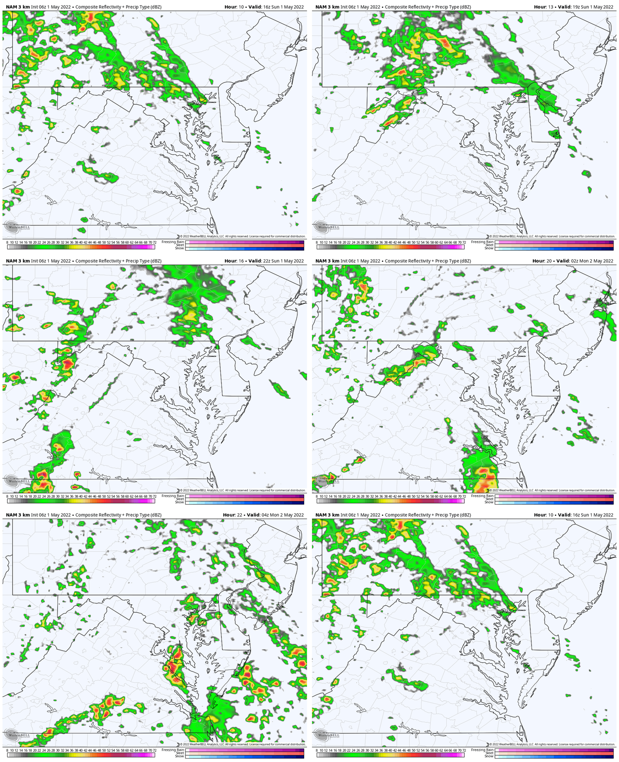
Afternoon Temperatures: Chilly
With the earlier arrival of rain, the afternoon temps drop into the 50s for most central areas.
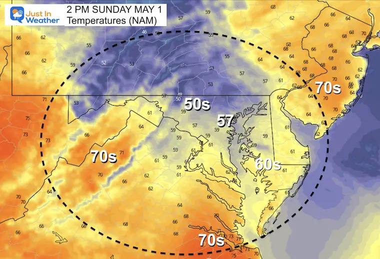
HRRR Model
12 PM to 10 PM —> slider
The arrival of rain seen here a few hours later… That allows temps to warm up a little more and a more robust line of storms.
Afternoon Temperatures: Warmer before storm line arrives
My thoughts:
My son has an afternoon baseball game, so we will be affected by this weather. At this point, I have to lean towards the HRRR Model solution with the later arrive, warmer lead up to larger line of storms. However, it is more likely the result is somewhere between the two, but looking a little more like the HRRR.
We should have a better idea between 10 AM and Noon to see how this line is progressing.
I will follow up with an update later this morning to confirm which set up is looking more likely.
CLIMATE DATA
TODAY May 1st
Normal Low in Baltimore: 47ºF
Record 34ºF in 1876
Normal High in Baltimore: 70ºF
Record 89ºF 1985
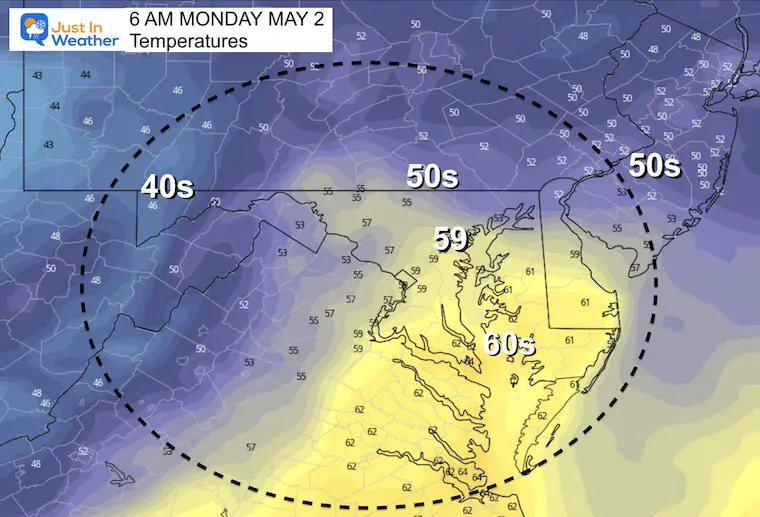
Monday Morning Temperatures
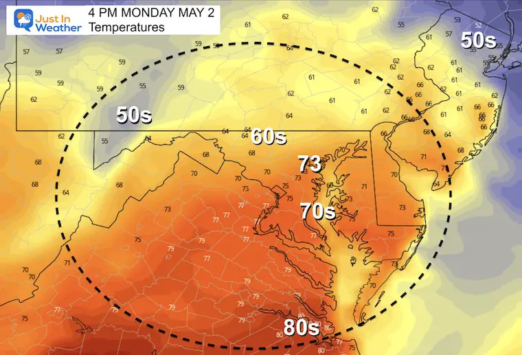
Monday Afternoon Temperatures
Looking Ahead:
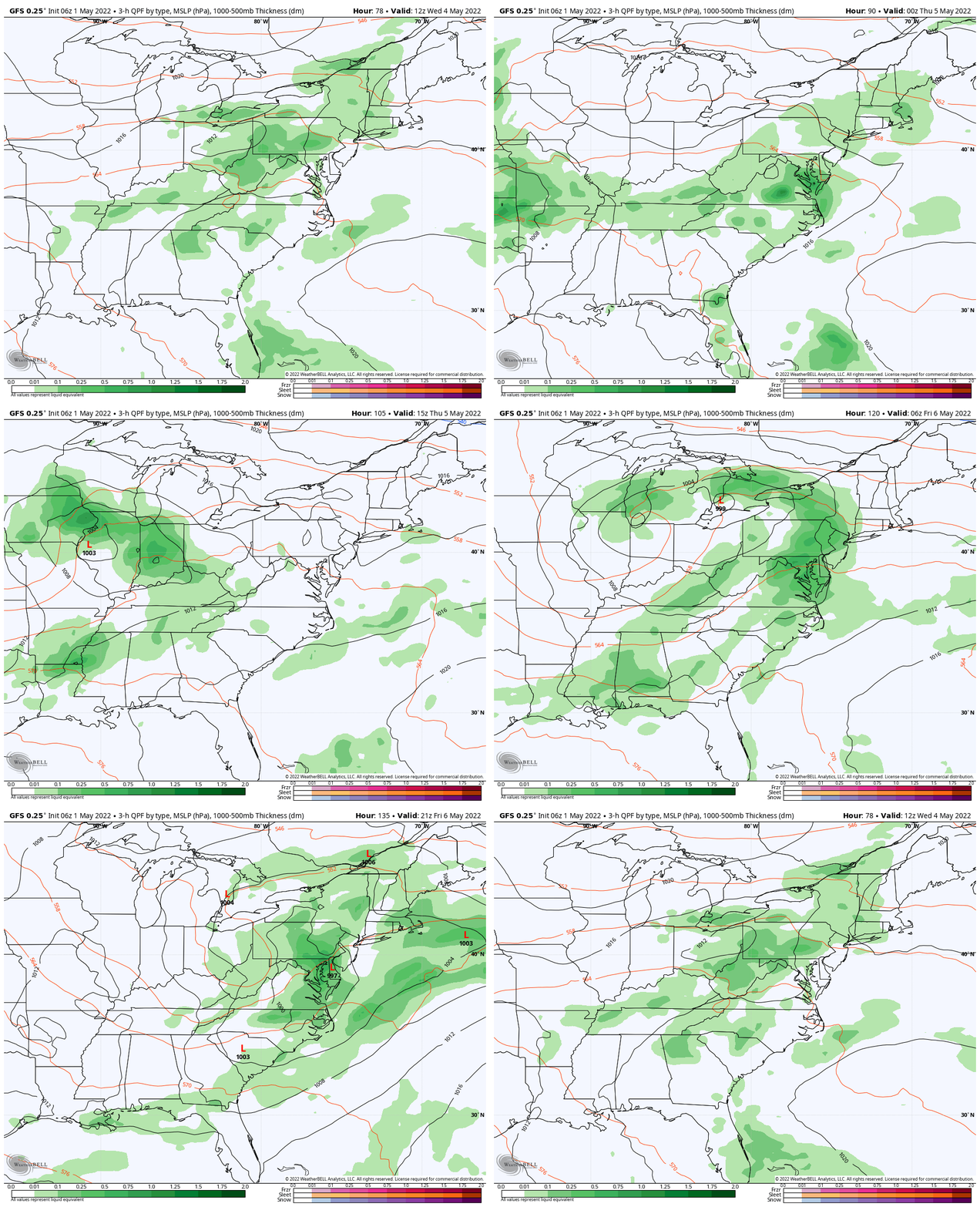
Wednesday To Friday
We can’t seem to shake the stormy pattern. Persistent rain is likely to dominate the end of the work week, and may continue into next weekend.
Weather posts straight to your inbox
Sign up and be the first to know!
7 Day Forecast
As we enter the month of May, we are still dealing a cooler weather. The next storm is likely to keep temps below average with rain at the end of the week and into next weekend.

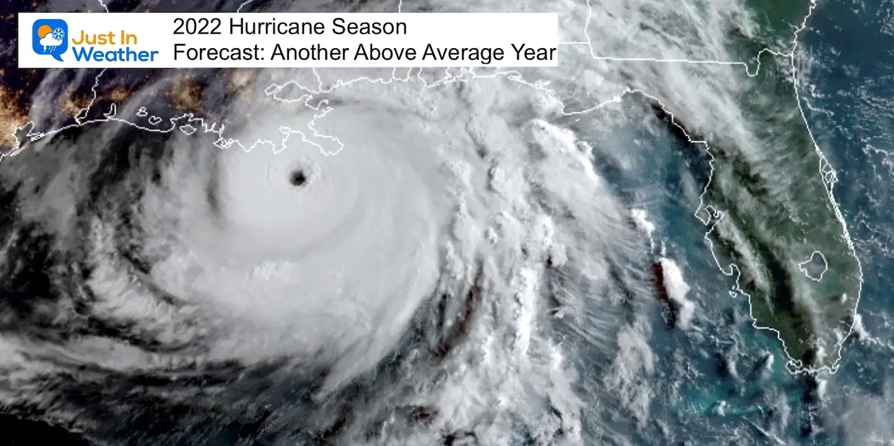
Tropical Season Begins June 1
Related Posts
Atlantic Tropical History: Maps of Origin Regions Every 10 Days
Please share your thoughts, best weather pics/video, or just keep in touch via social media
Facebook: Justin Berk, Meteorologist
Twitter: @JustinWeather
Instagram: justinweather
*Disclaimer due to frequent questions:
I am aware there are some spelling and grammar typos. I have made a few public statements over the years, but if you are new here you may have missed it:
I have dyslexia, and found out at my second year at Cornell. I didn’t stop me from getting my meteorology degree, and being first to get the AMS CBM in the Baltimore/Washington region.
I do miss my mistakes in my own proofreading. The autocorrect spell check on my computer sometimes does an injustice to make it worse.
All of the maps and information are accurate. The ‘wordy’ stuff can get sticky.
There is no editor that can check my work when I need it and have it ready to send out in a newsworthy timeline.
I accept this and perhaps proves what you read is really from me…
It’s part of my charm.


