How Hurricanes Interact With Land And Helped Shape The US East Coast
September 3 2019
I have had a lot of questions and comments recently with Hurricane Dorian slowly heading towards the eastern US. There is a range from fear of another Isabel for The Chesapeake Bay to the expectation that most storms miss the Mid Atlantic. My purpose here is a quick look at tropical cyclone circulation which has a strong and weak side at landfall.
Thousands of years of storm tracks have both reshaped the east coast and also help to guide storms. The ultimate atmospheric memory has been on display and we can see the results.
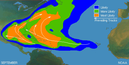
Climatologically Speaking, most storms travel east to west in the tropics, but at higher latitudes the westerlies curve the storms as they move north and push them from west to east. This is the typical tracks for storms in September.
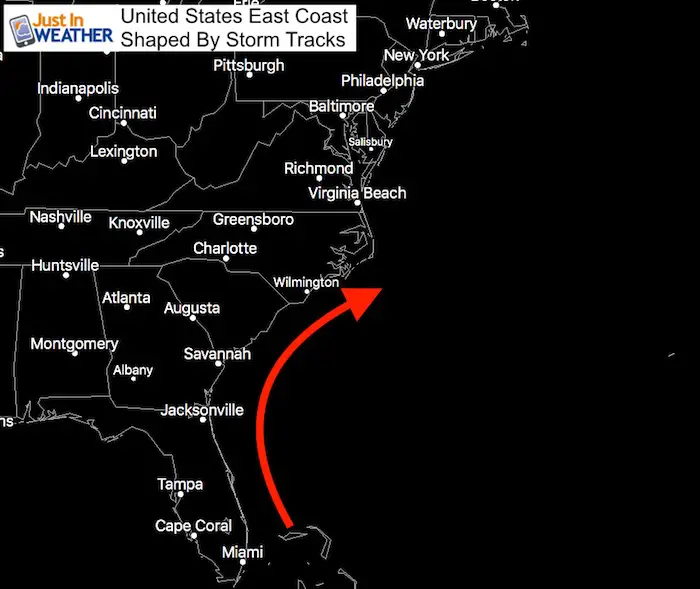
Storm Tracks Of The East Coast
If we look closer at the US East Coast we can see the shape of the coastline, the shape is often how many storms travel. This is no coincidence. This has been carved out from thousands of years of storms (both tropical and winter storms) the make that turn north and then northeast.
[adrotate group=”4″]
North Carolina
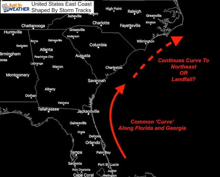
When we look closely at the map, North Carolina sticks out! Often this land area catches storms that don’t make the turn sharp enough, or guides storms to continue out to the Atlantic.
Landfall By State
Between 1878 and 2016, here are the direct impacts of storms by state.
- North Carolina has the same as Louisiana with 48!
- Florida is the clear winner (98) due part to its size and being surrounded by water on both sides.
- Compare the lower landfall numbers for Georgia (14), then increased just up the coast for South Carolina (28).
- Farther up the coast: Maryland and Delaware get less (2) than Connecticut and Massachusetts (9). Why? In part, New England sticks out and catches more storms that tend to be farther east. But more on Maryland below…
Before looking at the unique South and North Carolina coasts, let’s get a better look at hurricane circulation:
Hurricane Anatomy
- All storms circulate in the Northern Hemisphere circulate winds counterclockwise.
When a hurricane makes landfall:
- Strong Side: The right side is the strongest side as it has winds off the water and moving in the same direction as the storm
- Weaker Side: The left side of the storm has winds pulling in from the land which is slowed by friction. It also is moving in the opposite direction as the forward movement… The opposing force results in slower winds than the right side.
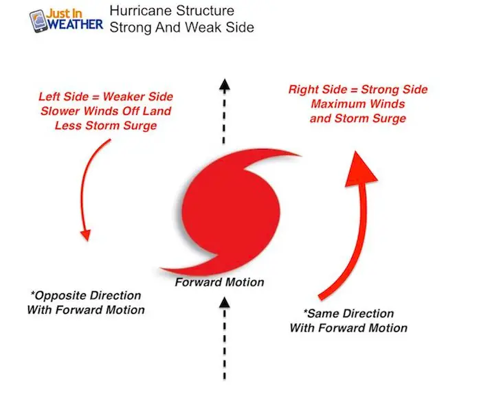
The first thing that should stand out is that most storms that move up the east coast, keep the strongest side over the ocean. The weaker side is what usually faces the land… if a storm follows the coast and moves back out into the Atlantic.
If it makes landfall, then it gets interesting….
South and North Carolina Circular Coasts
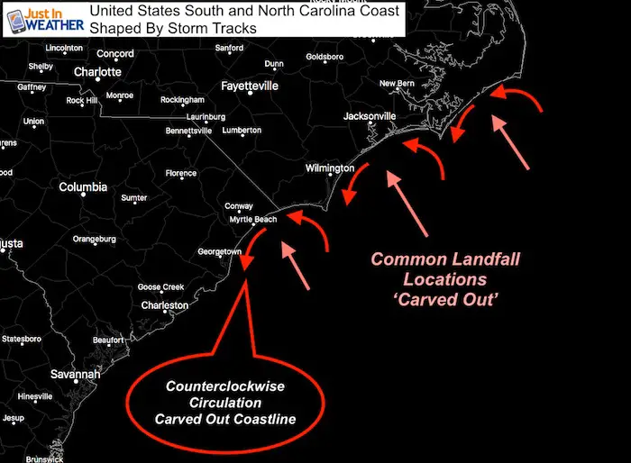
The shape of the coastline has been carved out by geographically favored landfall locations. The Carolinas stick out and catch more storms on the chin. A few chins!
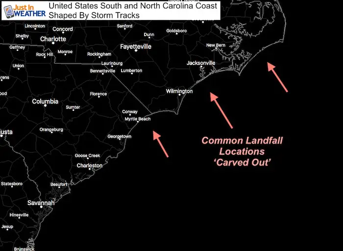
The circulation around the storms has eroded and moved the sandy shores to result in the map looking like this today.
Storms don’t hit the same spots, but in those general areas more often than others. Patterns like this exist for a variety of weather around the planet favored in one area over another. Sometimes we just get to see the results clearly like this.
[adrotate group=”4″]
What about us farther north?
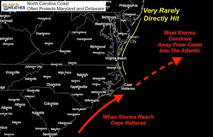
Due to the geography, most hurricanes and tropical storms are already curving away along the coast, or hit land before reaching Virginia, Maryland, or Delaware. This part of the coast rarely gets a direct hit.
It should be noted that storms along this path can send their outer bands into Maryland, but this is on the weaker side of the storm.
Also, waves and some surge can ‘turn the corner’ from Cape Hatteras and move into Virginia Beach and up the Chesapeake Bay. But often that is ahead of the storm and minor. If a storm follows this path shown below, the winds (counterclockwise) will turn from the north and actually drain out of the Bay as the storm makes is closest pass by.
Still high waves and erosion on this weaker side along the ocean coast is common.
A Little Surge And Bring Big Flooding To The Bay
The SLOSH Model helps identify how water can sway from one side of the shallow Chesapeake Bay to the other. This can happen from water being pushed up form the ocean, but also from strong winds. The water level is often higher on one side versus another if the wind flow is right.
SLOSH MODEL
Here are the impacts of Hurricanes Category 1 and 2 flooding on the Chesapeake
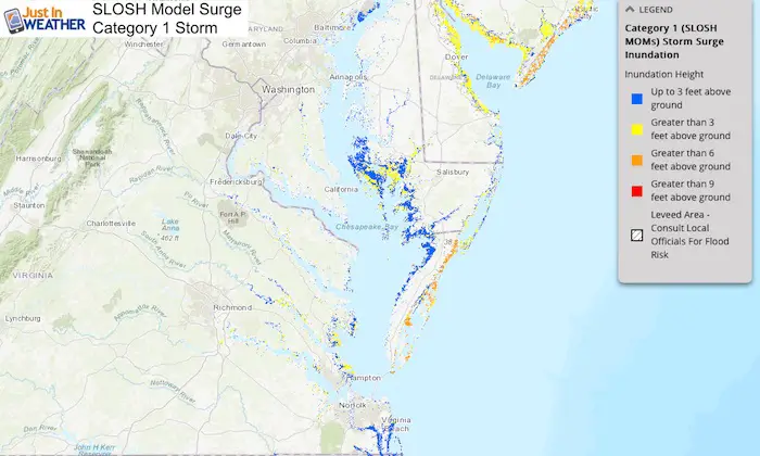
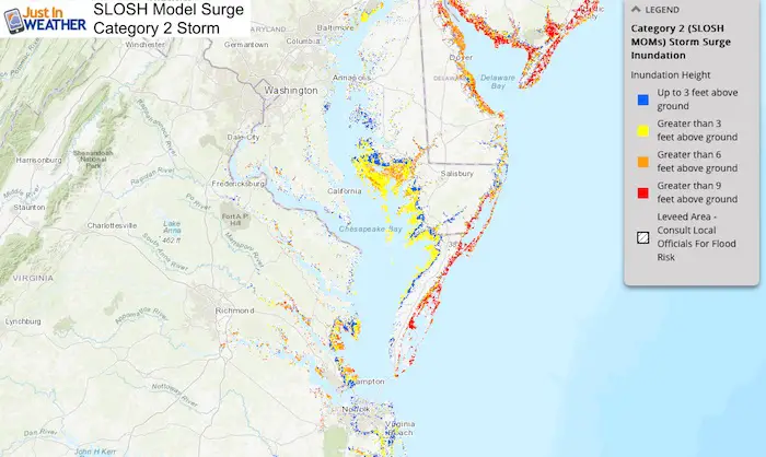
Only 2 storms since 1878 made a direct impact
1933– An unnamed hurricane flooded Ocean City and created the Inlet we know today that separates the resort from Assateague Island.
I moved to Maryland in 1997 and only seen a couple big impact events since then.
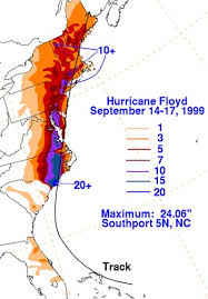
1999 – Hurricane Floyd
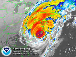
That storm hit North Carolina first, so it weakened the blow a little. But the winds and rain expanded a very large area up the coast.
2003- Hurricane Isabel
Hurricane Isabel in 2003 actually did not hit Maryland as a hurricane. That epic storm moved in a very rare track NOT curving and remaining on a NW track towards Cleveland.
It led to major flooding form storm surge up the Chesapeake Bay. That made landfall in North Carolina, but it hit Maryland by Frostburg not the coast! It was a tropical storm. That was a very rare event!

[adrotate group=”4″]
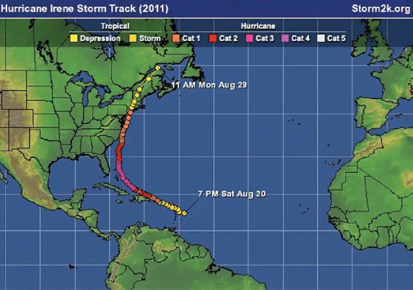
2011 Hurricane Irene
I was working at my last TV station at the time and covered the event in Ocean City. The Cat 1 eye passed 15 miles east of Ocean City. I remember it was around midnight and winds peaked at 70 mph at the beach.
Keep In Touch Every Day
Just in case you don’t get all posts on your social media feed, stay up to date with the latest info…
Click here to sign up for email alerts…. Be the first to hear any new weather
Thank you to our Title Sponsor for Maryland Trek 6
Shining on with Smyth and their contribution, our team has raised over $95,000 for Just In Power Kids to provide free programs for kids in and post cancer treatment.
Please share your thoughts, best weather pics/video, or just keep in touch via social media
-
Facebook: Justin Berk, Meteorologist
-
Twitter: @JustinWeather
-
Instagram: justinweather
Maryland Trek Cycle Jerseys From Hill Killer
All proceeds will go to the Maryland Trek 6 total and Just In Power Kids programs
Just In Power Kids:
Proceeds go to our programs Providing FREE holistic care for kids in cancer treatment and up to 5 years post treatment and caregivers.

Shine On
Proceeds from all sales go to Just In Power Kids. Click the image to shop and show your support.
Love Maryland Shirts and Hoodies
This shirt was designed by my ‘bonus’ daughter Jaiden. The hoodie has been the biggest hit, so our promotion has been extended until the end of this week.
|
||
|
Show your love for Maryland and make this 14 year old artist and her mom extra proud
|
Related Links:


