


January 4 Weather One More Cold Day Then January Thaw By Mid Week
Sunday, January 4, 2026 Overnight, there were some snow showers that crossed the region. I would not be surprised if there are reports of a fresh dusting of snow on…
Tuesday, September 17 2024
Morning Report
There are some things that went wrong with the forecast this week. That storm that landed in South Carolina yesterday was never named. It had 50 mph winds at its peak and brought tremendous rainfall and flooding to the Southeast coast. Parts of North Carolina received OVER 18 inches of rainfall from this system.
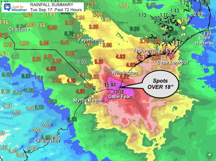
However, it never became a full-fledged tropical storm! That would require convection (sustained storms) wrapped around the center. Instead, it was a regular Low Pressure with a cool and warm side/fronts. The difference was how much moisture it was able to hold AND how the remaining circulation would behave when arriving north during the week. This proves a storm does not need a name to do damage and some non-tropical storms can be worse.
The American GFS Model has it falling apart, and that looks like the better solution. The European ECMWF Model was more robust in holding it together with impact into the weekend. That does not look likely now, and I was wrong to put more emphasis on that. Neither model is 100% correct, but there does seem to be a winner here.
The Euro has an ongoing outstanding reputation, but the GFS upgrades do appear to have worked this time. I will focus on this going forward as it may be useful into the winter.
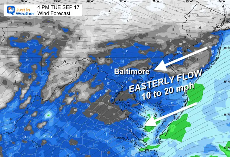
The extended Easterly Wind AND today’s Full Supermoon will keep the water levels up. Flooding is expected during the high tides.
Annapolis High Tides:
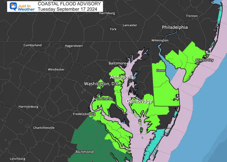
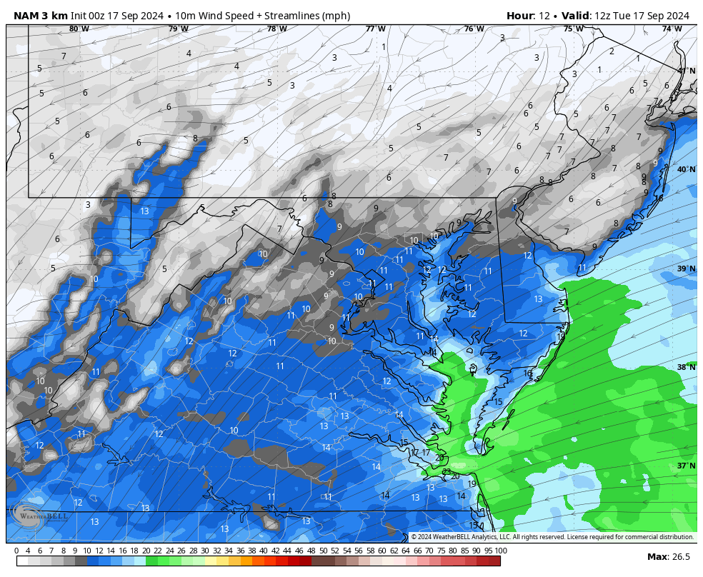
The combination of High Pressure in New England and the old Storm in the Southeast US will increase the wind from an Easterly Direction. This brings in cooler, damp air, plus higher water on the beaches and in the Chesapeake Bay. Coastal Flood Advisories are in place.
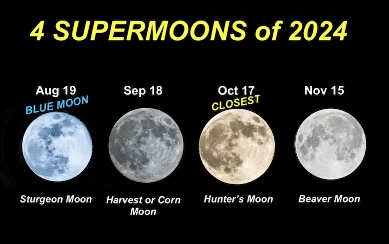
We have a Full Supermoon today, which will enhance the high tide and flooding potential.
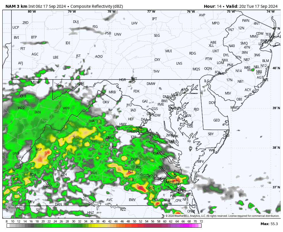
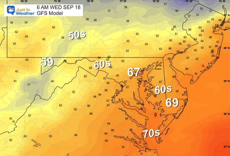
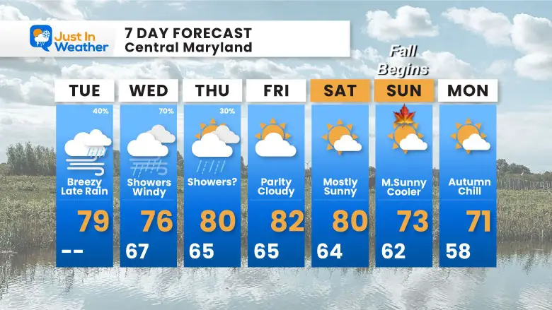
The old storm is less potent but still expanding the rain to the north. Showers will arrive later today and tonight.
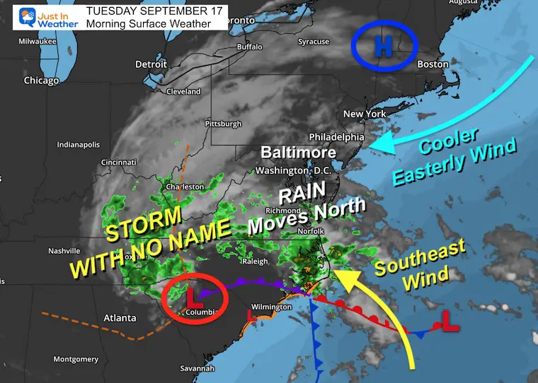
Winds will be flowing from the East to Northeast at 10 to 20 mph.
Showers arrive in to central Maryland this evening with bands of heavier rain and maybe T’storm overnight.
Sunrise at 6:50 AM
Sunset at 7:11 PM
Normal Low in Baltimore: 59ºF
Record 44ºF in 1984
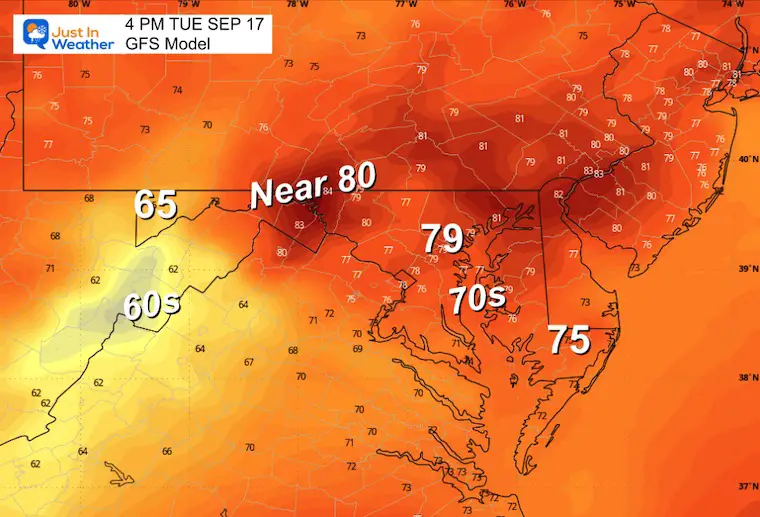
Normal High in Baltimore: 79ºF
Record 97ºF 1991
See more about the 4 Supermoons Through November here:
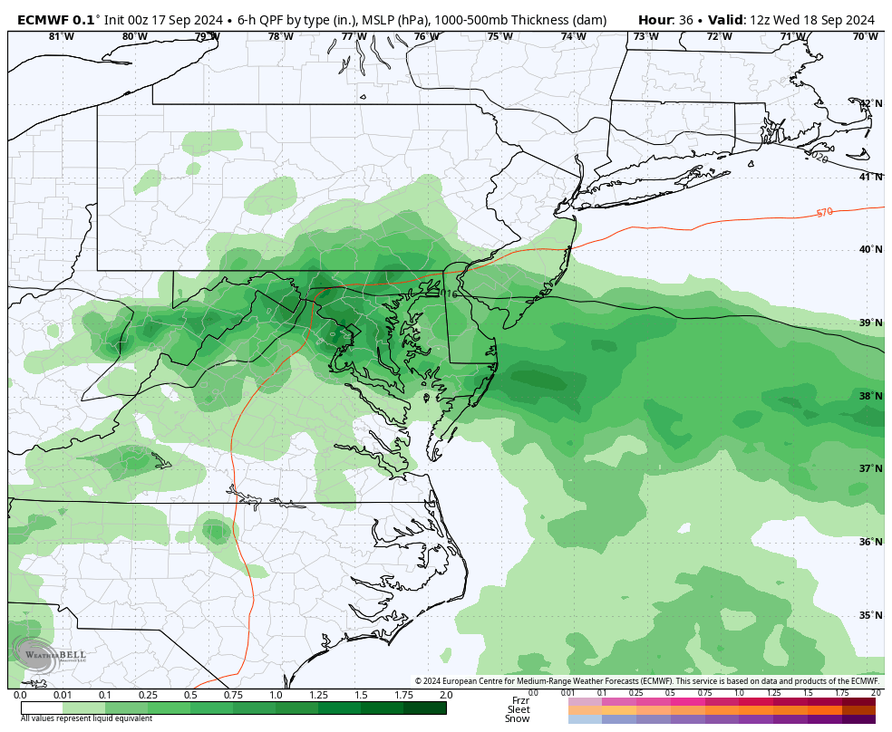
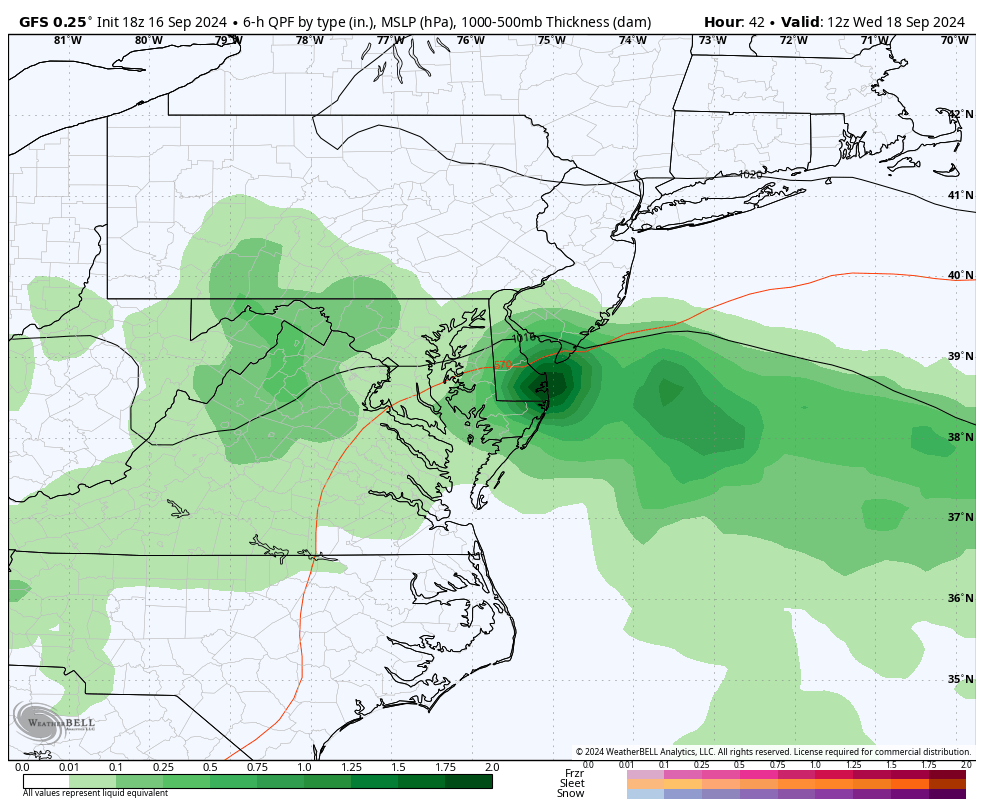
I will acknowledge my mistake. I leaned heavily on the European Model which had the storm stronger and lasting longer. The GFS Model had broken up the storm and lowered the rain totals a few days ago. It is now looking like it may be the better model this time.
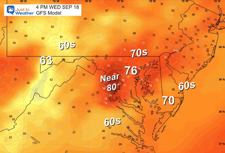
More widespread rain in the morning. Then breaking up, for a dryer Thursday. This model is still trying to bring a coastal Low back (retrograding) Friday for Delmarva.
Heavier rain along the coast while breaking up the rain across inland areas. Still showing scattered showers late Wednesday and Thursday.
This product still has more rain.
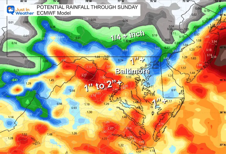
This product continues to be substantially lower and looks like the winner this time. This is worth remembering going forward through the season and into winter.
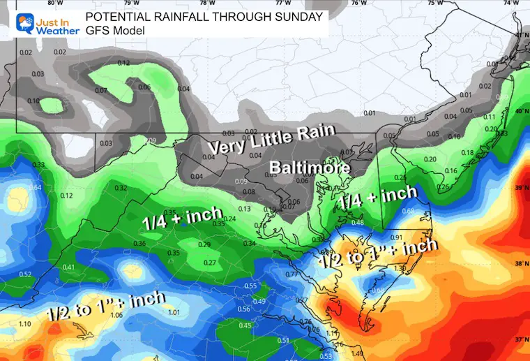
It looks like this storm is falling apart with less impact. That will allow the dry and cooler air to build in sooner.
Click here to see: NOAA Released Its Most Aggressive Hurricane Season Forecast
The annual event: Hiking and biking 329 miles in 7 days between The Summit of Wisp to Ocean City.
Each day, we honor a kid and their family’s cancer journey.
Fundraising is for Just In Power Kids: Funding Free Holistic Programs. I never have and never will take a penny. It is all for our nonprofit to operate.
Click here or the image to donate:

I am aware there are some spelling and grammar typos and occasional other glitches. I take responsibility for my mistakes and even the computer glitches I may miss. I have made a few public statements over the years, but if you are new here, you may have missed it: I have dyslexia and found out during my second year at Cornell University. It didn’t stop me from getting my meteorology degree and being the first to get the AMS CBM in the Baltimore/Washington region.
One of my professors told me that I had made it that far without knowing and to not let it be a crutch going forward. That was Mark Wysocki, and he was absolutely correct! I do miss my mistakes in my own proofreading. The autocorrect spell check on my computer sometimes does an injustice to make it worse. I also can make mistakes in forecasting. No one is perfect at predicting the future. All of the maps and information are accurate. The ‘wordy’ stuff can get sticky.
There has been no editor who can check my work while writing and to have it ready to send out in a newsworthy timeline. Barbara Werner is a member of the web team that helps me maintain this site. She has taken it upon herself to edit typos when she is available. That could be AFTER you read this. I accept this and perhaps proves what you read is really from me… It’s part of my charm. #FITF