


January 6 Weather Some Fog And Clouds Followed By The Warm Up With Rain By The Weekend
Tuesday, January 6, 2026 The storm track has shifted to the north. We are still on the edge, which is why we have areas of fog, and most of the…
Monday, September 16, 2024
Morning Report
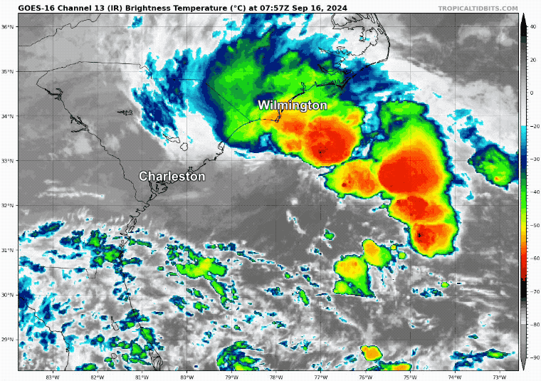
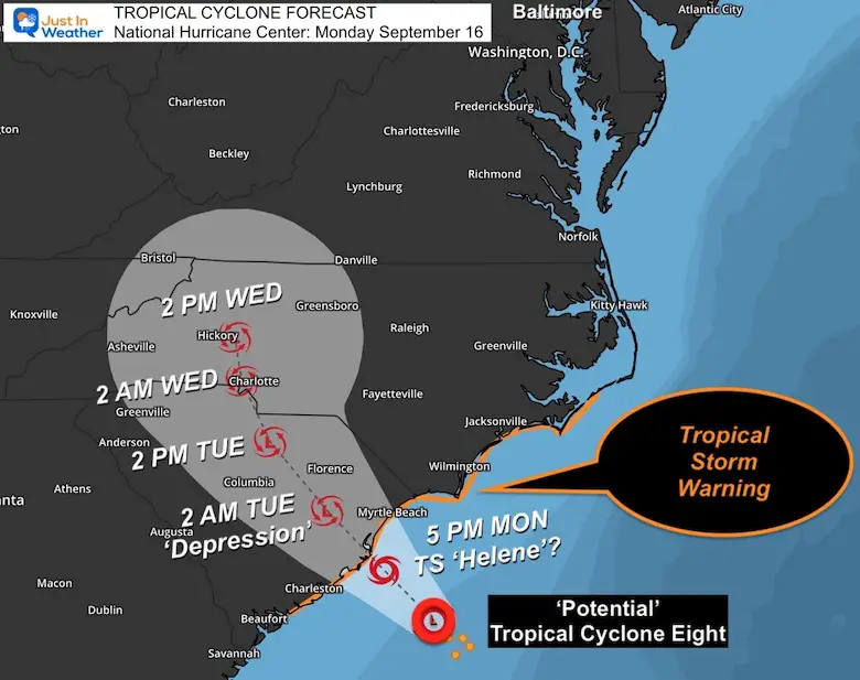
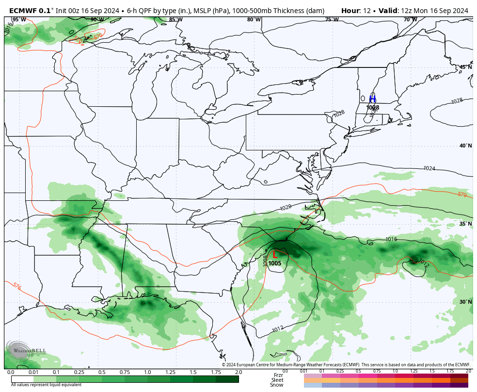
The storm off the coast of South Carolina has yet to be formally named. It is still Potential Tropical Cyclone Eight with 45 mph winds and does not have a formal tropical structure. If it gets better organized, it will be called Helene briefly. Landfall is expected today, which will then weaken it.
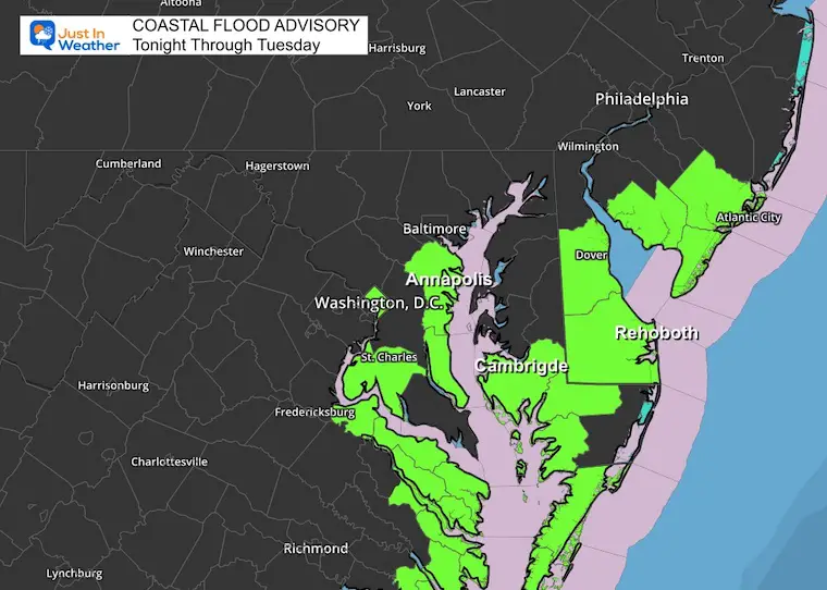
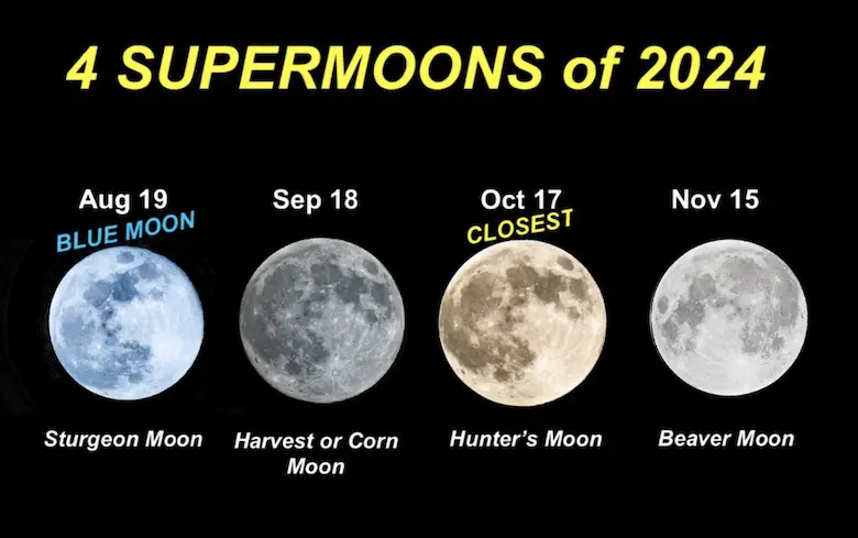
The onshore wind flow is expected all week long. It will combine with High Pressure in New England and the Supermoon this week to enhance the high water and coastal flooding. This includes the Chesapeake Bay.
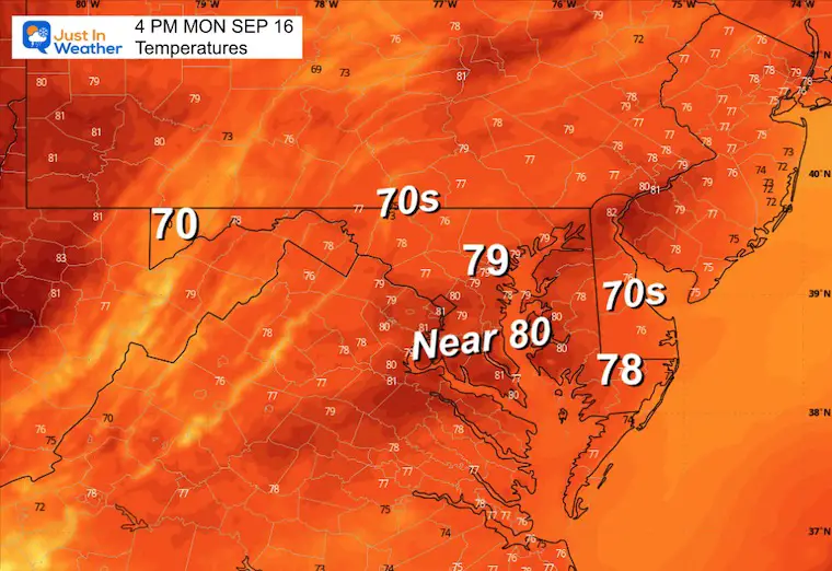
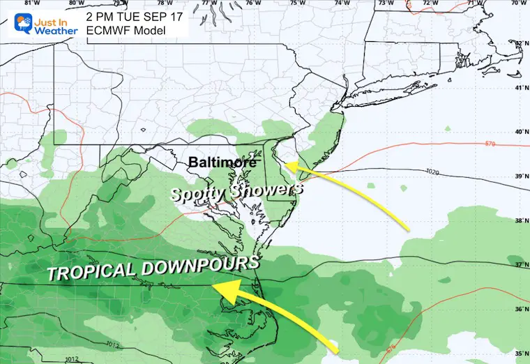
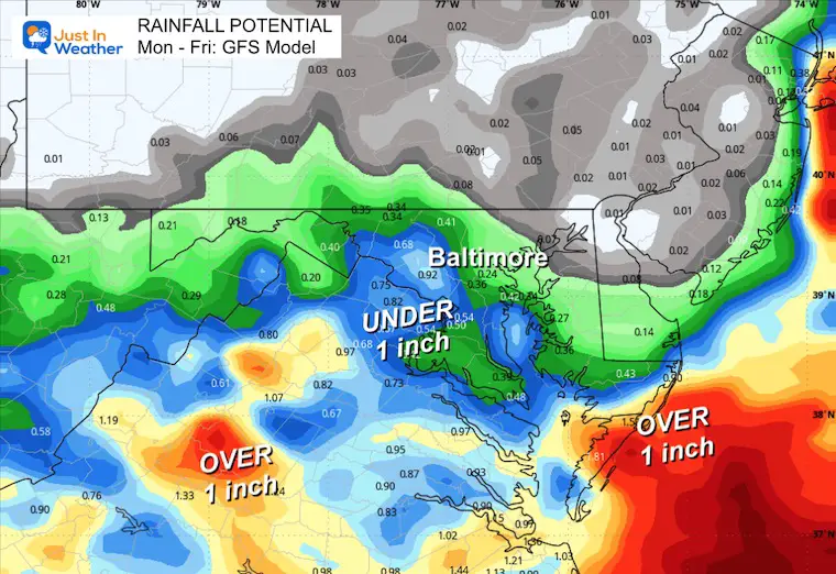
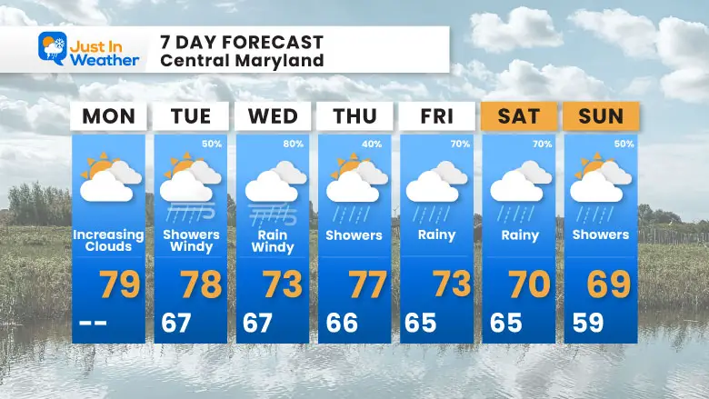
Rain will develop, but steady rain in our region is more likely on Wednesday, followed by perhaps a few more bursts into the weekend. Temperatures will continue to get cooler as well. See the forecast map below.
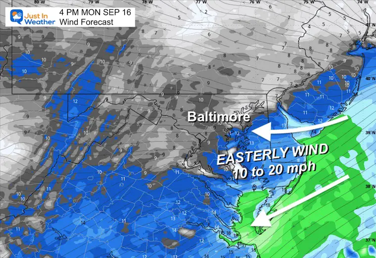
With High Pressure passing to our North, the flow around it will gradually increase FROM THE EAST. That will help to bring in more moisture, cooler temperatures, and higher water into the beaches and Chesapeake Bay.
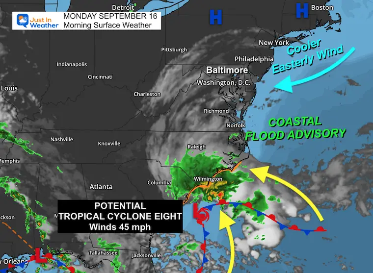
The extended Easterly Wind this week, plus the Full Supermoon, will keep the water levels up. Flooding is expected during the high tides.
Note: The medical waste that washed up on the Ocean City, MD Beaches on Sunday remains an additional threat as well.
Easterly flow will help to mix in more clouds and keep temps in check.
Sunrise at 6:49 AM
Sunset at 7:12 PM
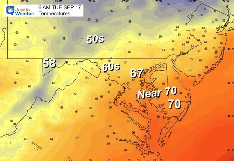
Normal Low in Baltimore: 59ºF
Record 41ºF in 1873
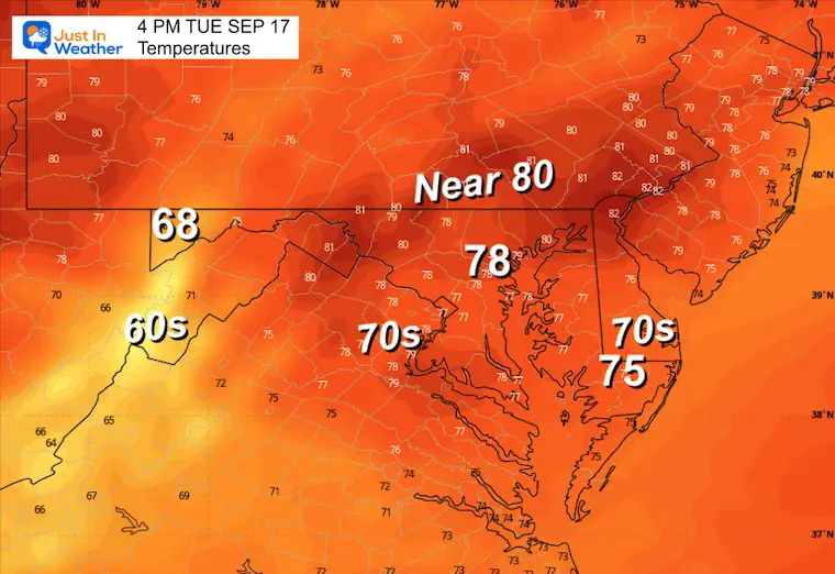
Normal High in Baltimore: 80ºF
Record 98ºF 1991
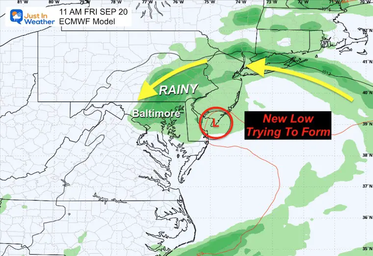
The primary storm will bring tropical rain and combine with High Pressure to keep winds onshore all week. Here is the European Model solution that shows a new Low Pressure trying to form and drift along the coast all week long.
This is a SUGGESTION not a promise. If you have a weather app, it may be based on the American GFS Model, which is less aggressive.
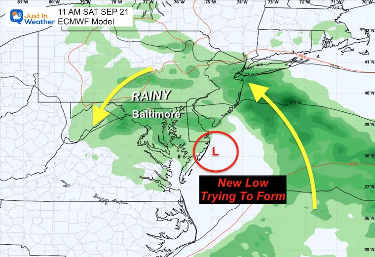
The flow of tropical moisture from the Southeast will keep us with rain into the weekend. It now looks like Wednesday may be the rainiest day, followed by lingering showers or redeveloping rain if a new Low Pressure can form along the coast. If so, this may linger and drift into the weekend.
A slower development of the system may keep the rain to the south, with showers expanding north into the Mid-Atlantic. The heavier rain may be delayed a day.
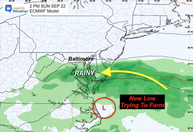
This may turn out to be the day with the bulk of the rain for The Mid Atlantic. The notion is based on a new secondary Low forming to enhance the rain.
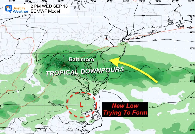
Watching the potential new Low trying to form along the coast.
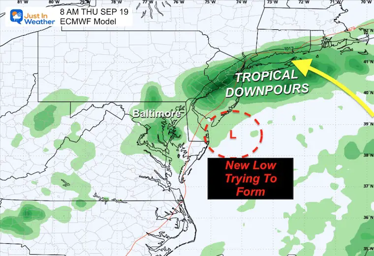
Still watching the potential new Low trying to form along the coast.
Still watching the potential new Low trying to form along the coast.
Still watching the potential new Low trying to form along the coast.
This product accounts for a second storm that will linger all week.
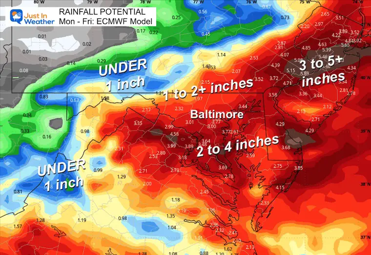
This product is substantially lower as it does not develop the influence of a stronger and slow-moving secondary Low this week.
I am following the European Model projection. This redevelops a new Low that will linger into the weekend, keeping the risk of rain around each day, as shown above.
Temperatures will gradually turn cooler.
Click here to see: NOAA Released Its Most Aggressive Hurricane Season Forecast
The annual event: Hiking and biking 329 miles in 7 days between The Summit of Wisp to Ocean City.
Each day, we honor a kid and their family’s cancer journey.
Fundraising is for Just In Power Kids: Funding Free Holistic Programs. I never have and never will take a penny. It is all for our nonprofit to operate.
Click here or the image to donate:

See more about the 4 Supermoons Through November here:
I am aware there are some spelling and grammar typos and occasional other glitches. I take responsibility for my mistakes and even the computer glitches I may miss. I have made a few public statements over the years, but if you are new here, you may have missed it: I have dyslexia and found out during my second year at Cornell University. It didn’t stop me from getting my meteorology degree and being the first to get the AMS CBM in the Baltimore/Washington region.
One of my professors told me that I had made it that far without knowing and to not let it be a crutch going forward. That was Mark Wysocki, and he was absolutely correct! I do miss my mistakes in my own proofreading. The autocorrect spell check on my computer sometimes does an injustice to make it worse. I also can make mistakes in forecasting. No one is perfect at predicting the future. All of the maps and information are accurate. The ‘wordy’ stuff can get sticky.
There has been no editor who can check my work while writing and to have it ready to send out in a newsworthy timeline. Barbara Werner is a member of the web team that helps me maintain this site. She has taken it upon herself to edit typos when she is available. That could be AFTER you read this. I accept this and perhaps proves what you read is really from me… It’s part of my charm. #FITF