


Winter Weather Advisory Sunday As Snowfall In Two Parts Affecting Two Different Areas
Saturday Evening Update January 17 2026 One thing I carry after all of my years of forecasting: If one model does a really good job in an active pattern, then…
September 15 2024
Sunday Evening
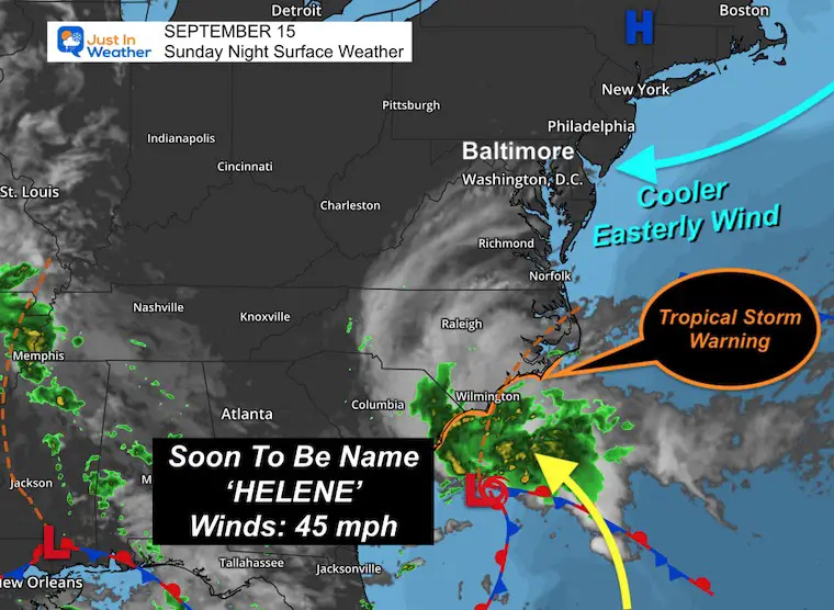
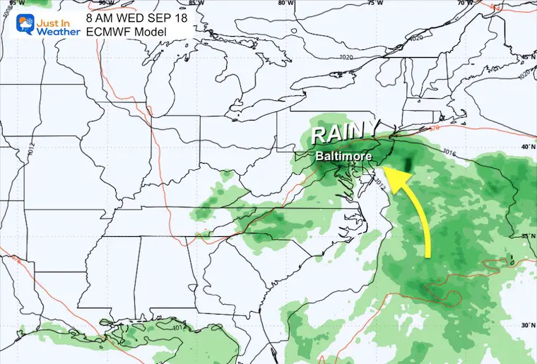
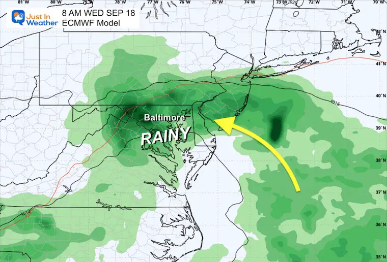
Low pressure being tracked closely off the South Carolina coast has a high chance of being upgraded by the National Hurricane Center tonight. If so, it will be Helene, only the 8th named Atlantic storm this season.
The winds are already 45 mph, and tropical storm-force winds reach 175 miles from the center. The naming is based on the proper structure. It currently has frontal boundary structures (wake and cool sides) and may not completely lose them. It is possible it becomes a hybrid or subtropical.
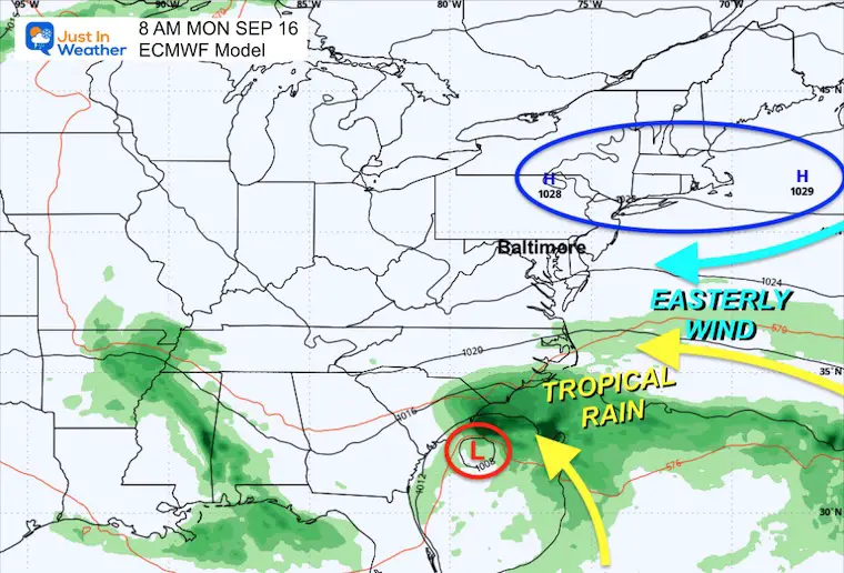
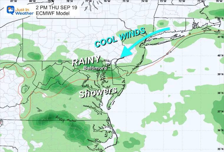
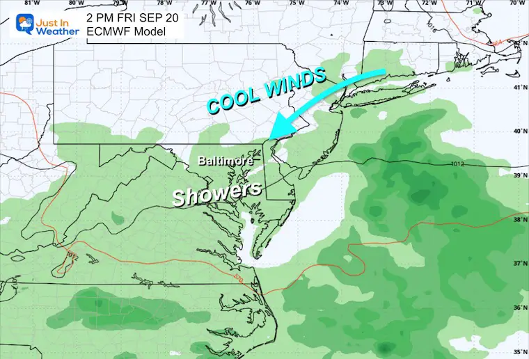
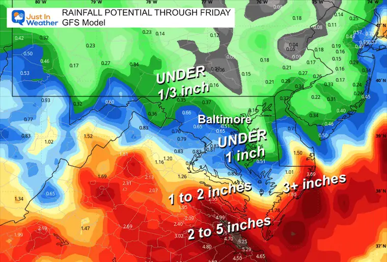
The weather set up across the East Coast will enhance a persistent east wind, which will increase our moisture with cooler temperatures. It may also be combined with the Supermoon to raise water levels in the Chesapeake Bay, increasing the potential for flooding.
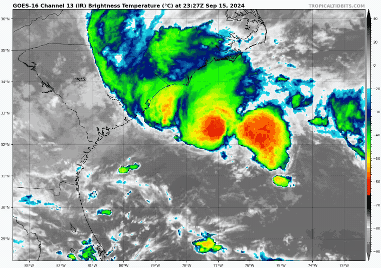
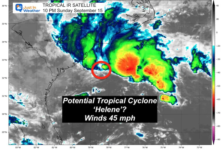
NHC has not named the storm yet. It may run out of time before landfall, but it is still expected to have the same impact.
Click here for the newer Monday Morning Report.
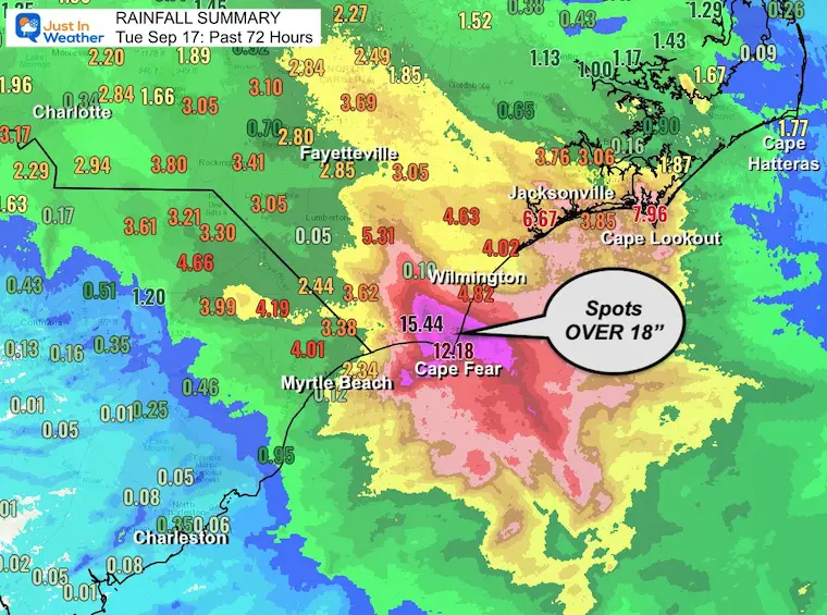
This storm had 50 mph winds with 70 mph gusts on coastal NC. It brought extensive flooding with spots over 15 inches of rainfall…but it NEVER GOT NAMED! IT WAS NOT A FULL TROPICAL SYSTEM. IT WAS ‘NOT’ HELENE. The inland forecast for rain has been lowered in the Mid Atlantic.
Click here for the Tuesday Morning Report
This storm has two things going for it. First, it is sitting in a favorable area over the warm water of the Gulf Stream. This will provide the fuel needed to become tropical. Secondly, this week is the peak of a normal hurricane season.
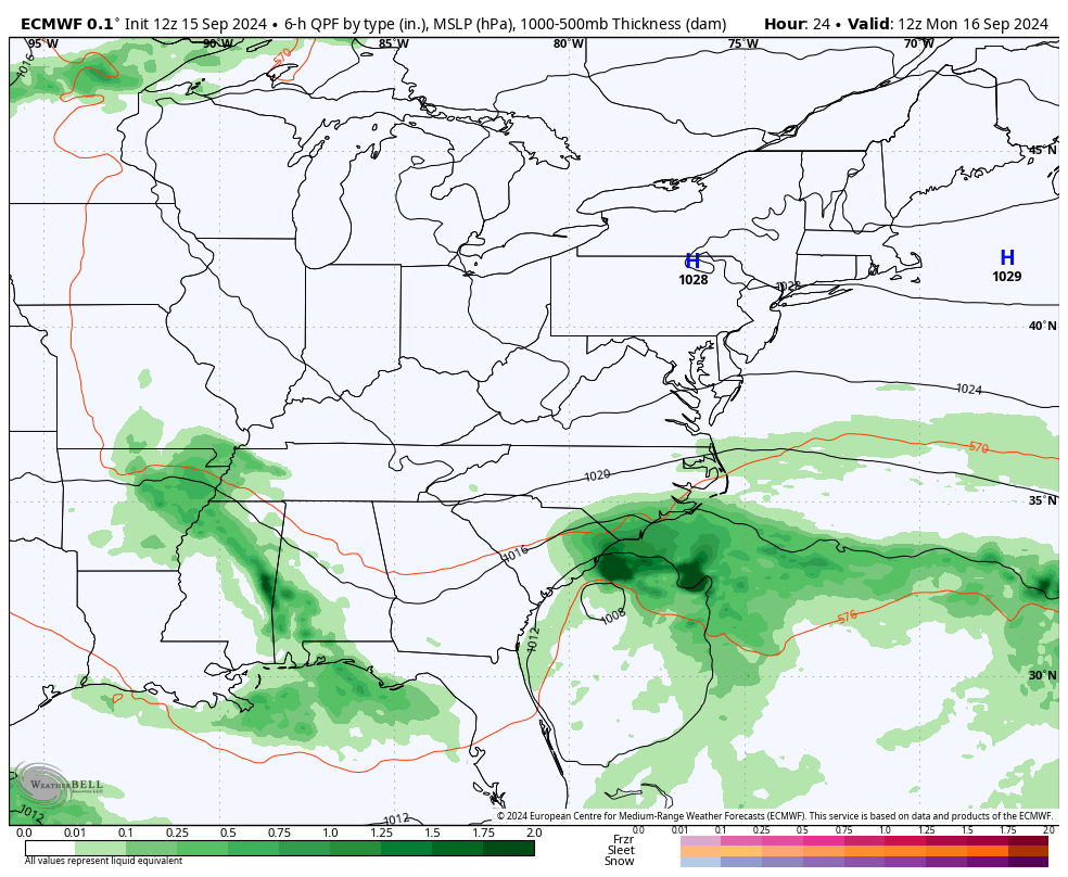
What it has going against it is time and space. The upper-level wind flow will move this onshore by Monday night. It will not last long, but it still could bring 3 to 6 inches of rainfall along its path.
Notes: Tropical Storm Force winds extend 175 miles away from the center.
Named Storms
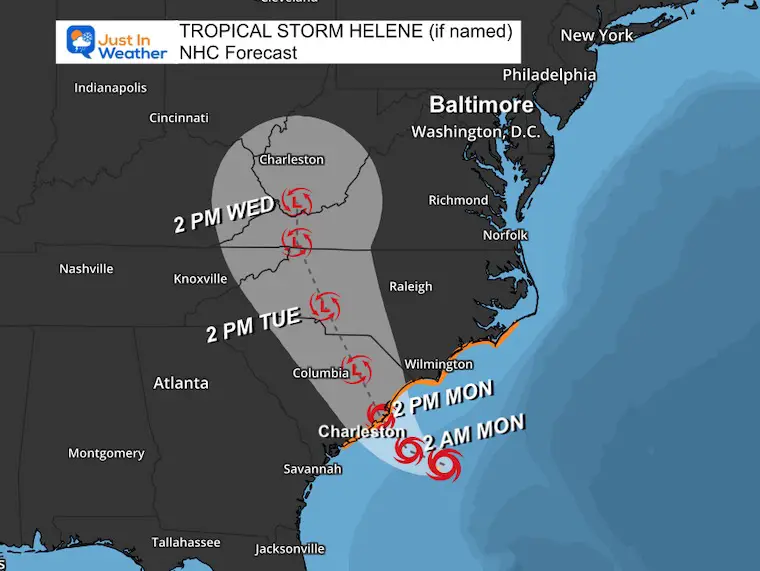
A Tropical Storm Warning is in effect for…
* Edisto Beach, South Carolina northward to Ocracoke Inlet, North Carolina
The onshore flow FROM THE EAST will be enhanced by High Pressure in New England and the (expected) Tropical Storm Helene in the Southeast US. Rip currents and beach erosion will be widespread along the East Coast. Flooding is possible into the Chesapeake Bay.
(Daily snapshots below)
WIND:
Tropical storm conditions are expected within the warning area beginning late tonight.
STORM SURGE:
South Santee River, SC to Oregon Inlet, NC… 1-3 ft
Neuse and Bay Rivers, NC… 1-3 ft
Pamlico and Pungo Rivers, NC… 1-3 ft
RAINFALL:
3 to 6 inches along the path with up to 8 inches in northeastern South Carolina.
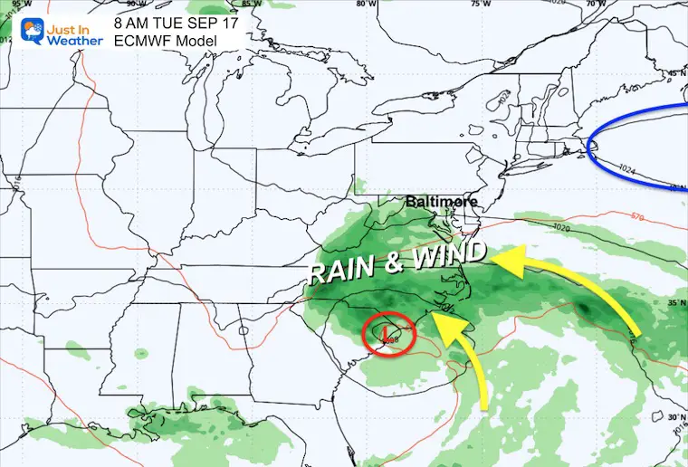
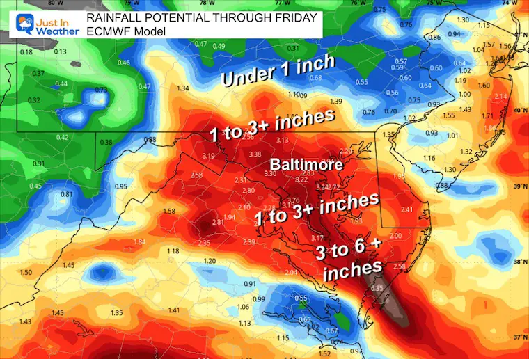
This solution has cut back on the rain farther north into the Mid-Atlantic.
Click here to see: NOAA Released Its Most Aggressive Hurricane Season Forecast
The annual event: Hiking and biking 329 miles in 7 days between The Summit of Wisp to Ocean City.
Each day, we honor a kid and their family’s cancer journey.
Fundraising is for Just In Power Kids: Funding Free Holistic Programs. I never have and never will take a penny. It is all for our nonprofit to operate.
Click here or the image to donate:

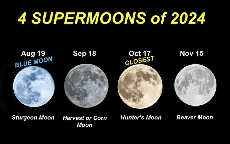
See more about the 4 Supermoons Through November here:
I am aware there are some spelling and grammar typos and occasional other glitches. I take responsibility for my mistakes and even the computer glitches I may miss. I have made a few public statements over the years, but if you are new here, you may have missed it: I have dyslexia and found out during my second year at Cornell University. It didn’t stop me from getting my meteorology degree and being the first to get the AMS CBM in the Baltimore/Washington region.
One of my professors told me that I had made it that far without knowing and to not let it be a crutch going forward. That was Mark Wysocki, and he was absolutely correct! I do miss my mistakes in my own proofreading. The autocorrect spell check on my computer sometimes does an injustice to make it worse. I also can make mistakes in forecasting. No one is perfect at predicting the future. All of the maps and information are accurate. The ‘wordy’ stuff can get sticky.
There has been no editor who can check my work while writing and to have it ready to send out in a newsworthy timeline. Barbara Werner is a member of the web team that helps me maintain this site. She has taken it upon herself to edit typos when she is available. That could be AFTER you read this. I accept this and perhaps proves what you read is really from me… It’s part of my charm. #FITF