


Winter Weather Advisory Sunday As Snowfall In Two Parts Affecting Two Different Areas
Saturday Evening Update January 17 2026 One thing I carry after all of my years of forecasting: If one model does a really good job in an active pattern, then…
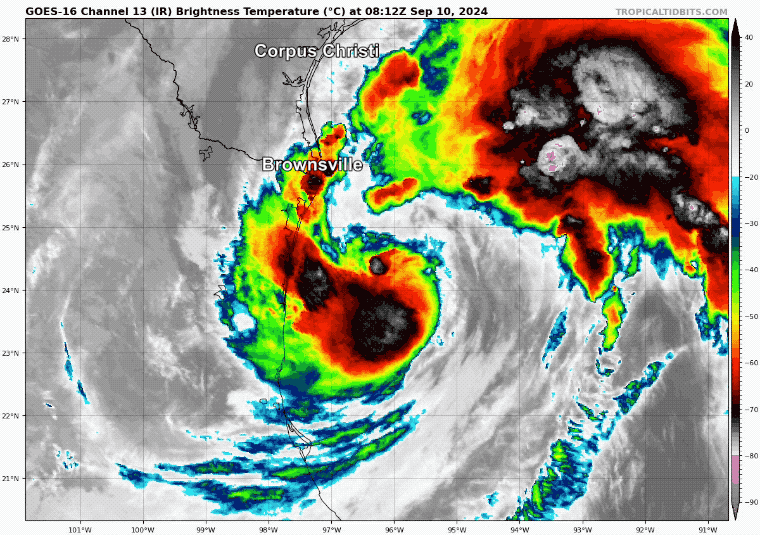
Tuesday September 10, 2024
Morning Report
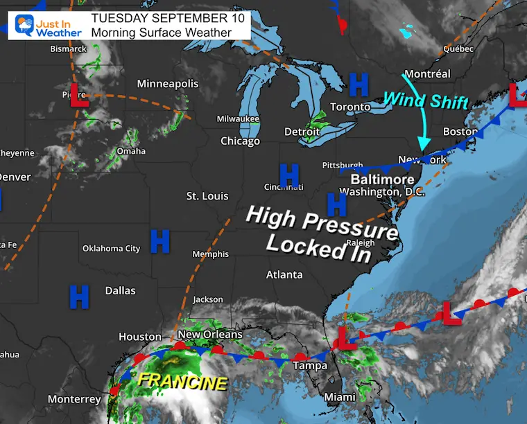
We are about to enter a nice stretch of late summer weather in the Mid-Atlantic, while the Western Gulf Coast experiences rain and wind from developing Francine.
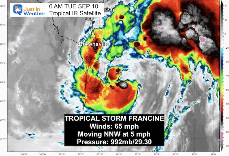
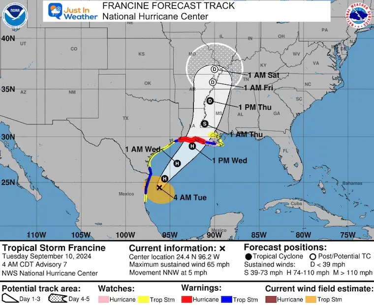
This morning, the Tropical Storm has winds of 65 mph and is expected to become a hurricane today and make landfall later tomorrow. The full report on this storm is below.
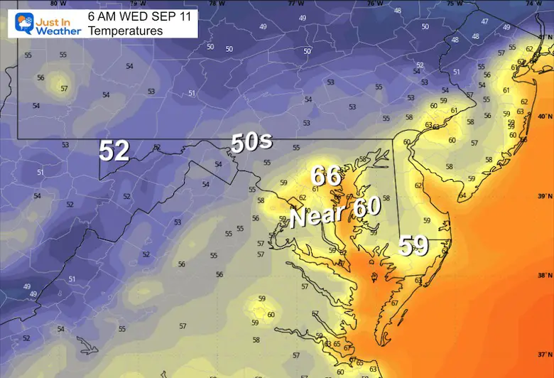
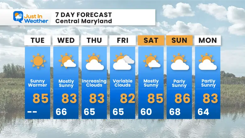
High Pressure is still in control with a chilly start. This will be locked in all week to influence two things:
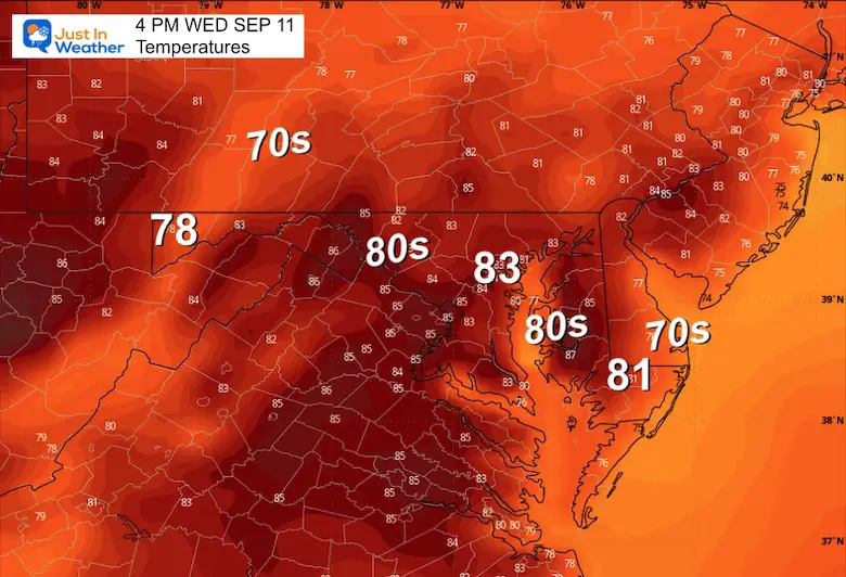
Simply a pleasantly warm and sunny September Day!

Sunrise at 6:44 AM
Sunset at 7:22 PM
Normal Low in Baltimore: 61ºF
Record 41ºF in 1956
Normal High in Baltimore: 82ºF
Record 98ºF 1983
The temps may be a little cooler with a wind shift FROM the East.
SUMMARY OF 400 AM CDT…0900 UTC…INFORMATION
———————————————-
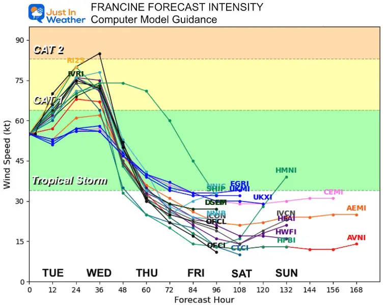
Almost certainly reaching Category 1. It does have a chance to overachieve and reach Category 2 before making landfall.
Hurricane Warnings and Watches have been issued along the Louisiana coastline.
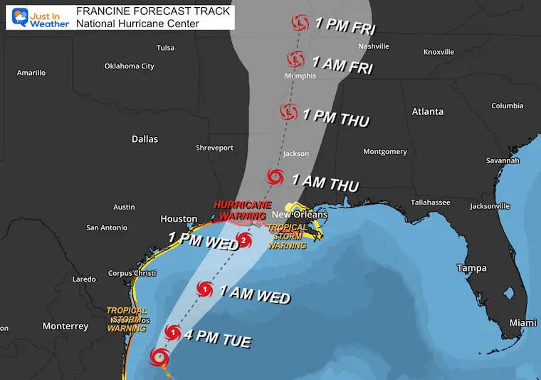
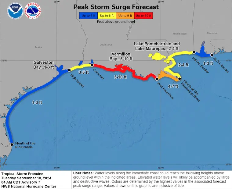
A Storm Surge Warning is in effect for…
* High Island Texas to the Mouth of the Mississippi River Louisiana
* Vermilion Bay
A Hurricane Warning is in effect for…
* The Louisiana coast from Sabine Pass eastward to Morgan City
A Storm Surge Watch is in effect for…
* Mouth of the Mississippi River Louisiana to the Mississippi/Alabama Border
* Lake Maurepas
* Lake Pontchartrain
A Hurricane Watch is in effect for…
* The Louisiana coast from Morgan City eastward to Grand Isle
A Tropical Storm Warning is in effect for…
* Morgan City to Grand Isle
* High Island to Sabine Pass
* Mouth of the Rio Grande to Port Mansfield
* La Pesca Mexico to the Mouth of the Rio Grande
A Tropical Storm Watch is in effect for…
* Barra del Tordo to La Pesca Mexico
* Port Mansfield to High Island Texas
* East of Grand Isle Louisiana to Mouth of the Pearl River, including metropolitan New Orleans
* Lake Pontchartrain
* Lake Maurepas
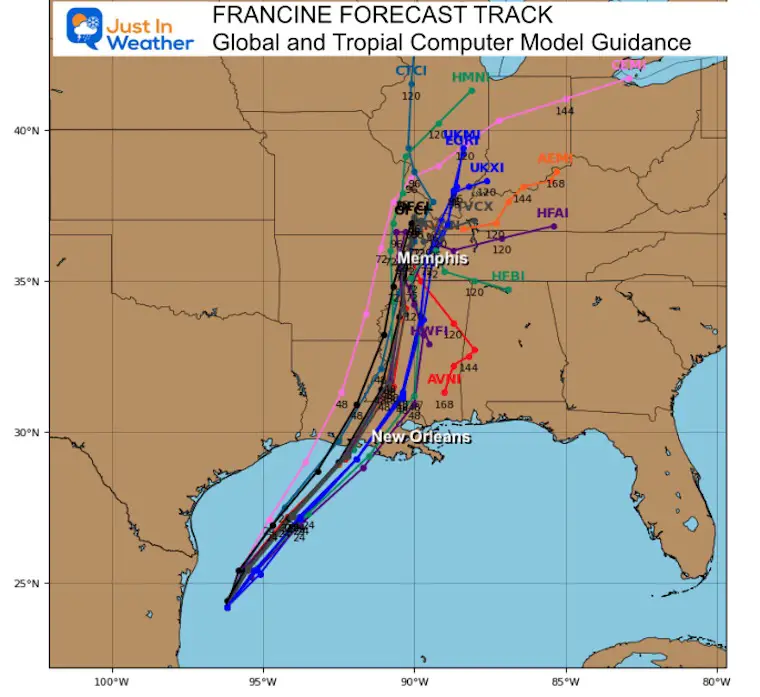
Warmer and quieter weather will dominate the week for us. The ridge building in (orange) will block the inland track of the tropical cyclone (blue).
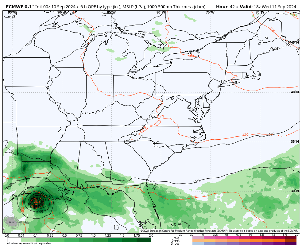
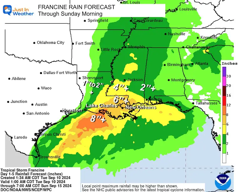
The inland impact from Francine as it gets downgraded will stay well west.
High Pressure will be locked in across the Northeast US, keeping us dry.
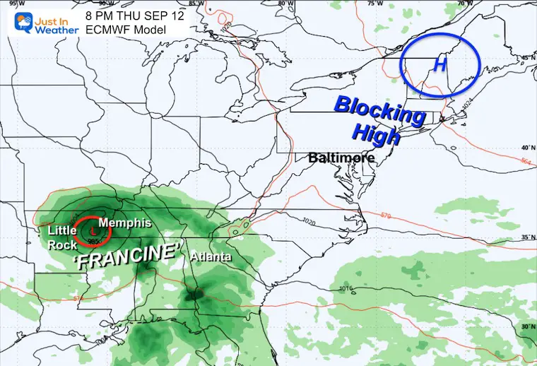
We will get NO Impact from Francine. High Pressure will be in control and the only chance will be the wind shift that may bring in more clouds for a few days.
If You Missed It
Click here to see: NOAA Released Its Most Aggressive Hurricane Season Forecast
The annual event: Hiking and biking 329 miles in 7 days between The Summit of Wisp to Ocean City.
Each day, we honor a kid and their family’s cancer journey.
Fundraising is for Just In Power Kids: Funding Free Holistic Programs. I never have and never will take a penny. It is all for our nonprofit to operate.
Click here or the image to donate:

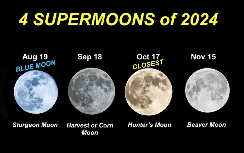
See more about the 4 Supermoons Through November here:
I am aware there are some spelling and grammar typos and occasional other glitches. I take responsibility for my mistakes and even the computer glitches I may miss. I have made a few public statements over the years, but if you are new here, you may have missed it: I have dyslexia and found out during my second year at Cornell University. It didn’t stop me from getting my meteorology degree and being the first to get the AMS CBM in the Baltimore/Washington region.
One of my professors told me that I had made it that far without knowing and to not let it be a crutch going forward. That was Mark Wysocki, and he was absolutely correct! I do miss my mistakes in my own proofreading. The autocorrect spell check on my computer sometimes does an injustice to make it worse. I also can make mistakes in forecasting. No one is perfect at predicting the future. All of the maps and information are accurate. The ‘wordy’ stuff can get sticky.
There has been no editor who can check my work while writing and to have it ready to send out in a newsworthy timeline. Barbara Werner is a member of the web team that helps me maintain this site. She has taken it upon herself to edit typos when she is available. That could be AFTER you read this. I accept this and perhaps proves what you read is really from me… It’s part of my charm. #FITF