Sunday June 30 2024
Our pattern of a day or two with really warm and humid days getting replaced by a cooler air mass is continuing. This Sunday was extra steamy as storms last night added humidity but did not cool us down. That is about to change, and the cold front moving through tonight will ignite more storms that may turn severe.
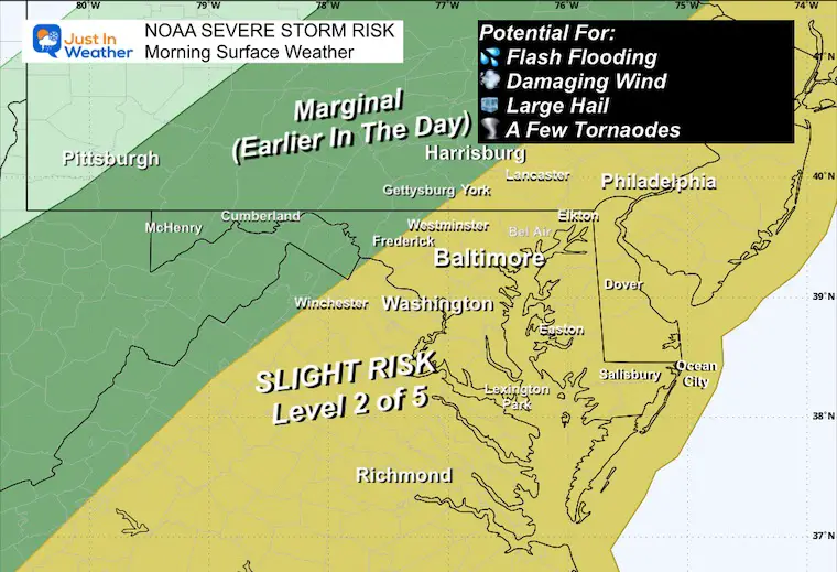
The set up has produced storms in Pennsylvania and parts of Maryland this afternoon. The atmospheric dynamics support the next line of storms to form SOUTH of Baltimore which may include Annapolis to Northern Delmarva and then affect all areas southward through midnight.
NOAA Severe Storm Risk
Storms this evening do have the chance to turn severe, but the intensity will speak around sunset, then weaken while remaining strong tonight after losing the daytime heating.
Storms may include:
- Flash Flooding
- Winds gusts over 58 mph
- Large Hail over 1” Diameter
- A Few Tornadoes
Note: Any storm may contain dangerous lightning
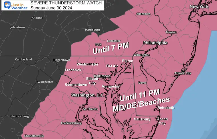
Severe Thunderstorm Watch
Note that it ends earlier at 7 PM in Pennsylvania while the energy moves south.
It ends at 11 PM in Maryland and Delaware and is likely to be cancelled from North to South sooner as the storms progress southward.
Alert Reminder
- A ‘WATCH’ may be issued if the ingredients become evident for a good chance of severe storms developing within six hours.
- A ‘WARNING’ will be issued only if a storm of this caliber is identified. This ‘warning’ will include tracking in a county and specific towns for the following 45 minutes.
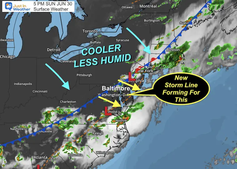
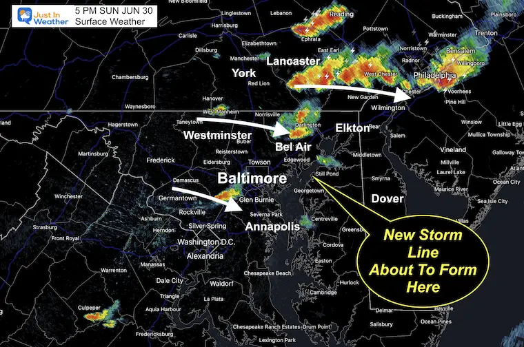
Surface Weather: Sunday at 5 PM
The cold front is well behind the line of storms but starting to move into central Maryland. The storm risk behind (north and west) is shutting down.
The prefrontal trough across the Chesapeake Bay and Delmarva will be the focal point for the energy this evening. This is where we can expect the flare-up of a new line of strong to severe storms.
COMPARE DOPPLER RADAR
TO MODEL FORECASTS
Initialization:
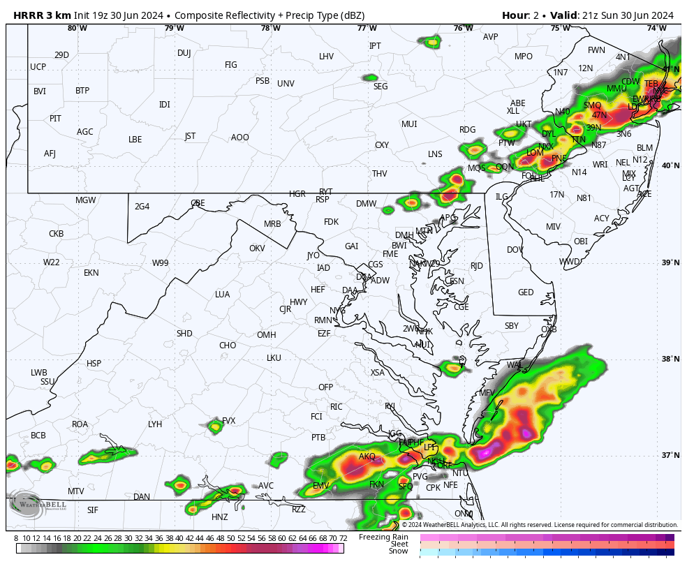
Doppler Radar at 5 PM
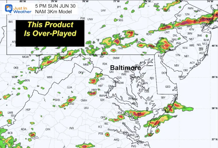
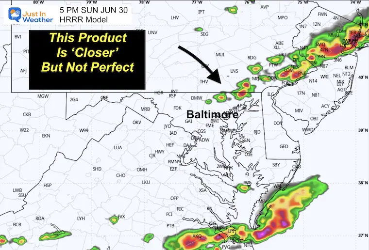
While writing this report, I chose 5 PM as an arbitrary time to compare what storms are displayed on the radar with what two short-range models had forecast for this time.
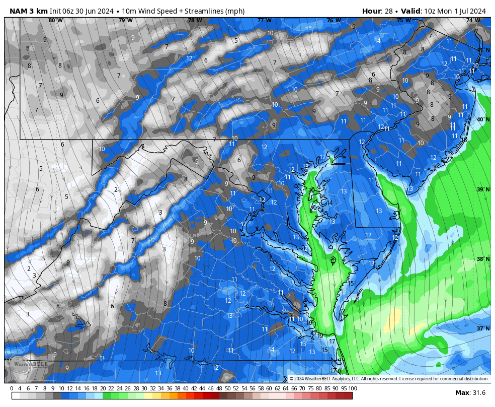
NAM 3 Km at 5 PM
This is overdone AND too slow/too far north, so I must ditch it today. This model had a much more active line in Southern Pennsylvania.
HRRR 3 Km Model at 5 PM
This is the best we have for now to use as a baseline for a timeline and location.This model product is closer to what we have seen but actually underplayed. There is more storm activity, and we can expect more than shown here through tonight.
Radar Simulation from 5 PM Sunday to 4 AM Monday
This is a SUGGESTION, not a promise. This product has recently been underplaying storms.
Also, allow a 1-hour buffer for the spread of timing in the maps below.
Snapshots
This is a SUGGESTION, not a promise. This product has recently been underplaying storms.
Also, allow a 1-hour buffer for the spread of timing in the maps below.
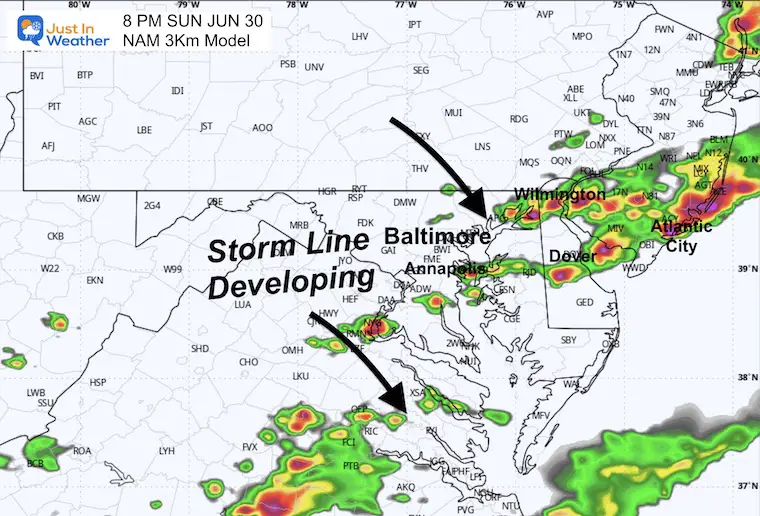
8 PM
Line forming near Annapolis through Wilmington, DE. This may affect I-95 traffic between Baltimore and Philadelphia.
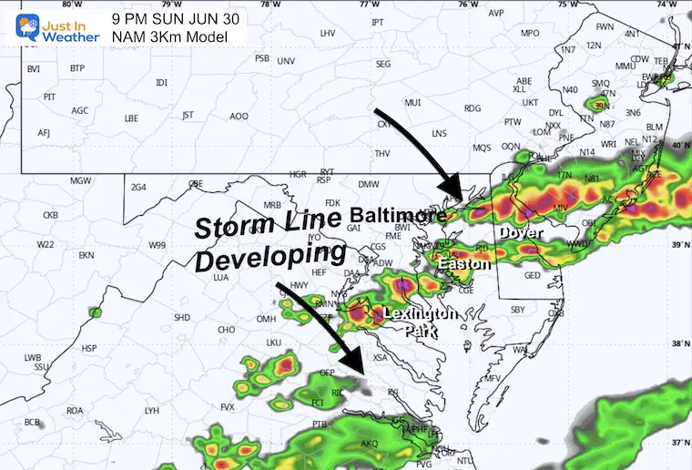
9 PM
Focus on Southern Maryland and Delmarva.
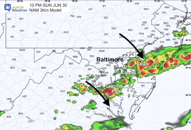
10 PM
Delaware may get ROCKED after sunset.
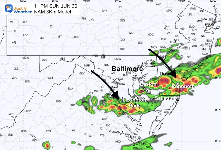
11 PM
Southern Maryland and the DE Beaches get the light show.
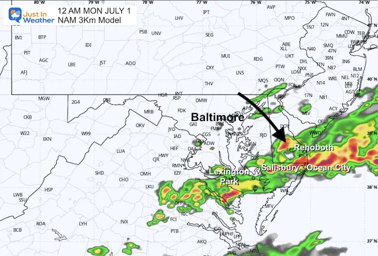
Midnight
Light show moves to Ocean City.
MONDAY WEATHER
A new air mass will bring in a strong breeze and lower humidity. In the afternoon, this may also produce a mix of clouds and sun.
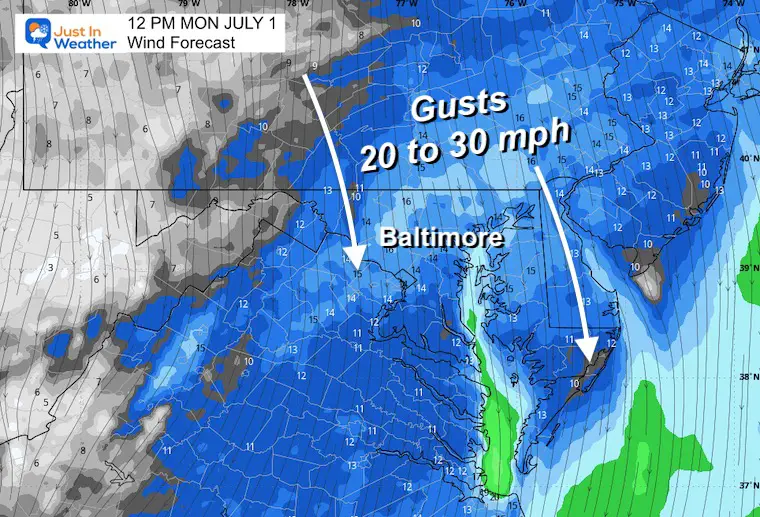
Wind Forecast 6 AM to Midnight
Wind Forecast Snapshot at Noon
Gusts FROM THE NORTH at 20 to 30 mph!
This will bring in cooler and less humid air.
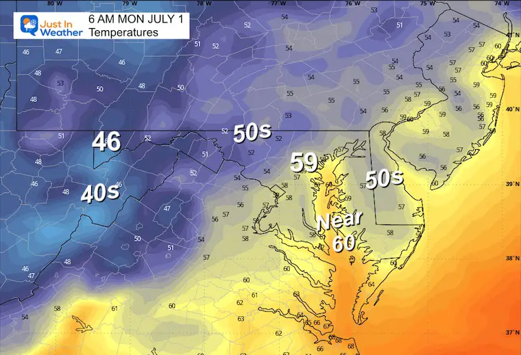
Morning Temperatures
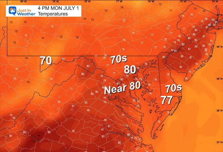
Afternoon Temperatures
Looking Ahead:
Wednesday Evening to Friday Evening
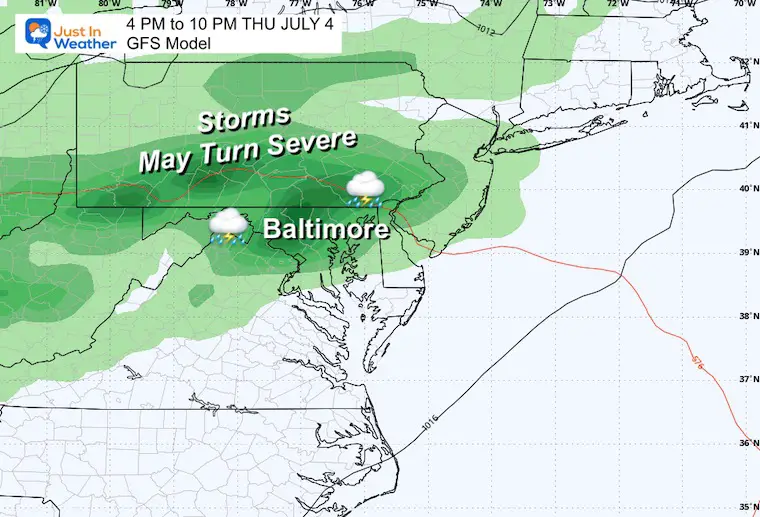
The next surge of heat, humidity, and storms will line up with Independence Day!
July 4th Evening
There is a chance for strong to severe evening storms. This is five days away, so it’s worth keeping in mind with a buffer. It might change, but you might want to allow for a change of plans.
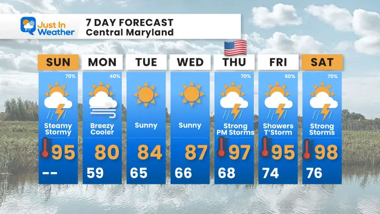
7 Day Forecast
After the stormy end to the weekend, the work week will start breezy, cooler, and less humid. The heat, humidity, and storms will climb back up for Independence Day!
If You Missed It: Click To See
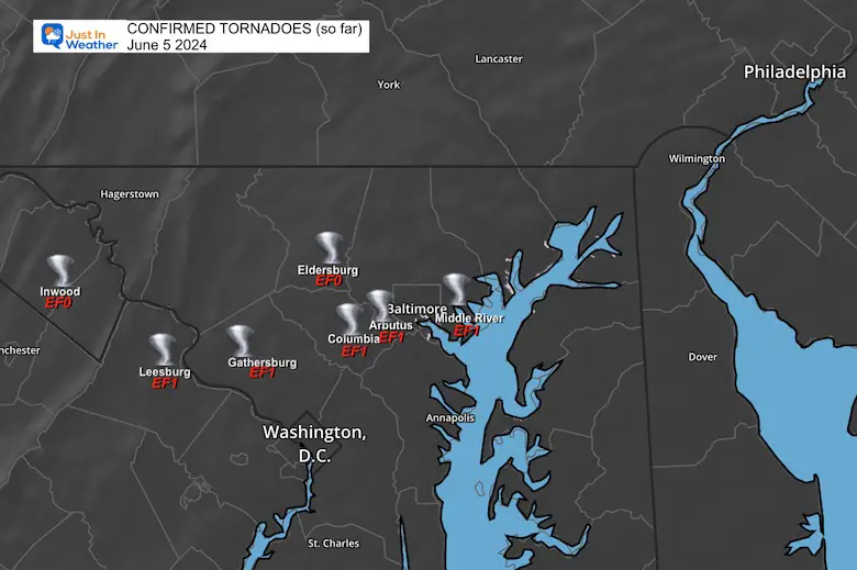
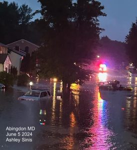
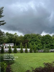
June 5 Storm Report (Preliminary) With Videos And Photos
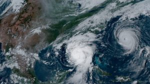
Hurricane Season Outlook
Click to read: NOAA Releases Most Aggressive Outlook
Please share your thoughts and best weather pics/videos, or just keep in touch via social media
RESTATING MY MESSAGE ABOUT DYSLEXIA
I am aware there are some spelling and grammar typos and occasional other glitches. I take responsibility for my mistakes and even the computer glitches I may miss. I have made a few public statements over the years, but if you are new here, you may have missed it: I have dyslexia and found out during my second year at Cornell University. It didn’t stop me from getting my meteorology degree and being the first to get the AMS CBM in the Baltimore/Washington region.
One of my professors told me that I had made it that far without knowing and to not let it be a crutch going forward. That was Mark Wysocki, and he was absolutely correct! I do miss my mistakes in my own proofreading. The autocorrect spell check on my computer sometimes does an injustice to make it worse. I also can make mistakes in forecasting. No one is perfect at predicting the future. All of the maps and information are accurate. The ‘wordy’ stuff can get sticky.
There has been no editor who can check my work while writing and to have it ready to send out in a newsworthy timeline. Barbara Werner is a member of the web team that helps me maintain this site. She has taken it upon herself to edit typos when she is available. That could be AFTER you read this. I accept this and perhaps proves what you read is really from me… It’s part of my charm. #FITF


