Thursday June 27
Morning Report
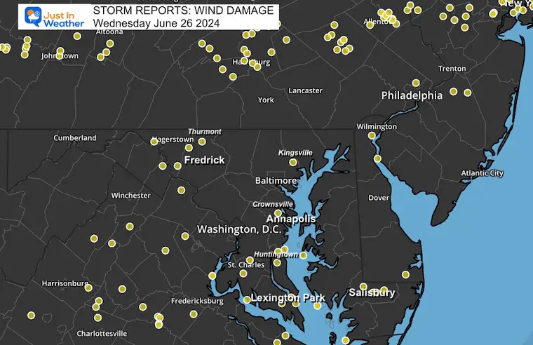
After tying the record high temperature in Baltimore yesterday, strong storms brought nearly 1/2 inch of rain on average to much of our region. Stronger storms did produce some damage.
Storm Reports From Wednesday
RECORD HIGH TIED YESTERDAY
Baltimore reached 99ºF at BWI
This tied the same mark set in 1952 AND 1954
Today
A new air mass is building in. Initially, the breeze will be noticeable, and the clouds will slowly clear from North to South. It may take until midday or afternoon in Southern Maryland and the beaches.
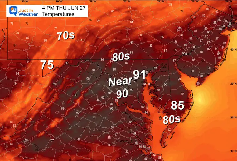
Lower humidity will be felt this afternoon, then a cooler day tomorrow.
This weekend, the heat and humidity will return. It will be accompanied by storms that may turn strong to severe again Saturday afternoon through Sunday.
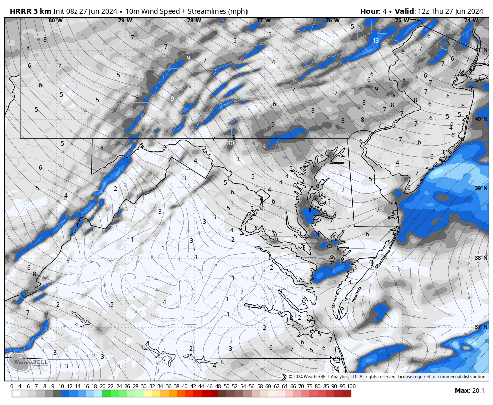
Morning Surface Weather
The cold front continues to move through the region, with leftover showers towards the beaches and clouds still holding inland.
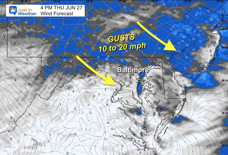
There will be gradual clearing as a breeze builds from the Northwest, and lower humidity will be felt this afternoon.
A push of cooler air will arrive from The Great Lakes tomorrow as High Pressure builds in.

Wind Forecast 8 AM to 8 PM
Afternoon Wind Snapshot
Afternoon Temperatures
CLIMATE DATA: Baltimore
TODAY June 27
Sunrise at 5:43 AM
Sunset at 8:37 PM
Normal Low in Baltimore: 66ºF
Record 50ºF in 1979
Normal High in Baltimore: 88ºF
Record 100ºF 2010
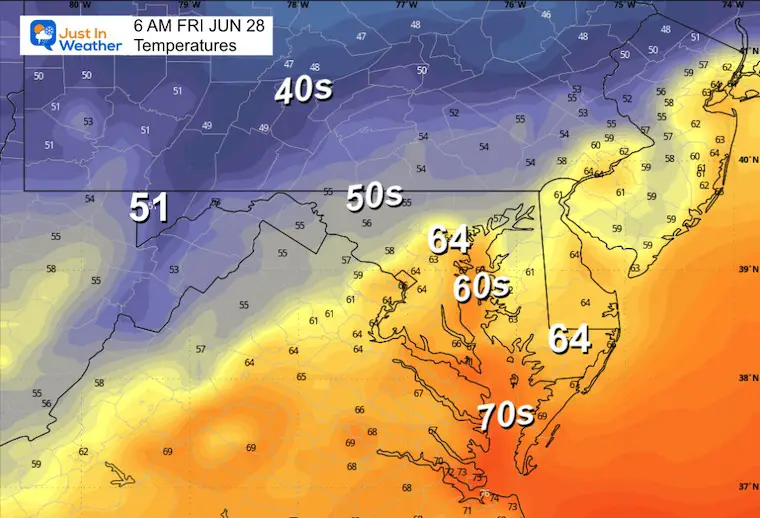
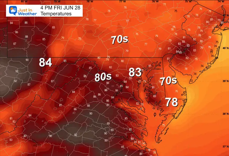
Friday
A much more comfortable day with cooler temperatures and lower humidity.
Morning Temperatures
Afternoon Temperatures
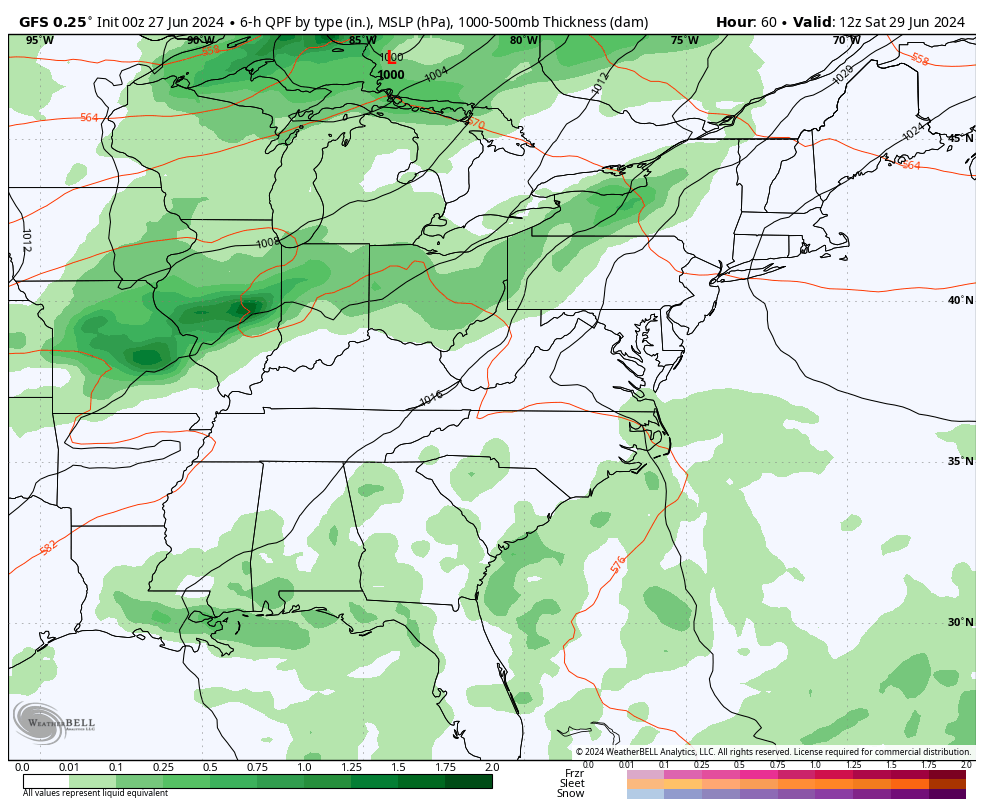
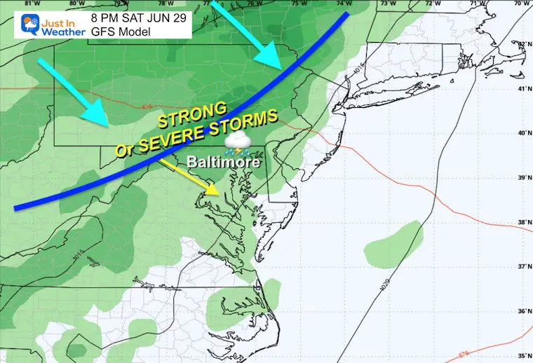
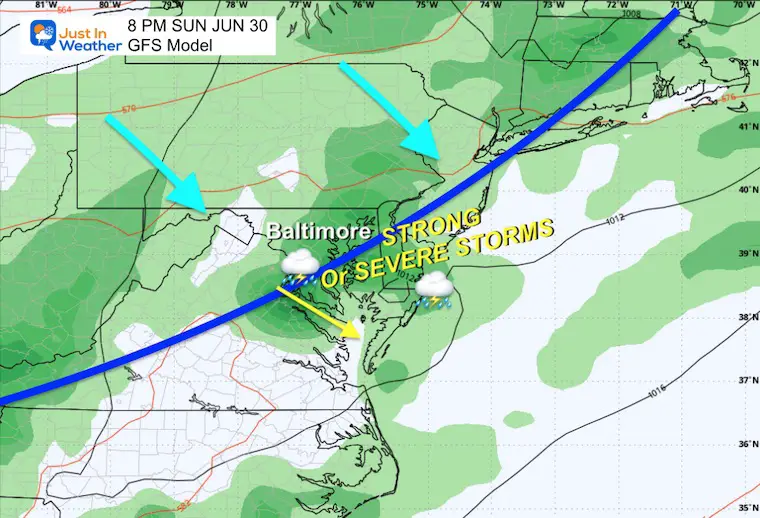
Looking Ahead Storm Forecast: Saturday Morning to Monday Evening
Saturday Evening
After a hot day, storms may be strong to severe in the late afternoon and at night.
Sunday Afternoon
A cooler day may limit the severe risk, but it may end up more cloudy and wet.
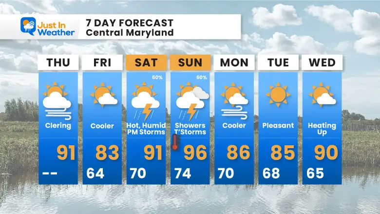
7 Day Forecast
The pattern will swing back the other way to heat and humidity, resulting in strong storms. It looks like Saturday will bring storms late afternoon and evening. On Sunday, there may be more throughout the day.
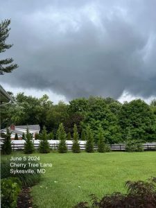
If You Missed It: Click To See
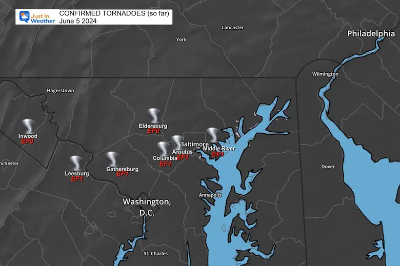
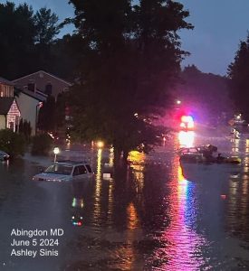
June 5 Storm Report (Preliminary) With Videos And Photos
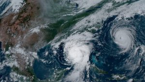
Hurricane Season Outlook
Click to read: NOAA Releases Most Aggressive Outlook
Please share your thoughts and best weather pics/videos, or just keep in touch via social media
RESTATING MY MESSAGE ABOUT DYSLEXIA
I am aware there are some spelling and grammar typos and occasional other glitches. I take responsibility for my mistakes and even the computer glitches I may miss. I have made a few public statements over the years, but if you are new here, you may have missed it: I have dyslexia and found out during my second year at Cornell University. It didn’t stop me from getting my meteorology degree and being the first to get the AMS CBM in the Baltimore/Washington region.
One of my professors told me that I had made it that far without knowing and to not let it be a crutch going forward. That was Mark Wysocki, and he was absolutely correct! I do miss my mistakes in my own proofreading. The autocorrect spell check on my computer sometimes does an injustice to make it worse. I also can make mistakes in forecasting. No one is perfect at predicting the future. All of the maps and information are accurate. The ‘wordy’ stuff can get sticky.
There has been no editor who can check my work while writing and to have it ready to send out in a newsworthy timeline. Barbara Werner is a member of the web team that helps me maintain this site. She has taken it upon herself to edit typos when she is available. That could be AFTER you read this. I accept this and perhaps proves what you read is really from me… It’s part of my charm. #FITF


