Wednesday, June 26
Morning Report
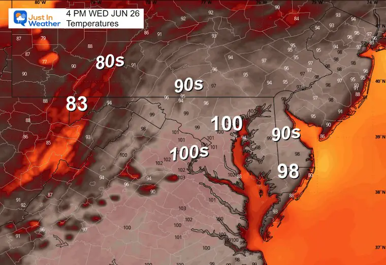
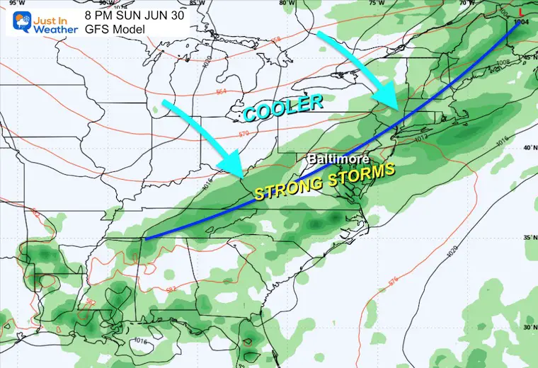
Here we go again with an oppressively hot day! Temperatures will approach 100ºF in metro areas around Baltimore and Central Maryland to Northern Virginia. With a strong cold front arriving tonight, storms that erupt this afternoon through tonight will have the potential to turn severe.
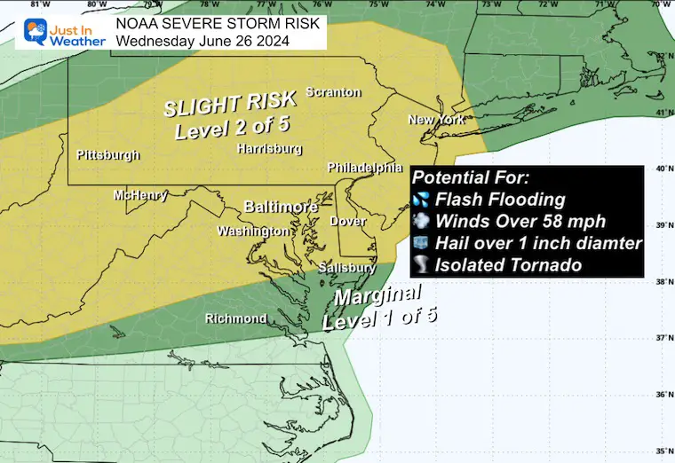
NOAA has issued a Severe Storm Risk for Wednesday afternoon, as storms may produce damaging wind, large hail, and even an isolated tornado. The one saving grace is that the bulk of the energy will arrive tonight, reducing the instability and lessening some of the energy.
Another brief break on Thursday and Friday, with more heat and strong storms over the weekend.
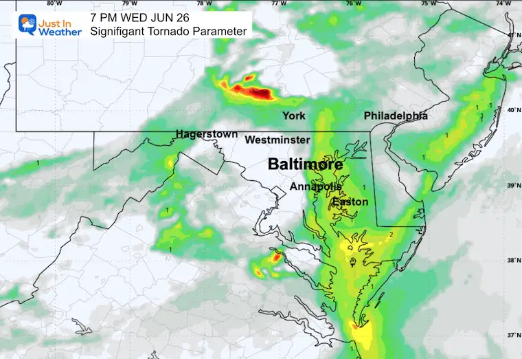
NOAA Severe Storm Risk
Potential for storms to produce flash flooding, winds of 58 mph, large hail up to 1 inch in diameter, and an isolated tornado.
Any storm can produce dangerous lightning!
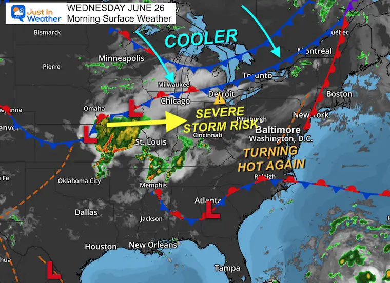
Morning Surface Weather
The heat is building in again with high humidity. This will feed the approaching cold front and energy from the Mid-West. It will arrive by this evening and into tonight with the potential for storms to turn severe.
Live Radar and Lightning Widget
High Temperatures
Heat Index Values may approach 105ºF.
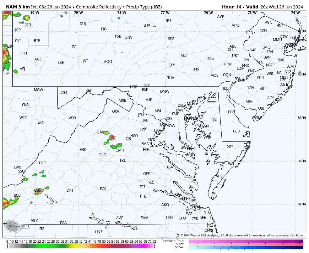
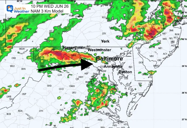
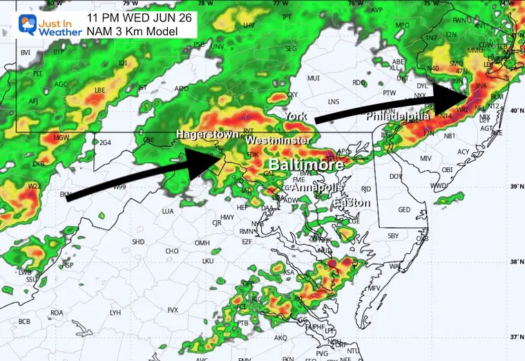
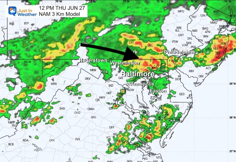
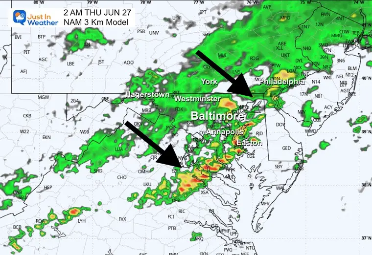
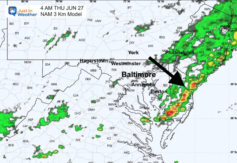
Radar Simulation: 4 PM Wed to 6 AM Thu
Snapshots:
7 PM
Significant Tornado Parameter
Highest potential for twisters with wind sheer, rising air, and other dynamic forces.
10 PM
11 PM
Midnight
2 AM
4 AM
CLIMATE DATA: Baltimore
TODAY June 26
Sunrise at 5:42 AM
Sunset at 8:37 PM
Normal Low in Baltimore: 66ºF
Record 52ºF in 1979; 1986
Normal High in Baltimore: 88ºF
Record 99ºF 1952; 1954
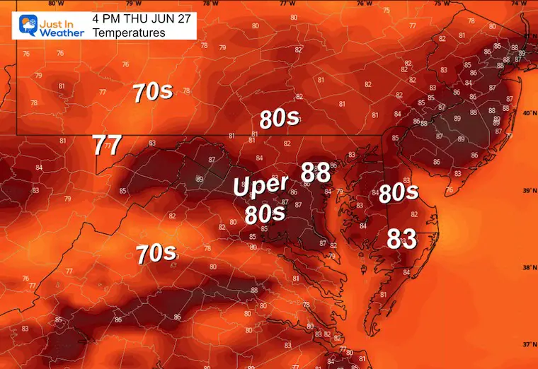
Thursday
After an early shower and leftover clouds, a wind shift from the North will bring in a cooler and less humid air mass.
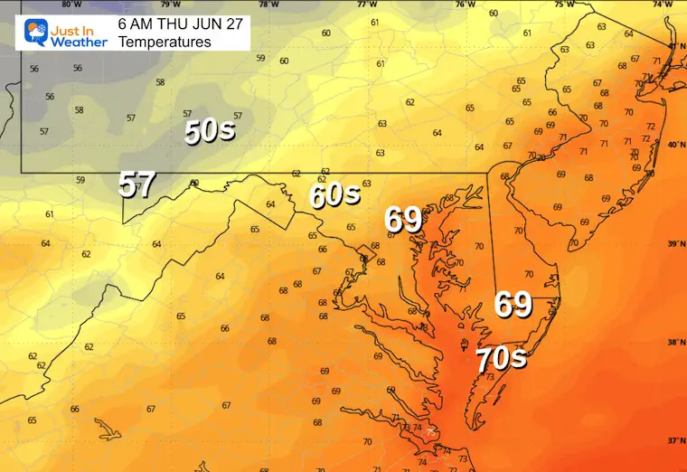
Morning Temperatures
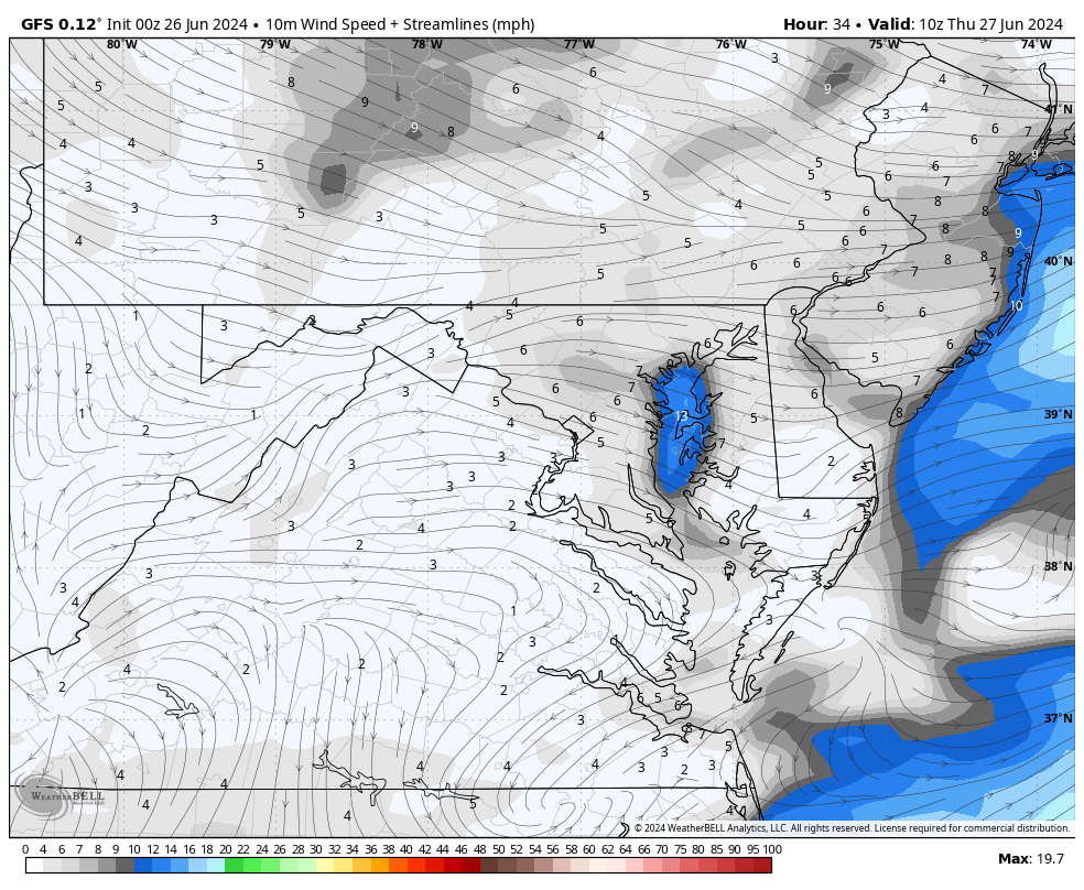
Wind Forecast: 6 AM to 4 PM
Afternoon Temperatures
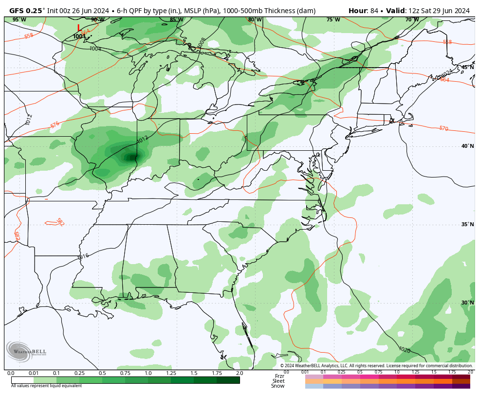
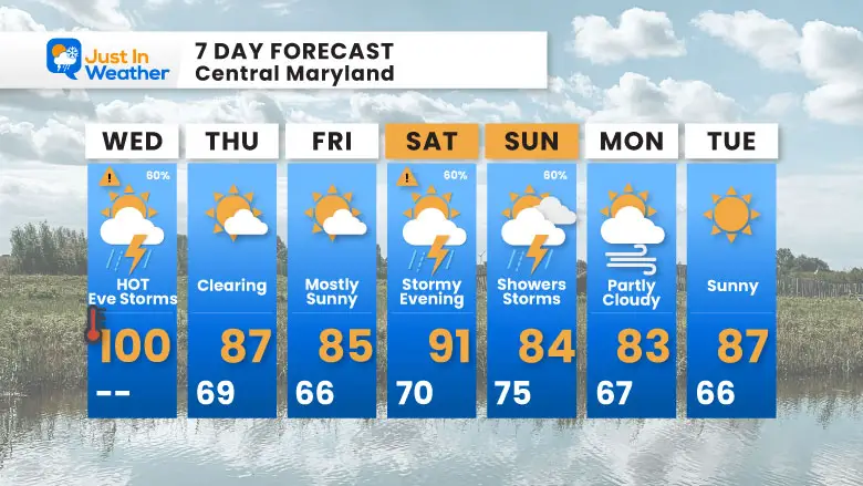
Looking Ahead Storm Forecast: Saturday to Monday
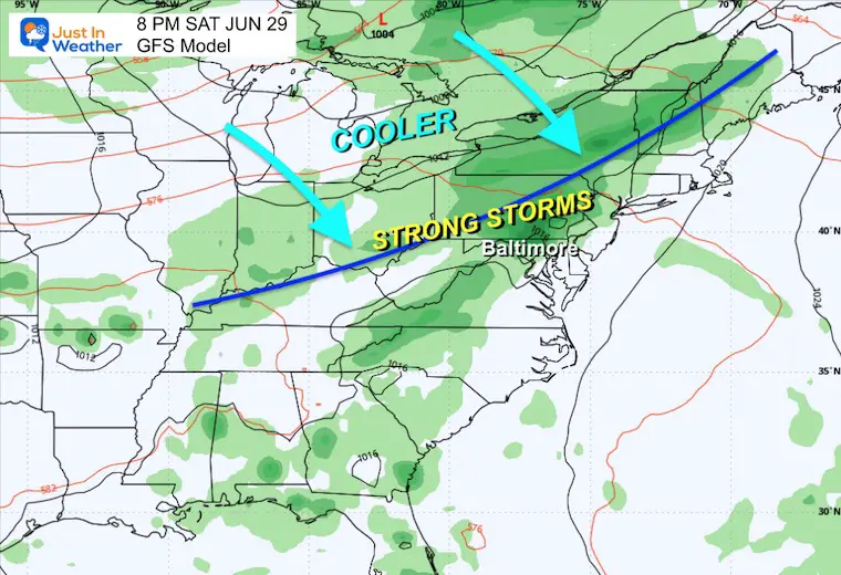
Saturday Evening
After a hot day, storms may be strong to severe in the evening and overnight.
Sunday Afternoon
A cooler day may limit the severe risk, but it may end up more cloudy and wet.
7 Day Forecast
Relief after the heat and storms today…
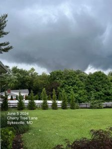
If You Missed It: Click To See
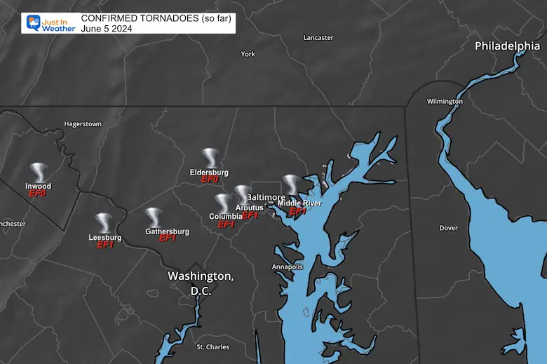
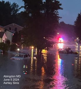
June 5 Storm Report (Preliminary) With Videos And Photos
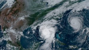
Hurricane Season Outlook
Click to read: NOAA Releases Most Aggressive Outlook
Please share your thoughts and best weather pics/videos, or just keep in touch via social media
RESTATING MY MESSAGE ABOUT DYSLEXIA
I am aware there are some spelling and grammar typos and occasional other glitches. I take responsibility for my mistakes and even the computer glitches I may miss. I have made a few public statements over the years, but if you are new here, you may have missed it: I have dyslexia and found out during my second year at Cornell University. It didn’t stop me from getting my meteorology degree and being the first to get the AMS CBM in the Baltimore/Washington region.
One of my professors told me that I had made it that far without knowing and to not let it be a crutch going forward. That was Mark Wysocki, and he was absolutely correct! I do miss my mistakes in my own proofreading. The autocorrect spell check on my computer sometimes does an injustice to make it worse. I also can make mistakes in forecasting. No one is perfect at predicting the future. All of the maps and information are accurate. The ‘wordy’ stuff can get sticky.
There has been no editor who can check my work while writing and to have it ready to send out in a newsworthy timeline. Barbara Werner is a member of the web team that helps me maintain this site. She has taken it upon herself to edit typos when she is available. That could be AFTER you read this. I accept this and perhaps proves what you read is really from me… It’s part of my charm. #FITF


