


January 16 A Chance For Light Snow This Weekend In Different Parts Of Our Region Each Day
Friday January 16 There is a lot to talk about this morning in all directions. The deep freeze has reached Florida, with parts of it in the 20s and snow…
Sunday, June 23
Morning Report
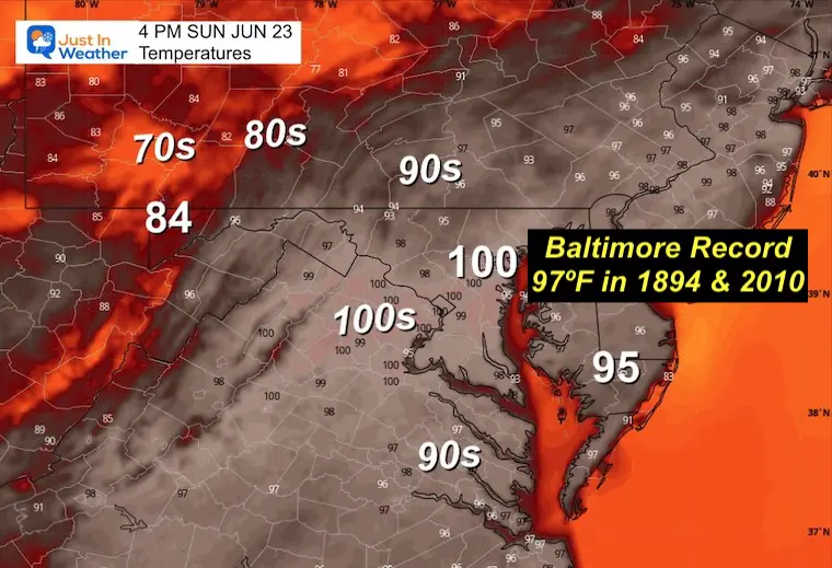
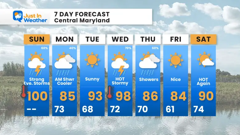
This heat wave has lived up to expectations. On Saturday, a new record was set at Baltimore’s BWI airport when a temperature of 101ºF was reached. The high temperature is expected to possibly reach 100ºF again today, which would break another record.
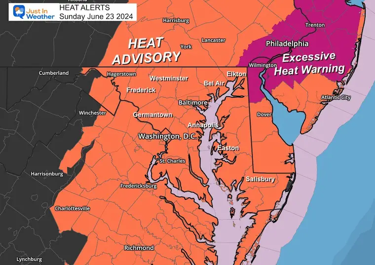
When including the high humidity, the Heat Index will again push 105ºF to 110ºF, making it uncomfortable and dangerous to be outside. It may be no surprise that another Heat Advisory has been issued.
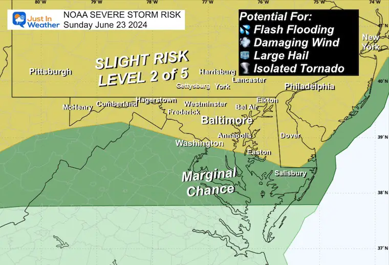
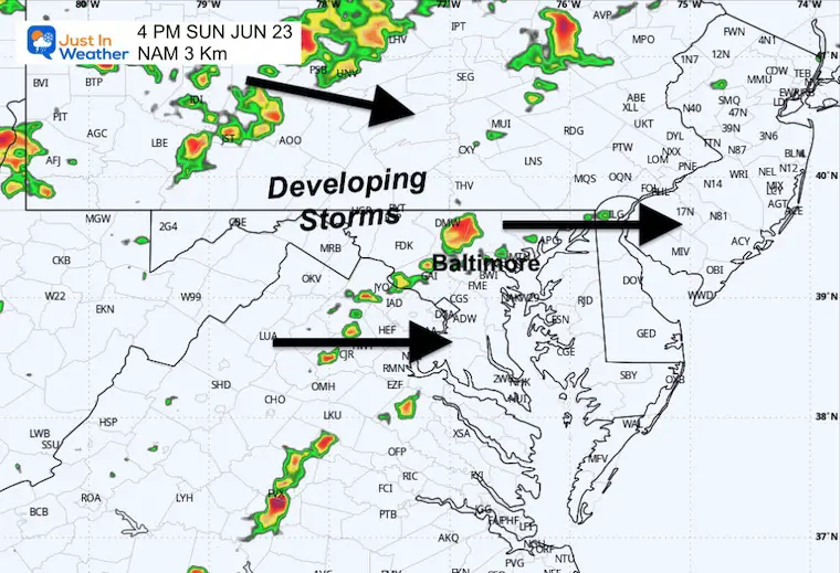
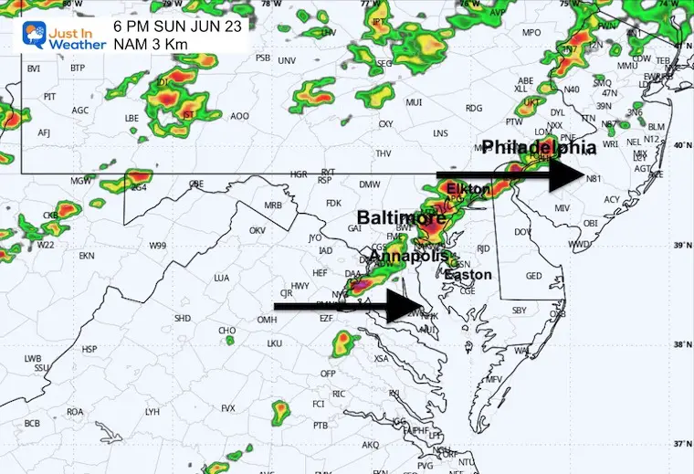
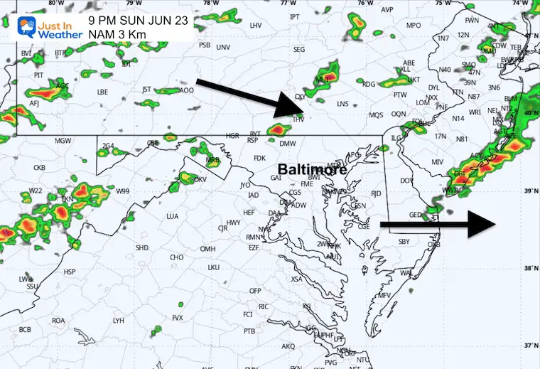
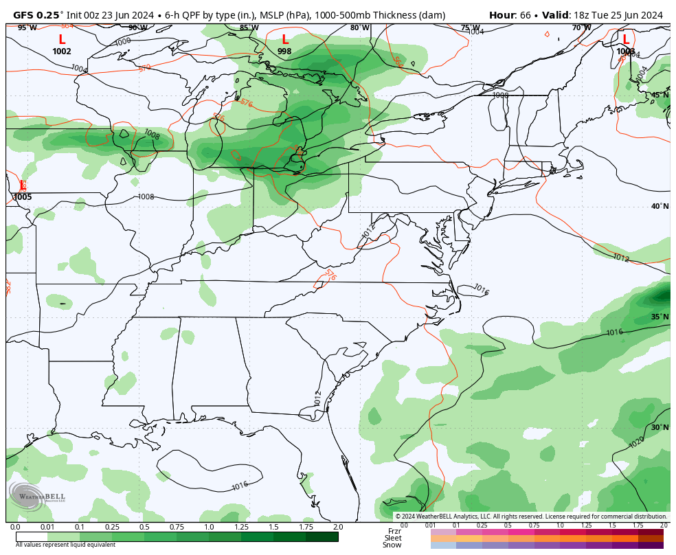
Strong to severe thunderstorms (Slight Risk) may develop after 3 PM as a cold front arrives and interacts with the high heat and humidity.
A very good chance to break another record high. The Heat Index will feel like 105ºF to 110ºF.
Baltimore Record High: Sunday, June 23 = 97ºF set in 1894 and 2010.
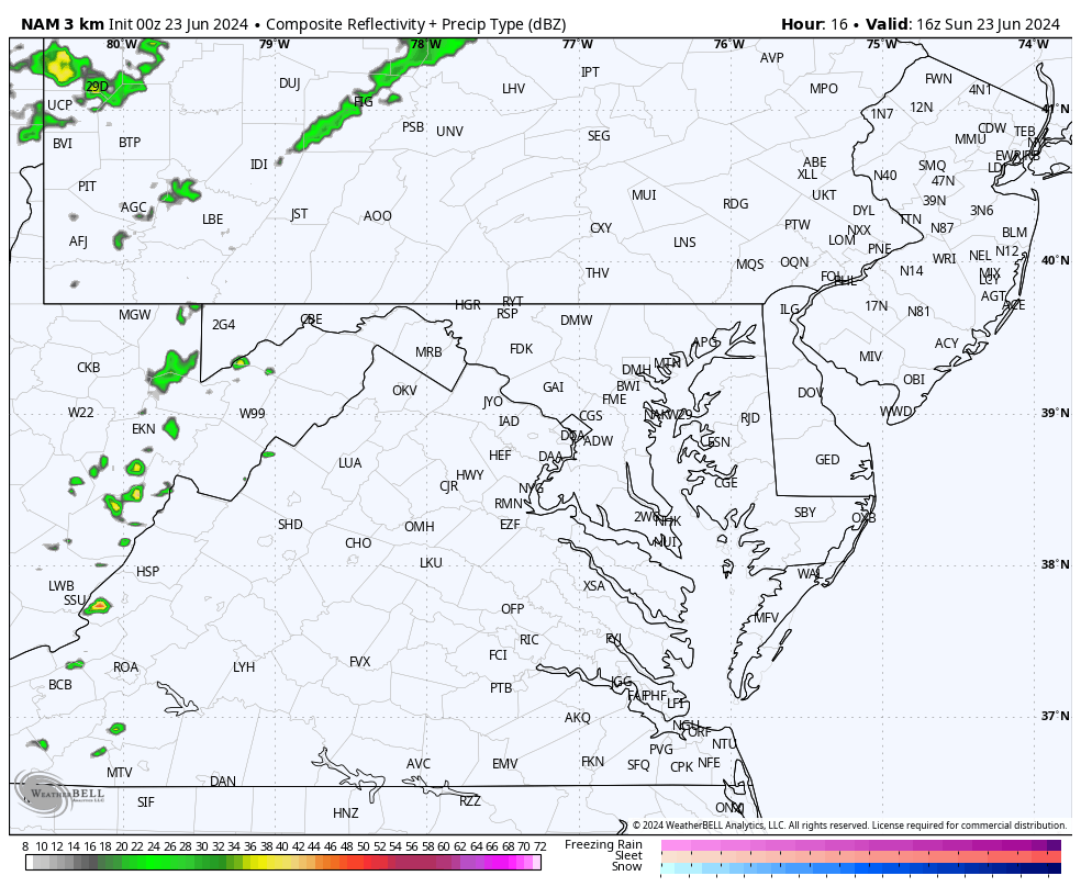
This ‘Slight Risk’ is level 2 of 5 and includes Southern Pennsylvania to Central Maryland and parts of Delmarva. Storms have the potential to produce:
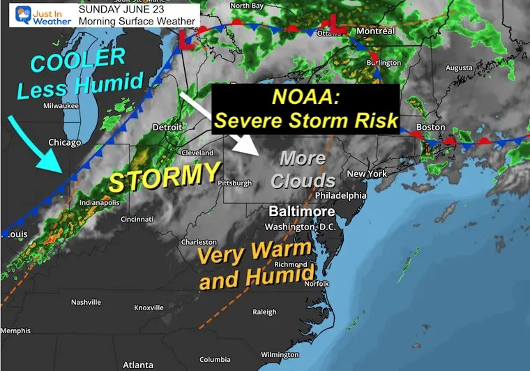
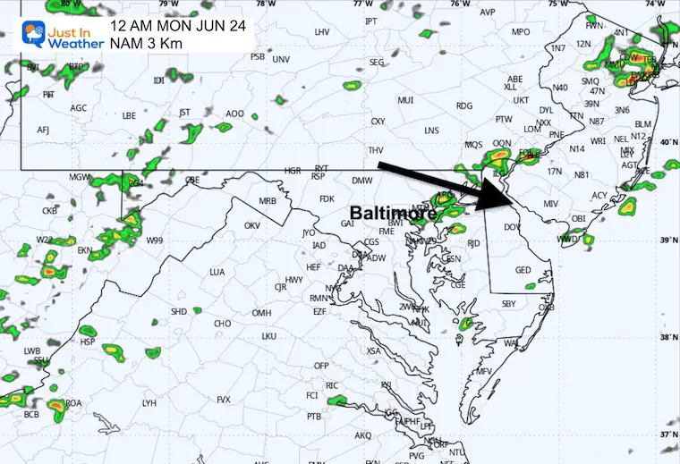
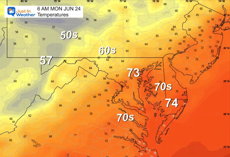
While still warm and humid, there are more clouds around this morning. The main event will be the strong cold front that will arrive later today and ignite some strong to severe storms.
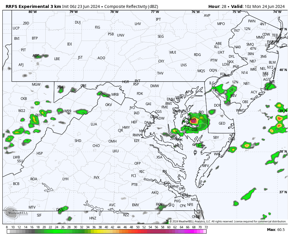
I am showing a wider view to track the progress. We can expect more local activity to pop up after 3 PM. See the short-range modeling ‘suggestion’ below.
The humidity will be more noticeable, making it feel like 100ºF or hotter.
Sunrise at 5:41 AM
Sunset at 8:37 PM
Normal Low in Baltimore: 65ºF
Record 48ºF in 1992
Normal High in Baltimore: 87ºF
Record 97ºF 1894
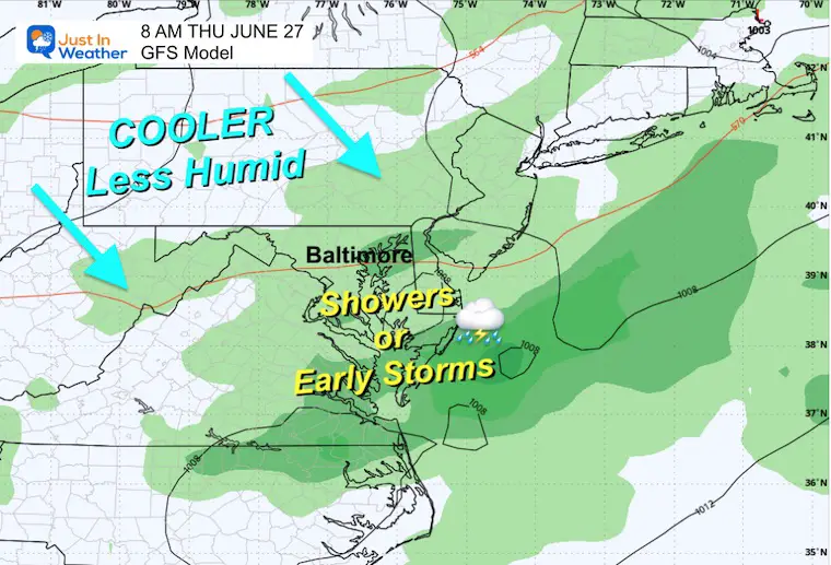
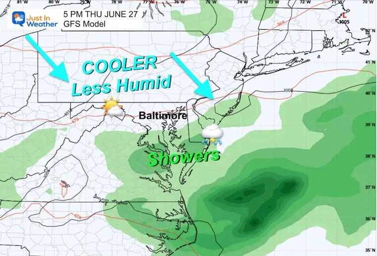
A break from the heat as morning showers and clouds may linger.
Morning showers across Lower Delmarva…
Then some pop-up showers in the afternoon and evening. But they will be isolated.
A round of strong to severe storms can be expected to arrive later on Wednesday as the next cold front bumps up the heat and humidity again.
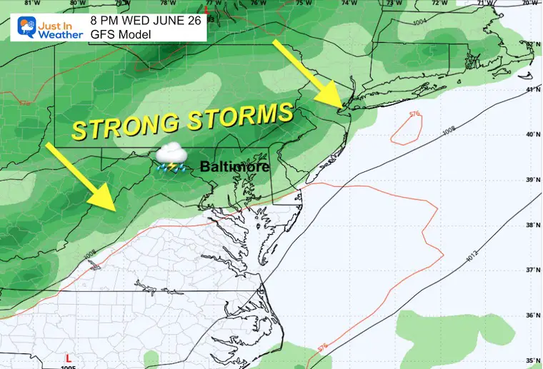
The heat will break briefly today, with a noticeably cooler day on Monday. Then, it will be back in the 90s and humid by midweek. The next round of storms may be severe on Wednesday as the next push of cooler air arrives.
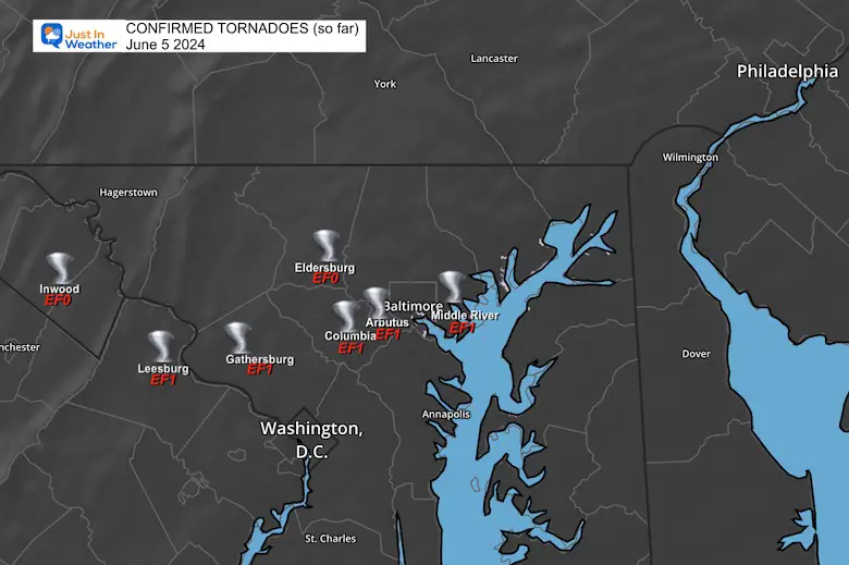
June 5 Storm Report (Preliminary) With Videos And Photos


Click to read: NOAA Releases Most Aggressive Outlook

I am aware there are some spelling and grammar typos and occasional other glitches. I take responsibility for my mistakes and even the computer glitches I may miss. I have made a few public statements over the years, but if you are new here, you may have missed it: I have dyslexia and found out during my second year at Cornell University. It didn’t stop me from getting my meteorology degree and being the first to get the AMS CBM in the Baltimore/Washington region.
One of my professors told me that I had made it that far without knowing and to not let it be a crutch going forward. That was Mark Wysocki, and he was absolutely correct! I do miss my mistakes in my own proofreading. The autocorrect spell check on my computer sometimes does an injustice to make it worse. I also can make mistakes in forecasting. No one is perfect at predicting the future. All of the maps and information are accurate. The ‘wordy’ stuff can get sticky.
There has been no editor who can check my work while writing and to have it ready to send out in a newsworthy timeline. Barbara Werner is a member of the web team that helps me maintain this site. She has taken it upon herself to edit typos when she is available. That could be AFTER you read this. I accept this and perhaps proves what you read is really from me… It’s part of my charm. #FITF