Tuesday June 18
Morning Report
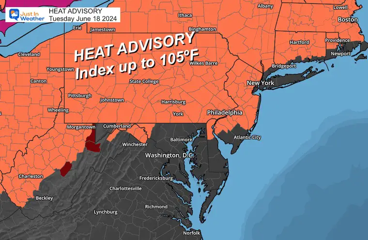
There continues to be a lot of talk about the Heat Dome and the Heat Wave this week. In reality, our region is just on the edge, and the irony is that it may be warmer north and west of Baltimore in the higher elevations. This will be due to the saving influence of some cooling winds from the Chesapeake Bay and Atlantic.
A Heat Advisory is in place in these areas and NOT in Central Maryland. That may change later in the week and weekend as the Ridge/Heat Dome shifts and takes full control.
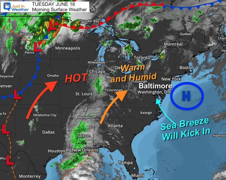
Morning Surface Weather
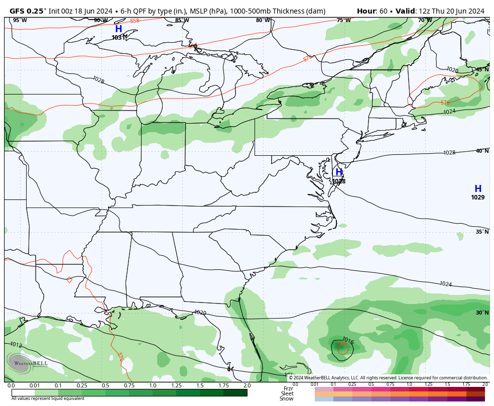
High Pressure off the East Coast is the main reason for this Heat Wave.. but there are subtle waves in the atmosphere.
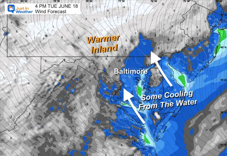
The area near the Chesapeake Bay and Atlantic Ocean will get a breeze off the water to keep temps in check.
Inland there is a corridor of clouds and showers in the Lower Mississippi River Valley to the Great Lakes.
The main storm track is still locked across the Northern Plains.
Heat Advisory
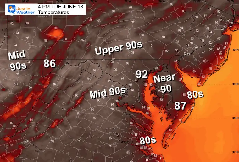
Afternoon Temperatures
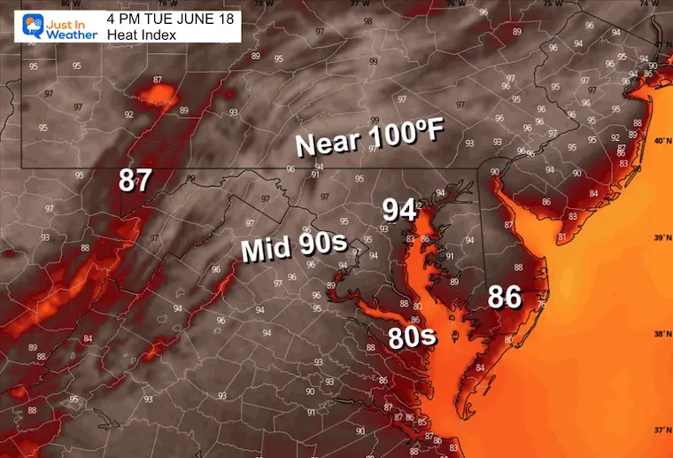
Heat Index
What it feels like when calculating the humidity. This is because it limits your body’s ability to cool off from evaporating sweat.
Wind Forecast
The airflow from the Atlantic and the Chesapeake Bay will provide a sea breeze cooling effect nearby.
CLIMATE DATA: Baltimore
TODAY June 18
Sunrise at 5:40 AM
Sunset at 8:36 PM
Normal Low in Baltimore: 64ºF
Record 48ºF in 1959
Normal High in Baltimore: 85ºF
Record 97ºF 1944
Wednesday
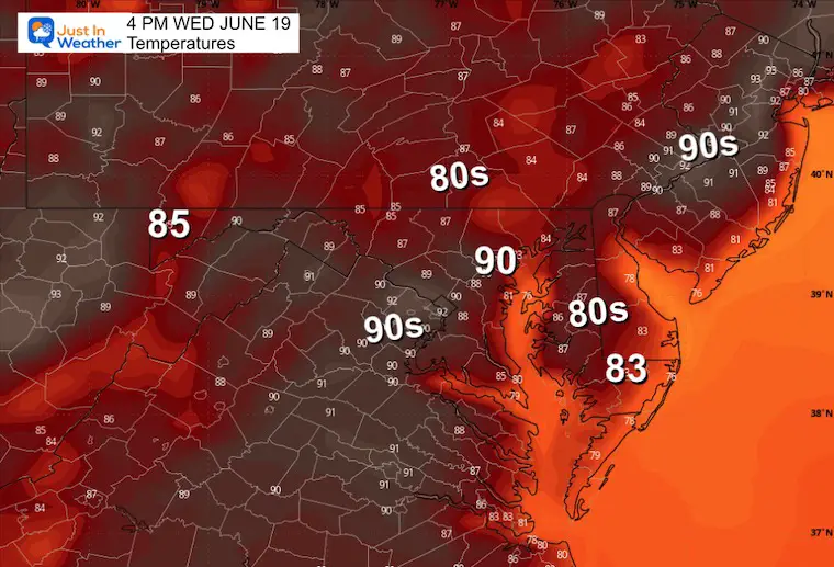
Still hot but not under the full effect of the Heat Dome yet.
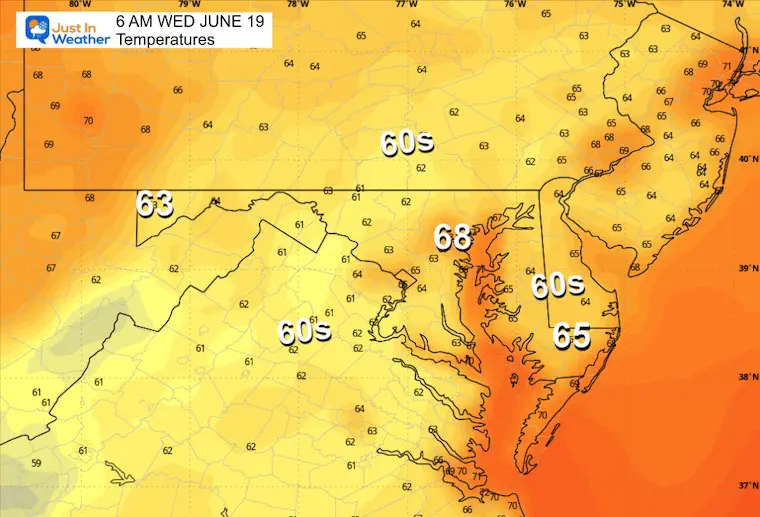
Morning Temperatures
Afternoon Temperatures
Looking Ahead:
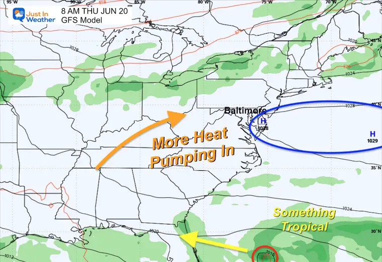
Thursday Surface Weather
As High-Pressure parks off the East Coast and locks in that Heat Wave/Heat Dome, rain and storms will ride around the periphery. This may include ‘something tropical’ riding under the ridge into Florida. This will eventually break down and allow the storms to occur later in the weekend.
Storm Forecast Animation: Thursday to Monday
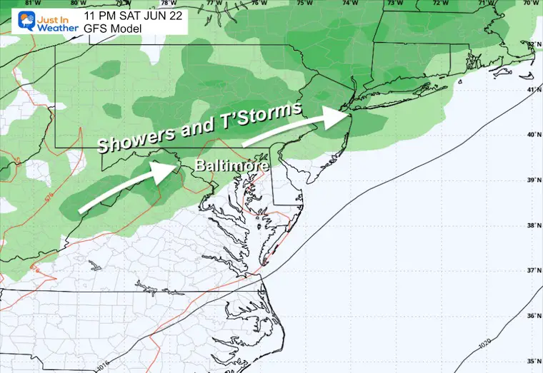
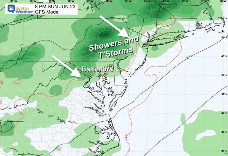
High Pressure off the East Coast will gradually break down and let more moisture shift. The better chance for showers and thunderstorms will be in metro areas later Saturday and Sunday.
Snapshots
Saturday Night
Sunday Night
Notable early dates for 100ºF in Baltimore
- June 20, 1931
- June 21, 2012
- June 22, 1988
- June 24, 2010
- June 27, 2010
- June 29, 1934 = 105ºF HOTTEST MONTHLY RECORD
- June 30, 1959
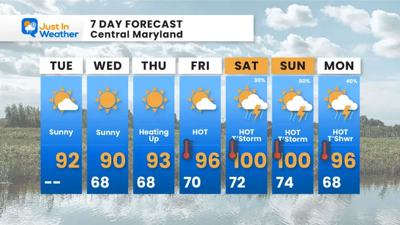
7 Day Forecast
The true heat will surge in by the weekend. This will include higher humidity and the likelihood of late-day showers and thunderstorms.
If You Missed It: Click To See
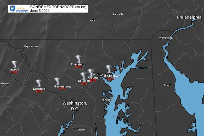
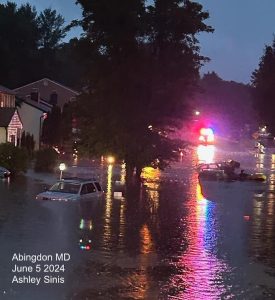
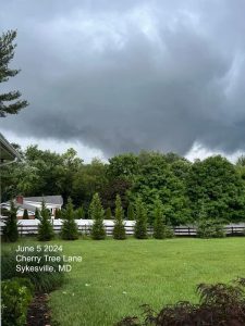
June 5 Storm Report (Preliminary) With Videos And Photos
Hurricane Season Outlook
Click to read: NOAA Releases Most Aggressive Outlook

Please share your thoughts and best weather pics/videos, or just keep in touch via social media
RESTATING MY MESSAGE ABOUT DYSLEXIA
I am aware there are some spelling and grammar typos and occasional other glitches. I take responsibility for my mistakes and even the computer glitches I may miss. I have made a few public statements over the years, but if you are new here, you may have missed it: I have dyslexia and found out during my second year at Cornell University. It didn’t stop me from getting my meteorology degree and being the first to get the AMS CBM in the Baltimore/Washington region.
One of my professors told me that I had made it that far without knowing and to not let it be a crutch going forward. That was Mark Wysocki, and he was absolutely correct! I do miss my mistakes in my own proofreading. The autocorrect spell check on my computer sometimes does an injustice to make it worse. I also can make mistakes in forecasting. No one is perfect at predicting the future. All of the maps and information are accurate. The ‘wordy’ stuff can get sticky.
There has been no editor who can check my work while writing and to have it ready to send out in a newsworthy timeline. Barbara Werner is a member of the web team that helps me maintain this site. She has taken it upon herself to edit typos when she is available. That could be AFTER you read this. I accept this and perhaps proves what you read is really from me… It’s part of my charm. #FITF


