Friday June 14, 2024
Afternoon Update
A strong cold front is about to push into the warm and humid air mass in place. This will set us up for a nice weather weekend, and then a true heat wave will follow next week.
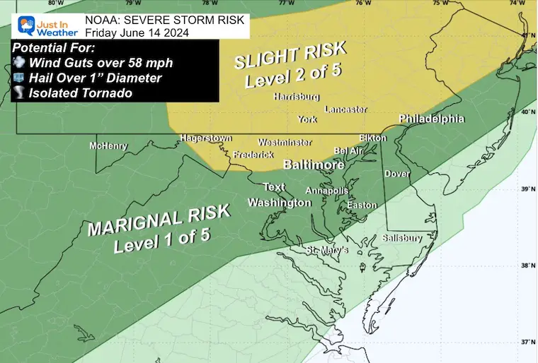
The focus this afternoon and evening is the risk of severe storms. NOAA posted a Slight Risk (Level 2 of 5) for today near and north of Baltimore into southern Pennsylvania. Considering the high travel to the beach or mountains for the weekend getaway, some may get caught in additional traffic due to passing storms.
I have been checking the dynamics in place and the latest model simulation plots, and found the best suggestions for the storm timeline compared to the Live Radar and Lightning Widget below.
Alert Review
As of this post before 4 PM, No Watches had been issued for our region. But that might change. If so…
If any severe weather is anticipated, one of the two following alerts may be issued:
- Watch: This means it MAY HAPPEN! It will last 4 to 6 hours and cover many counties.
- Warning: This means IT IS HAPPENING NOW: This will usually cover 45 minutes and list specific towns in the path and counties impacted.
NOAA Severe Storm Risk
The Slight Risk is Level 2 of 5, mainly near and north of Baltimore into Pennsylvania.
Potential for: Winds over 58 mph, large hail over 1-inch diameter, isolated tornados.
Afternoon Set Up
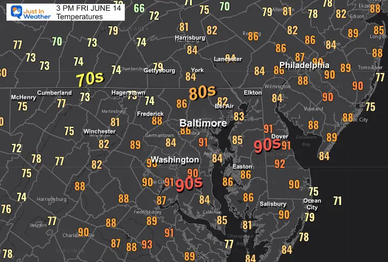
Temperatures
This clearly shows that the rain has already chilled the air into the 70s, while the deep 80s and 90s remain in central Maryland.
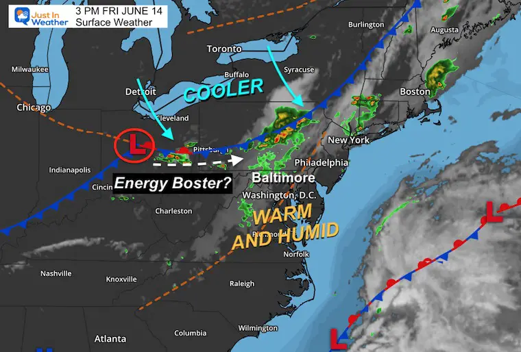
Surface Weather
The strong cold front is moving through Pennsylvania and will cross Maryland tonight. The energy is mainly in Pennsylvania, and Low Pressure may ignite more energy into the evening.
The other components are the higher temperatures and humidity farther south. So, as this travels into Maryland, it will encounter that, but the loss of sunlight and daytime heating may limit the impact while it could still be strong between Annapolis, Easton, and Salisbury, MD.
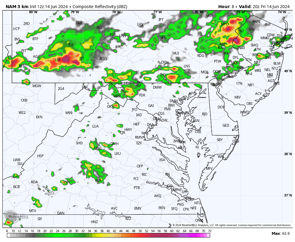
Live Radar and Lightning
Compare to modeling
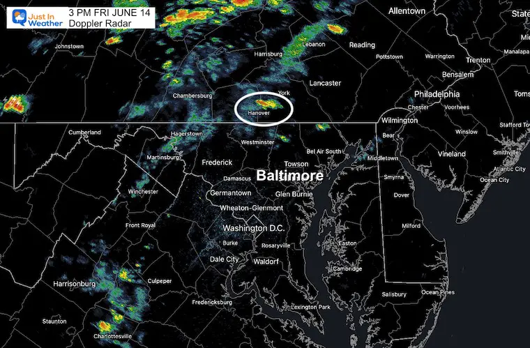
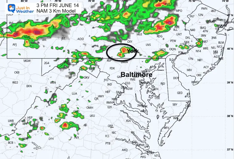
3 PM Doppler Radar
I focused on that shower in York Couty, PA.
3 PM Forecast: NAM 3 Km
The same shower appeared on this model, while other short-range products missed it.
This model has performed well, but as we can see, it has been underestimating the storm activity. So, going forward, it will likely be more active than shown here.
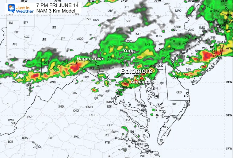
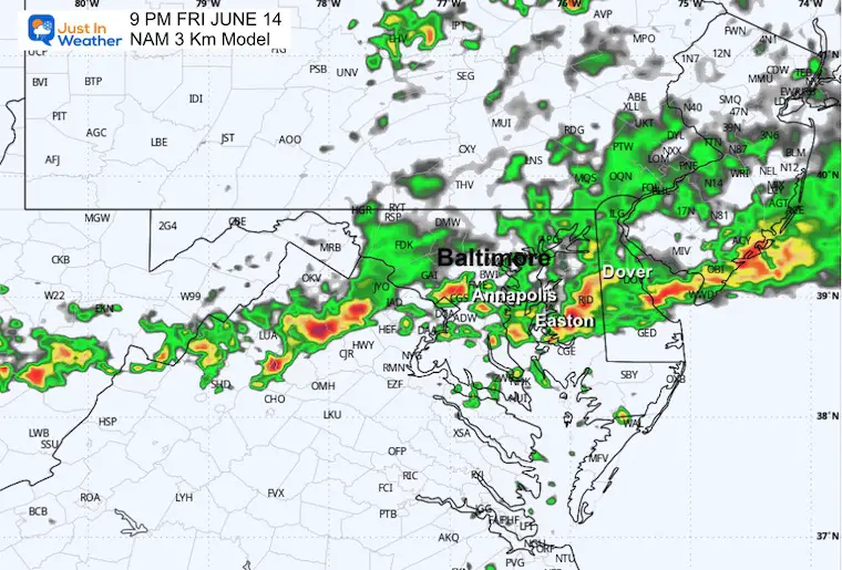
Forecast Animation 4 PM to Midnight
Note that this is a suggestion. In recent weeks we have had more activity, which has arrived a little faster than shown on this product. So please allow a 30 to 60-minute buffer.
7 PM Snapshot (SUGGESTION)
South of Hagerstown and near or just south of Baltimore to Annapolis.
9 PM Snapshot (SUGGESTION)
Possibly still active around the Bay Bridge between Annapolis and along Rt 50 to Easton.
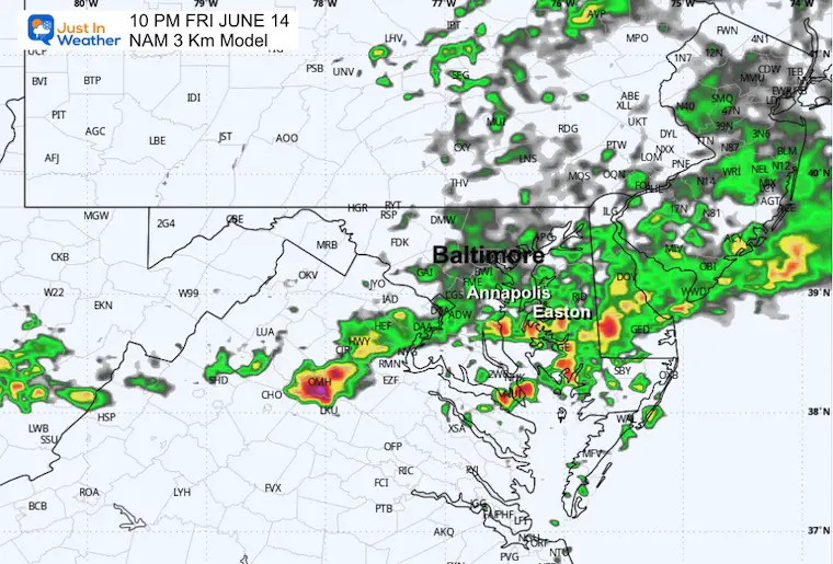
10 PM Snapshot (SUGGESTION)
Southern Maryland to near Easton, St. Michaels, and Cambridge.. into Southern Delaware.
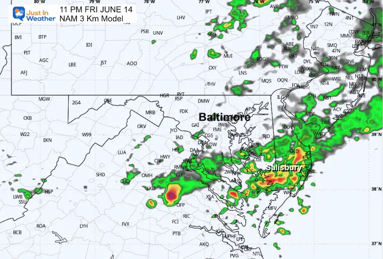
11 PM Snapshot (SUGGESTION)
Eastern Shore near Salisbury and the beaches.
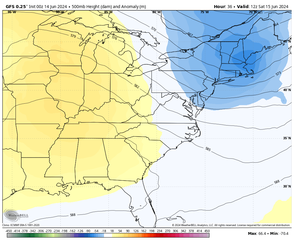
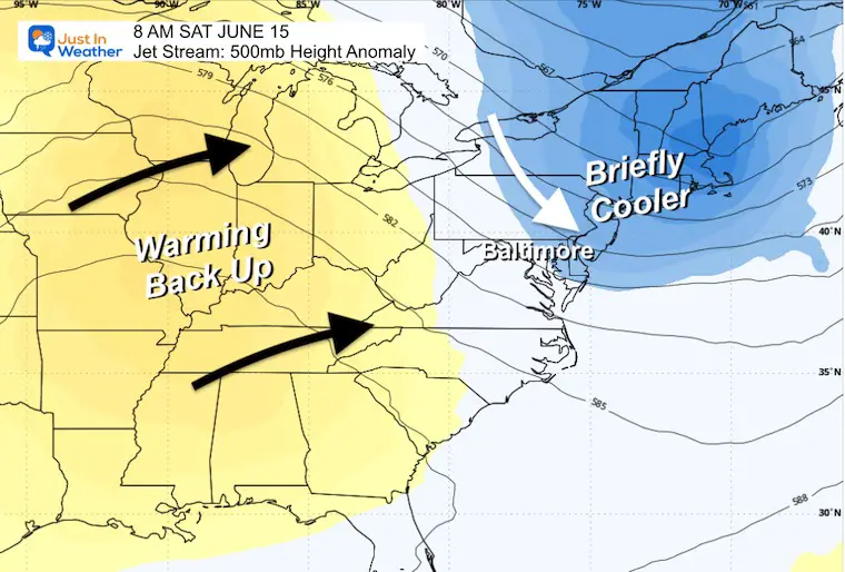
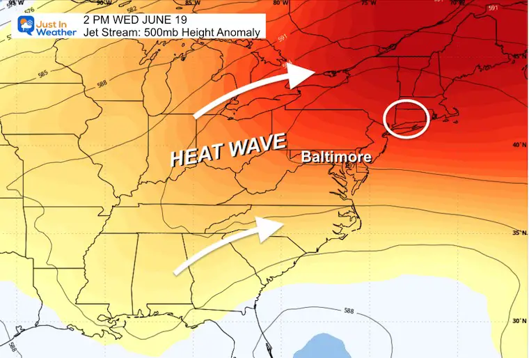
Looking Ahead: Jet Stream Next Week
Friday to Wednesday
Snapshots
Saturday Morning
Briefly cooler and pleasant this weekend.
Wednesday Afternoon
Likely pushing into the mid-90s and lasting for a few days. This may be our first legitimate heat wave of the year.
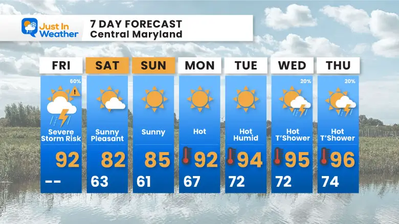
7 Day Forecast
After a pleasant weekend, our first heat wave of the year is expected next week. The risk of rain will be low.
If You Missed It: Click To See
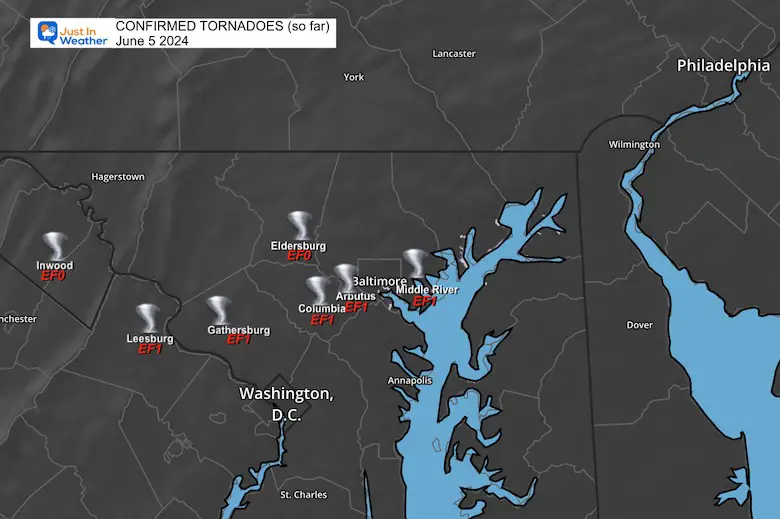
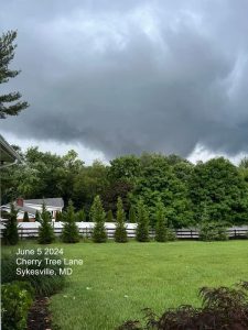
June 5 Storm Report (Preliminary) With Videos And Photos
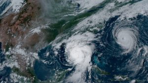
Hurricane Season Outlook
Click to read: NOAA Releases Most Aggressive Outlook
Please share your thoughts and best weather pics/videos, or just keep in touch via social media
RESTATING MY MESSAGE ABOUT DYSLEXIA
I am aware there are some spelling and grammar typos and occasional other glitches. I take responsibility for my mistakes and even the computer glitches I may miss. I have made a few public statements over the years, but if you are new here, you may have missed it: I have dyslexia and found out during my second year at Cornell University. It didn’t stop me from getting my meteorology degree and being the first to get the AMS CBM in the Baltimore/Washington region.
One of my professors told me that I had made it that far without knowing and to not let it be a crutch going forward. That was Mark Wysocki, and he was absolutely correct! I do miss my mistakes in my own proofreading. The autocorrect spell check on my computer sometimes does an injustice to make it worse. I also can make mistakes in forecasting. No one is perfect at predicting the future. All of the maps and information are accurate. The ‘wordy’ stuff can get sticky.
There has been no editor who can check my work while writing and to have it ready to send out in a newsworthy timeline. Barbara Werner is a member of the web team that helps me maintain this site. She has taken it upon herself to edit typos when she is available. That could be AFTER you read this. I accept this and perhaps proves what you read is really from me… It’s part of my charm. #FITF


