Saturday, April 27
Morning Report
One day to get through before the surge of summer heat. Today, we get clouds and rain showers as a warm front approaches. But on this chilly side, many may stay in the 50s or drop back during the afternoon.
The new air mass and the lead-up to summer heat will arrive Sunday as we bring the 80s back into the vocabulary, which will last the week ahead.
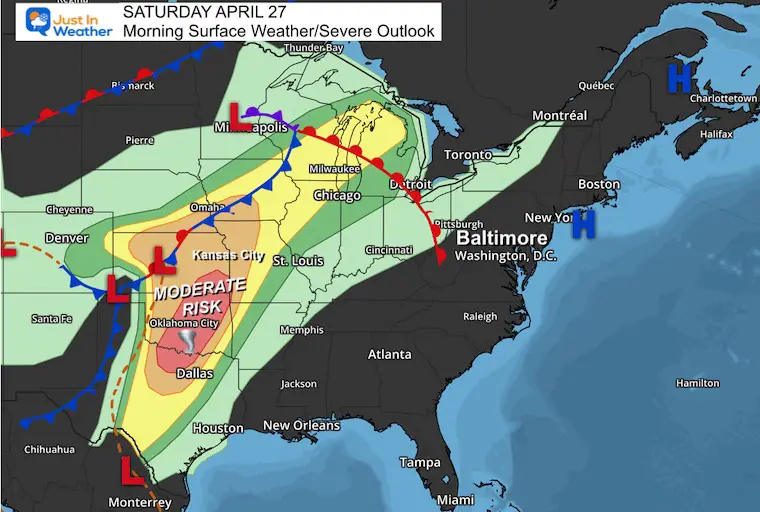
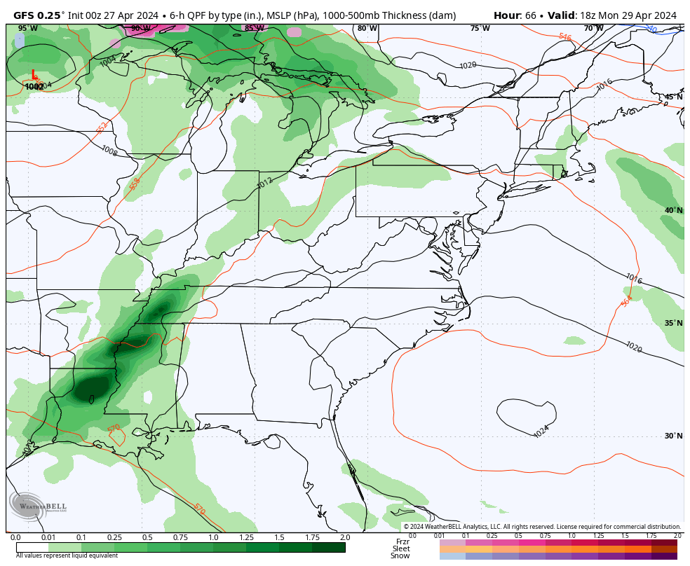
Severe Storms have erupted across the middle of our nation. We may get in on some of that action locally on Tuesday.
Morning Surface Weather
Eastern US View
A round of SEVERE STORMS will develop this afternoon across the Central Plains. There is a significant expectation for a tornado outbreak and large hail between Dallas and Kansas City.
Mid Atlantic View
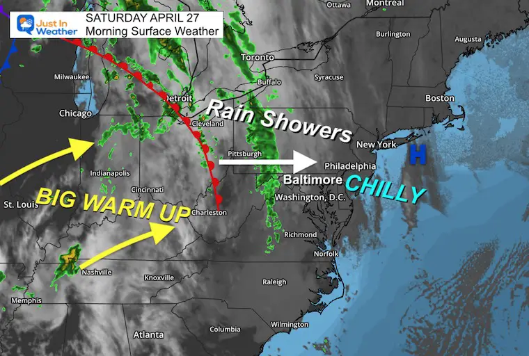
There is a chilly air mass with plenty of clouds and the expectation of rain showers. This is all ahead of the Warm Front that will move through later. On the other hand, the surge of summer heat will be here tomorrow.
Live Radar Widget
Radar Simulation: 8 AM to 8 PM
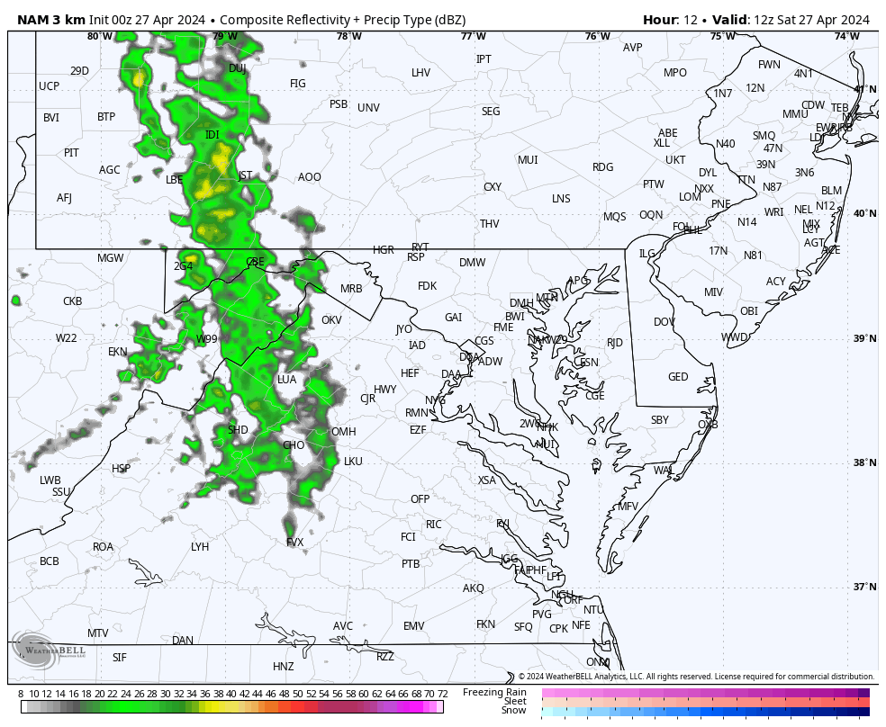
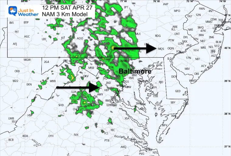
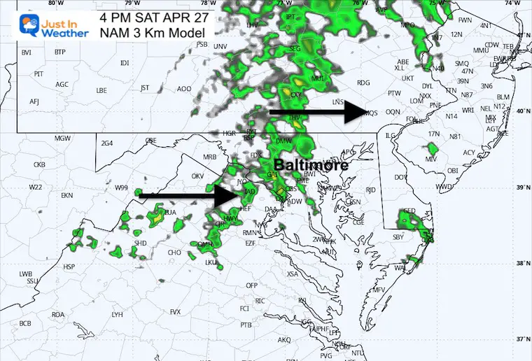
There may be two waves of rain showers, the first arriving late morning to early afternoon and the second a few hours later.
Note: There is a better chance for rain in central Maryland and northward and less chance to the south and on the Eastern Shore.
Snapshots
Noon
4 PM
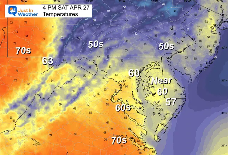
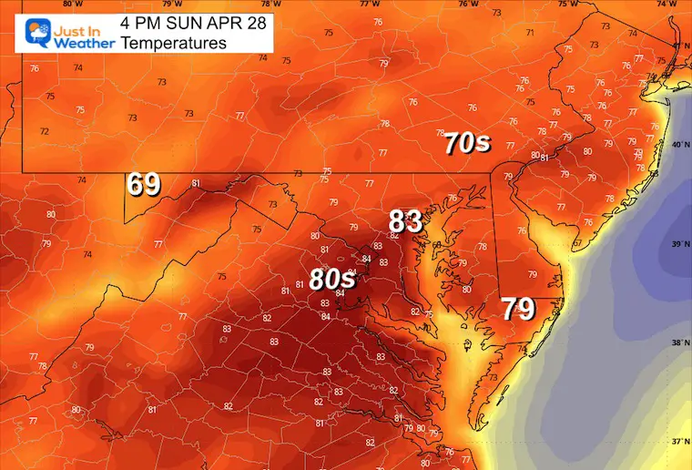
4 PM Temperatures
With the clouds and rain, temperatures will be in the 50s to near 60ºF.
CLIMATE DATA: Baltimore
TODAY April 27
Sunrise at 6:14 AM
Sunset at 7:55 PM
Normal Low in Baltimore: 48ºF
Record 35ºF in 2001
Normal High in Baltimore: 71ºF
Record 92ºF 1994
In Case You Missed This
Sunday Weather: Warmer
Morning Temperatures
Afternoon at 4 PM
Storm Simulation: Monday Afternoon to Wednesday
SNAPSHOTS
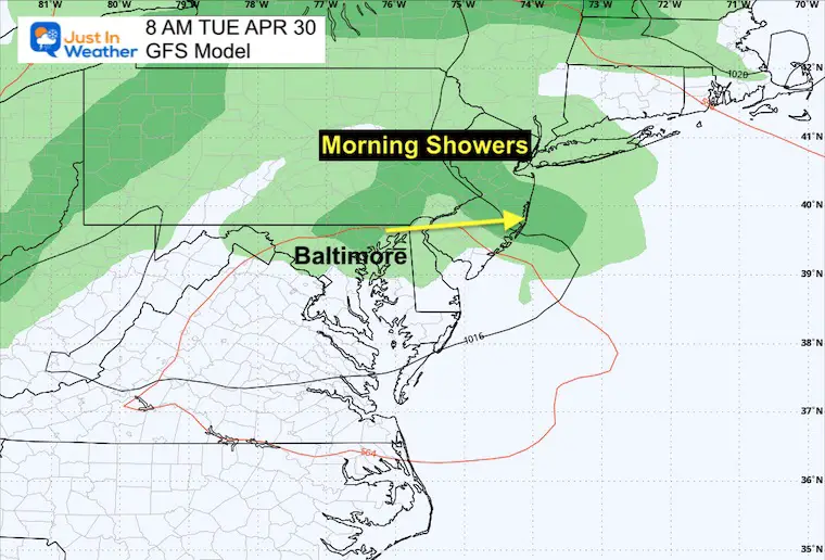
Tuesday Morning
Early-day showers may be leftover from the previous day’s storms in the Ohio Valley.
Tuesday Afternoon
A new round of storms will have the potential to turn severe as it enters the Mid-Atlantic late afternoon and evening.

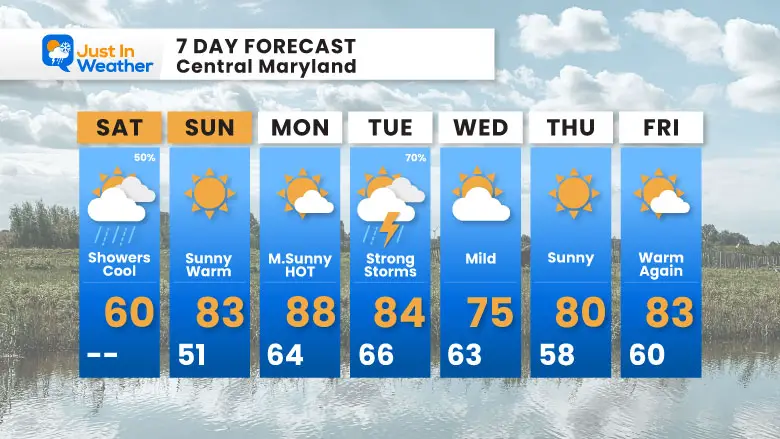
7 Day Forecast
Definitely a SHIFT to a warmer pattern as we enter May.
Storms on Tuesday may turn severe, then we remain warm the rest of the week.
STEM Assemblies/In School Fields Trips Are Back
Click to see more and ‘Book’ a visit to your school

Please share your thoughts and best weather pics/videos, or just keep in touch via social media
RESTATING MY MESSAGE ABOUT DYSLEXIA
I am aware there are some spelling and grammar typos and occasional other glitches. I take responsibility for my mistakes and even the computer glitches I may miss. I have made a few public statements over the years, but if you are new here, you may have missed it: I have dyslexia and found out during my second year at Cornell University. It didn’t stop me from getting my meteorology degree and being the first to get the AMS CBM in the Baltimore/Washington region.
One of my professors told me that I had made it that far without knowing and to not let it be a crutch going forward. That was Mark Wysocki, and he was absolutely correct! I do miss my mistakes in my own proofreading. The autocorrect spell check on my computer sometimes does an injustice to make it worse. I also can make mistakes in forecasting. No one is perfect at predicting the future. All of the maps and information are accurate. The ‘wordy’ stuff can get sticky.
There has been no editor who can check my work while writing and to have it ready to send out in a newsworthy timeline. Barbara Werner is a member of the web team that helps me maintain this site. She has taken it upon herself to edit typos when she is available. That could be AFTER you read this. I accept this and perhaps proves what you read is really from me… It’s part of my charm. #FITF


