Wednesday, April 3
Morning Report
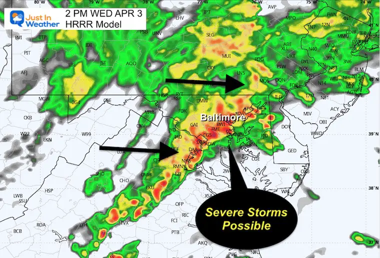
Today is our storm day! Rain has already brought early thunderstorms with it across southern Pennsylvania. The entire system will cross our region today, bringing heavier rain and developing storms that may turn severe. This will include Maryland and southward.
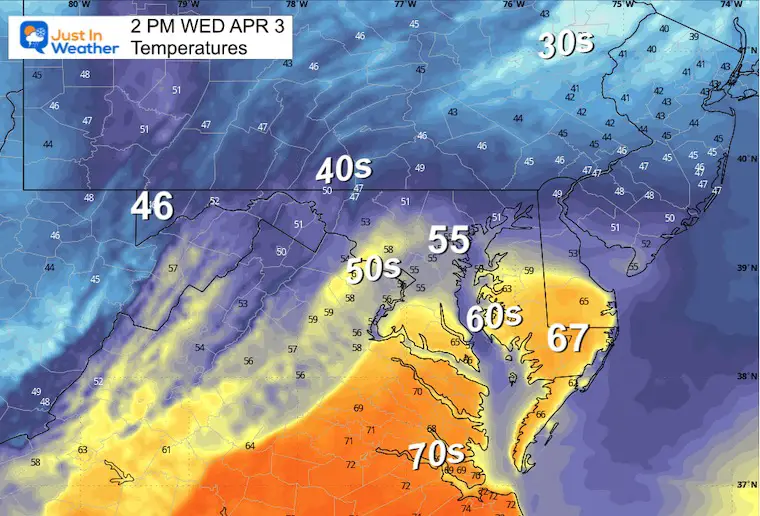
It is important to note there is a large temperature spread across our region from the 40s to the north and 70s to the south. The severe risk will be farther south, where warmer temperatures will fuel higher cloud tops mid-day into this afternoon. See the radar simulation below.
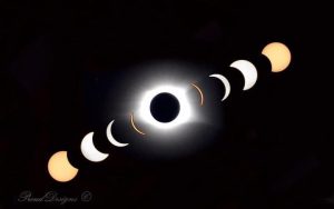
On the bright side, despite a few more chilly and unsettled days, the outlook for Monday’s Solar Eclipse is looking sunny and dry.
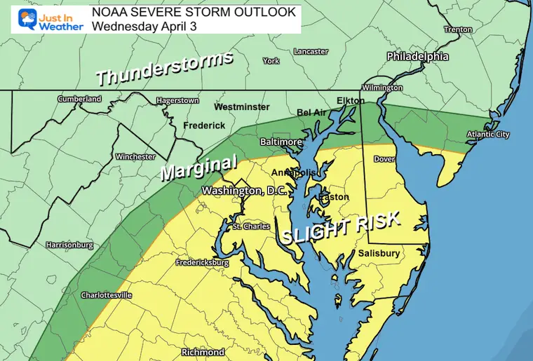
NOAA Severe Storm Risk
ENHANCED RISK: This area may have isolated tornados with a higher chance for large hail and damaging winds. An isolated tornado is possible, but the odds are low.
SLIGHT RISK: Here with less energy, storms still may produce damaging winds over 58 mph and pockets of hail.
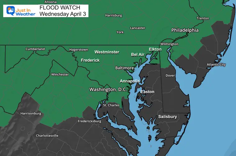
Flood Watch
Locally heavy storm cells may produce 1 to 3 inches of rainfall.
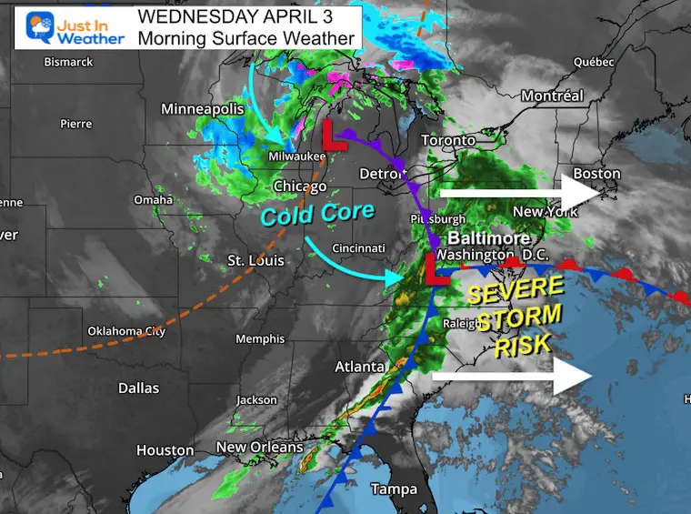
Morning Surface Weather
The strong and complex weather system has a sharp temperature contrast across the region. This is part of what will feed the severe storm risk today. The better chance will be farther south, where temperatures will be warmer.
The core of the cold air is with the Low across the Great Lakes. This will pivot our way over the next few days, keeping our weather unsettled through Friday.
Compare To The Live Radar Widget
Radar Simulation 8 AM to 8 PM
Periods of rain may include some thunder this morning.
The line of strong to severe storms will arrive mid-day. The timing on this product is not perfect, so consider a window between 12 PM and 4 PM.
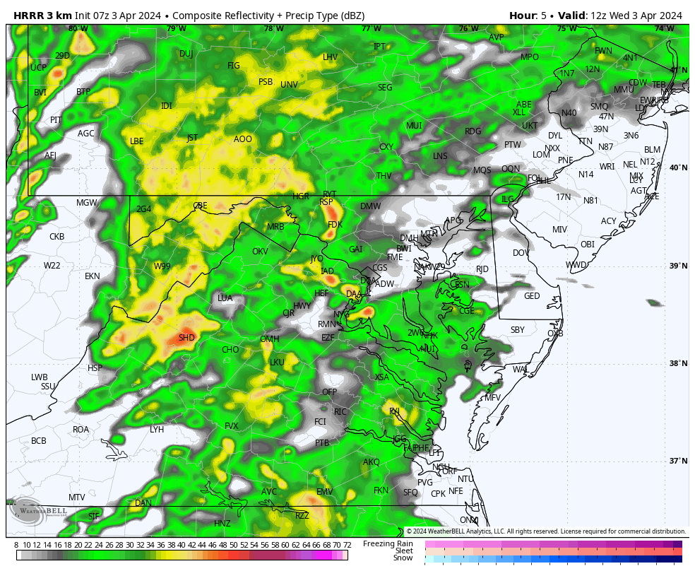
2 PM Snapshot
This is a suggestion, but it may arrive 1 to 2 hours earlier.
Afternoon Temperatures
In Case You Missed It
2024 SOLAR ECLIPSE INFO: Compare to 2017 Event
CLIMATE DATA: Baltimore
TODAY April 3
Sunrise at 6:47 AM
Sunset at 7:33 PM
Normal Low in Baltimore: 39ºF
Record 27ºF in 1965; 1985; 2013
Normal High in Baltimore: 62ºF
Record 88ºF 1963
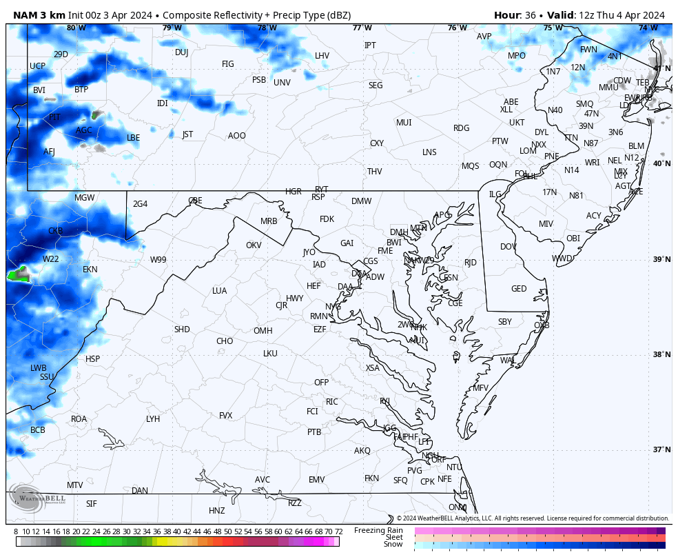
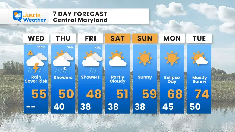
Thursday Weather
Temperatures Remain Chilly
Morning

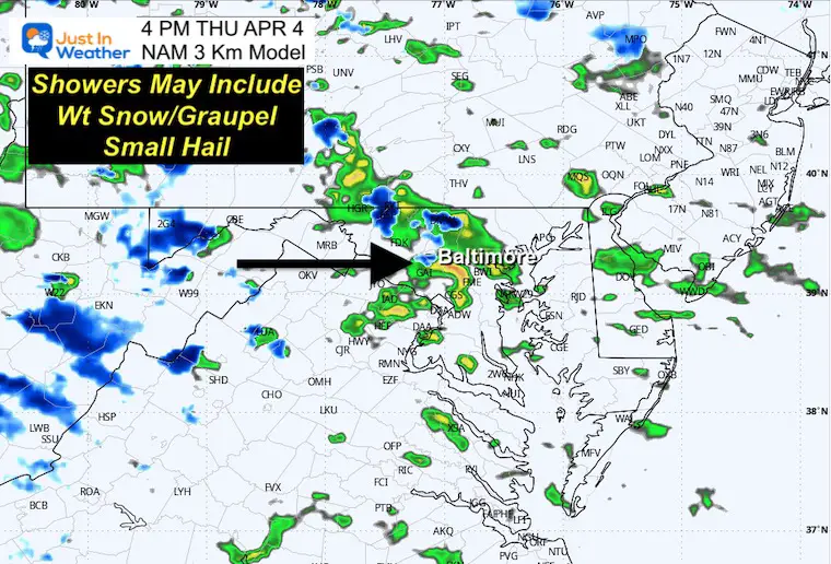
Radar Simulation: 8 AM to 8 PM
4 PM Snapshot
There may be some wet snow, graupel, or small hail mixed in with the showers.
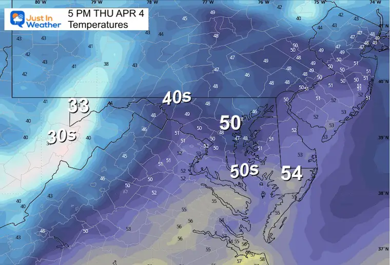
Afternoon Temperatures
Well above freezing at the surface, but we can get that wintry stuff falling from much colder clouds.
7 Day Forecast
Today is the Storm Day!
Showers on Thursday may mix with wet snow, graupel, or small hail.
While chilly into the weekend, the outlook is sunny for the solar eclipse Monday as we warm up.
STEM Assemblies/In School Fields Trips Are Back
Click to see more and ‘Book’ a visit to your school

Please share your thoughts and best weather pics/videos, or just keep in touch via social media
RESTATING MY MESSAGE ABOUT DYSLEXIA
I am aware there are some spelling and grammar typos and occasional other glitches. I take responsibility for my mistakes and even the computer glitches I may miss. I have made a few public statements over the years, but if you are new here, you may have missed it: I have dyslexia and found out during my second year at Cornell University. It didn’t stop me from getting my meteorology degree and being the first to get the AMS CBM in the Baltimore/Washington region.
One of my professors told me that I had made it that far without knowing and to not let it be a crutch going forward. That was Mark Wysocki, and he was absolutely correct! I do miss my mistakes in my own proofreading. The autocorrect spell check on my computer sometimes does an injustice to make it worse. I also can make mistakes in forecasting. No one is perfect at predicting the future. All of the maps and information are accurate. The ‘wordy’ stuff can get sticky.
There has been no editor who can check my work while writing and to have it ready to send out in a newsworthy timeline. Barbara Werner is a member of the web team that helps me maintain this site. She has taken it upon herself to edit typos when she is available. That could be AFTER you read this. I accept this and perhaps proves what you read is really from me… It’s part of my charm. #FITF
Recent Snow Reports
Click each map for the maps and snow spotter lists.
February 17 Snow Report Maps
February 13 Snow Report Maps
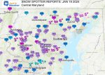
January 19 Recap
Click here for the maps and full report
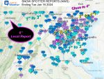
Jan 16 Snow Report
Click here or the map to see: The Snow Report Ending Jan 16
Subscribe for eMail Alerts
Explore More
Maryland Snow Climate History And Other Winter Pages


