March 15 Weather Rain Showers And Gradually Turning Cooler
March 15 2024
Friday Morning Update
Beware the Ides of March! The high temperature in Baltimore did reach 80ºF yesterday. This was not a record, but it did feel like a summer preview briefly. The reality is that it is not the reality for mid-March, and the bottom will fall out.
Today will still be mild. Rain showers will be scattered but will serve as a signal that a change is on the way.
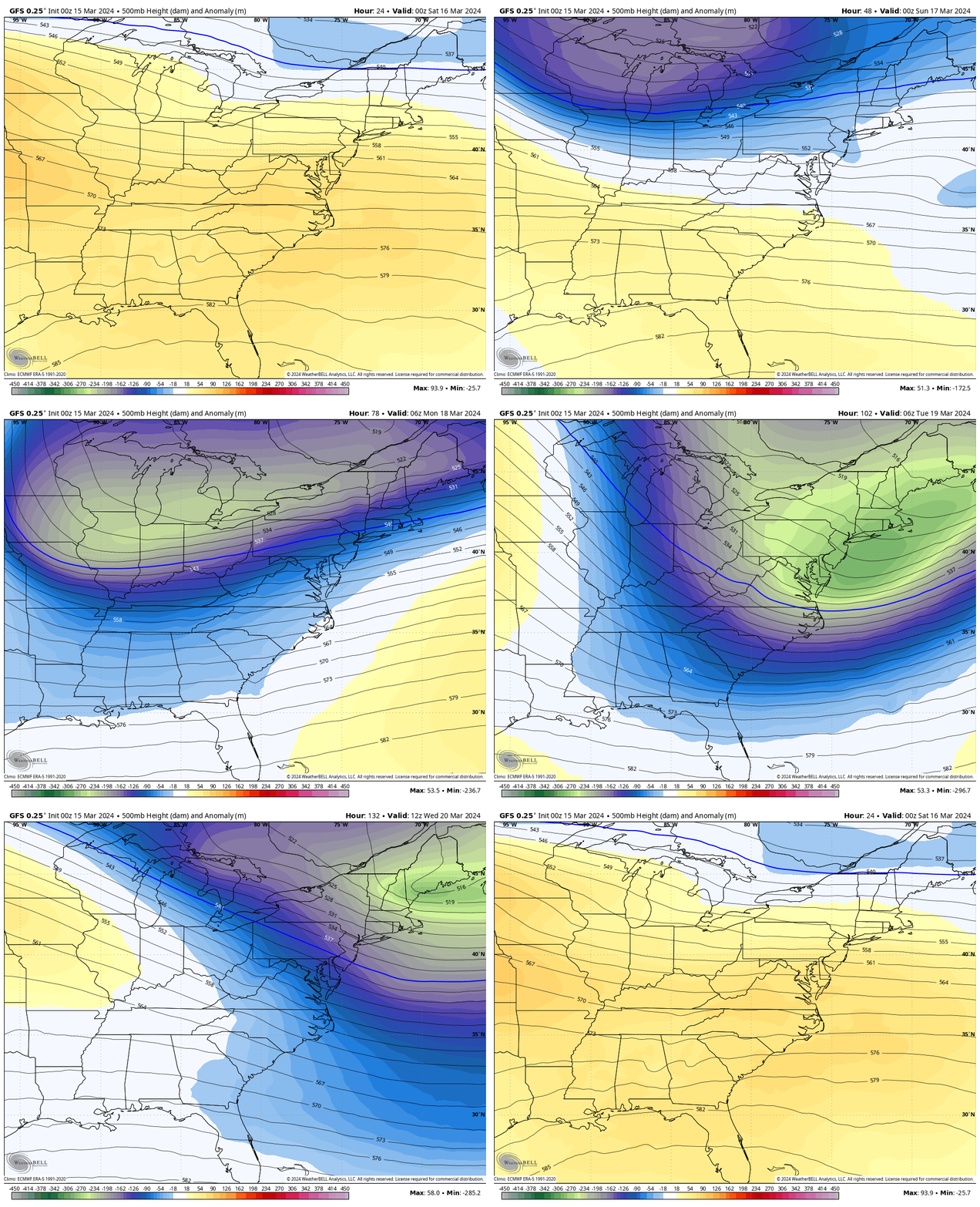
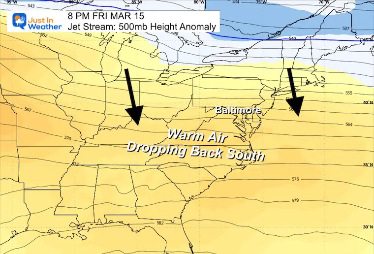
The weekend will end up dry for a change, as cooler air will be filtering in. Much colder air will arrive early next week and will be briefly below average.
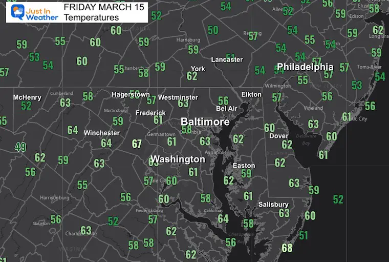
Morning Temperatures
Most of the region is starting in or close to the 60s. This is like a late spring-like feel to the air.
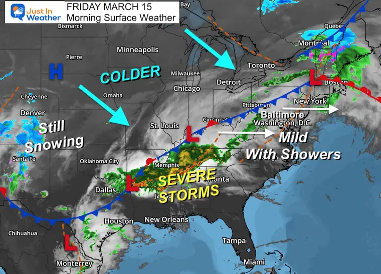
Morning Surface Weather
The approaching cold front will be responsible for some scattered rain showers. The main energy and severe storms will be in the Southeast US.
The colder weather will gradually move in and truly be felt by early next week.
Live Radar Widget
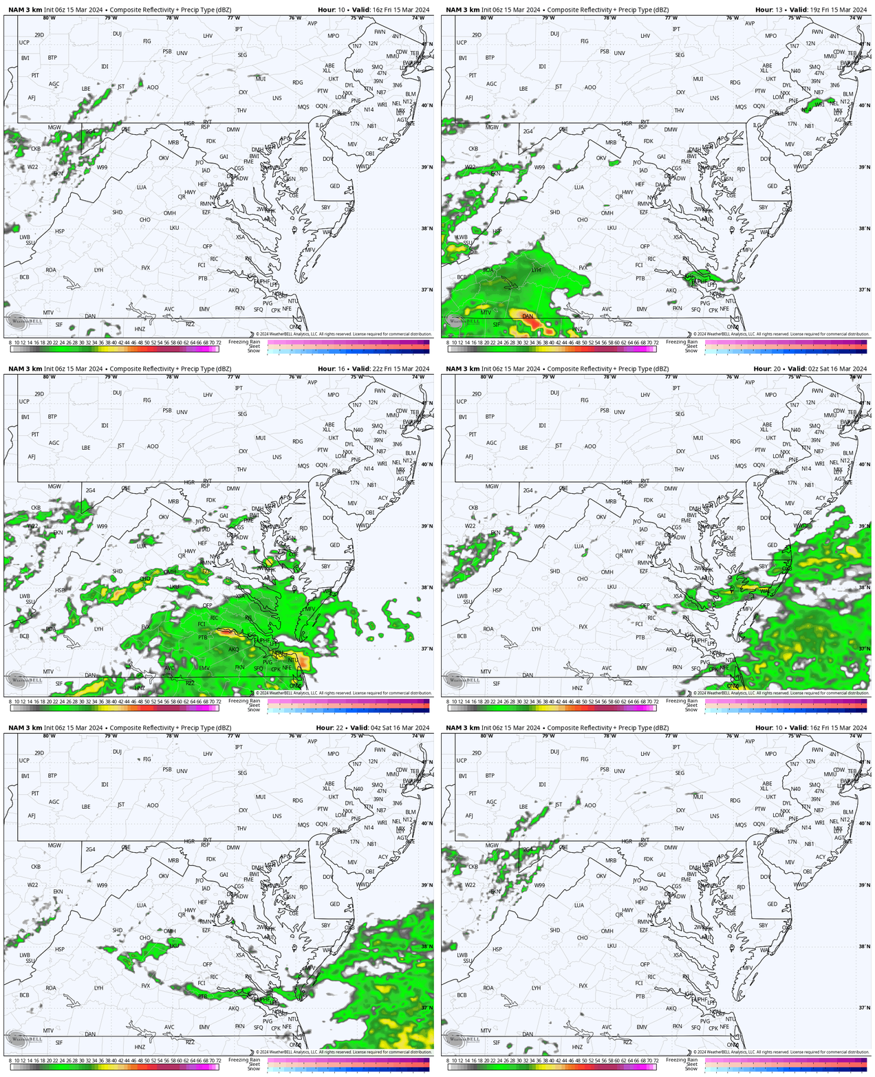
Radar Simulation Noon to Midnight
This product has been missing some activity, so we may see more than is shown here. That’s why I put the live radar widget above.
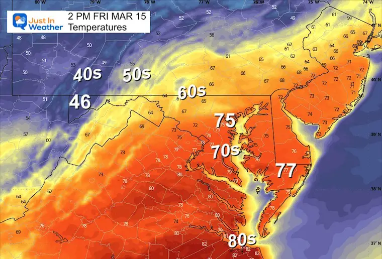
Afternoon Temperatures
Still warm, but cooler than yesterday with rain showers. There could be an isolated rumble of thunder.
CLIMATE DATA: Baltimore
TODAY March 15
Sunrise at 7:17 AM
Sunset at 7:14 PM
Normal Low in Baltimore: 34ºF
Record 10ºF in 1993
Normal High in Baltimore: 54ºF
Record 82ºF 1990
SEASONAL SNOW at BWI
11.3 inches
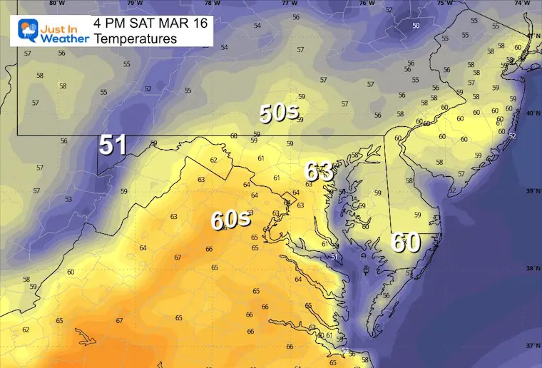
Saturday Weather
Morning Temperatures
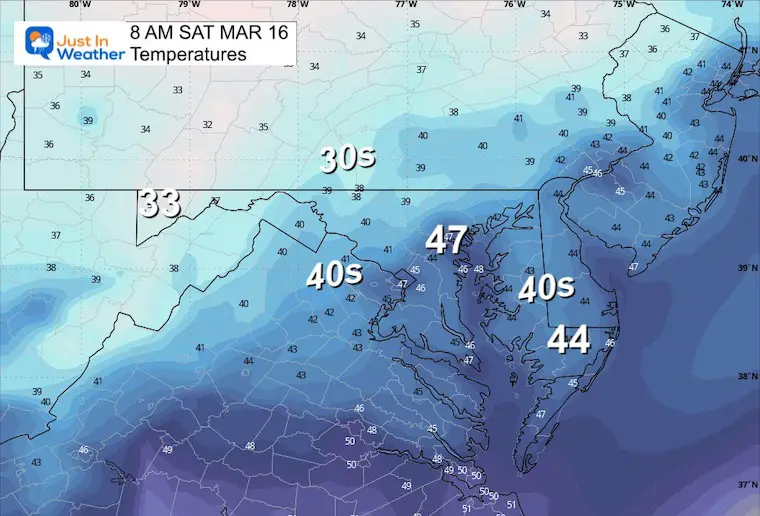
Afternoon Temperatures
Jet Stream Animation Friday To Wednesday
Friday Snapshot
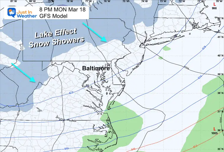
Monday Evening Snapshot
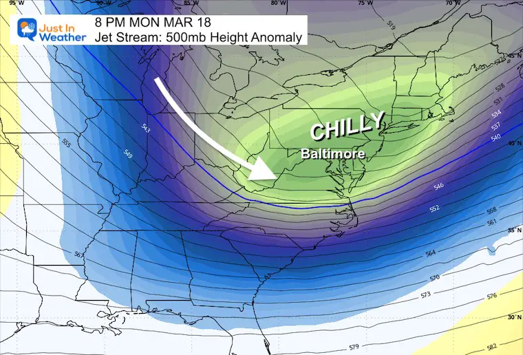
Monday
Colder winds bring mountain snow showers. Some may cross the mountains into metro areas late in the afternoon.
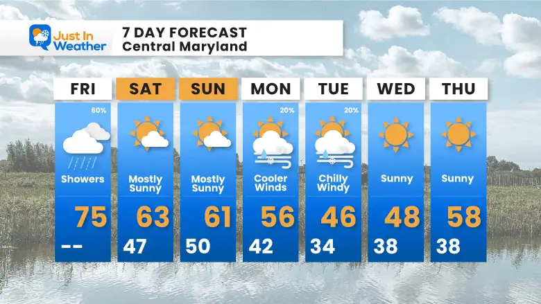
7 Day Outlook
A gradual cool-down this weekend. The surge of colder air will come with gusty winds early next week.
STEM Assemblies/In School Fields Trips Are Back
Click to see more and ‘Book’ a visit to your school
Please share your thoughts and best weather pics/videos, or just keep in touch via social media
-
Facebook: Justin Berk, Meteorologist
-
Twitter
-
Instagram
RESTATING MY MESSAGE ABOUT DYSLEXIA
I am aware there are some spelling and grammar typos and occasional other glitches. I take responsibility for my mistakes and even the computer glitches I may miss. I have made a few public statements over the years, but if you are new here, you may have missed it: I have dyslexia and found out during my second year at Cornell University. It didn’t stop me from getting my meteorology degree and being the first to get the AMS CBM in the Baltimore/Washington region. One of my professors told me that I had made it that far without knowing and to not let it be a crutch going forward. That was Mark Wysocki, and he was absolutely correct! I do miss my mistakes in my own proofreading. The autocorrect spell check on my computer sometimes does an injustice to make it worse. I also can make mistakes in forecasting. No one is perfect at predicting the future. All of the maps and information are accurate. The ‘wordy’ stuff can get sticky. There has been no editor who can check my work when I need it and have it ready to send out in a newsworthy timeline. Barbara Werner is a member of the web team that helps me maintain this site. She has taken it upon herself to edit typos when she is available. That could be AFTER you read this. I accept this and perhaps proves what you read is really from me… It’s part of my charm. #FITF
Recent Snow Reports
Click each map for the maps and snow spotter lists.
February 17 Snow Report Maps
February 13 Snow Report Maps
January 19 Recap
Click here for the maps and full report
Jan 16 Snow Report
Click here or the map to see: The Snow Report Ending Jan 16
Subscribe for eMail Alerts
Weather posts straight to your inbox
Sign up and be the first to know!


