March 14 Pi Day Weather Will Be Very Warm Then Rain Tomorrow
March 14, 2024
Thursday Morning Update
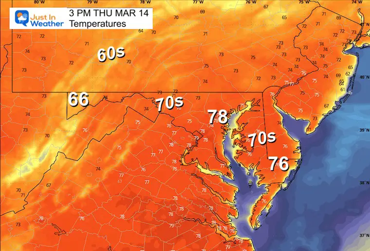
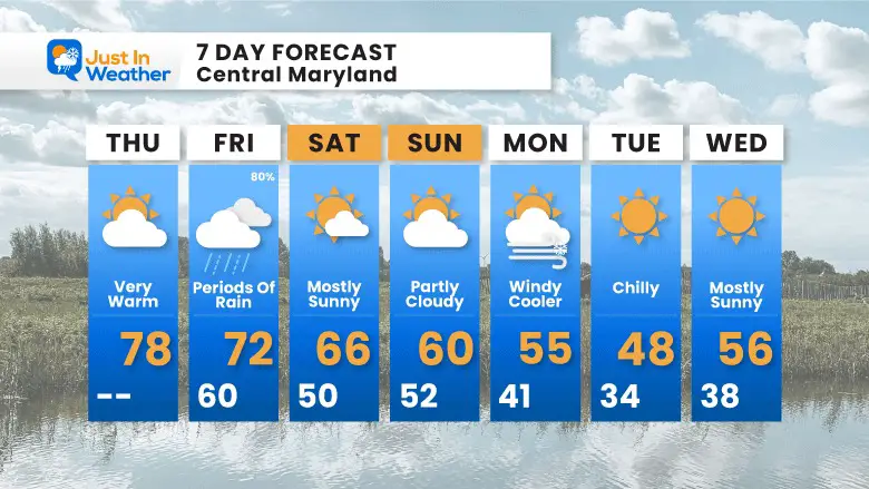
Today’s date, 3/14 represents Pi and is the birthday of Albert Einstein. While math enthusiasts celebrate, we will add another number in the local weather to the list. Most of our region will surge well into the 70s. Depending on how soon the sun breaks free of the early clouds, there is a chance to reach 80ºF at BWI. The record was 83ºF in 2007.
Enjoy this while it lasts as temps will start to drop, beginning with a round of rain Friday. Then, the weekend will step back into the 60s, followed by another push of colder air early next week.
Morning Temperatures
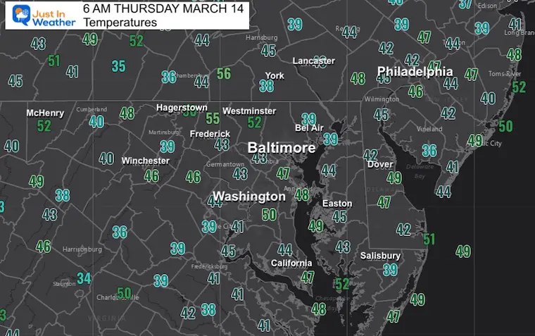
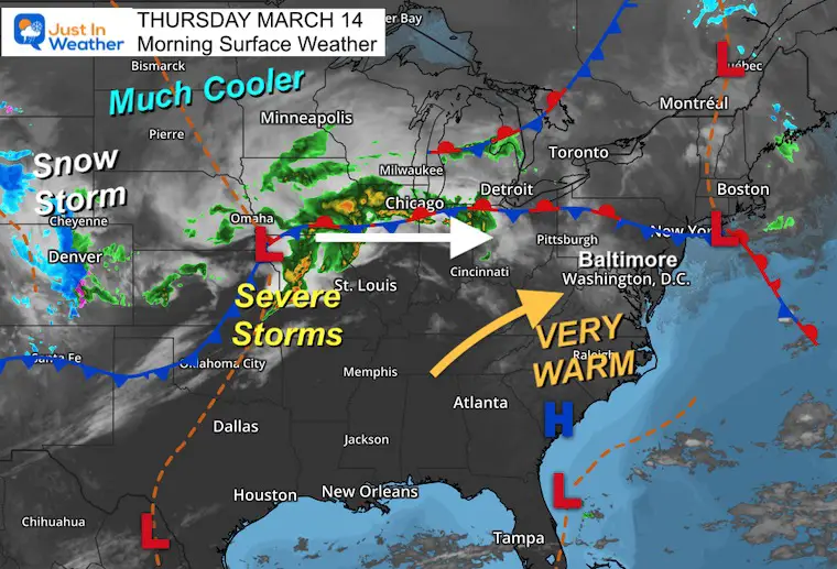
Morning Surface Weather
Morning clouds will give way to sunshine. We often end up warmer than expected, so there is a chance to approach 80ºF if the sun breaks out sooner.
There are severe storms in the Mississippi River Valley with the next system.
Behind this, in the colder air, Denver is getting its largest snowstorm of the season.
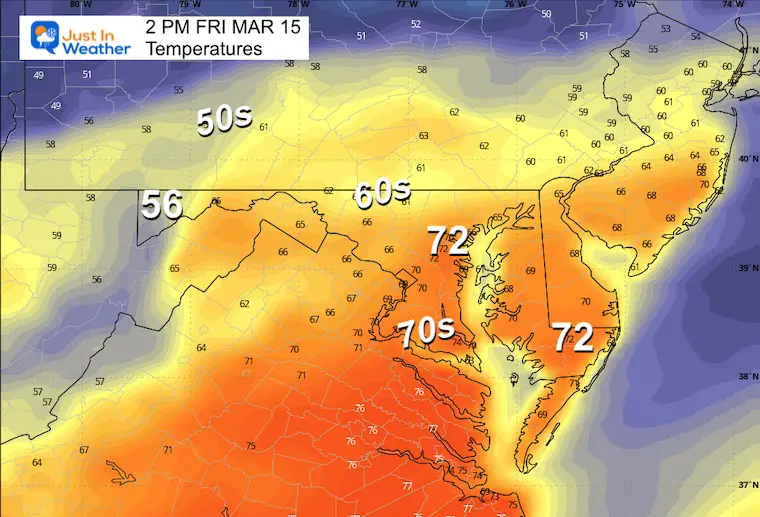
Afternoon Temperatures
If we break into full sunshine sooner, there is a chance some thermometers reach 80ºF.
CLIMATE DATA: Baltimore
TODAY March 14
Sunrise at 7:19 AM
Sunset at 7:13 PM
Normal Low in Baltimore: 33ºF
Record 14ºF in 1888
Normal High in Baltimore: 54ºF
Record 83ºF 2007
SEASONAL SNOW at BWI
11.3 inches
Friday Weather
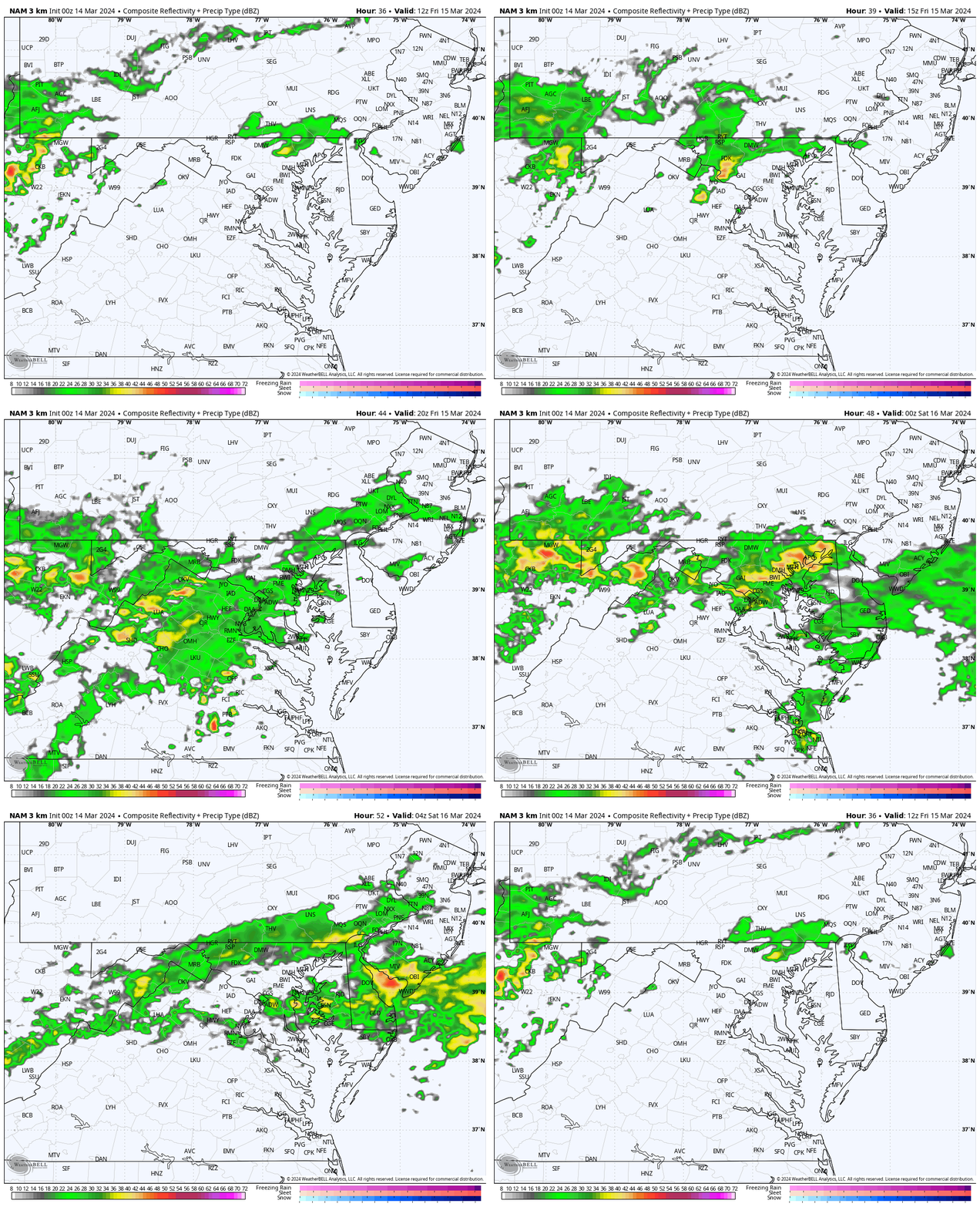
Radar Simulation: 8 AM to Midnight
Showers will begin in the morning, and then rain will become steadier later in the day and at night.
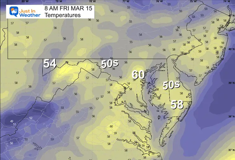
Morning Temperatures
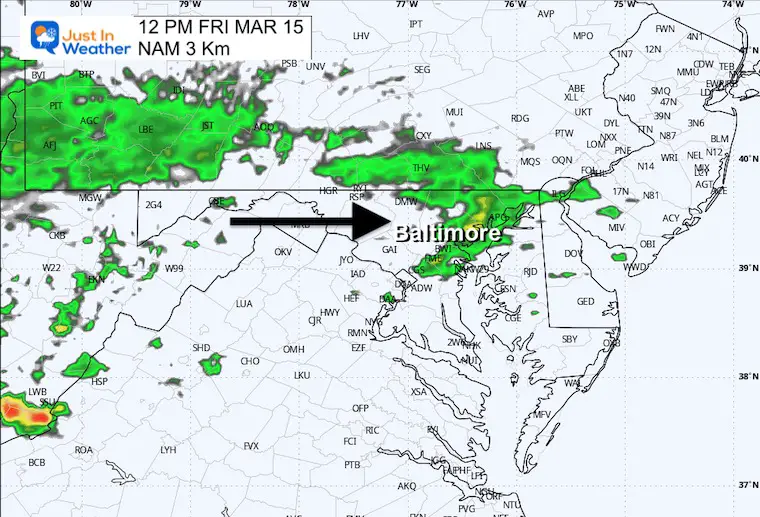
Mid-Day Radar Simulation
Showers will develop in the morning and become more widespread through the afternoon.
Afternoon Temperatures
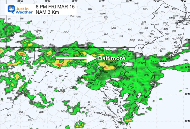
Evening Radar Simulation
Steady rain later in the day and overnight.
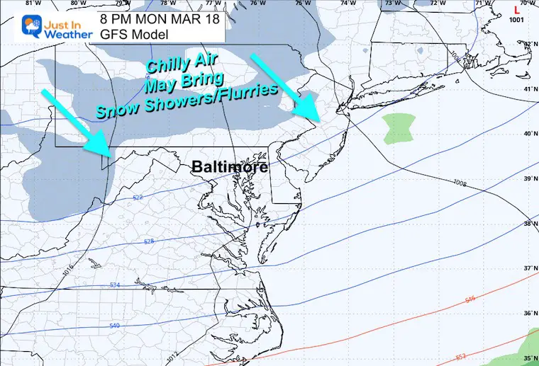
Monday
Colder winds bring mountain snow showers. Some may cross the mountains into metro areas late in the afternoon.
7 Day Outlook
The weekend now looks dry and still warmer than average, but cooling down.
The next push of colder air will be early next week. This might include flurries later on Monday.
Recent Snow Reports
Click each map for the maps and snow spotter lists.
February 17 Snow Report Maps
February 13 Snow Report Maps
January 19 Recap
Click here for the maps and full report
Jan 16 Snow Report
Click here or the map to see: The Snow Report Ending Jan 16
Subscribe for eMail Alerts
Weather posts straight to your inbox
Sign up and be the first to know!
Explore More
Maryland Snow Climate History And Other Winter Pages
STEM Assemblies/In School Fields Trips Are Back
Click to see more and ‘Book’ a visit to your school
Please share your thoughts and best weather pics/videos, or just keep in touch via social media
-
Facebook: Justin Berk, Meteorologist
-
Twitter
-
Instagram
RESTATING MY MESSAGE ABOUT DYSLEXIA
I am aware there are some spelling and grammar typos and occasional other glitches. I take responsibility for my mistakes and even the computer glitches I may miss. I have made a few public statements over the years, but if you are new here, you may have missed it: I have dyslexia and found out during my second year at Cornell University. It didn’t stop me from getting my meteorology degree and being the first to get the AMS CBM in the Baltimore/Washington region. One of my professors told me that I had made it that far without knowing and to not let it be a crutch going forward. That was Mark Wysocki, and he was absolutely correct! I do miss my mistakes in my own proofreading. The autocorrect spell check on my computer sometimes does an injustice to make it worse. I also can make mistakes in forecasting. No one is perfect at predicting the future. All of the maps and information are accurate. The ‘wordy’ stuff can get sticky. There has been no editor who can check my work when I need it and have it ready to send out in a newsworthy timeline. Barbara Werner is a member of the web team that helps me maintain this site. She has taken it upon herself to edit typos when she is available. That could be AFTER you read this. I accept this and perhaps proves what you read is really from me… It’s part of my charm. #FITF


