April 19 Warming Back Up To Summer Levels And Record Heat On The Way
April 19 2023
Wednesday Morning Update
This may seem like a boring weather pattern, but it is quite interesting when looking at the big picture. The Warnings this morning do spread from fire to ice just outside the edges of our area. The larger weather map shows another storm in the Northern Plains states that will help pump in heat up to summer levels for us to end the week.
For the weekend, another round of needed rain and thunderstorms is expected Saturday evening.
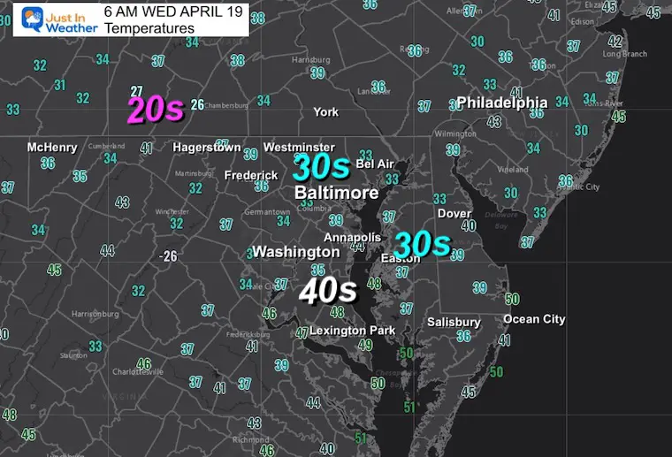
Morning Temperatures
Some might have frost….
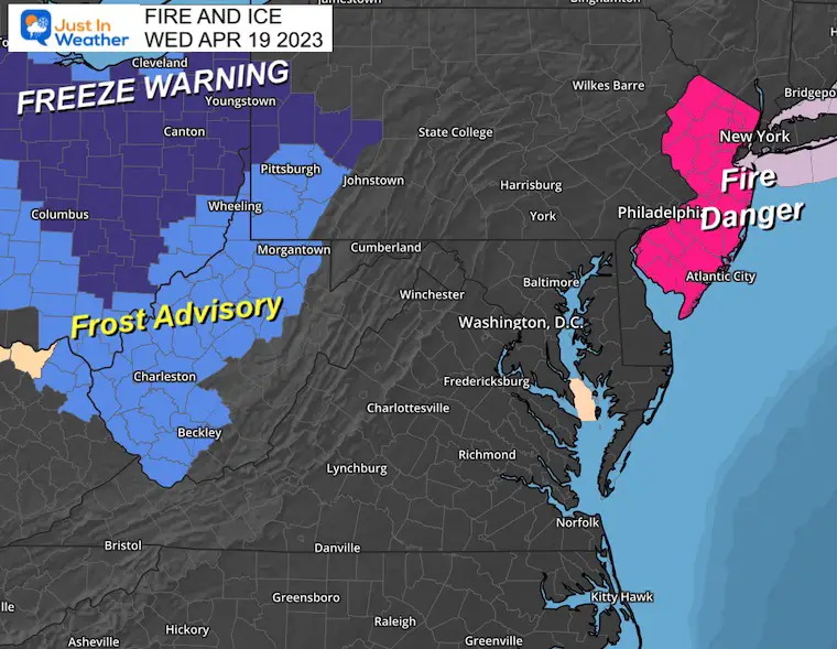
Fire and Ice
The ice part is west of Maryland into West Virginia and Ohio where there are Frost Advisories and Freeze Warnings.
The Fire Danger Risk is up for all of New Jersey.
Morning Surface Weather
High Pressure means more dry weather for the Eastern US. The next large storm in the Northern Plains is going to be responsible for pumping in very warm air over the next few days.
While we may have some local temps in the 30s, we should get back to the 70s this afternoon.
By tomorrow, the 80s, and even approaching 90ºF on Friday.
The bottom will fall out with thunderstorms on Saturday Evening.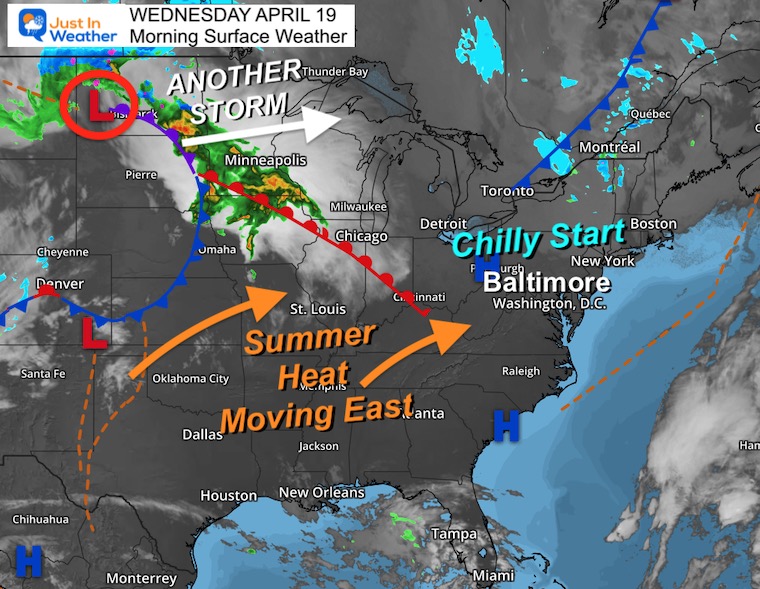
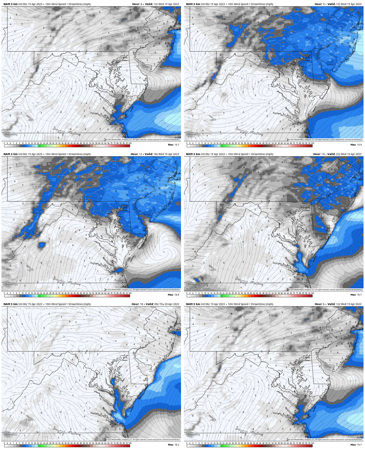
Wind Forecast
8 AM to 8 PM
The wind will be stronger farther north and east, and calmer south and west.
Using Baltimore as the center point, going north to PA, west to Delmarva and New Jersey the winds will be averaging 10 to 20 mph, with higher gusts.
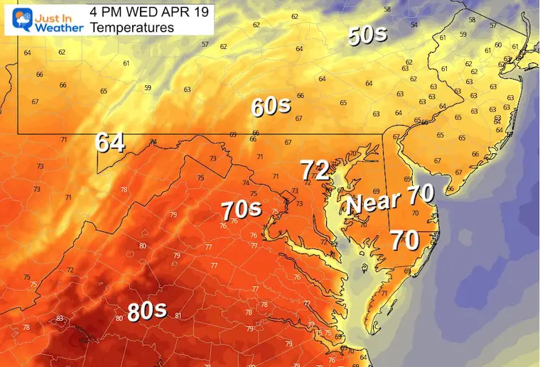
Afternoon Temperatures
A very wide spread of temperatures will be enhanced by more clouds near and north of the PA line, and more sun with the warm and dry winds from Baltimore and southward.
Subscribe for eMail Alerts
Weather posts straight to your inbox
Sign up and be the first to know!
CLIMATE DATA
TODAY April 19
Normal Low in Baltimore: 45ºF
Record 24ºF in 1875
SNOW: Trace in 1983
Normal High in Baltimore: 68ºF
Record 93ºF in 1896
REPORTS:
Winter 2023 Recap: My BUSTED Snow Outlook
La Niña Has Ended. El Niño May Return By Fall
Thursday Weather
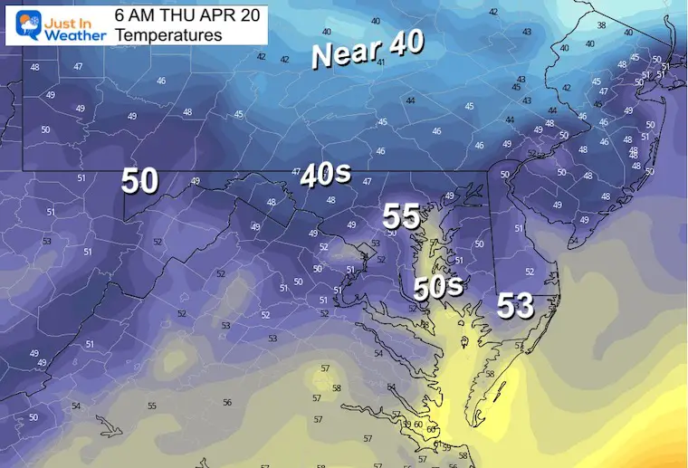
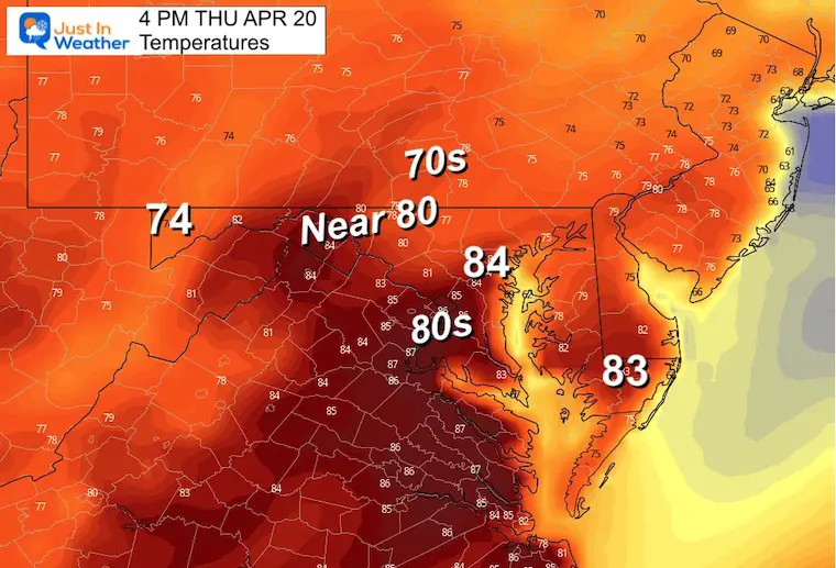
Here comes the summer heat again!
Morning Temperatures
Afternoon Temperatures
Record for Baltimore: 94ºF in 1941.
Look Ahead:
Saturday Morning to Monday Morning
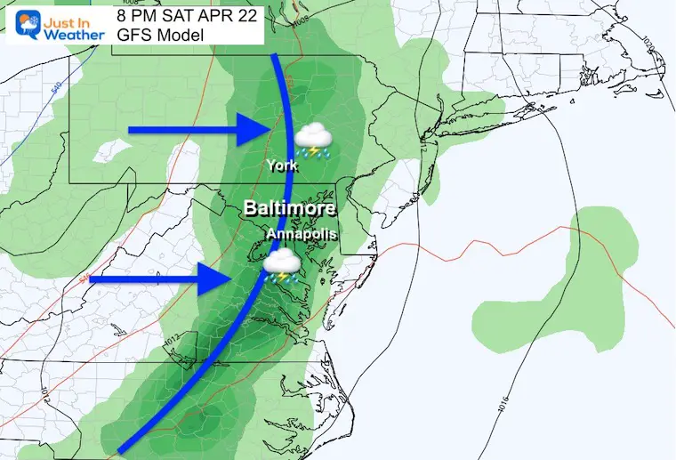
The next storm will follow the path of the last one through the Great Lakes. It will surge with warm winds building ahead of the storm on Friday and Saturday, followed by a period of rain and thunderstorms, then a return of colder air to end the weekend.
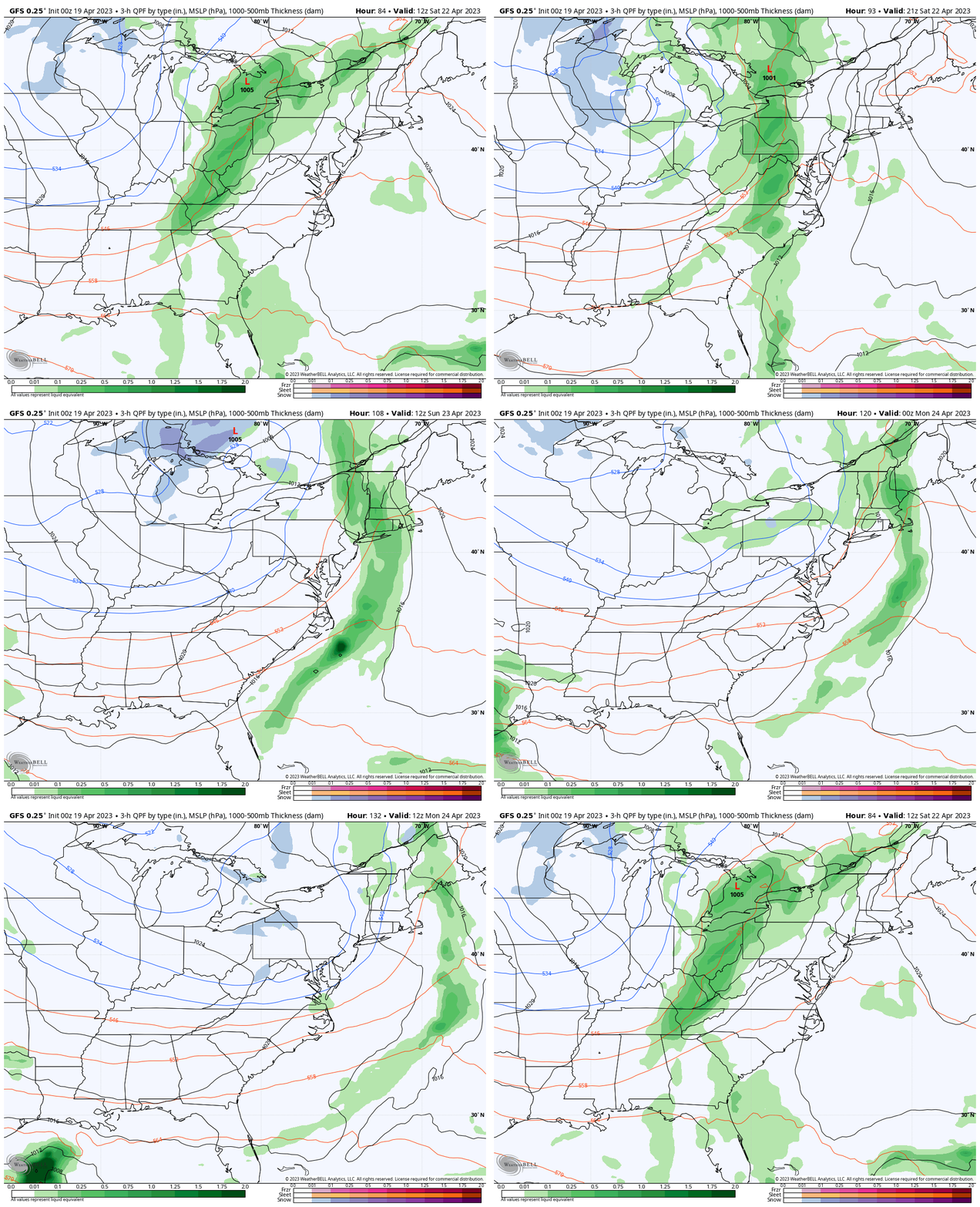
Snapshot Saturday Evening
Timing the cold front still needs to be narrowed a bit. For now, I feel confident that metro areas will remain dry through 4 PM. Then we will watch for a line of storms to arrive from the mountains into the evening and night. It will be gone by Sunday morning.
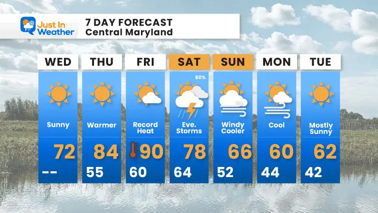
7 Day Forecast
Bouncing back up to summer heat! The record on Friday would be set if BWI beats 88ºF set in 1957.
The storm line on Saturday will be AFTER 4 PM. Most of the day will be dry.
Sunday and early next week will be cooler than average for a change.
STEM Assemblies/In School Fields Trips Are Back
Click to see more and ‘Book’ a visit to your school
Please share your thoughts, best weather pics/videos, or just keep in touch via social media
-
Facebook: Justin Berk, Meteorologist
-
Twitter
-
Instagram
RESTATING MY MESSAGE ABOUT DYSLEXIA
I am aware there are some spelling and grammar typos, and occasional other glitches. I take responsibility for my mistakes, and even the computer glitches I may miss. I have made a few public statements over the years, but if you are new here you may have missed it: I have dyslexia, and found out during my second year at Cornell University. It didn’t stop me from getting my meteorology degree, and being first to get the AMS CBM in the Baltimore/Washington region. One of my professors told me that I had made it that far without knowing, and to not let it be a crutch going forward. That was Mark Wysocki and he was absolutely correct! I do miss my mistakes in my own proofreading. The autocorrect spell check on my computer sometimes does an injustice to make it worse. I also can make mistakes in forecasting. No one is perfect predicting the future. All of the maps and information are accurate. The ‘wordy’ stuff can get sticky. There has been no editor that can check my work when I needed it and have it ready to send out in a newsworthy timeline. Barbara Werner is a member of the web team that helps me maintain this site. She has taken it upon herself to edit typos, when she is able. That could be AFTER you read this. I accept this and perhaps proves what you read is really from me… It’s part of my charm.
#FITF


