First Flakes: Mountain Snow To Suburb Flurries Wednesday
Tuesday October 18 2022
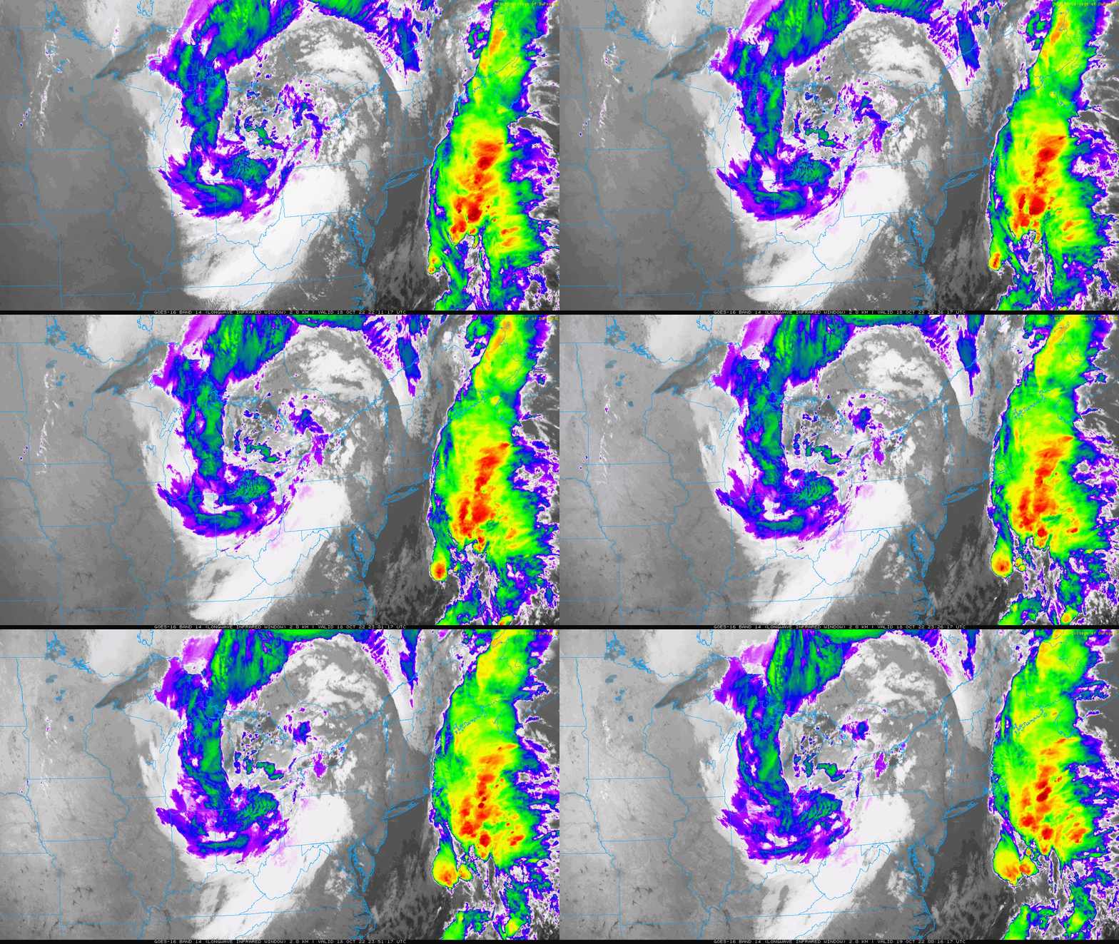
This first taste of arctic air is part of a closed of Low Pressure spinning around the Great Lakes. It is very prominent on the satellite loop. The air is just cold enough to produce the expected first snow of the season for western Maryland.
The cold air with clearing sky has prompted Frost Advisories and Freeze Warnings around the Bay and inland suburbs for Wednesday morning.
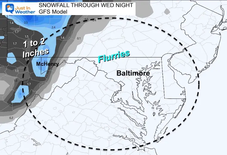
We have already discussed this Lake Effect set up for Garrett County, around Deep Creek Lake, and the surrounding mountains above 2000 Ft elevation. They could pick up a dusting to 1 inch by Wednesday night.
If you happen to view that at daybreak or want to come back, I will post a live web cam at Deep Creek Lake below to watch on your screen.
I suggested a few days ago that the upper level energy could help bring a few flurries over the mountains. That is still an option to get our early Faith in the Flakes worked up. I am aware when just seeing a few flakes can get us winter lovers exited, but that really is about the best we ‘may’ get. Check this out.
Satellite Loop
2 Hours ending at 8:15 PM
Evening Temperatures
Just cold enough with lower 30s this evening in the mountains and across the Ohio Valley.

Freeze Warning and Frost Advisory
Freezing temps expected inland west and north of Baltimore. Frost can form with temps in the upper 30s, which is expected to Annapolis, Washington, and Delmarva.
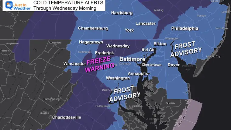
Morning Temperatures

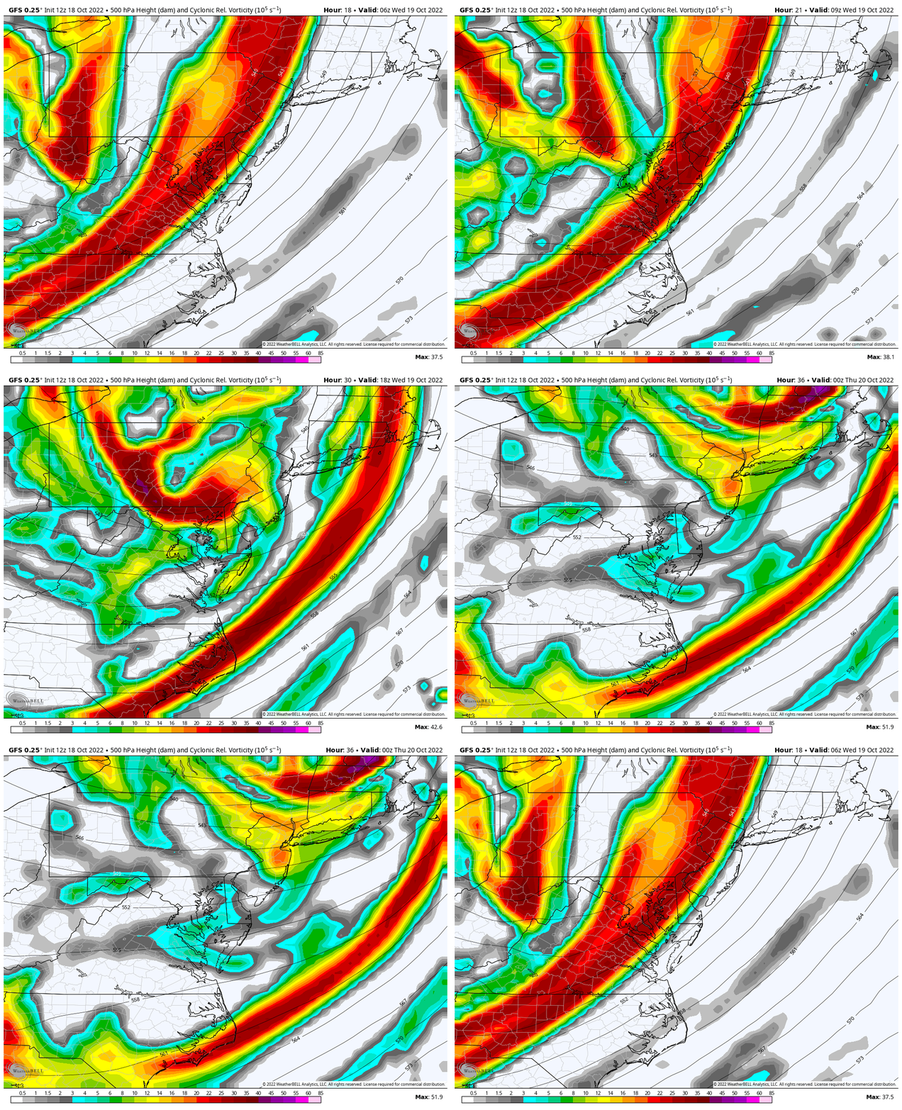
Vorticity Animation: 4 AM to 4 PM Wednesday
This is the spin aloft, which promotes lift and helps enhance cloud and shower formation. The mountains help enhance the showers where the air is forced to rise. However, the showers often stop farther east where the air sinks.
This spin helps advance showers farther east…
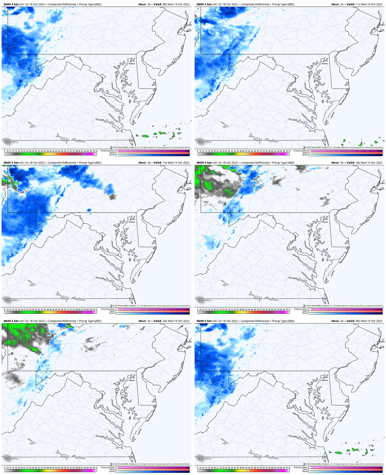
Radar Simulation: 4 AM to 4 PM Wednesday
Snow (blue) seems to stall with the terrain in Garrett County, but the lower elevations to the east it stops.
However, there are some showers that get added lift between sunrise and noon.
Snapshots:
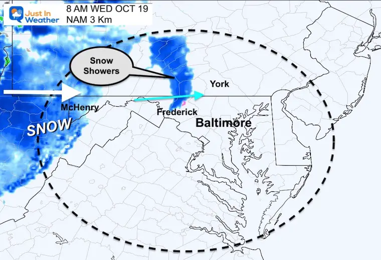
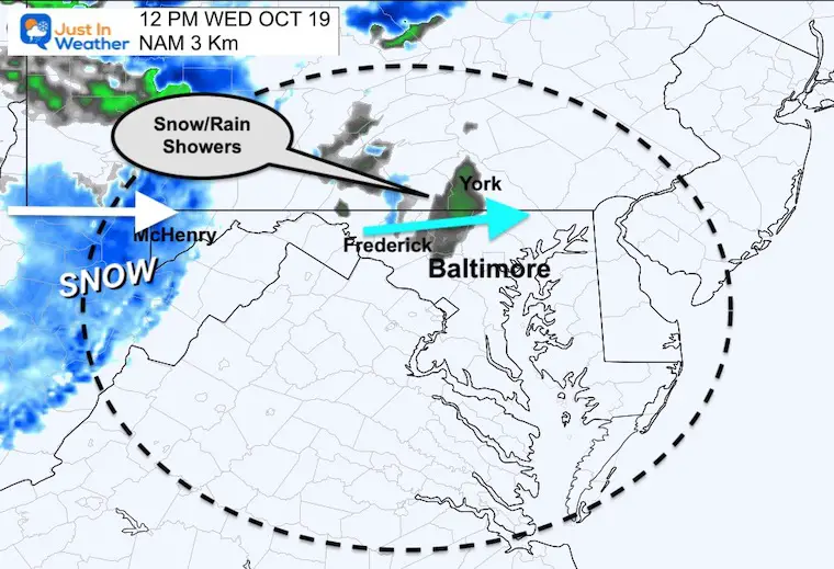
Note that the NAM 3 Km model has been a little slow with other events. So I would consider these verifying 1 to 2 hours earlier than the time stamp,
We can still generalize this ‘between sunrise and noon’ for showers across north central Maryland and south central Pennsylvania.
8 AM
One burst of snow possible across the mountains in Frederick County and track to Taneytown, Gettysburg, and York.
Noon
A few more showers that may be light rain or mixed with snow may continue across the northern suburbs. This may include Westminster, Hereford/Parkton, Shrewsbury/York, and Forest Hill. No stickage is expected.
Is It Snowing At Deep Creek Lake?
Live Web Cam: Wisp/Deep Creek Lake
This webcam is positioned at The Greene Turtle Deep Creek Lake and shows Wisp Resort, including a zoomed-in view of Squirrel Cage, The Face, the terrain park, Boulder, the mountain coaster, the tubing park and a shot of McHenry Cove at Deep Creek Lake!
Snow Forecast:
There will be some snow sticking around Deep Creek Lake with a wide variety depending on elevation or proximity to the water. It will be fun to see some ground cover with the peak foliage.
Weather posts straight to your inbox
Sign up and be the first to know!
EXPLORE MORE: WHEN IS THE FIRST FROST?
STEM Assemblies/In School Fields Trips Are Back
Click to see more and ‘Book’ a visit to your school
Faith in the Flakes Gear
ALSO SEE: Farmer’s Almanac Comparison
CONNECTION TO WINTER?
If you want a snowy winter, this is what you might want to look for in the rest of the tropical season.
Rainbow Ice Cave In Mt. Rainier A Very Rare Find: Photos And Video
Normals And Records: Maryland and Baltimore Climate History
SNOWSTIX – Available Now
Please share your thoughts, best weather pics/videos, or just keep in touch via social media
-
Facebook: Justin Berk, Meteorologist
-
Twitter: @JustinWeather
-
Instagram: justinweather


