May 3 Early Fog And Sprinkles Then Severe Storms West Later
May 3 2022
Tuesday Morning Report
Today is going to be more cloudy as we watch the next storm system approach. Winds from the Atlantic will keep Delmarva and coastal areas cooler. To the west, an active live of storms may turn sever this evening and tonight.
That storm risk will shift into southern Maryland on Wednesday… Then we focus on the larger storm to bring rain, wind, and chilly temps Friday into the weekend.
Morning Set Up
Morning Temperatures

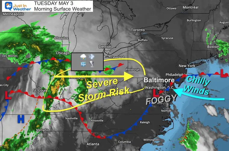
Morning Surface Weather
A stationary front shows where the influence of the cooler ocean winds will be today…across Delmarva.
To our west the heavy rain and strong or severe storms is across Illinois, Indiana, and Ohio. This will reach the western Maryland mountains this evening.
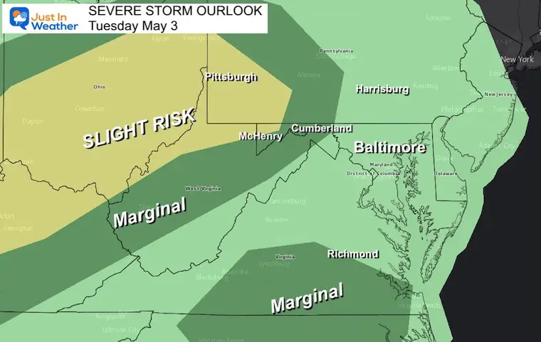
Severe Storm Outlook: NOAA
The slight risk for storms to turn severe. This includes winds over 58 mph, large hail, and isolated tornados.

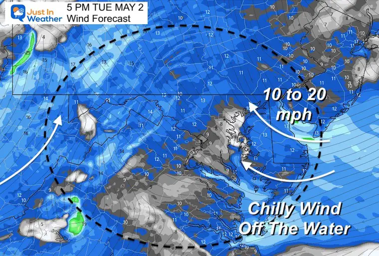
Wind Forecast
The increasing wind from the water this afternoon will make a difference in the spread of temperatures.
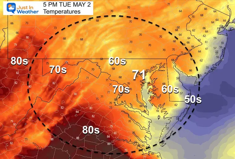
Afternoon Temperatures
Wide spread of temps will be based on the wind flow…
That easterly wind developing off of water will keep Delmarva much cooler.
Severe Storm Outlook: NOAA Closer View
The slight risk includes Pittsburgh and Garrett County Maryland tonight…
However, some of the remnant storms may reach east as shown below…
Radar Simulation:
NAM 3 Km 12 PM to Midnight
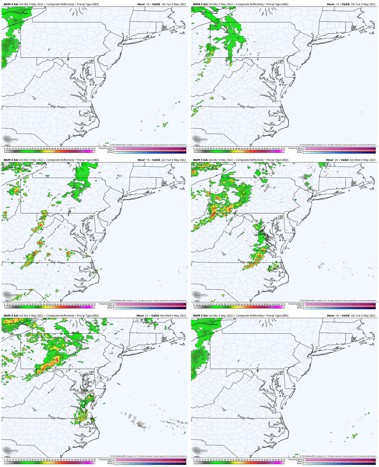
Evening Snapshot
The HRRR Model is more active (similar to Sunday). So we may see thee storm reach into parts of central Maryland and Pennsylvania’s Mid-State by midnight.

CLIMATE DATA
TODAY May 3rd
Normal Low in Baltimore: 48ºF
Record 34ºF in 2005
Normal High in Baltimore: 70ºF
Record 92ºF 2018
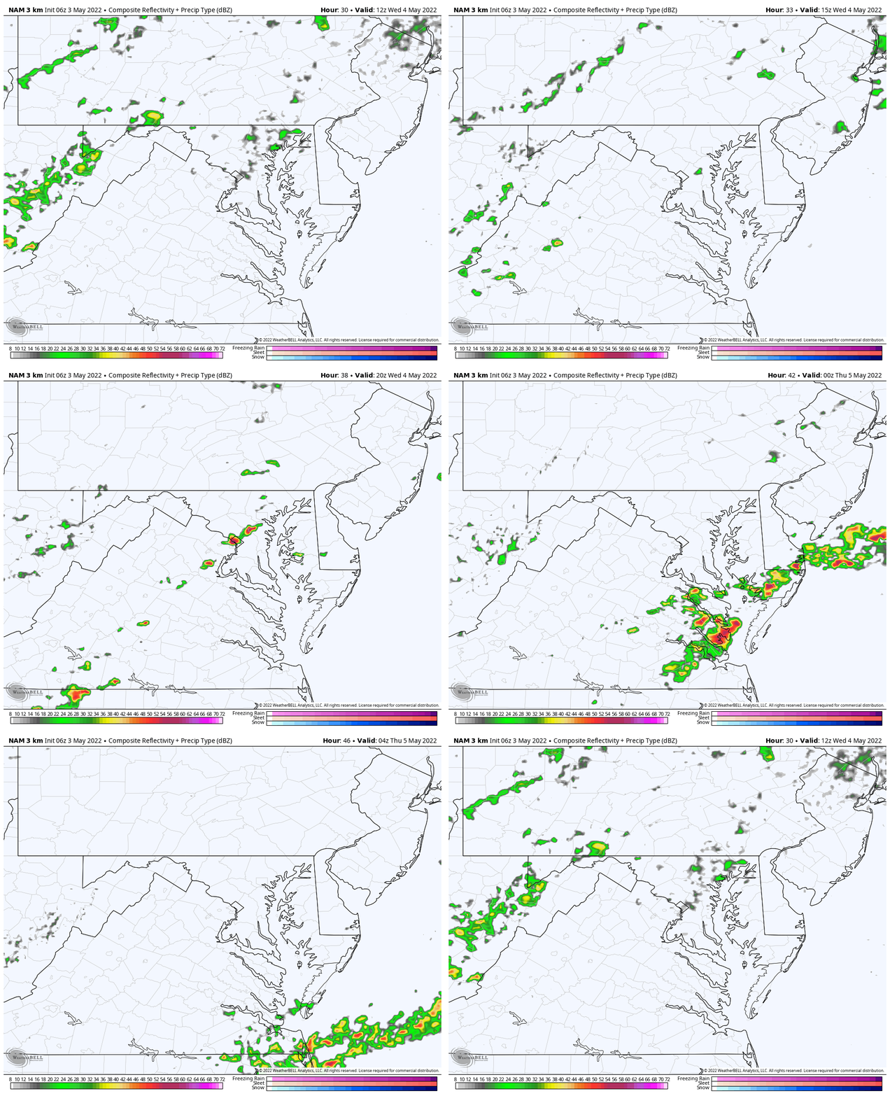
Wednesday Rain Animation
Morning showers then a cluster of storms possible between central Maryland and the coast.
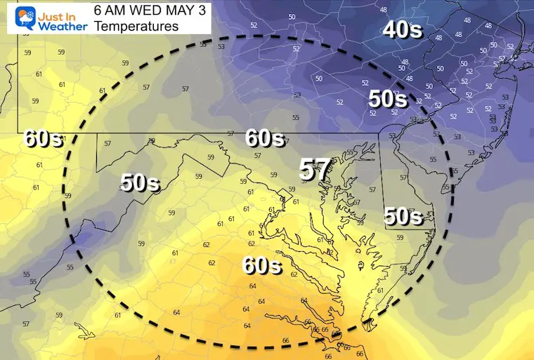
Wednesday Morning Temperatures
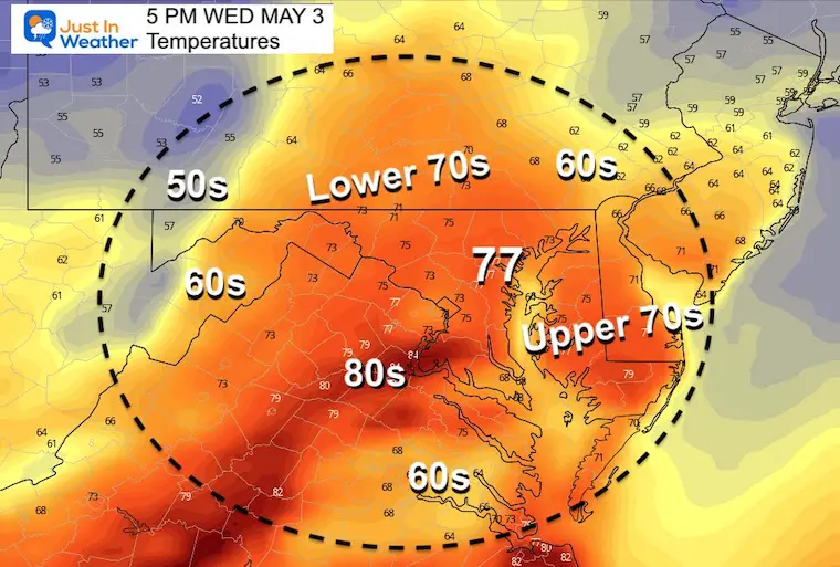
Wednesday Afternoon Temperatures
Looking Ahead:
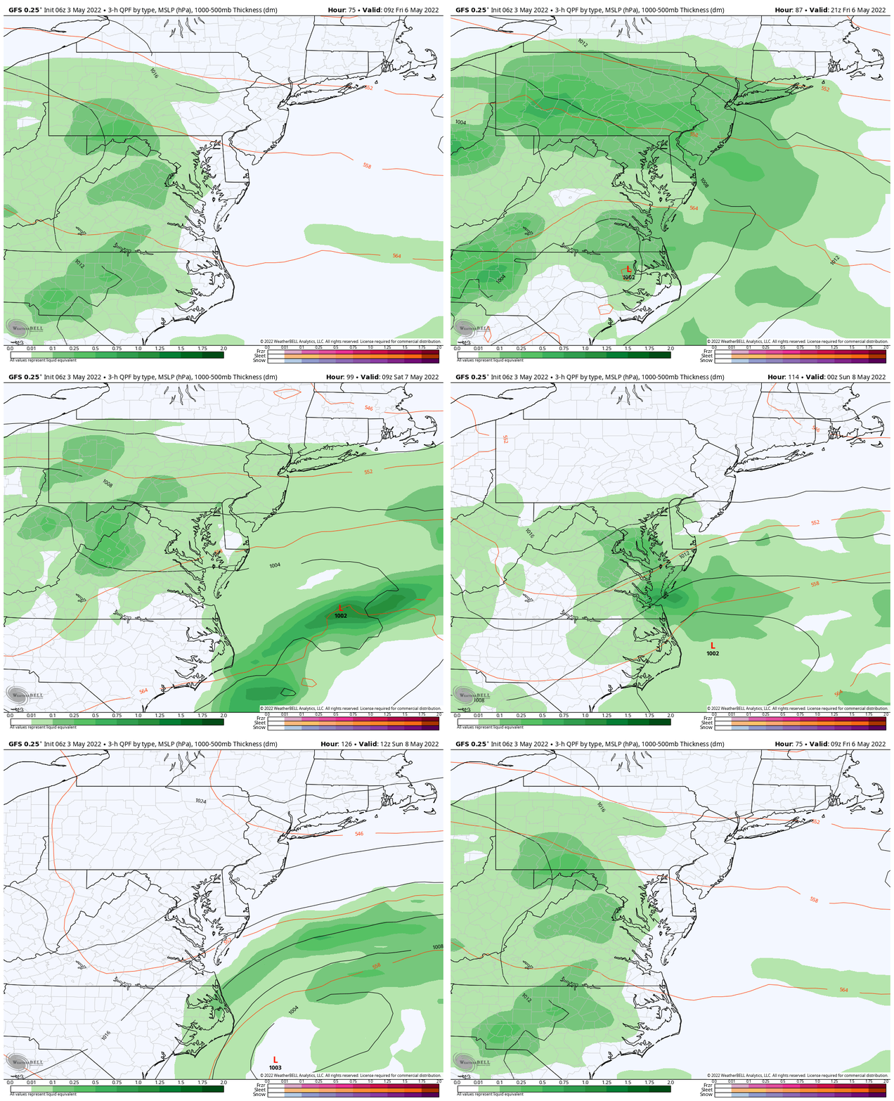
Friday to Sunday
Rainy end to the week with heavy showers and storms Friday.. then lingering rain and wind on Saturday. It will turn chilly, then remain chilly with the wind on Sunday.
Weather posts straight to your inbox
Sign up and be the first to know!
7 Day Forecast
Chilly and wet end to the week, then a slow moderation next week.

Tropical Season Begins June 1
Related Posts
Atlantic Tropical History: Maps of Origin Regions Every 10 Days
Please share your thoughts, best weather pics/video, or just keep in touch via social media
Facebook: Justin Berk, Meteorologist
Twitter: @JustinWeather
Instagram: justinweather
*Disclaimer due to frequent questions:
I am aware there are some spelling and grammar typos. I have made a few public statements over the years, but if you are new here you may have missed it:
I have dyslexia, and found out at my second year at Cornell. I didn’t stop me from getting my meteorology degree, and being first to get the AMS CBM in the Baltimore/Washington region.
I do miss my mistakes in my own proofreading. The autocorrect spell check on my computer sometimes does an injustice to make it worse.
All of the maps and information are accurate. The ‘wordy’ stuff can get sticky.
There is no editor that can check my work when I need it and have it ready to send out in a newsworthy timeline.
I accept this and perhaps proves what you read is really from me…
It’s part of my charm.


