Freeze Watch Friday Morning: Likely To Upgrade To Warning Plus Expanded Frost
April 28 2022
Thursday Afternoon Update
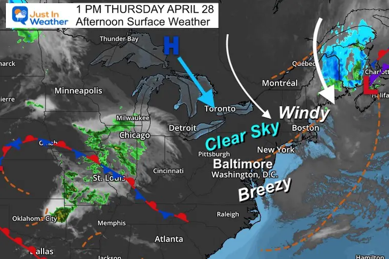
The sunshine is a good thing this afternoon, but also the reason to speculate a higher chance for a freeze tonight. The clearing sky will allow for maximum radiational cooling, when coupled with less wind. Please let this be your signal or reminder to protect your new plantings with a tarp or other covering… and bring your potted plants indoors.
After Friday morning, we should be OK into the weekend and early next week.
Surface Weather Update
The storm departing from eastern Maine should ease our winds…
Clouds have already dispersed, so the set up is to allow for additional cooling tonight.
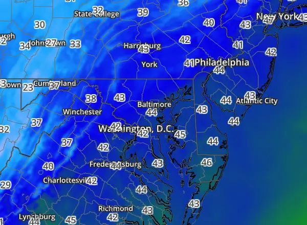
Latest Temperature Observations
Showing LAST 12 HOURS Regional map data
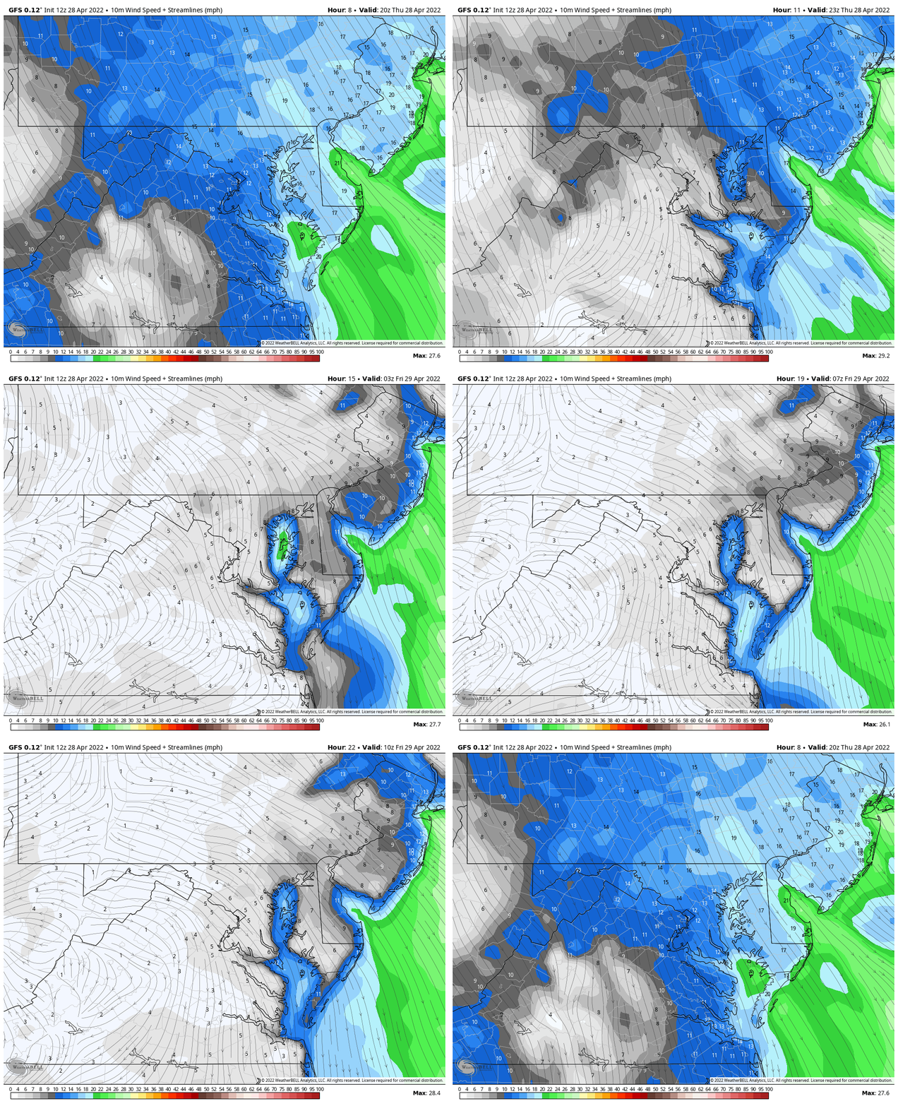
Wind Forecast
4 PM Thursday to 6 AM Friday
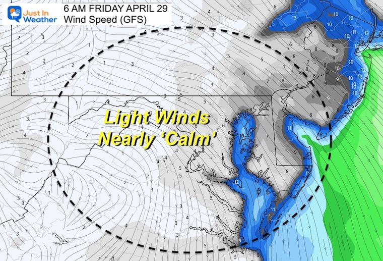
Snapshot: 6 AM Friday
Winds should be very light to nearly calm. That will allow to be radiational cooling (heat escaping to the atmosphere and space)…
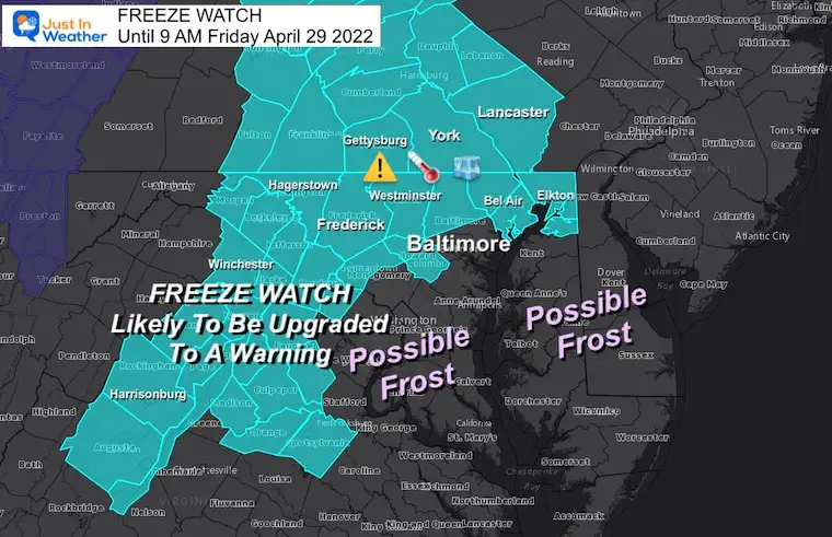
Freeze Watch/Frost ‘Potential’
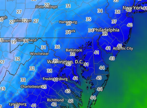
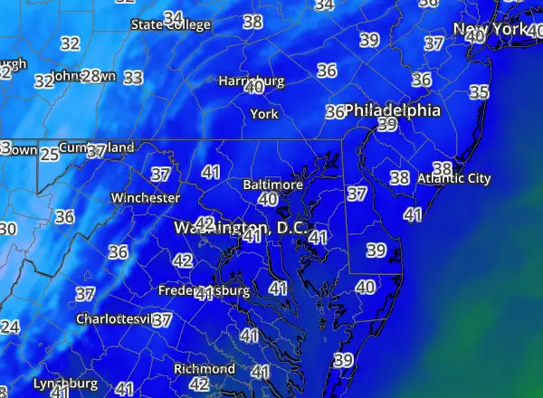
The region highlighted in the Freeze Watch has the best chance to drop below 32ºF tonight, and be upgraded to a ‘warning’ at any time.
A larger region region through southern Maryland – inland from the water – should reach the mid 30s. With less wind, a crop and plant danger of frost may develop by Friday morning
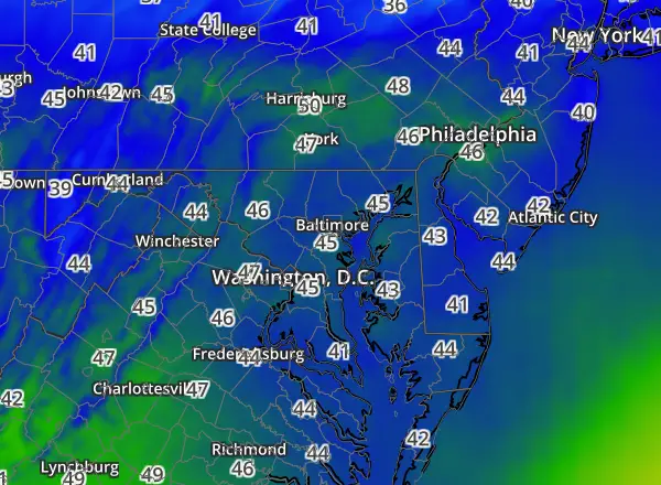
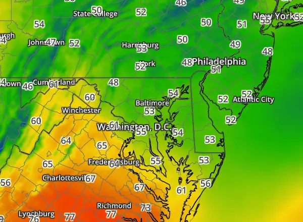
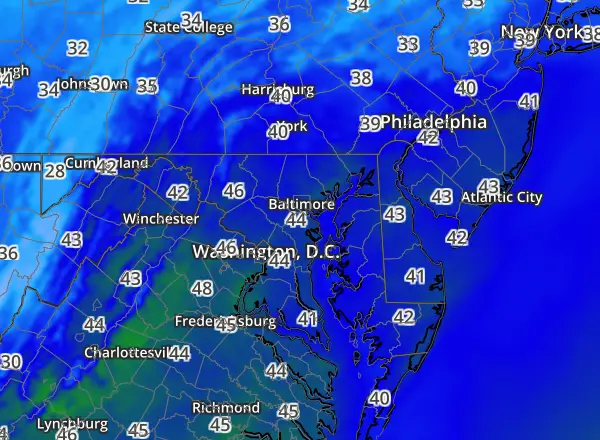
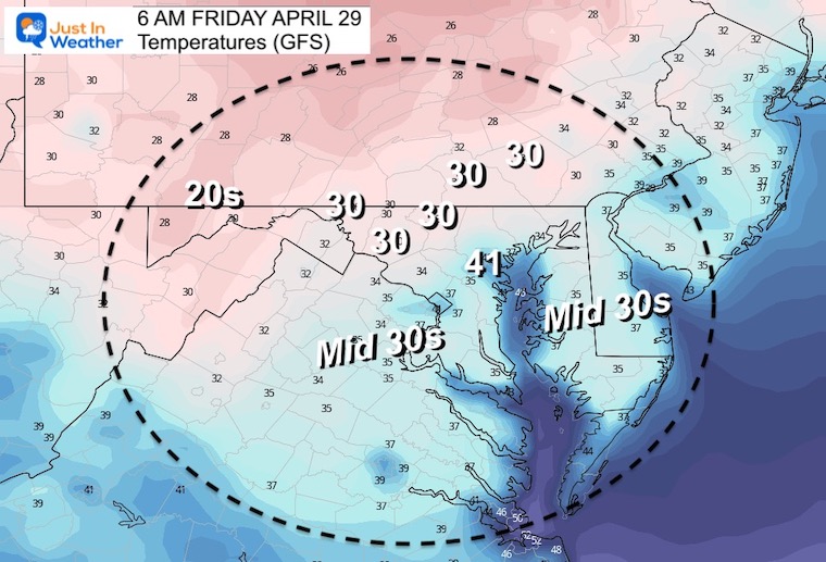
Temperature Forecast Friday Morning
Many areas just north and west of Baltimore should drop below 32ºF.
Notice the Mid 30s for a large region through Southern Maryland…
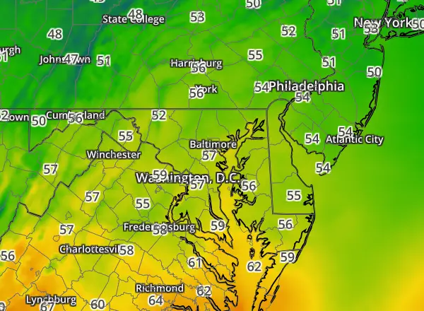
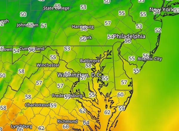
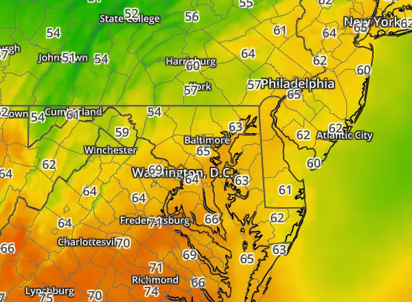
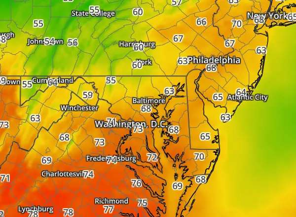
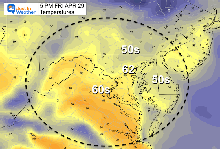
Friday Afternoon
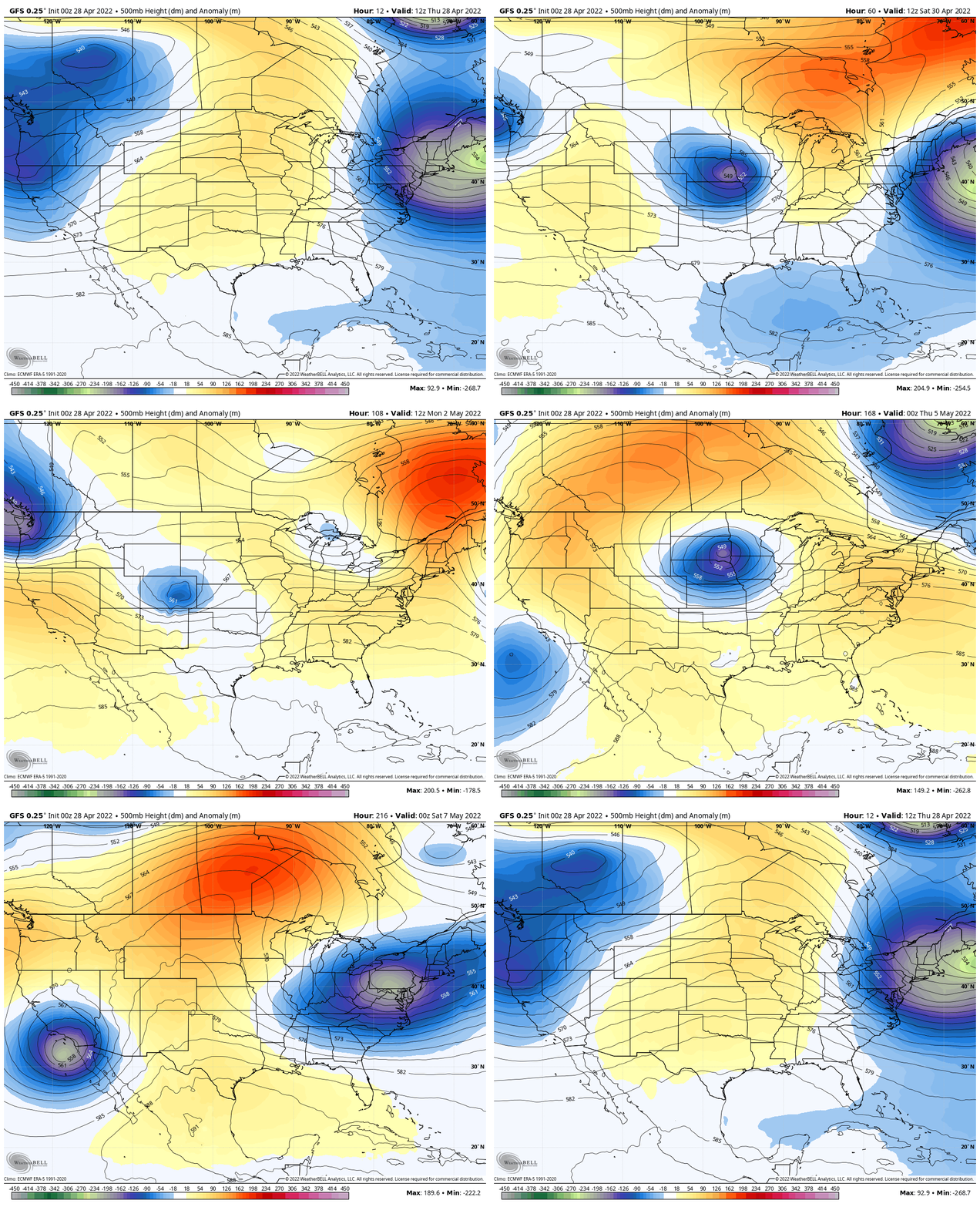
Looking Ahead: Jet Stream Through Next Friday
While we lift the jet and warm up early next week, anther storm with chilly air may reach us at the next of next week.
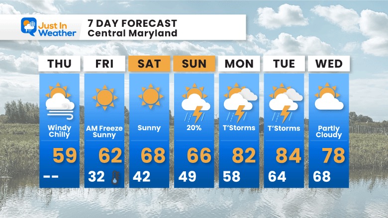
7 Day Forecast
Widespread Spread frost tomorrow morning. It is possible some local areas drop to freezing. That’s a plant killer for sure.
The slow warming trend this weekend back closer to ‘normal’ will peak in the 80s early next week. That comes with Thunderstorms, then another cool down later next week.
Weather posts straight to your inbox
Sign up and be the first to know!
Tropical Season Begins June 1
Related Posts
Atlantic Tropical History: Maps of Origin Regions Every 10 Days
Please share your thoughts, best weather pics/video, or just keep in touch via social media
Facebook: Justin Berk, Meteorologist
Twitter: @JustinWeather
Instagram: justinweather
*Disclaimer due to frequent questions:
I am aware there are some spelling and grammar typos. I have made a few public statements over the years, but if you are new here you may have missed it:
I have dyslexia, and found out at my second year at Cornell. I didn’t stop me from getting my meteorology degree, and being first to get the AMS CBM in the Baltimore/Washington region.
I do miss my mistakes in my own proofreading. The autocorrect spell check on my computer sometimes does an injustice to make it worse.
All of the maps and information are accurate. The ‘wordy’ stuff can get sticky.
There is no editor that can check my work when I need it and have it ready to send out in a newsworthy timeline.
I accept this and perhaps proves what you read is really from me…
It’s part of my charm.


