


Winter Weather Advisory Sunday As Snowfall In Two Parts Affecting Two Different Areas
Saturday Evening Update January 17 2026 One thing I carry after all of my years of forecasting: If one model does a really good job in an active pattern, then…
April 20 2022
Wednesday Morning Report
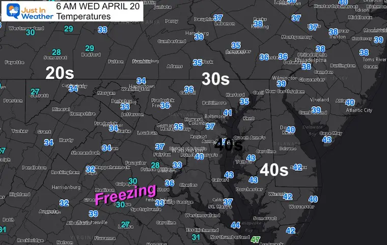
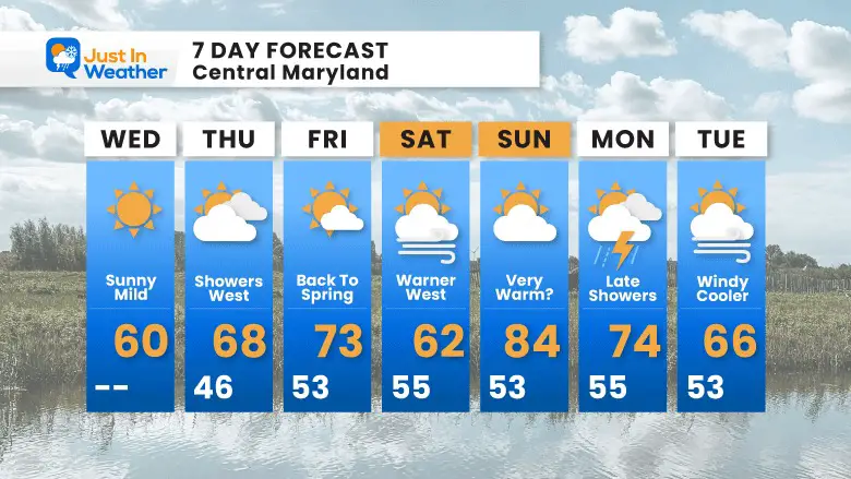
Temperatures did not get as cold as expected, but there are widespread 30s and possible frost you may need to scrape off of your car. We are NOT done yet. While we expect a warm up, and I am still pushing one day with potential to hit the 80s, we could have another frost next week.
It is frosty…
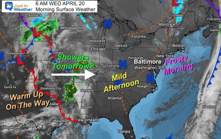
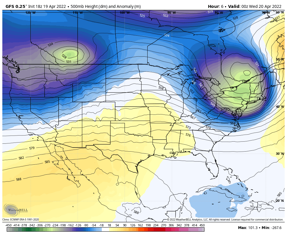
High Pressure is in control… This is what has allowed the clear sky and calm wind.
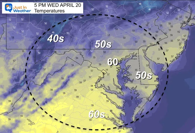
Temps will warm, and high clouds will spread in this afternoon ahead of the next system, which will bring our western half of the region tomorrow.
Seasonal Snow: 14.4”
Normal Low in Baltimore: 44ºF
Record 27ºF in 1904
Normal High in Baltimore: 66ºF
Record 94ºF 1941
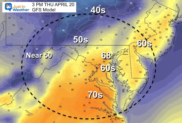
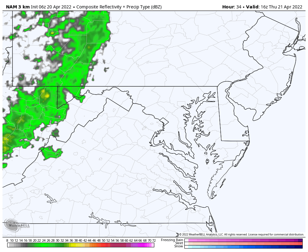
There will be rain in western Maryland, with some showers reaching to the western and northern suburbs of Baltimore. This system will be falling apart east of the mountains, so it should remain dry near The Bay and Delmarva.
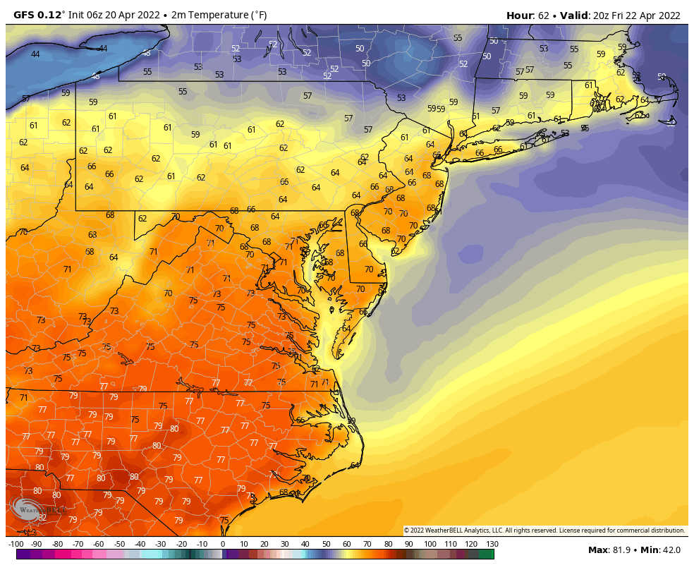
Friday Through Sunday Afternoon
Temps should be warm on Friday AND Sunday. However on Saturday a chilly air mass is expected to move in FROM New England. That is the ‘back door’. The is always hard to forecast, but the warm air may hang on in central VA and western MD, then make a return on Sunday.
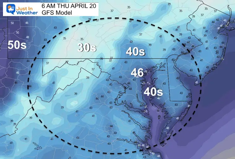
One more cool down next week could bring one more frost.
The weekend will be split… Inland on Saturday will remain ‘warmer’ (I know there is a typo but I do not have time to correct it). On Sunday that warm air mass will try to make a return.
Next week we get that final push of winter jet stream. The chance of FROST may come just beyond this time frame… on Wednesday morning.
Sign up and be the first to know!

Atlantic Tropical History: Maps of Origin Regions Every 10 Days


*Disclaimer due to frequent questions:
I am aware there are some spelling and grammar typos. I have made a few public statements over the years, but if you are new here you may have missed it:
I have dyslexia, and found out at my second year at Cornell. I didn’t stop me from getting my meteorology degree, and being first to get the AMS CBM in the Baltimore/Washington region.
I do miss my mistakes in my own proofreading. The autocorrect spell check on my computer sometimes does an injustice to make it worse.
All of the maps and information are accurate. The ‘wordy’ stuff can get sticky.
There is no editor that can check my work when I need it and have it ready to send out in a newsworthy timeline.
I accept this and perhaps proves what you read is really from me…
It’s part of my charm.