New Years Day Snow Squall And Falling Temps Entering 2026
Wednesday, December 31 New Year's Eve Update Closing out the year, we have a strong clipper to our north. This is going to drag a distinct push of arctic air…
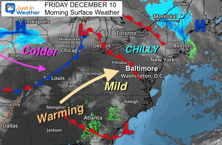
Friday December 10
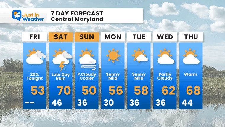
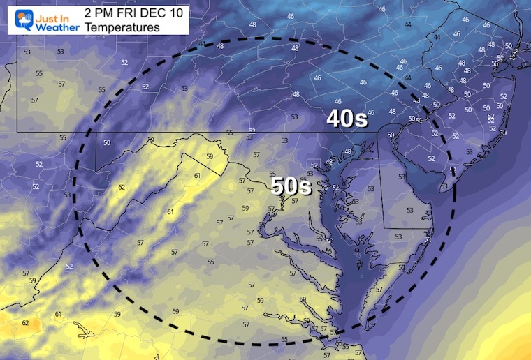
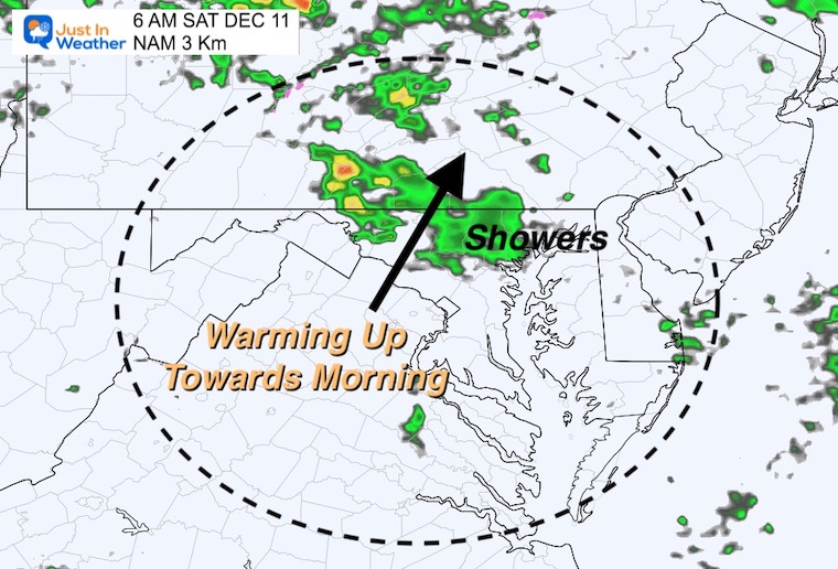
We have one more ‘blip, before we get into the longer stretch of mild weather promised. This will begins today with a little push up on the thermometer. Tonight some showers will mark a warm up by morning.
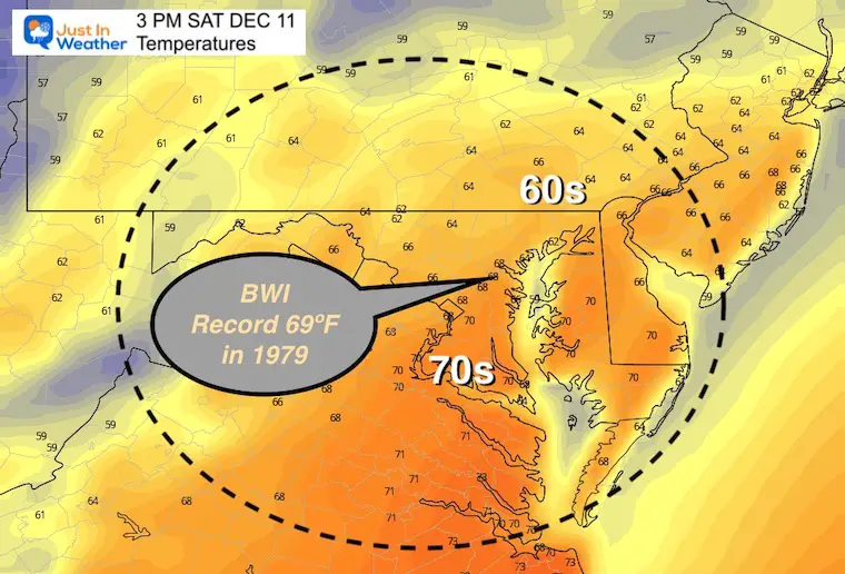
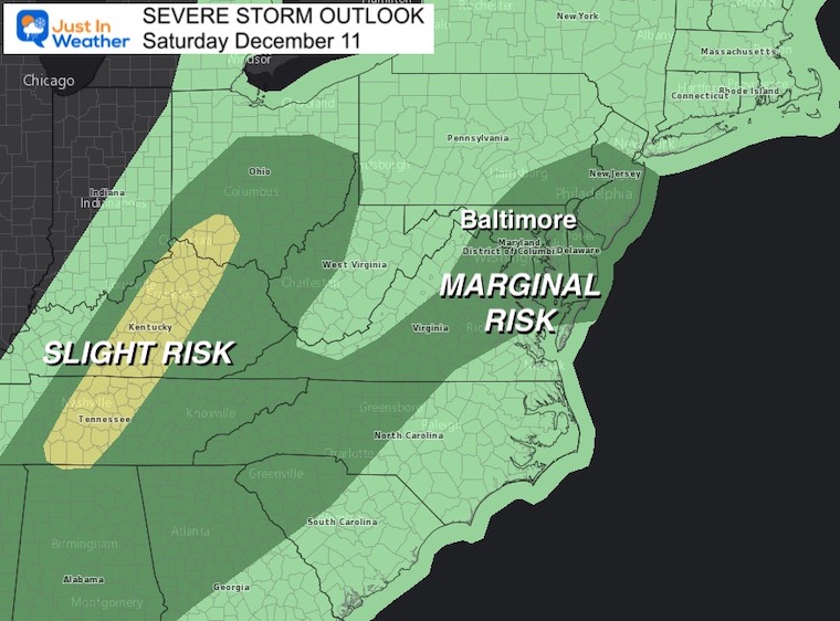
Saturday may challenge the record high at Baltimore’s BWI and other weather stations. The change of rain you may have seen on your apps, and in the 7-day below is mainly for late in the day. This may come with thunder and a marginal risk for a severe cell popping up.
Sunday will be cooler, then next week will set in the mild weather pattern we expect to last a week to 10 days.
One warm front is moving through this morning. Then another surge of warmer air will arrive tonight.
The cold front to our west will swing through Saturday night with a line of rain, then briefly colder Sunday.

Slightly above average.
Low Pressure will pass through the Great Lakes. This will pump in that warm air, then rain Saturday, followed by the colder air.
Normal Low in Baltimore: 29ºF
Record 1ºF in 1876
Normal High in Baltimore: 47ºF
Record 72ºF 1966
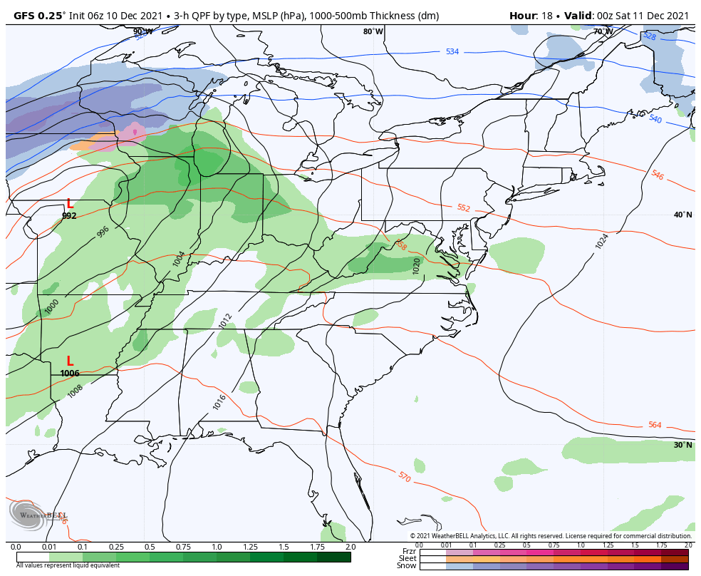
A round of showers (which may arrive an hour or two earlier than this plot) will mark the next push of warmer air.
The lows will be just after midnight, followed by warming towards dawn.
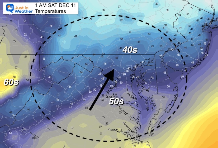
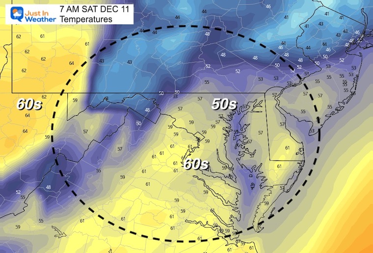
It should be warmer at sunrise Saturday than Friday afternoon.
Note: The Record High at BWI was set in 1979 at 69ªF.
Warm ups then to verify warmer than model plots, so we have a chance to outrun these numbers.
Reminder that this model has tended to be slow. So, this may arrive an hour or so sooner.


There will be some thunder with that line of rain, but marginal risk for any local cells to turn severe.
The blip of chill will be with seasonal air on Sunday. Then we get into that mild/above average pattern next week. The really warm air might be delayed a day later next week. However, we will reach the 60s and make another run for 70ºF in spots.