Labor Day Storms And Cat 5 Hurricane Dorian Nearly Stalled In Bahamas
Monday Labor Day September 2 2019
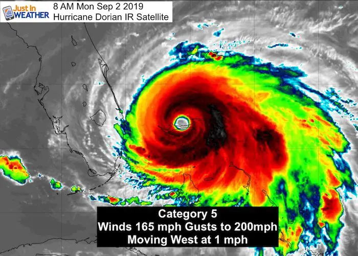
This morning I want to address out local weather along with Hurricane Dorian. The hurricane is nearly stalled in the Bahamas. It still has 165 mph and is moving at 1 mph across Grand Bahama Island. The satellite loop below shows what may be the wobble and hint at the turn to the north. It’s this slow movement and question where it turns that will determine how close it gets to the US coast. Evacuations are in place or planned from Florida to North Carolina as we will deal with this storm through Friday. The northern edge may reach Maryland.
Hurricane Dorian Stats
- Hurricane Force Winds reach 45 mph from the center
- Tropical Storm Force Winds reach 140 miles away
- Center is 120 miles east of West Palm Beach Florida
- Nearly stalled with movement to the west at 1 mph
Here is the latest Dorian satellite. The loop and forecast details are below our local weather:
[adrotate group=”4″]
Visible Satellite And Morning Shadows
Morning Visible Satellite:
Look closely at the eye: The sun is on the right/east and casting a shadow (dark) from the tall clouds from the eye wall into the eye, while clear above, and sun is hitting the clouds (brighter) on the western/left eye wall.
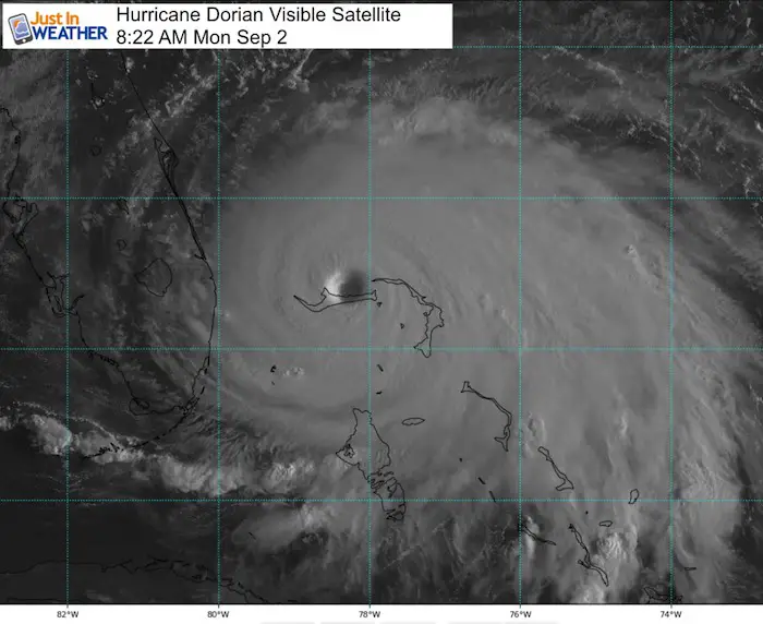
Hurricane Dorian is one of the strongest landfalling hurricanes on record and continues to hammer The Bahamas with Category 5 conditions. This will be completely devastating when we see the results. The storm has winds of 165 mph and is crawling at 1 mph. When and where it starts to turn north will help us understand how close to the US this gets. Tropical Storm force winds are already reaching parts of Florida. This storm will get larger in size as it moves north and weakens a little.
Labor Day Eastern US Weather
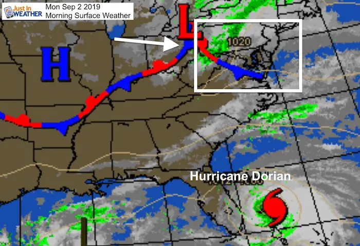
Morning Local Weather
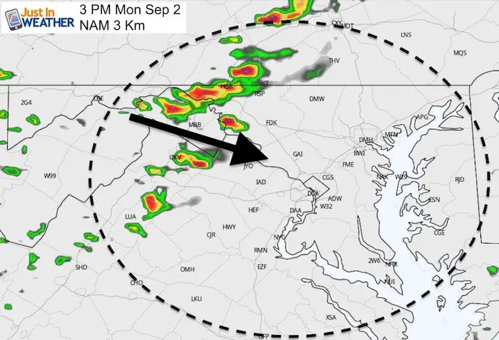
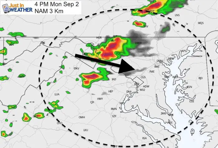
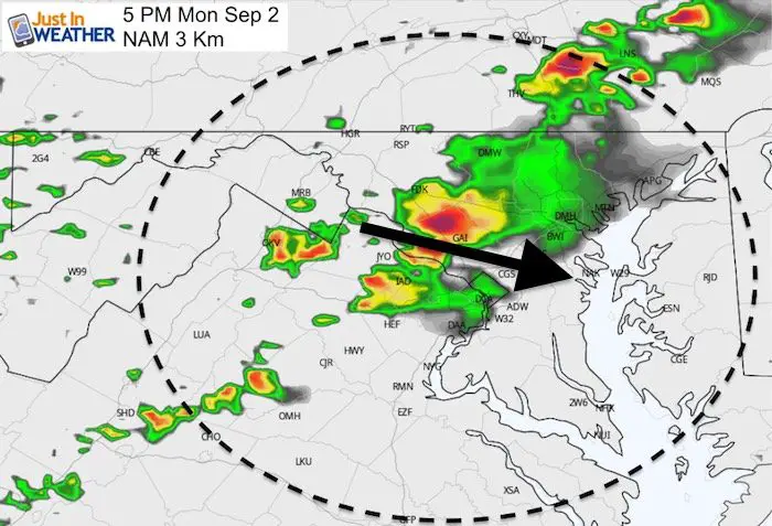
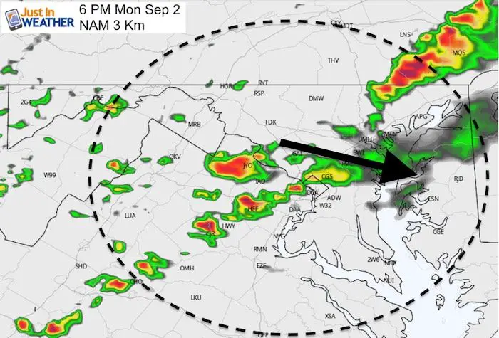
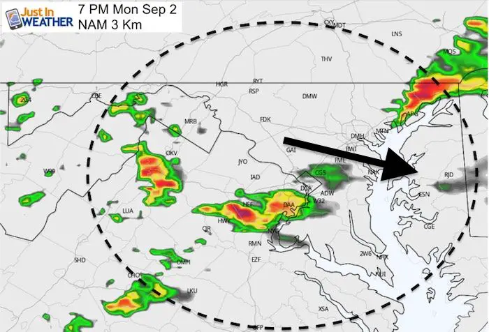
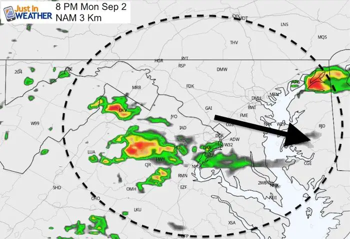
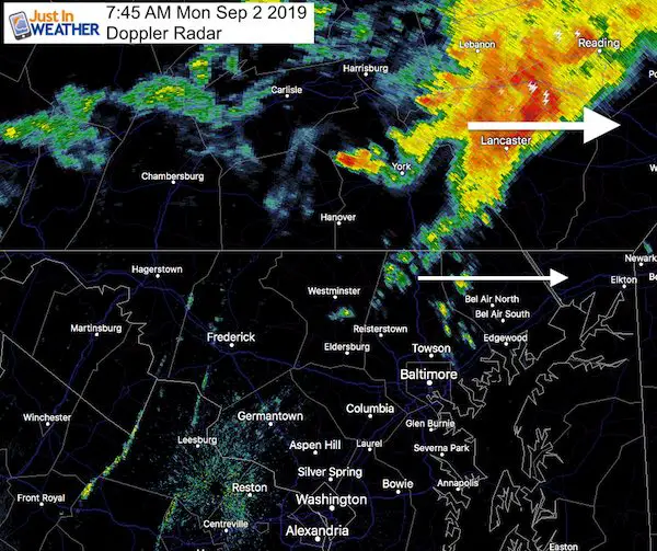
Doppler Radar showed storms in Southern PA at 7:45 AM with some showers across Carroll, Baltimore, and Harford Counties. This is moving to the east. More showers are possible today, with the risk of storms after 3 PM
Radar Simulation —> slider
[adrotate group=”4″]
High Temperatures

Hurricane Dorian IR Satellite Loop
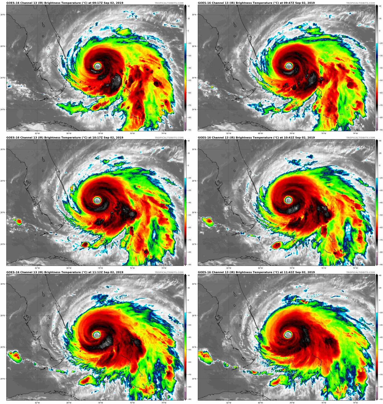
SUMMARY OF 800 AM EDT...1200 UTC...INFORMATION
----------------------------------------------
LOCATION...26.7N 78.2W
ABOUT 35 MI...50 KM ENE OF FREEPORT GRAND BAHAMA ISLAND
ABOUT 120 MI...190 KM E OF WEST PALM BEACH FLORIDA
MAXIMUM SUSTAINED WINDS...165 MPH...270 KM/H
PRESENT MOVEMENT...W OR 270 DEGREES AT 1 MPH...2 KM/H
MINIMUM CENTRAL PRESSURE...916 MB...27.05 INCHES
Forecast Tracks Watches And Warnings
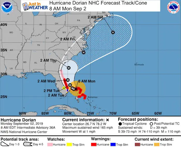
The interaction with land and some steering currents should bring this down to a Category 4 as it turns north along the Florida. Coast.
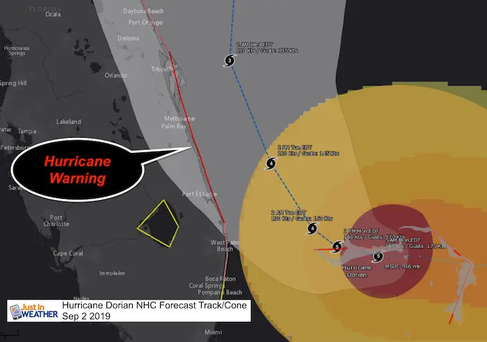
A Storm Surge Warning is in effect for...
* Lantana to the Volusia/Brevard County Line

A Storm Surge Watch is in effect for...
* North of Deerfield Beach to south of Lantana
* Volusia/Brevard County Line to the Mouth of the St. Mary's River

A Hurricane Warning is in effect for...
* Grand Bahama and the Abacos Islands in the northwestern Bahamas
* Jupiter Inlet to the Volusia/Brevard County Line

A Hurricane Watch is in effect for...
* North of Deerfield Beach to Jupiter Inlet
* Volusia/Brevard County Line to the Mouth of the St. Mary's River

A Tropical Storm Warning is in effect for...
* North of Deerfield Beach to Jupiter Inlet

A Tropical Storm Watch is in effect for...
* North of Golden Beach to Deerfield Beach
* Lake Okeechobee


Hurricane Dorian Track Up The Coast
[adrotate group=”4″]
US East Coast Forecast?
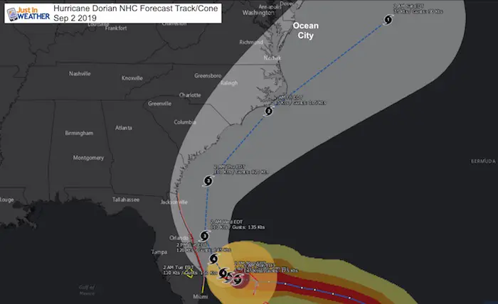
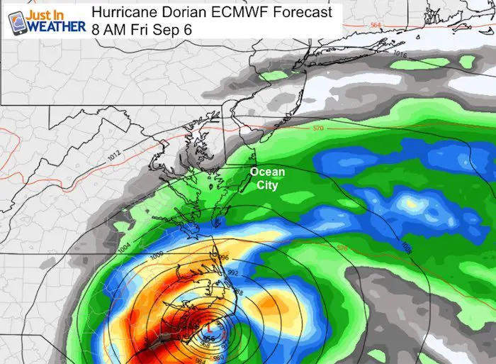
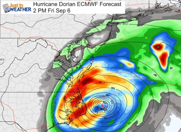
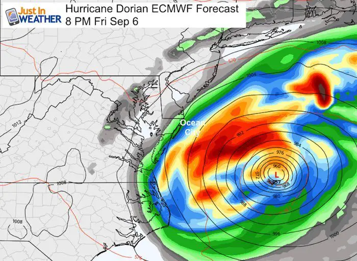
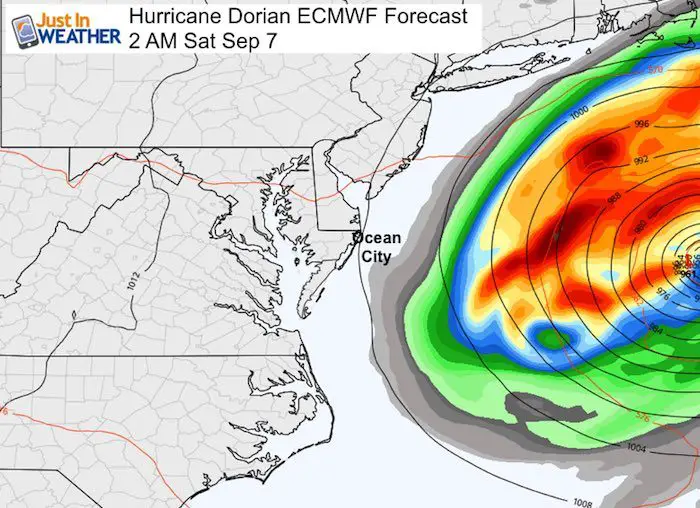
This is still too close to call. The HWRF Model has the storm on the left side of the track with landfall.  The European Model is along the
center of the cone clipping Cape Hatteras NC. The northern edge of rain hitting Maryland.
Forecasts
HWRF Model
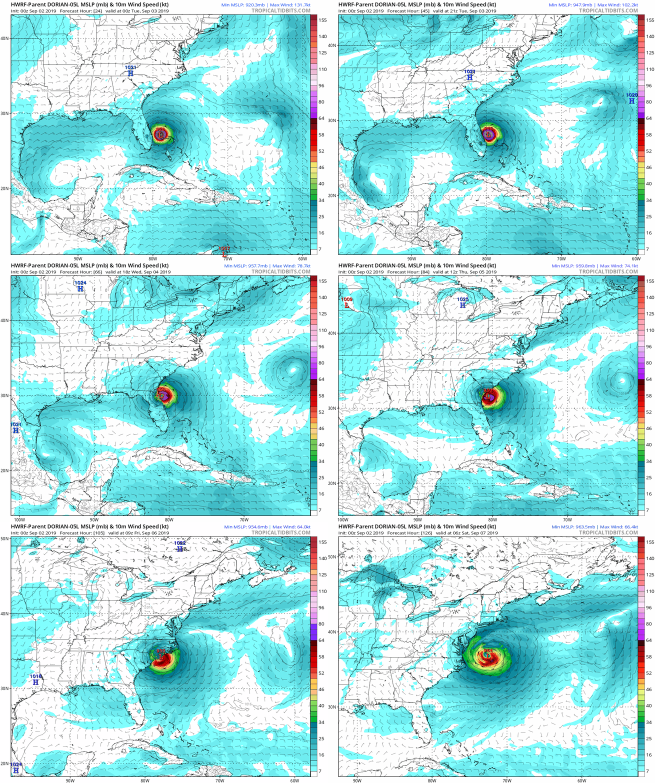
European Model Forecast —> slider
If this verifies, outer bands will reach southern Maryland and Ocean City Friday. But some storm surge up the Bay possible Thursday evening. As the storm moves away it will drain water out of the Bay and lower water levels a lot.
[adrotate group=”4″]
NHC Forecast Track/Cone
Temperature Outlook
Colder air will get pulled in Thursday and Friday as Dorian gets closer.
Keep In Touch Every Day
Just in case you don’t get all posts on your social media feed, stay up to date with the latest info…
Click here to sign up for email alerts…. Be the first to hear any new weather
Thank you to our Title Sponsor for Maryland Trek 6
Shining on with Smyth and their contribution, our team has raised over $95,000 for Just In Power Kids to provide free programs for kids in and post cancer treatment.
Please share your thoughts, best weather pics/video, or just keep in touch via social media
-
Facebook: Justin Berk, Meteorologist
-
Twitter: @JustinWeather
-
Instagram: justinweather
Maryland Trek Cycle Jerseys From Hill Killer
All proceeds will go to the Maryland Trek 6 total and Just In Power Kids programs
Just In Power Kids:
Proceeds go to our programs Providing FREE holistic care for kids in cancer treatment and up to 5 years post treatment and caregivers.

Shine On
Proceeds from all sales go to Just In Power Kids. Click the image to shop and show your support.
Love Maryland Shirts and Hoodies
This shirt was designed by my ‘bonus’ daughter Jaiden. The hoodie has been the biggest hit, so our promotion has been extended until the end of this week.
|
||
|
Show your love for Maryland and make this 14 year old artist and her mom extra proud
|
Related Links:


